Mesovortices & QLCS Tornadogenesis: How Leading-Edge Outflow Surges and Sheared Gust Fronts Spin Damaging Squall Line Tornadoes
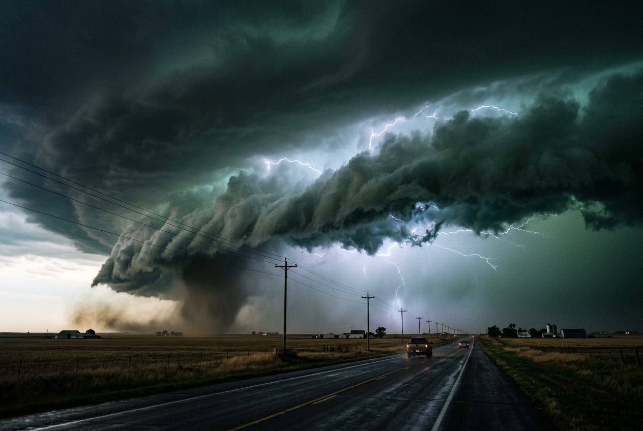
In the dead of an autumn night across the rolling interior lowlands, the atmosphere can undergo a catastrophic metamorphosis in a matter of heartbeats. Long before the sky unleashes its full fury, the physical senses register an ominous dislocation. The air hanging over the porch is thick, warm, and stagnant—saturated with moisture and smelling faintly of turned soil, decaying leaves, and the metallic sharpness of distant ozone. To the west, the horizon has vanished into an ink-black rampart that blotted out the stars. There is no classic, solitary supercell silhouette strobing cleanly against the night; instead, an unbroken, horizon-spanning wall of cloud advances like an iron curtain.
       [ WARM, MOIST INFLOW ] ---> (Updraft along Gust Front)
                                     /
   =================================/  <-- Surging Shelf Cloud (Arcus)
   [ COLD, DENSE OUTFLOW POOL ]    /
   <-----------------------------/
Then, the ambient world falls completely quiet. The crickets abruptly cease their chorus as the micro-barograph needle on the desk indoors begins a nervous, fluttering descent. A faint, low-frequency rumble—not discrete claps of thunder, but a continuous, tearing roar like an approaching freight train—vibrates through the soles of your feet. A sudden, chilling gust punches through the still canopy, dropping the ambient temperature by ten degrees Celsius in under thirty seconds. The smell of petrichor surges violently as horizontal sheets of mist whip parallel to the ground. Above, backlit by ceaseless intra-cloud illumination, the boiling, striated underbelly of a shelf cloud surges overhead.
Without the warning of a classic bell-shaped wall cloud or an isolated funnel visible against the twilight, the wind shears violently from a gentle southeasterly breeze into a shrieking, rain-choked west-northwesterly gale. Embedded within this blinding torrent of rain and flying debris, a shallow, violently rotating vortex spins up out of seemingly empty air, carving a narrow path of destruction across the landscape before dissipating almost as quickly as it was born.
This is the signature of a quasi-linear convective system (QLCS) mesovortex—a localized, shallow, and notoriously unpredictable engine of severe weather that challenges traditional forecasting paradigms.
What’s Actually Happening — Plain English First
To understand why these storms are so dangerous and elusive, one must first look at the traditional mental model of a tornado. For decades, popular science and classic meteorological education have focused on the textbook supercell. A supercell is an isolated, majestic storm powered by a deep, rotating updraft known as a mesocyclone.
SUPERCELL (Deep Mesocyclone)            QLCS (Leading-Edge Mesovortex)
=============================           ==============================
Height: 10–15 km column                 Height: Shallow (< 3 km, boundary layer)
Lifespan: 1–4 hours                     Lifespan: 10–30 minutes
Location: Storm core / wall cloud       Location: Leading edge gust front / apex
Precursors: Long-lived hook echo        Precursors: Rapid spin-up, zero hook echo
Think of a supercell as a towering, vertically integrated factory that stretches ten to fifteen kilometers into the stratosphere. Because this massive column of rotating air is so deep and persistent, operational Doppler radar networks operated by authorities such as the National Oceanic and Atmospheric Administration (NOAA) can detect its rotation high above the ground twenty to thirty minutes before a funnel ever reaches the earth.
A quasi-linear convective system (QLCS), commonly experienced as a squall line or a bow echo, operates on an entirely different physical architecture. Rather than an isolated, rotating cylinder, a QLCS is a continuous, linear convective front spanning hundreds of kilometers.
As the thunderstorms along this line produce rain, that precipitation falls through drier air, evaporating and chilling the air mass. Think of the atmosphere as a layered cake where gravity governs how different slices interact: cold air is dense and heavy, while warm, humid air is buoyant and light. As this massive dome of rain-cooled, heavy air cascades downward to the surface, it forms a vast "cold pool."
This cold pool surges forward along the ground like an unstoppable atmospheric bulldozer. The leading edge of this cold surge is the gust front.
Where this rushing wall of cold air collides with the warm, buoyant ambient air sitting ahead of the storm, extreme horizontal and vertical friction occurs. It is very much like two parallel conveyor belts moving in opposite directions—or a swift river current brushing against a stagnant bank. Small, turbulent eddies begin to swirl along the boundary.
If one of these localized swirls happens to line up directly beneath an explosive, localized pocket of rising air along the gust front, the atmosphere acts like a figure skater pulling their arms inward during a spin: the swirling eddy is stretched vertically, its diameter tightens from a kilometer across down to a few hundred meters, and its rotation accelerates exponentially into a tornadic mesovortex.
Because these vortices are confined to the lowest two to three kilometers of the atmosphere and can spin up in under five minutes, radar beams scanning far above the surface often overshoot them completely, leaving forecasters and ground observers with virtually no advance warning.
The Science: Vorticity Dynamics and Cold Pool Mechanics
To dissect the fluid dynamics governing QLCS tornadogenesis, atmospheric scientists at institutions like the National Severe Storms Laboratory (NSSL) and the Storm Prediction Center (SPC) examine three interconnected physical processes:
- Horizontal Shearing Instability (Shear-Driven Vorticity Breakdown)
- Baroclinic Vorticity Generation and Updraft Tilting
- Low-Level Vertical Stretching
              SURGING COLD POOL & VORTEX FORMATION (PLAN VIEW)

      Northern Bookend / Cyclonic Mesovortex (Apex)
                  \       ^
                   \     /  [Surging Bow Segment]
  Warm Inflow  ---> [ APEX ] ===> REAR INFLOW JET (RIJ)
                   /     \
                  /       v
       Southern Anticyclonic Shear Zone
1. Horizontal Shearing Instability Along the Boundary
Along the leading edge of a squall line's gust front, an intense horizontal gradient in the line-parallel wind velocity develops. If the ambient air ahead of the line is moving from the south at $10\text{ m/s}$, while the cold pool directly behind the gust front is rushing east-southeast at $30\text{ m/s}$, an extreme horizontal velocity shear is established across a narrow zone $\Delta x$.
This localized shear zone generates a vertical vorticity sheet ($\zeta$), defined mathematically as the curl of the horizontal wind field:
$$\zeta = \frac{\partial v}{\partial x} - \frac{\partial u}{\partial y} \approx \frac{\Delta v}{\Delta x}$$
According to Rayleigh’s hydrodynamic instability criterion, a continuous sheet of concentrated shear cannot remain smooth; it naturally breaks down and rolls up into discrete, circular vertical vortex couplets—a process known as Kelvin-Helmholtz or horizontal shear breakdown.
2. Baroclinic Vorticity and Tilting
Simultaneously, the thermal contrast between the rain-cooled outflow and the warm ambient inflow creates a sharp horizontal density gradient. In fluid dynamics, when lines of constant pressure (isobars) cross lines of constant density or temperature (isopycnals), baroclinic vorticity is generated.
Along the gust front, the horizontal gradient in virtual potential temperature ($\nabla \theta_v$) produces horizontal rolling tubes of vorticity ($\mathbf{\omega}_h$). As the dense cold pool drives forward, the powerful convective updraft at the gust front tilts these horizontal vortex tubes into the vertical plane:
$$\left(\frac{\partial \zeta}{\partial t}\right)_{\text{tilting}} = \mathbf{\omega}_h \cdot \nabla_h w = \left(\frac{\partial w}{\partial x}\frac{\partial v}{\partial z} - \frac{\partial w}{\partial y}\frac{\partial u}{\partial z}\right)$$
3. Vertical Stretching and the Cold Pool Velocity
Once vertical vorticity is established near the ground via shearing breakdown and tilting, the convergence and explosive vertical acceleration of air along the gust front amplifies this rotation through vorticity stretching.
The fundamental governing equation for vertical vorticity tendency in an inviscid framework is expressed as:
$$\frac{d\zeta}{dt} = (\zeta + f)\frac{\partial w}{\partial z} + \left(\frac{\partial w}{\partial x}\frac{\partial v}{\partial z} - \frac{\partial w}{\partial y}\frac{\partial u}{\partial z}\right) + \frac{1}{\rho^2}(\nabla \rho \times \nabla p)_z$$
Where $\zeta$ is vertical vorticity, $f$ is the Coriolis parameter, $w$ is vertical velocity, and $\rho$ is air density. Near the surface, the vertical stretching term, $\zeta \frac{\partial w}{\partial z}$, acts as the primary accelerator.
Key Mathematical Formulations and Worked Proofs
Equation 1: Line-Normal Cold Pool Propagation Speed ($c$)
To determine whether a gust front will remain balanced with ambient wind shear or surge out ahead—triggering vortex spin-up at the apex of a bow echo—forecasters calculate the theoretical propagation speed ($c$) of the density current using the classic Benjamin-von Kármán gravity current equation:
$$c = \sqrt{2 g H \left(\frac{\theta_{v,\text{warm}} - \theta_{v,\text{cold}}}{\bar{\theta}_v}\right)} = \sqrt{2 g H \frac{\Delta \theta_v}{\bar{\theta}_v}}$$
- Plain English Meaning: This equation calculates how fast a heavy wedge of rain-cooled air rushes forward across the earth based on its depth ($H$) and how much colder/denser it is compared to the surrounding air ($\Delta \theta_v$).
Worked Example:
Consider a severe nocturnal squall line advancing across the plains: * Acceleration due to gravity ($g$): $9.81\text{ m/s}^2$ * Cold pool depth ($H$): $1,500\text{ m}$ (1.5 km) * Ambient mean virtual potential temperature ($\bar{\theta}_v$): $300\text{ K}$ ($27^\circ\text{C}$) * Virtual potential temperature deficit within the cold pool ($\Delta \theta_v$): $6\text{ K}$
Let us calculate the forward propagation speed $c$:
$$c = \sqrt{2 \times 9.81\text{ m/s}^2 \times 1500\text{ m} \times \left(\frac{6\text{ K}}{300\text{ K}}\right)}$$
$$c = \sqrt{29430 \times 0.02} = \sqrt{588.6} \approx 24.26\text{ m/s}$$
Converting to operational meteorological units:
$$24.26\text{ m/s} \times 3.6 \approx 87.3\text{ km/h}\quad (\approx 54.3\text{ mph})$$
Equation 2: Vortex Amplification via Vertical Stretching
To see how rapidly a broad, benign eddy tightens into a destructive tornado, we examine the simplified 1D stretching equation:
$$\frac{\partial \zeta}{\partial t} \approx \zeta \left(\frac{\partial w}{\partial z}\right)$$
Integrating with respect to time ($t$) yields the exponential growth formula:
$$\zeta(t) = \zeta_0 \exp\left[\left(\frac{\partial w}{\partial z}\right) t\right]$$
- Plain English Meaning: The strength of the vertical spin increases exponentially over time based on the vertical acceleration gradient ($\partial w / \partial z$) of the updraft lifting the air.
Worked Example:
- An initial horizontal shear eddy along the gust front possesses a weak vertical vorticity of $\zeta_0 = 0.01\text{ s}^{-1}$.
- A localized updraft surges from $w = 0\text{ m/s}$ at ground level to $w = 18\text{ m/s}$ at an altitude of $z = 1,200\text{ m}$.
- The vertical updraft gradient is therefore:
$$\frac{\partial w}{\partial z} = \frac{18\text{ m/s} - 0\text{ m/s}}{1200\text{ m} - 0\text{ m}} = \frac{18}{1200} = 0.015\text{ s}^{-1}$$
- Let us compute the vertical vorticity after just $180\text{ seconds}$ (3 minutes):
$$\zeta(180) = 0.01 \times \exp(0.015 \times 180) = 0.01 \times \exp(2.70)$$
Since $\exp(2.70) \approx 14.88$:
$$\zeta(180) = 0.01 \times 14.88 \approx 0.1488\text{ s}^{-1}$$
Operational Radar Strategies in High-Shear, Low-CAPE (HSLC) Regimes
Forecasting and warning for QLCS mesovortices is one of the most demanding tasks in operational meteorology. These events frequently occur in High-Shear, Low-CAPE (HSLC) environments—common during transitional seasons (late autumn and early spring) and throughout winter across the American Midwest, the Dixie Alley region, and Western Europe.
       TYPICAL RADAR VELOCITY COUPLET PROFILE (0.5° TILT)

              [ Outbound Velocities (+25 m/s) ]  (Red/Yellow)
                              |
                     === SHEAR AXIS ===  <-- Diameter: 500m - 1.5km
                              |
              [ Inbound Velocities  (-25 m/s) ]  (Green/Blue)
In HSLC setups, the convective available potential energy (CAPE) is often meager (sometimes under $500\text{ J/kg}$), but the kinematic wind shear across the lowest 1–3 km is extreme ($0\text{--}1\text{ km Bulk Shear} > 30\text{--}40\text{ knots}$).
1. The 0.5° Velocity Slicing Strategy
Because QLCS mesovortices are inherently shallow—rarely extending above $3\text{ km}$ ($10,000\text{ ft}$) and often centered beneath $1.5\text{ km}$—radar beams scanning at higher elevation angles ($1.5^\circ$, $2.4^\circ$, etc.) overshoot the circulation entirely when the storm is more than $40\text{--}50\text{ miles}$ ($65\text{--}80\text{ km}$) from the radar site.
Forecasters at warning offices utilize specialized products and rapid low-level scans (such as the WSR-88D MESO-SAILS protocols documented by the NOAA Warning Decision Training Division): * Monitoring the lowest available base velocity slice ($0.5^\circ$). * Searching for tight, adjacent velocity bins showing inbound and outbound winds (a velocity couplet) across a horizontal distance of less than $1.5\text{ km}$.
2. Identifying the "Bow Apex" and Inflection Points
Mesovortices do not form randomly along a squall line. They concentrate where the line bends into a Bow Echo or line-echo wave pattern (LEWP).
As a Rear-Inflow Jet (RIJ)—a channel of elevated, dry, mid-level winds—plunges downward toward the surface behind the line, it pushes the convective line outward into an arching bow shape. At the apex (the protruding tip) and along the northern inflection point of this surging segment, cyclonic shear is maximized.
The northern end naturally develops a strong, cyclonic "bookend vortex," while the southern end develops an anticyclonic counterpart that often shears apart. Operational forecasters prioritize warning polygons on the northern side of surging bow apexes where cyclonic shear and updraft convergence overlap.
Historical Case Studies: Nocturnal Squall Line Disasters
The true lethality of QLCS tornadogenesis lies in its occurrence during the overnight hours, catching sleeping populations unprepared.
      HISTORICAL NOCTURNAL QLCS SCENARIO (EVOLUTION TIMELINE)

      Time: T+00 min        Time: T+15 min        Time: T+25 min
      Linear Gust Front     Bow Echo Surges       Mesovortex Spin-Up
      =================     ===============       ===================
      [---- Line ----]  ->  [---\ Apex /---]  ->  [---\ (Vortex) /---]
                            (Rear Inflow Jet)      (Tornado on Ground)
A prime example is the Late-Autumn Midwest and Ohio Valley QLCS Outbreak of November 17, 2013, and numerous nocturnal squall lines analyzed under World Meteorological Organization (WMO) severe weather programs.
During these events, an intense low-level jet (LLJ) pumped copious moisture northward ahead of a sharp cold front. While instability was limited, low-level wind shear was ferocious ($0\text{--}1\text{ km SRH} > 300\text{ m}^2/\text{s}^2$).
As the linear squall line swept eastward at highway speeds ($90\text{--}100\text{ km/h}$), dozens of small, short-lived mesovortices spun up along the leading gust front.
Eyewitnesses reported no audible sirens until the tornado was already on top of their homes because the vortices formed and collapsed within single radar scan cycles (under 5 minutes). Ground post-storm surveys confirmed classic QLCS signatures: narrow, highly focused damage tracks of EF-1 to EF-2 intensity embedded within a broad swath of straight-line wind damage.
Practical Outdoor Guidance: The Observer's Field Protocol
For storm spotters, emergency managers, hikers, and rural residents caught in the path of a rapidly approaching squall line, recognizing the physical signs of leading-edge tornadogenesis can be life-saving.
                  VISUAL SKY SIGNS & THREAT PROFILE

   Top: Dark, chaotic cloud mass (Rain / Hail Core)
   Mid: Striated, green/black shelf cloud (Arcus)
   Low: Rapidly scudding ragged cloud fragments (Fractus)
   Ground: Zero wall cloud; sudden rain-wrapped funnel along leading edge
1. Sky Observations (What to Look For)
- The Shelf Cloud (Arcus): A smooth, rolling shelf cloud indicates a dominant, cold-outflow-driven line. However, if the shelf cloud appears jagged, ragged, or features a sudden inward notch or "jog" in its leading edge, that notch often marks the boundary of a developing shear eddy.
- Absence of Classic Wall Clouds: Do not wait to spot an isolated, hanging wall cloud. In a QLCS, tornadoes descend directly from the turbulent base behind or along the leading gust front, frequently enveloped entirely in torrential curtains of rain ("rain-wrapped").
- Scud Cloud Motion (Fractus): Watch the ragged cloud fragments beneath the shelf. If they are rushing upward and rotating horizontally rather than simply blowing straight back, intense localized vertical stretching is underway.
2. Instrument Readings
- Barometer (Micro-barograph): Watch for a sudden, sharp pressure drop (a "mesolow" of 2 to 5 hPa) that interrupts the gradual barometric decline, followed instantly by a violent pressure surge (the "thunderstorm high" or cold pool jump).
- Thermometer: A rapid temperature plunge of $5^\circ\text{C}$ to $12^\circ\text{C}$ within two minutes signals the arrival of the cold pool density current.
- Wind Direction & Speed: If a strong southeasterly wind suddenly swings 90 to 120 degrees to the west-northwest and doubles in velocity, the gust front has passed. Any immediate counter-clockwise twitching or swirling of the wind indicates a nearby vortex circulation.
3. Safety Rules for Outdoor Situations
- The 45-Degree Rule for Line Systems: Because QLCS lines move extremely fast (often $70\text{--}100\text{ km/h}$), you cannot outrun them in a vehicle by driving parallel to the storm. If you are outdoors or on the road, travel at a 45-degree angle southward or eastward away from the apex of any visible radar bow.
- Shelter Immediately Upon Shelf Passage: The most dangerous window for tornadogenesis is the first 60 to 180 seconds following the arrival of the gust front. Do not wait for rain to start before taking shelter; the tornado often hits right as the initial blast of cold air crosses your location.
Today’s Meteorological Rule of Thumb
Comparative Field Summary
| Atmospheric Feature | Classic Supercell Tornado | QLCS Leading-Edge Mesovortex |
|---|---|---|
| Primary Genesis Layer | Mid-to-Deep Layer ($0\text{--}8\text{ km}$) | Boundary Layer / Shallow ($0\text{--}2.5\text{ km}$) |
| Dominant Instability Source | High Deep-Layer CAPE ($>1500\text{ J/kg}$) | Strong Low-Level Shear / High Helicity ($0\text{--}1\text{ km}$) |
| Visual Warning Sign | Isolated Wall Cloud / Clear Slot | Ragged Notch in Surging Shelf Cloud / Rain-Wrapped |
| Average Spin-Up Time | 15 to 30 Minutes | 2 to 5 Minutes |
| Typical Lifespan | 15 to 60+ Minutes | 5 to 20 Minutes |
| Radar Detection Window | Long Lead-Time ($>15\text{ min}$) | Rapid/Zero Lead-Time ($<5\text{ min}$) |
| Primary Mechanism | Mid-Level Mesocyclone Tilting/Descent | Gust-Front Shear Breakdown + Rapid Updraft Stretching |
By understanding the physics of cold pool gravity currents, shear instability breakdown, and vertical stretching, both forecasters and observant outdoor enthusiasts can decode the complex, hidden dynamics of squall line tornadoes before the sky unleashes its full force.