Santa Ana Winds & Adiabatic Compressional Heating: How Great Basin Anticyclones and Canyon Channelling Unleash Desiccating Coastal Gales
1. Opening Scene: The Scouring of the Coast
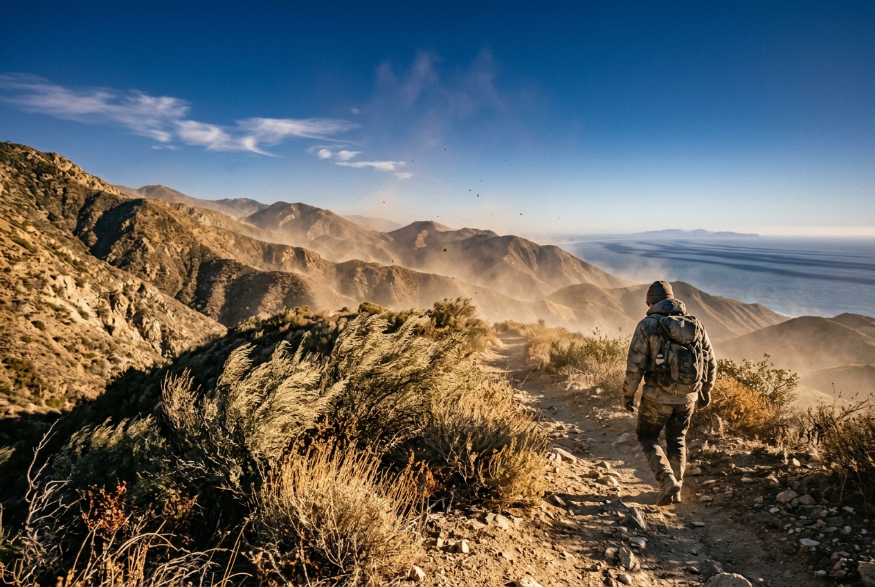
Stand on the sandstone escarpment of the Santa Monica Mountains at five o’clock on a late-October morning, and the world feels strangely unmoored. For weeks, the Pacific coast has lived under the quiet dominion of the marine layer: a cool, damp blanket of stratus cloud that creeps inland each night, leaving eucalyptus leaves dripping with maritime dew and the air tasting faintly of salt and cold kelp.
Then, within the span of twenty minutes, the atmosphere snaps.
The first physical sensation is not wind, but an eerie, electrostatic prickle on the skin. The temperature, which had hovered near a brisk 12°C (54°F), suddenly surges upward as though an invisible oven door has swung open across the ridgeline. The air pressure pulses against the eardrums—a subtle, heavy shift in barometric presence. Down along the shoreline, the thick bank of coastal fog does not simply burn away under the rising sun; it is violently obliterated, peeled back from the cliffs and driven twenty miles out to sea by an unseen hand.
By mid-morning, the wind arrives in earnest. It does not blow with the chaotic, turbulent buffeting of a winter rainstorm, but with the steady, laminar fury of a blowtorch. In the canyon throats—Cajon, San Gorgonio, Santa Ana—gusts scream through dry chaparral at 100 kilometres per hour (62 mph). The air smells of pulverized dust, brittle sage, and the static charge of friction.
Most unsettling of all is the hyper-lucidity of the visual field. Every trace of urban haze and marine mist has been scoured from the sky. Santa Catalina Island, forty miles offshore, appears so razor-sharp against the cobalt horizon that one can discern individual ravines on its volcanic ridges. The atmosphere has become an optical vacuum: searingly hot, blindingly clear, and desperately thirsty.
This is the onset of the Santa Ana wind—a meteorological spectacle long mythologized in Western literature as a madness-inducing omen, but governed entirely by the uncompromising laws of geophysical fluid dynamics and classical thermodynamics.
2. What is Actually Happening: Plain English First
To understand why a Santa Ana wind feels like a blast furnace, one must first confront a geographic paradox: the wind begins its life as a frigid, sub-freezing reservoir of air over the high deserts of Nevada and Utah.
Think of the atmosphere over the western United States as an immense topographical staircase. At the top of the stairs lies the elevated Great Basin—a vast, semi-arid plateau perched roughly 1,200 to 1,500 metres (4,000 to 5,000 feet) above sea level. At the bottom of the stairs lies the coastal plain of Los Angeles, Orange County, and San Diego, terminating at the Pacific Ocean.
When an intense, cold high-pressure system parks itself over this elevated plateau in autumn, the air within it is exceptionally dense, heavy, and cold. Meanwhile, along the warm Pacific shoreline, lower atmospheric pressure prevails. Nature abhorring an imbalance, this mountain of dense air begins spilling off the plateau, seeking the lower pressure at sea level.
As this air descends the topographical staircase, it plunges into regions of progressively higher atmospheric pressure. As anyone who has ever pumped up a bicycle tyre knows, when you squeeze a gas into a smaller volume, its temperature rises dramatically. The pump barrel grows hot not because of external heat, but because mechanical work is being done on the air molecules, forcing them closer together and elevating their thermal kinetic energy.
The descending Great Basin air experiences this exact mechanical compression on a planetary scale. For every kilometre the air parcel plunges down the mountain flanks toward the Pacific, the increasing weight of the atmosphere above it compresses and heats it by nearly 10 degrees Celsius.
Simultaneously, the air's capacity to hold water vapour expands exponentially as it warms. Think of an air parcel as a thermal sponge: when cold, it is a tiny sponge that can only hold a thimbleful of moisture before becoming saturated; when heated, the sponge expands to the size of a mattress. Without any new water sources to drink from as it rushes over dry mountains, the descending air’s relative moisture content plummets into the single digits.
Finally, as this vast atmospheric river encounters the towering barrier of the Transverse and Peninsular mountain ranges, it cannot simply flow over them uniformly. It is forced into narrow geographic gaps—canyons and mountain passes—behaving exactly like water rushing through a constricted garden hose nozzle. The air accelerates violently, turning a gentle regional descent into a localized, hurricane-force sandblaster.
3. The Science: Thermodynamics, Kinematics, and Synoptic Architecture
For atmospheric scientists and field observers equipped with portable instrumentation, a Santa Ana event provides an outdoor laboratory for classical thermodynamics, fluid kinematics, and synoptic meteorology.
3.1 The Synoptic Architecture: The Great Basin Dipole
The macroscale engine of a Santa Ana event is a planetary-scale pressure dipole established across the western cordillera of North America. This architecture requires two concurrent synoptic features, routinely tracked by the National Oceanic and Atmospheric Administration (NOAA) and the US National Weather Service:
- The Great Basin Anticyclone: Following the passage of a cold, mid-latitude upper-level trough, an intense surface high-pressure system (often $\ge 1032\text{ to }1040\text{ hPa}$) builds over the elevated Intermountain West (Nevada, Utah, and southern Idaho). Because this plateau sits at an average altitude of $z \approx 1,500\text{ m}$ above sea level, the air mass is chilled by nocturnal radiative cooling over arid soils, rendering it exceptionally dense.
- The Coastal Thermal Trough: Concurrently, a weak thermal trough or inverted low-pressure zone ($1010\text{ to }1014\text{ hPa}$) anchors itself along the Southern California bight and Baja California coastline.
This geometry sets up an extreme horizontal pressure gradient:
$$\nabla P = -\frac{1}{\rho} \frac{\partial P}{\partial x}$$
Where $\rho$ is ambient air density and $\partial P / \partial x$ represents the cross-mountain pressure differential. Typically, meteorologists measure the synoptic gradient using the surface pressure difference between Tonopah, Nevada (or Daggett in the Mojave Desert) and Los Angeles International Airport ($\Delta P_{\text{DAG-LAX}}$). When $\Delta P_{\text{DAG-LAX}}$ exceeds $+8\text{ to }+12\text{ hPa}$, a severe, basin-wide offshore wind event is triggered according to criteria documented by the American Meteorological Society.
Because the scale of the mountain barrier is mesoscale (spanning a few hundred kilometres) and the flow is strongly constrained by topography, the air parcel does not reach geostrophic balance (where the Coriolis force perfectly balances the pressure gradient). Instead, ageostrophic flow dominates: the air accelerates directly down the pressure gradient, spilling south-southwestward toward the coast.
3.2 Thermodynamics of Adiabatic Compressional Heating
As the cold parcel leaves the Great Basin plateau ($z_1 \approx 1,500\text{ m}$) and descends toward the coastal plain ($z_2 = 0\text{ m}$), it undergoes pure dry adiabatic compression.
According to the First Law of Thermodynamics for an ideal gas undergoing an adiabatic process ($dQ = 0$):
$$dQ = c_p \, dT - \alpha \, dP = 0$$
Where $c_p$ is the specific heat capacity of dry air at constant pressure ($1005\text{ J}\cdot\text{kg}^{-1}\cdot\text{K}^{-1}$), $\alpha = 1/\rho$ is specific volume, and $dP$ is the change in atmospheric pressure. Applying the hydrostatic equation ($dP = -\rho g \, dz$):
$$c_p \, dT = -\alpha (-\rho g \, dz) = \frac{1}{\rho} (\rho g \, dz) = g \, dz$$
Rearranging this yields the Dry Adiabatic Lapse Rate ($\Gamma_d$), a foundational constant maintained in standard meteorological tables by the World Meteorological Organization (WMO):
$$\Gamma_d = -\frac{dT}{dz} = \frac{g}{c_p} = \frac{9.80665\text{ m}\cdot\text{s}^{-2}}{1005\text{ J}\cdot\text{kg}^{-1}\cdot\text{K}^{-1}} \approx 9.8\times 10^{-3}\text{ K}\cdot\text{m}^{-1} = 9.8^\circ\text{C}/\text{km}$$
The total sensible temperature change ($\Delta T$) experienced by a purely descending parcel across a vertical displacement $\Delta z = z_1 - z_2$ is governed by:
$$\Delta T = \Gamma_d \cdot \Delta z$$
========================================================================================
                     STEP-BY-STEP MATHEMATICAL PROOF: DESCENT WARMING
========================================================================================
1. Initial Parameters (Great Basin Plateau Summit):
   • Altitude: z_1 = 1,500 m (1.5 km ASL)
   • Initial Temperature: T_1 = 2.0 °C (35.6 °F)
   • Target Altitude (Coastal Sea Level): z_2 = 0 m

2. Vertical Displacement:
   Δz = z_1 - z_2 = 1.5 km - 0.0 km = 1.5 km

3. Compressional Heating Magnitude:
   ΔT = Γ_d · Δz = (9.8 °C / km) · (1.5 km) = +14.7 °C

4. Final Sea-Level Temperature (Excluding Solar Insolation):
   T_2 = T_1 + ΔT = 2.0 °C + 14.7 °C = 16.7 °C (62.1 °F)

5. Addition of Diurnal Solar Radiation & Subsidence Inversion (+12.0 °C):
   T_surface = 16.7 °C + 12.0 °C = 28.7 °C (83.7 °F)
========================================================================================
Thus, an air parcel that begins as a frosty winter air mass ($2^\circ\text{C}$) in the Nevada desert arrives at Santa Monica beach as an unseasonable $29^\circ\text{C}$ ($84^\circ\text{F}$) thermal gale, heated entirely by mechanical compression and direct solar insolation without absorbing heat from external thermal reservoirs.
3.3 The Moisture Deficit: Clausius-Clapeyron and Vapor Pressure Deficit
The desiccation of the air during a Santa Ana event is mathematically linked to the exponential response of saturation vapor pressure to temperature, formalised by the Clausius-Clapeyron relation.
As the air parcel descends, its actual water content—measured by the water vapor mixing ratio ($w$) in grams of water vapor per kilogram of dry air—is strictly conserved, because no water is added or removed via precipitation or condensation:
$$w \approx 0.622 \frac{e}{P} \approx \text{constant}$$
Where $e$ is the ambient partial pressure of water vapor and $P$ is total atmospheric pressure.
However, the saturation vapor pressure ($e_s$)—the maximum partial pressure of water vapor the air can sustain before condensing—is an exponential function of temperature $T$. It is accurately approximated by the August-Roche-Magnus formula:
$$e_s(T) = e_0 \cdot \exp\left( \frac{17.27 \cdot T}{T + 237.3} \right)$$
Where $e_0 = 0.61078\text{ kPa}$ (the saturation vapor pressure at $0^\circ\text{C}$) and $T$ is in degrees Celsius.
Relative Humidity ($RH$) is defined as the ratio of ambient vapor pressure to saturation vapor pressure:
$$RH = \left( \frac{e}{e_s(T)} \right) \times 100\%$$
========================================================================================
                   MATHEMATICAL PROOF: RELATIVE HUMIDITY PLUNGE
========================================================================================
1. At Plateau Summit (z = 1,500 m, T = 2.0 °C, Ambient Vapor Pressure e = 0.424 kPa):
   e_s(2.0 °C) = 0.61078 · exp( (17.27 · 2.0) / (2.0 + 237.3) ) = 0.706 kPa
   RH_plateau = (0.424 kPa / 0.706 kPa) · 100% = 60.0%

2. At Coastal Basin Floor (z = 0 m, T = 30.0 °C, Conserved Vapor Pressure e ≈ 0.450 kPa):
   e_s(30.0 °C) = 0.61078 · exp( (17.27 · 30.0) / (30.0 + 237.3) ) = 4.246 kPa
   RH_coast = (0.450 kPa / 4.246 kPa) · 100% = 10.6%

3. Extreme Case: If T_surface reaches 35.0 °C (95.0 °F):
   e_s(35.0 °C) = 5.628 kPa
   RH_coast = (0.450 kPa / 5.628 kPa) · 100% = 8.0%
========================================================================================
The resulting Vapor Pressure Deficit ($VPD = e_s(T) - e$) explodes from $0.28\text{ kPa}$ on the plateau to over $3.80\text{ kPa}$ on the coast. In the terminology of plant physiology and wildland fire behavior (documented extensively by the Met Office), this extreme VPD exerts an unrelenting atmospheric suction on chaparral vegetation, extracting moisture from living scrub oak, chamise, and manzanita within hours and driving 10-hour fuel moisture levels below the critical 5% threshold.
3.4 Kinematics of Canyon Channeling and Hydraulic Flow
Why do Santa Ana winds achieve catastrophic speeds of 80 to 120 km/h in localized mountain corridors while remaining moderate elsewhere? The acceleration is driven by two coupled fluid-dynamic mechanisms: geometric Venturi funneling and supercritical hydraulic flow.
A. Mass Conservation and the Bernoulli Principle
When a layer of descending air of cross-sectional area $A_1$ and velocity $v_1$ is forced into a constricted mountain pass (such as Cajon Pass, notched between the San Gabriel and San Bernardino mountains) with reduced cross-sectional area $A_2$, the continuity equation for incompressible flow requires:
$$A_1 v_1 = A_2 v_2 \implies v_2 = v_1 \left( \frac{A_1}{A_2} \right)$$
As cross-sectional area constricts by a factor of 3 to 4, velocity must quadruple. Along a streamline, the Bernoulli Principle dictates that this kinematic acceleration is accompanied by a localized drop in static pressure ($\Delta P$):
$$\Delta P = \frac{1}{2}\rho \left( v_2^2 - v_1^2 \right)$$
B. Hydraulic Jump Dynamics and the Froude Number
Santa Ana winds often behave not merely as channeled winds, but as hydraulic torrents analogous to water spilling over a dam. This behaviour is governed by the shallow-water Froude number ($Fr$):
$$Fr = \frac{U}{\sqrt{g' \, H}}$$
Where $U$ is the wind speed, $H$ is the depth of the dense air layer, and $g' = g (\Delta \theta / \theta)$ is reduced gravity based on the potential temperature differential ($\Delta \theta$) across the capping inversion.
- Windward Side ($Fr < 1$): The flow approaching the mountain crest is thick, relatively slow, and subcritical.
- Crest / Pass ($Fr = 1$): At the topographic choke point, the flow reaches critical velocity.
- Leeward Slope ($Fr > 1$): As the air tumbles down the steep coastal-facing canyons, it converts potential energy into kinetic energy, transitioning into a shooting, supercritical torrent ($Fr > 1$) that clings to the lee slopes as an intense downslope windstorm.
- Hydraulic Jump: Upon striking the flat coastal plain or meeting the residual marine air mass, the supercritical flow abruptly decelerates in a violent, turbulent hydraulic jump, producing chaotic surface wind gusts, severe mechanical turbulence, and massive vertical wind shear hazardous to aviation.
3.5 Real-World Case Study & Synoptic Summary Table
Consider a classic, high-end autumn Santa Ana outbreak (characteristic of events such as the October 2003 Cedar Fire outbreak or the October 2007 siege documented across Southern California, detailed in historical archives on Wikipedia).
Below is an empirical meteorological comparison tracking the thermodynamic transformation of an air parcel as it transitions from the Great Basin plateau to the coastal plain:
| Meteorological Parameter | Great Basin Plateau (Tonopah / Mojave Ridge) | Cajon Pass Throat (Venturi Choke Point) | Coastal Plain (Santa Monica / San Diego) |
|---|---|---|---|
| Elevation ($z$) | $1,520\text{ m}$ ($4,987\text{ ft}$) | $1,140\text{ m}$ ($3,740\text{ ft}$) | $15\text{ m}$ ($50\text{ ft}$) |
| Barometric Pressure ($P$) | $845\text{ hPa}$ | $885\text{ hPa}$ | $1016\text{ hPa}$ |
| Air Temperature ($T$) | $3.5^\circ\text{C}$ ($38.3^\circ\text{F}$) | $7.2^\circ\text{C}$ ($45.0^\circ\text{F}$) | $32.8^\circ\text{C}$ ($91.0^\circ\text{F}$) |
| Dew Point Temperature ($T_d$) | $-4.0^\circ\text{C}$ ($24.8^\circ\text{F}$) | $-6.5^\circ\text{C}$ ($20.3^\circ\text{F}$) | $-9.0^\circ\text{C}$ ($15.8^\circ\text{F}$) |
| Mixing Ratio ($w$) | $2.8\text{ g/kg}$ | $2.7\text{ g/kg}$ | $2.6\text{ g/kg}$ (Conserved) |
| Saturation Vapor Pressure ($e_s$) | $0.785\text{ kPa}$ | $1.015\text{ kPa}$ | $4.982\text{ kPa}$ |
| Actual Vapor Pressure ($e$) | $0.448\text{ kPa}$ | $0.375\text{ kPa}$ | $0.312\text{ kPa}$ |
| Relative Humidity ($RH$) | $57.1\%$ | $36.9\%$ | $6.3\%$ |
| Vapor Pressure Deficit ($VPD$) | $0.337\text{ kPa}$ | $0.640\text{ kPa}$ | $4.670\text{ kPa}$ |
| Mean Wind Velocity ($v$) | $25\text{ km/h}$ (Northeast) | $95\text{ km/h}$ (Northeast) | $65\text{ km/h}$ (Gusts to $110\text{ km/h}$) |
4. Practical Outdoor Guidance: Field Diagnostics for the Observer
For the naturalist, mountaineer, sailor, or field meteorologist, a Santa Ana event can be diagnosed and tracked hours before severe surface winds materialize.
4.1 What to Look for in the Sky and Horizon
- The Wall of Offshore Dust and Scoured Stratus: Look westward toward the ocean. During an active Santa Ana, coastal fog is entirely absent from the shore, but an observer looking out over the Pacific will see a sharp, linear bank of stratus clouds pinned 15 to 40 miles offshore. Rising above it, distinct ribbons of pale brown dust stream directly out to sea from canyon mouths.
- Abnormal Optical Clarity (Rayleigh Dominance): Under ordinary onshore flow, maritime aerosols and photochemical smog scatter light via Mie scattering, producing a milky white haze. The continental desert air of a Santa Ana purges all fine particulates. The sky overhead shifts to a deep, cobalt blue, and distant mountain ranges 80 miles away appear unnaturally close and distinct.
- Altocumulus Lenticularis (Mountain Wave Clouds): Look directly above the crests of the Transverse Ranges. The high-velocity flow over the ridges often generates standing atmospheric gravity waves. If sufficient moisture exists aloft, stationary, lens-shaped lenticular clouds will hover directly over the leeward escarpments, marking zones of severe mountain wave turbulence.
4.2 Instrument Signatures for the Field Kit
If you carry a pocket weather station (such as a Kestrel) or monitor local automated weather stations (RAWS), watch for the classic tripartite signature:
- The Ridge-Top Dew Point Crash: The earliest indicator of an impending Santa Ana does not occur at the beach, but at mountain summits (e.g., Mount Wilson or Santiago Peak). Watch for the dew point at high elevations to collapse from $+5^\circ\text{C}$ to $-15^\circ\text{C}$ overnight. This signals that the Great Basin dry air mass has arrived aloft and is beginning to suppress the marine inversion.
- The Barometric Trend: Watch the local barometric altimeter. As the synoptic high builds inland, regional barometers rise; however, as the supercritical wind accelerates down the lee slopes, local micro-barometers will exhibit rapid, high-frequency pressure fluctuations ($\pm 2\text{ hPa}$) caused by turbulent eddies and hydraulic jump oscillations.
- The Dry-Bulb / Wet-Bulb Spread: Measure the wet-bulb depression ($T - T_w$). In a standard maritime air mass, $T - T_w$ is typically $2\text{ to }5^\circ\text{C}$. During a full-blown Santa Ana event, the dry-bulb may read $32^\circ\text{C}$ while the wet-bulb plummets to $14^\circ\text{C}$, yielding an extreme depression of $18^\circ\text{C}$—an absolute confirmation of extreme evaporative demand.
4.3 Practical Rules of Thumb for Specific Outdoor Activities
For the Hiker and Backcountry Traveler
- The Hydration Rule: Because relative humidity drops below 10% and wind speeds exceed 60 km/h, the rate of insensible perspiration (evaporative water loss through skin and respiration) quadruples. Double your standard water allowance from 0.5 litres/hour to 1.0 to 1.5 litres/hour, even if you do not feel actively sweaty—the sweat is evaporating instantaneously upon reaching the skin surface.
- The Wind-Reversal Escape Plan: If recreating in chaparral terrain, remember that any wildfire ignition during a Santa Ana will move at terrifying rates (up to 10–15 km/h) driven by spot-fire ember casting up to a mile downwind. Never position yourself southwest (downwind) of an uncontained ignition.
For the Sailor and Coastal Waterman
- The Offshore Gale Hazard: While coastal waters within 500 metres of the beach may appear deceptively flat due to wind blowing directly off the land, wind speeds increase drastically 1 to 5 miles offshore. Small craft venturing out of harbours will encounter sudden 40-knot katabatic squalls and steep, short-period wind waves building rapidly in the open channels between the mainland and the Channel Islands.
For the Gardener and Arborist
- The Desiccation Defense: The explosive increase in Vapor Pressure Deficit ($VPD > 4.0\text{ kPa}$) extracts moisture from shallow root systems faster than vascular plants can draw water from the soil, causing irreversible cavitation in xylem vessels. Deeply irrigate sensitive root zones 12 hours prior to wind onset; surface spraying during the event is useless, as droplets evaporate before reaching the soil.
5. Today's Meteorological Rule of Thumb
The Santa Ana Paradox: The colder and denser the air mass over the elevated Great Basin, the hotter, drier, and more violent the gale that reaches the Pacific coast. When mountain summit dew points crash below freezing while the coast remains calm, expect the furnace to ignite at sea level within twelve hours—driven by 9.8 degrees of compressional warming for every vertical kilometre of descent.