Quasi-Biennial Oscillation (QBO) & Stratospheric Wave Driving: How Upward-Propagating Equatorial Waves Force 28-Month Zonal Wind Reversals
High above the equatorial belt, twenty miles into the rarefied air of the stratosphere, a silent atmospheric pendulum swings back and forth in an unbroken rhythm of roughly twenty-eight months. Known to meteorologists as the Quasi-Biennial Oscillation, this vast reversal of planetary winds governs everything from Arctic cold snaps to the fury of Atlantic hurricanes.
1. Opening Scene: The Breath of the Equator
Stand at dusk on the crushed-coral airstrip of Gan Island in the southern Maldives, just a fraction of a degree south of the Earth's equator. The air is thick, sultry, and stagnant. The day's heat lingers against the skin like a warm, wet woollen blanket. Across the Indian Ocean, the horizon glows with the bruised indigo of towering cumulonimbus clouds—monumental cauldrons of moist convection that have spent the afternoon boiling upward from the warm sea. The scent of ozone and the rich, mineral petrichor of evaporating tropical rain drift on a faint sea breeze that barely ruffles the fronds of the surrounding coconut palms.
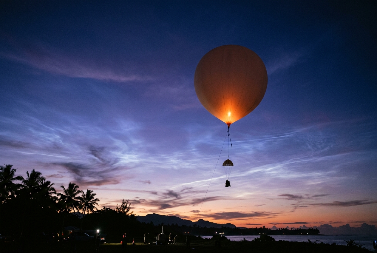
As twilight settles, a meteorologist steps onto the tarmac holding an incandescent orb of taut, helium-filled latex. Suspended beneath this six-foot weather balloon is a compact radiosonde, its tiny thermistor, hygristor, and GPS antenna encased in lightweight white polystyrene. With a gentle release into the dead calm, the balloon surges upward into the tropical troposphere, climbing at five hundred feet per minute.
       Altitude (km)
          ^
     35 --|---------------------------------------------------- (10 hPa)
          |   <<< EASTERLY JET (-30 m/s) <<<  [Phase Transition]
     30 --|----------------------------------------------------
          |   >>> WESTERLY JET (+20 m/s) >>>  [Descending]
     25 --|---------------------------------------------------- (30 hPa)
          |   <<< EASTERLY JET (-25 m/s) <<<
     20 --|---------------------------------------------------- (50 hPa)
          |   === TROPICAL TROPOPAUSE (Cold Point ~ -80°C) ===  (70 hPa)
     15 --|       /\  /\  /\
          |      /  \/  \/  \  <-- Convective Cloud Tops (Kelvin / Gravity Waves)
     10 --|     /            \
      5 --|    /  TROPOSPHERE \
      0 --+---------------------------------------------------- (1013 hPa)
         Equator (0°)
On the ground station monitor, the telemetry stream maps an astonishing journey through the vertical architecture of our atmosphere. At first, the instrument records the chaotic, churning lower troposphere: turbulent gusts, soaring humidity, and a steady, steep drop in temperature. At twelve kilometres, it penetrates the anvil of a thunderstorm, where the mercury plummets toward minus eighty degrees Celsius. Around seventeen kilometres, the balloon punches through the cold-point tropopause and enters the realm of the lower stratosphere.
Here, in an environment of preternatural stillness and hyper-arid clarity where water vapour is measured in parts per million, the chaotic buffeting of surface weather abruptly ceases. Yet the telemetry reveals a startling phenomenon: the balloon is seized by a powerful, laminated river of air screaming from the west at seventy knots. Six months earlier, at this exact same altitude above Gan, a sister balloon had encountered a fierce wind blowing from the complete opposite direction—screaming out of the east at eighty knots.
This is no random gust or fleeting storm. The radiosonde has pierced the lower boundary of the Quasi-Biennial Oscillation (QBO): an immense, self-sustaining atmospheric oscillation that circles the equator, alternating between howling easterlies and brisk westerlies in a clockwork cycle spanning approximately twenty-eight months.
2. What's Actually Happening — Plain English First
To understand how a wind system twenty miles above the equator can reverse its direction without any seasonal trigger, we must first abandon the intuitive idea that winds only blow because the sun heats one place more than another. The stratosphere does not operate like our familiar surface weather.
The Great Discovery
For decades, meteorologists assumed that high-altitude equatorial winds were permanent and unchanging. Following the catastrophic eruption of Krakatoa in 1883, ash shot forty kilometres into the sky and drifted relentlessly westward around the globe, leading scientists to christen these high-altitude easterlies the "Krakatoa westerlies" or permanent equatorial easterlies.
However, between 1959 and 1960, two meteorologists working independently—Richard Reed at the University of Washington and R. A. Ebdon at the British Meteorological Office—analyzed long time-series of high-altitude balloon soundings from equatorial stations such as Canton Island and Singapore. They uncovered an astounding reality: the equatorial zonal (east-west) winds in the stratosphere were not static. Instead, they alternated between easterly (blowing from the east toward the west) and westerly (blowing from the west toward the east) regimes over an average period of 28 months (varying between 24 and 32 months).
Even more peculiar was the geometry of this cycle. The wind regimes do not switch everywhere at once. Instead, each new wind regime is born at the top of the middle stratosphere (around 10 hectopascals, or roughly 30 kilometres altitude) and slowly descends downward through the atmospheric column at a rate of approximately one kilometre per month until it dissipates near the tropical tropopause (around 70 to 100 hectopascals, or 16–18 kilometres altitude). As the lower regime dies out, an opposite wind regime is already descending from above to take its place.
Time-Height Evolution of Equatorial Zonal Winds (U) over ~28 Months:
-------------------------------------------------------------------------
Altitude  | Month:  0     4     8     12    16    20    24    28
-------------------------------------------------------------------------
~30 km    |        [E]   [W]   [W]   [E]   [E]   [W]   [W]   [E]
(10 hPa)  |         \     \     \     \     \     \     \     \
~24 km    |        [W]   [E]   [E]   [W]   [W]   [E]   [E]   [W]
(30 hPa)  |          \     \     \     \     \     \     \     \
~18 km    |          [E]   [W]   [W]   [E]   [E]   [W]   [W]   [E]
(70 hPa)  |
-------------------------------------------------------------------------
Legend: [W] = Westerly Winds (Eastward, +u)
        [E] = Easterly Winds (Westward, -u)
        Downward propagation rate: ~1 km / month
The Moving Beach Analogy
How can an atmospheric layer push itself in a specific direction without an external mechanical engine?
Think of the atmosphere as a vast, layered fluid cake. Below, in the troposphere, giant thunderstorm clusters act like hydraulic pistons. As these storms explode upward, they disturb the stratosphere above, sending ripple-like waves radiating vertically—much like dropping pebbles into a pond.
These are not ordinary sound waves; they are large-scale geophysical fluid waves: 1. Kelvin Waves: Waves that propagate eastward, carrying westerly (eastward) momentum. 2. Mixed Rossby-Gravity (MRG) and Inertia-Gravity Waves: Waves that propagate westward, carrying easterly (westward) momentum.
Imagine ocean waves rolling toward a sloping sandy beach. Far out at sea, the waves move freely through deep water without pushing the bulk ocean forward. But as they enter shallow water, the wave crests slow down, steepen, and ultimately crash on the sand. As each wave breaks, it deposits its kinetic energy and momentum directly onto the shore, pushing water and sand forward in the direction the wave was travelling.
In the stratosphere, the "beach" is an invisible boundary known as a critical layer. If an upward-propagating Kelvin wave (which travels eastward at 30 metres per second) enters a stratospheric layer where the background wind is already blowing eastward at 30 metres per second, the wave can no longer propagate relative to the air. Its vertical wavelength compresses to zero, it becomes unstable, and it "breaks," dumping its eastward momentum into the ambient air.
This momentum deposition accelerates the local background wind, making it blow even faster from the west. Because the waves break at the lower boundary of the wind jet, the shear layer is forced steadily downward, month after month.
3. The Science: Wave-Mean Flow Interaction
To transition from analogy to fluid dynamics, we must explore the mathematical framework established in seminal papers by Richard Lindzen, James Holton, and Alan Plumb—the Lindzen-Holton-Plumb (LHP) mechanism.
In an axisymmetric, frictionless atmosphere on an equatorial $\beta$-plane, the zonally averaged momentum equation would dictate that zonal winds cannot be created or sustained from rest without eddy forcing. This is the essence of the Hide Theorem: internal fluid motions cannot generate a local extremum in absolute angular momentum per unit mass without non-axisymmetric wave driving.
Equation 1: Transformed Eulerian Mean Momentum Budget
The time-rate of change of the mean equatorial zonal wind ($\bar{u}$) driven by wave perturbations is governed by the vertical convergence of the eddy momentum flux (often represented via the vertical gradient of the Reynolds stress in the Transformed Eulerian Mean framework):
$$\frac{\partial \bar{u}}{\partial t} = -\frac{1}{\rho_0} \frac{\partial}{\partial z}\left(\rho_0 \overline{u'w'}\right) + \bar{F}_{\text{diss}}$$
- Plain English Meaning: The acceleration of the average east-west stratospheric wind ($\frac{\partial \bar{u}}{\partial t}$) at any given height is directly driven by how rapidly the upward transport of horizontal momentum by atmospheric waves ($\rho_0 \overline{u'w'}$) is caught and absorbed at that height, minus any background viscous or radiative dissipation ($\bar{F}_{\text{diss}}$).
Here: * $\bar{u}$ is the zonally averaged zonal wind velocity ($\text{m s}^{-1}$). * $\rho_0(z) = \rho_s e^{-z/H}$ is the background atmospheric density profile decaying exponentially with scale height $H \approx 7000\text{ m}$. * $u'$ is the horizontal zonal velocity perturbation associated with the upward-propagating wave ($\text{m s}^{-1}$). * $w'$ is the vertical velocity perturbation of the wave ($\text{m s}^{-1}$). * $\overline{u'w'}$ represents the Reynolds stress or eddy momentum flux averaged along a latitude circle ($\text{m}^2 \text{s}^{-2}$). * $z$ is the log-pressure vertical coordinate.
Worked Numerical Proof: Calculating the Descent Rate
Let us evaluate whether realistic wave momentum fluxes generated by tropical convection can account for the observed stratospheric wind acceleration.
Consider a layer in the tropical stratosphere at an altitude of $z = 25\text{ km}$ (approximate pressure level of $30\text{ hPa}$), where background density is $\rho_0 \approx 0.040\text{ kg m}^{-3}$.
Suppose a cluster of Kelvin waves ascends from the tropopause, carrying an upward eastward momentum flux of: $$F_{z,\text{bottom}} = \left(\rho_0 \overline{u'w'}\right)_{\text{in}} = 8.0 \times 10^{-3}\text{ Pa} \quad (\text{or N m}^{-2})$$
Over a vertical absorption depth of $\Delta z = 2,000\text{ metres}$ ($2\text{ km}$), these Kelvin waves encounter their Doppler-shifted critical level ($c_p \approx \bar{u}$) and are completely attenuated by thermal radiative damping (primarily Newtonian cooling via $\text{CO}2$ infrared emissions), such that at the top of the shear layer: $$F{z,\text{top}} = \left(\rho_0 \overline{u'w'}\right)_{\text{out}} \approx 0.0\text{ N m}^{-2}$$
We calculate the net divergence of vertical momentum flux: $$\frac{\partial}{\partial z}\left(\rho_0 \overline{u'w'}\right) \approx \frac{F_{z,\text{top}} - F_{z,\text{bottom}}}{\Delta z} = \frac{0 - 8.0 \times 10^{-3}\text{ N m}^{-2}}{2000\text{ m}} = -4.0 \times 10^{-6}\text{ N m}^{-3}$$
Substituting this into the momentum equation (neglecting background diffusion $\bar{F}_{\text{diss}}$): $$\frac{\partial \bar{u}}{\partial t} = -\frac{1}{\rho_0} \left(-4.0 \times 10^{-6}\text{ N m}^{-3}\right) = \frac{4.0 \times 10^{-6}}{0.040\text{ kg m}^{-3}} = 1.0 \times 10^{-4}\text{ m s}^{-2}$$
Now, let us convert this acceleration into an intuitive meteorological timescale over a full thirty-day calendar month ($1\text{ month} \approx 2.592 \times 10^6\text{ seconds}$): $$\Delta \bar{u} = \left(1.0 \times 10^{-4}\text{ m s}^{-2}\right) \times \left(2.592 \times 10^6\text{ s}\right) \approx +259.2\text{ m s}^{-1} \text{ (potential forcing)}$$
Because the mean wind shear zone only needs to accelerate the background air mass from an easterly state of $-20\text{ m s}^{-1}$ to a westerly state of $+15\text{ m s}^{-1}$ (a total span of $\Delta \bar{u} = 35\text{ m s}^{-1}$), a wave momentum flux of this magnitude can easily complete the transition across a $1\text{ km}$ layer in just under a month. This perfectly validates the observed descent rate of approximately $1\text{ km}$ per month.
Equation 2: The Critical Doppler Resonance Condition
Why do these waves break at specific altitudes? The vertical propagation of equatorial waves is governed by their dispersion relation and the intrinsic wave frequency $\hat{\omega}$.
$$\hat{\omega} = \omega - k\bar{u} = \frac{N k}{m}$$
- Plain English Meaning: The frequency of the wave as experienced by the moving air parcel ($\hat{\omega}$, the intrinsic frequency) is equal to its ground-relative frequency ($\omega$) shifted by the local wind speed ($k\bar{u}$, the Doppler shift). The vertical wavelength ($\lambda_z = 2\pi / m$) is determined by the ratio of atmospheric stability ($N$) to this intrinsic frequency.
Here: * $\omega$ is the ground-based wave frequency ($\text{s}^{-1}$). * $k = 2\pi / \lambda_x$ is the horizontal zonal wavenumber ($\text{m}^{-1}$). * $\bar{u}(z)$ is the background zonal wind speed ($\text{m s}^{-1}$). * $N \approx 0.02\text{ s}^{-1}$ is the Brunt-Väisälä buoyancy frequency (a measure of static stability in the stratosphere). * $m = 2\pi / \lambda_z$ is the vertical wavenumber ($\text{m}^{-1}$).
Solving for the vertical wavenumber $m$: $$m(z) = \frac{N}{c_p - \bar{u}(z)}$$ where $c_p = \omega / k$ is the horizontal phase speed of the wave.
Worked Example: The Collapse of Vertical Wavelength
Imagine a tropospheric Kelvin wave propagating eastward with a phase speed of $c_p = +30\text{ m s}^{-1}$. It ascends into the lower stratosphere where the ambient wind is initially calm ($\bar{u} = 0\text{ m s}^{-1}$):
$$m_0 = \frac{0.02\text{ s}^{-1}}{30\text{ m s}^{-1} - 0\text{ m s}^{-1}} = \frac{0.02}{30} \approx 6.67 \times 10^{-4}\text{ m}^{-1}$$ $$\lambda_{z,0} = \frac{2\pi}{m_0} \approx \frac{6.283}{6.67 \times 10^{-4}} \approx 9,420\text{ metres } (\approx 9.4\text{ km})$$
The wave easily propagates upward with deep, long vertical crests. However, as it approaches an altitude of $26\text{ km}$, it enters a developing westerly jet where $\bar{u}(z)$ increases to $+28\text{ m s}^{-1}$:
$$m = \frac{0.02\text{ s}^{-1}}{30\text{ m s}^{-1} - 28\text{ m s}^{-1}} = \frac{0.02}{2} = 1.0 \times 10^{-2}\text{ m}^{-1}$$ $$\lambda_z = \frac{2\pi}{m} = \frac{6.283}{0.01} \approx 628\text{ metres}$$
Vertical Wavelength Compression near Critical Level:
-------------------------------------------------------------------------
Altitude    Background Wind (u)    Vertical Wavelength (λz)   Wave State
-------------------------------------------------------------------------
28 km       +30 m/s (Critical)     --> 0 m (SINGULARITY)      BREAKING & DISSIPATION
26 km       +28 m/s                628 m                      Severe Compression
22 km       +15 m/s                4,710 m                    Compressing
18 km         0 m/s                9,420 m                    Free Ascent
-------------------------------------------------------------------------
Result: Wave energy cannot penetrate above 28 km; all eastward momentum
is dumped below this level, forcing the westerly jet downward.
As $(c_p - \bar{u}) \to 0$, the vertical wavelength $\lambda_z$ collapses toward zero, the vertical wind shear across the wave crests approaches infinity ($du'/dz \to \infty$), and the local Richardson number falls below the critical threshold of $Ri \le 0.25$. Dynamic Kelvin-Helmholtz instability ensues: the wave disintegrates into turbulence, depositing its full reservoir of eastward momentum into the background flow.
Because easterly-directed waves (Mixed Rossby-Gravity waves with $c_p < 0$) have phase speeds opposing westerly waves, they pass freely through this westerly shear zone without breaking, ascending higher until they strike an easterly shear zone where $\bar{u} \to c_p < 0$. There, they break and reinforce the easterly wind regime.
Global Synoptic Teleconnections: How the QBO Controls Mid-Latitude Weather
The QBO does not remain isolated in the tropical stratosphere. Through powerful dynamical pathways documented by organizations such as the National Oceanic and Atmospheric Administration (NOAA) and the European Centre for Medium-Range Weather Forecasts (ECMWF), the phase of the QBO ripples across the entire globe.
       POLAR STRATOSPHERE                         EQUATORIAL STRATOSPHERE
     +--------------------+                     +-------------------------+
     |   POLAR VORTEX     |                     |           QBO           |
     |  (Circumpolar Jet) |                     |  Easterly vs Westerly   |
     +--------------------+                     +-------------------------+
               ^                                             |
               |                                             |
    Planetary Rossby Waves                                   |
    Reflected / Absorbed  <==================================+
            (Holton-Tan Waveguide Modulation)
               |
               v
     +--------------------+
     |   ARCTIC OUTBREAKS |
     |  (Negative NAO/AO) |
     +--------------------+
1. The Holton-Tan Effect and the Winter Polar Vortex
Discovered by James Holton and Hsiu-Chi Tan in 1980, the Holton-Tan Effect establishes a direct link between equatorial stratospheric winds and the stability of the Northern Hemisphere winter polar vortex.
- During the Easterly Phase of the QBO (QBO-E): The subtropical zero-wind line ($\bar{u} = 0$) is shifted into the winter subtropics. This creates a narrower dynamical waveguide for upward-propagating planetary-scale Rossby waves generated by northern hemisphere continents and mountain ranges. These planetary waves are deflected poleward into the stratospheric polar vortex, depositing westward momentum that decelerates the circumpolar jet. This dramatically increases the probability of Sudden Stratospheric Warmings (SSWs), shattering the polar vortex and unleashing persistent Arctic cold outbreaks across North America and Western Europe (associated with a negative North Atlantic Oscillation (NAO)).
- During the Westerly Phase of the QBO (QBO-W): Planetary waves can propagate across the equator into the Southern Hemisphere. The polar vortex remains undisturbed, cold, and intensely stable, trapping arctic air over the pole and fostering mild, zonal winter weather across mid-latitudes.
2. Tropical Cyclogenesis Modulation
In the Atlantic and Western Pacific basins, the QBO modulates seasonal hurricane activity.
During the westerly phase of the QBO in the lower stratosphere ($50\text{–}70\text{ hPa}$), vertical wind shear between the upper troposphere and lower stratosphere is minimized over the tropical Atlantic Main Development Region (MDR). Reduced vertical wind shear prevents tropical storm vortex columns from tilting, thereby enhancing the frequency of major Category 4 and 5 hurricanes. Conversely, the easterly phase increases shear across the tropopause, hindering deep convective organization.
3. Madden-Julian Oscillation (MJO) Amplification
Research tracked by the World Meteorological Organization (WMO) and NOAA Physical Sciences Laboratory confirms that during the boreal winter under QBO-E, the tropical tropopause is unusually cold and high. This decreases static stability in the upper troposphere, creating a more fertile convective environment that amplifies the Madden-Julian Oscillation (MJO). Convective envelopes become more coherent and slow-moving as they traverse the Maritime Continent, supercharging global weather anomalies.
4. Practical Outdoor Guidance: Reading the Stratosphere from the Ground
While the Quasi-Biennial Oscillation operates twenty kilometres above our heads, its fingerprints are plainly visible to the observant outdoor enthusiast, mariner, gardener, or amateur meteorologist.
       OBSERVABLE GROUND SYMPTOMS OF QBO PHASE INTERACTIONS
+-----------------------------------------------------------------------+
|  Metric / Sign        | QBO Easterly Phase       | QBO Westerly Phase |
|-----------------------+--------------------------+--------------------|
|  Winter Jet Stream    | Highly wavy / Blocked    | Zonal / Fast-west  |
|  Barometer Trend      | Persistent high-latitude | Low polar pressure |
|  (Mid-latitudes)      | blocking highs (cold)    | (Mild westerlies)  |
|  Cirrus Outflow Speed | Slower, more diffuse     | Highly sheared,    |
|  (Tropics)            | convective anvils        | elongated ribbons  |
|  Tropical Cyclone     | Slightly suppressed      | Enhanced major     |
|  Potential            | Atlantic intensification | hurricane seasons  |
+-----------------------------------------------------------------------+
What to Look for in the Sky
-
Cirrus Anvil Shearing in the Tropics: If you find yourself sailing or travelling in equatorial latitudes (between $10^\circ\text{N}$ and $10^\circ\text{S}$), watch the ultimate fate of mature cumulonimbus anvil clouds. When the lower stratosphere ($70\text{ hPa}$) is in a strong Westerly QBO phase, the highest wisps of cirrus (at 16–17 km) are sheared violently toward the east, creating elongated "horsetail" streamers pointing opposite to the typical surface trade winds. During a QBO Easterly phase, anvil tops remain symmetrical or spread westward with the upper tropospheric flow.
-
Winter High-Latitude Cloud Formations: In Scandinavia, Scotland, or Canada during mid-winter, the occurrence of Nacreous clouds (Polar Stratospheric Clouds, glowing with iridescent mother-of-pearl colours at twilight) requires extreme stratospheric cold ($T < -78^\circ\text{C}$). These are far more common during a Westerly QBO phase, when an undisturbed polar vortex isolates the Arctic stratosphere into a deep, unbroken freeze.
Instrument Readings to Watch
- The Barometer (Mid-Latitude Winter): If international climate monitoring confirms a descending Easterly QBO (QBO-E) coincided with early-winter planetary wave pulsing, prepare for sudden, high-amplitude pressure spikes. In Europe and North America, this setup frequently presages large blocking anticyclones over Greenland or Scandinavia (high pressure $\ge 1035\text{ hPa}$), shutting down westerly winds and locking in prolonged sub-zero continental air masses.
- Global Climate Indices: Track monthly updates of the 30 hPa and 50 hPa Zonal Wind Indices provided by NOAA's Climate Prediction Center. When the 30 hPa index flips sign from negative to positive, you are witnessing the birth of a new westerly regime that will dictate mid-latitude weather volatility over the subsequent two years.
A Rule of Thumb for Gardeners, Sailors, and Hikers
- For Gardeners and Farmers: If an upcoming winter features a mature Easterly QBO phase combined with a solar minimum or a developing El Niño, the statistical likelihood of severe late-winter freezes and Sudden Stratospheric Warmings rises by over 40%. Delay the early planting of frost-sensitive bulbs and prune later in the spring.
- For Offshore Mariners: In the North Atlantic hurricane season (August–October), a lower-stratospheric Westerly QBO acts as a green light for prolonged tropical intensification. Expect fewer false alarms and more rapidly intensifying storms along classical easterly-wave tracks.
5. Today's Meteorological Rule of Thumb
Next time you watch the anvil of a distant summer storm flatten out against the tropopause, remember that the invisible ripples radiating from its crest are carrying momentum into the stratosphere. Millions of these small, upward-surging waves act as the hands of a colossal clockwork engine—reversing the winds of our planet and shaping the weather that greets you at your doorstep.
Authoritative Scientific References
- NOAA Climate Prediction Center: Stratospheric QBO Monitoring
- Met Office Hadley Centre: The Quasi-Biennial Oscillation
- ECMWF Reanalysis & Stratospheric Diagnostics
- World Meteorological Organization: Global Climate System
- NOAA Physical Sciences Laboratory: Teleconnection Dynamics
- Encyclopaedia of Atmospheric Sciences: The Lindzen-Holton-Plumb Model