Pacific-North American (PNA) Pattern & Rossby Wave Dispersion: How Great-Circle Wave Trains and Pressure Dipoles Steer Continental Weather
1. Opening Scene: The Two Halves of a Divided Continent
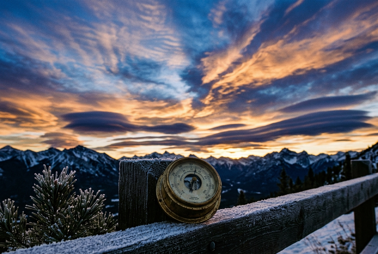
High along the spine of the Oregon Cascades in mid-January, the winter air is astonishingly still. At three thousand metres, where howling Pacific gales and rime-laden blizzards should otherwise pummel the volcanic ridges, a strange, sun-drenched quietude has settled. The atmosphere feels heavy, glassy, and unyielding. The mercury climbs improbably to fourteen degrees Celsius in the midday sun. Below the peaks, an unbroken sea of low-level stratus sits trapped within the Willamette Valley, locked beneath a suffocating temperature inversion. For three straight weeks, the barometric dial in Portland has remained pinned stubbornly at 1032 hectopascals. The snowpack is evaporating into the dry mountain air without melting into runoff, and the winds aloft whisper only as faint, warm easterly breezes.
Three thousand five hundred kilometres to the east, on the wind-scoured shoreline of Lake Erie, an entirely different world unfolds. The air does not merely feel cold; it stings with the kinetic ferocity of an Arctic express. The ambient temperature reads minus twenty-two degrees Celsius, but the sustained forty-knot northwesterly wind drives the wind chill below minus thirty-five. Over the unfrozen, relatively warm waters of the Great Lakes, violent convective plumes of lake-effect snow erupt in narrow, blinding bands, burying coastal towns beneath metres of crystalline powder. The barometer here is low, depressed, and trembling.
   PACIFIC NORTHWEST (RIDGE)                   EASTERN SEABOARD (TROUGH)
   [ 1032 hPa - Sinking Air ]                  [ 996 hPa - Ascending Air ]
        Warm, Dry, Stagnant                         Bitter Siberian Blast
              \                                             /
               \                 JET STREAM                /
                \~~~~~~~~~~\                  /~~~~~~~~~~~/
                            \~~~~~~~~~~~~~~~~/
To the casual observer, these two simultaneous weather extremes appear entirely unrelated—local quirks of regional geography separated by a vast continent. Yet they are not independent events. They are the crest and the trough of a single, planetary-scale fluid wave, a massive atmospheric vibration anchored across thousands of kilometres of ocean and continent. A solitary perturbation in the convective engine of the tropical Pacific has struck the global atmosphere like a bronze bell, sending ripples across the hemisphere that freeze one half of North America in ice and bake the other in anomalous winter warmth.
2. What’s Actually Happening — Plain English First
To understand why the weather can become locked into such persistent, continent-spanning patterns for weeks at a time, we must first abandon the notion that weather is purely local. The troposphere—the shallow, eight-to-twelve-kilometre-deep blanket of air wrapping our planet—behaves as a continuous, shallow ocean of fluid governed by the laws of thermodynamics and fluid mechanics on a rapidly spinning sphere.
Think of the mid-latitude jet stream not as a rigid pipe, but as a vast, swift river flowing from west to east around the globe. If you toss a boulder into a placid, fast-moving brook, the water does not simply swallow the rock and move on smoothly. Instead, a series of standing ripples and V-shaped wakes spreads downstream from the obstacle. In the atmosphere, giant clusters of tropical thunderstorms over the warm waters of the western and central Pacific act as that boulder. When these storms boil upward, they pump millions of tonnes of warm air into the upper troposphere, creating a massive regional high-pressure outflow.
Because the Earth is spinning, this fluid pulse cannot simply expand outwards in a straight line. As air moves poleward from the equator, the rotational velocity of the planet beneath it decreases, forcing the moving air to turn toward the right in the Northern Hemisphere due to the Coriolis effect. The fluid overshoots, curves back equatorward, overshoots again, and oscillates. This serpentine undulation creates a stationary planetary wave—known scientifically as a Rossby wave.
In 1981, meteorologists John M. Wallace and David S. Gutzler published a seminal paper in the Monthly Weather Review, demonstrating that the Northern Hemisphere’s winter weather is dominated by a recurring four-center teleconnection pattern: the Pacific-North American (PNA) Pattern.
                                [ FOUR-CENTER PNA ARCHITECTURE ]

                                     (2) ALEUTIAN LOW
                                        [Negative Z*]
                                            /     \
                                           /       \  (Great-Circle Ray Path)
                                          /         \
    (1) SUBTROPICAL PACIFIC              /           (3) CANADIAN RIDGE
        [Positive Z*]  -----------------                 [Positive Z*]
        (Near Hawaii)                                         \
                                                               \
                                                                \
                                                            (4) SE US TROUGH
                                                                [Negative Z*]
When observed at the 500-hectopascal pressure level (roughly 5.5 kilometres above sea level, halfway up the atmospheric column), this wave pattern resembles an alternating checkerboard of geopotential height anomalies: 1. Subtropical Pacific Center: An anomaly of positive height near Hawaii ($20^\circ\text{N}, 160^\circ\text{W}$). 2. Aleutian Low Center: A deep negative height anomaly spanning the North Pacific and Gulf of Alaska ($45^\circ\text{N}, 165^\circ\text{W}$). 3. Northwestern North American Center: A massive positive height ridge over the Canadian Rockies and Pacific Northwest ($55^\circ\text{N}, 115^\circ\text{W}$). 4. Southeastern United States Center: A deep, cold negative trough carving through the Gulf Coast and Eastern Seaboard ($30^\circ\text{N}, 85^\circ\text{W}$).
When these four centers lock into place, the planetary wave becomes "stationary." The weather patterns do not slide across the continent at normal storm speeds; they stall. The western ridge acts as an atmospheric ramp, deflecting Pacific storms north into the Arctic, while the eastern trough serves as an open conduit, pulling freezing Siberian and polar air directly down into the heart of North America.
3. The Science: Rossby Wave Dispersion and Hoskins-Karoly Ray Tracing
To understand the mathematical mechanics that govern how these planetary waves propagate and establish teleconnections, we turn to the conservation of potential vorticity on a rotating sphere.
The Beta-Plane and Stationary Rossby Wavenumber ($K_s$)
Consider an idealized, non-divergent, two-dimensional barotropic fluid on a mid-latitude $\beta$-plane. The fundamental governing equation is the conservation of absolute vorticity:
$$\frac{D}{Dt}(\zeta + f) = 0$$
where $\zeta = \nabla^2 \psi$ is the relative vorticity (with $\psi$ representing the streamfunction), $f = f_0 + \beta y$ is the Coriolis parameter linearized around a reference latitude $\phi_0$, and $\beta = \frac{2\Omega \cos \phi_0}{a}$ represents the latitudinal gradient of planetary vorticity ($a$ being Earth's radius and $\Omega$ Earth's angular rotation rate).
Linearizing this equation about a constant uniform zonal background westerly flow $\bar{u}$ such that $\psi = -\bar{u}y + \psi'(x, y, t)$, the perturbation vorticity equation becomes:
$$\left( \frac{\partial}{\partial t} + \bar{u}\frac{\partial}{\partial x} \right) \nabla^2 \psi' + \beta \frac{\partial \psi'}{\partial x} = 0$$
Assuming wave-like solutions for the perturbation of the form $\psi'(x, y, t) = \text{Re}\left{ \hat{\psi} \exp\left[ i(kx + ly - \omega t) \right] \right}$, where $k$ is the zonal wavenumber, $l$ is the meridional wavenumber, and $\omega$ is the angular frequency, we substitute this ansatz into the linearized vorticity equation:
$$(-i\omega + i k \bar{u})(-(k^2 + l^2))\hat{\psi} + i k \beta \hat{\psi} = 0$$
Dividing by $-i\hat{\psi}$ (for non-trivial solutions) yields the famous Rossby Wave Dispersion Relation:
$$\omega = \bar{u}k - \frac{\beta k}{k^2 + l^2} = \bar{u}k - \frac{\beta k}{K^2}$$
where $K = \sqrt{k^2 + l^2}$ is the total horizontal wavenumber. The phase speed in the zonal direction $c_x = \frac{\omega}{k}$ is given by:
$$c_x = \bar{u} - \frac{\beta}{K^2}$$
For a wave to become stationary—meaning its crests and troughs remain fixed relative to the Earth's surface ($c_x = 0$, $\omega = 0$)—the eastward advection by the background mean flow must exactly balance the westward propagation driven by the planetary $\beta$-effect. Setting $c_x = 0$ yields the Stationary Rossby Wavenumber ($K_s$):
$$K_s = \sqrt{\frac{\beta}{\bar{u}}}$$
The corresponding stationary wavelength $\lambda_s$ is:
$$\lambda_s = \frac{2\pi}{K_s} = 2\pi \sqrt{\frac{\bar{u}}{\beta}}$$
Worked Example 1: Calculating the Stationary Wavelength of North American Waves
Let us calculate the spatial dimensions of a stationary planetary wave under typical winter mid-latitude conditions.
- Reference Latitude ($\phi_0$): $45^\circ\text{ N}$
- Earth's Radius ($a$): $6.371 \times 10^6\text{ m}$
- Earth's Rotation Rate ($\Omega$): $7.292 \times 10^{-5}\text{ rad s}^{-1}$
- Mean Upper-Tropospheric Jet Speed ($\bar{u}$): $25.0\text{ m s}^{-1}$
Step 1: Compute the Rossby parameter $\beta$ $$\beta = \frac{2\Omega \cos \phi_0}{a} = \frac{2(7.292 \times 10^{-5}\text{ s}^{-1}) \cos(45^\circ)}{6.371 \times 10^6\text{ m}} = \frac{1.0312 \times 10^{-4}}{6.371 \times 10^6} \approx 1.619 \times 10^{-11}\text{ m}^{-1}\text{s}^{-1}$$
Step 2: Calculate the stationary wavenumber $K_s$ $$K_s = \sqrt{\frac{1.619 \times 10^{-11}\text{ m}^{-1}\text{s}^{-1}}{25.0\text{ m s}^{-1}}} = \sqrt{6.476 \times 10^{-13}\text{ m}^{-2}} \approx 8.047 \times 10^{-7}\text{ m}^{-1}$$
Step 3: Calculate the stationary wavelength $\lambda_s$ $$\lambda_s = \frac{2\pi}{K_s} = \frac{6.283185}{8.047 \times 10^{-7}\text{ m}^{-1}} \approx 7.808 \times 10^6\text{ m} \approx 7,808\text{ km}$$
Synoptic Interpretation: Half of this wavelength ($\frac{\lambda_s}{2} \approx 3,900\text{ km}$) represents the exact distance from the center of a planetary ridge to the center of the adjacent downstream trough. Measuring the map distance between the Canadian Rocky Mountain ridge ($115^\circ\text{W}$) and the Southeastern US trough ($85^\circ\text{W}$) across mid-latitudes yields roughly $3,800\text{ to }4,000\text{ km}$. The geometry of continental weather is dictated directly by fundamental planetary parameters.
Hoskins-Karoly Ray Tracing on a Spherical Earth
While the flat $\beta$-plane illustrates the fundamental physics, real teleconnections occur on a spherical Earth where background winds vary with latitude and longitude. In their classic 1981 paper published in the Journal of the Atmospheric Sciences, Sir Brian Hoskins and David Karoly applied WKBJ ray-tracing approximations to demonstrate how Rossby wave energy disperses across the globe.
Atmospheric wave energy does not propagate at the phase velocity (the speed at which individual crests move); it propagates at the group velocity $\mathbf{c}g = (c{gx}, c_{gy})$:
$$c_{gx} = \frac{\partial \omega}{\partial k} = \bar{u} + \frac{\beta(k^2 - l^2)}{(k^2 + l^2)^2}$$
$$c_{gy} = \frac{\partial \omega}{\partial l} = \frac{2\beta k l}{(k^2 + l^2)^2}$$
For stationary waves ($\omega = 0$, where $K^2 = k^2 + l^2 = K_s^2 = \beta / \bar{u}$), substituting this relation into the group velocity components yields:
$$c_{gx} = \bar{u} + \frac{\beta(k^2 - l^2)}{K_s^4} = \bar{u} + \bar{u}\frac{k^2 - l^2}{K_s^2} = \frac{2\bar{u}k^2}{K_s^2}$$
$$c_{gy} = \frac{2\beta k l}{K_s^4} = \frac{2\bar{u}kl}{K_s^2}$$
The total group speed magnitude $|\mathbf{c}_g|$ for a stationary wave simplifies elegantly to:
$$|\mathbf{c}g| = \sqrt{c{gx}^2 + c_{gy}^2} = \frac{2\bar{u}k}{K_s^2}\sqrt{k^2 + l^2} = \frac{2\bar{u}k}{K_s} = 2\bar{u} \cos \alpha$$
where $\alpha = \arctan(l/k)$ is the angle of the wavevector relative to the east.
On a sphere, the stationary wavenumber acts as an atmospheric refractive index $n(\phi)$. As a wave packet excited in the tropics propagates poleward into regions of stronger westerly winds ($\bar{u}$ increases) and changing $\beta(\phi)$, the meridional wavenumber $l$ must continuously adjust:
$$l^2(\phi) = K_s^2(\phi) - \frac{k^2}{\cos^2 \phi}$$
When wave energy moves poleward into sub-polar regions where $K_s^2 < \frac{k^2}{\cos^2 \phi}$, $l^2$ drops to zero. The wave reaches a turning latitude, where it undergoes total internal reflection, bending back equatorward toward the subtropics. Consequently, Rossby wave packets emanate from the tropical Pacific, arc poleward through the Aleutian Islands and Alaska, and refract southeastward into the North American continent along great-circle paths.
Worked Example 2: Group Velocity and Energy Travel Times
Suppose anomalous deep convection near Hawaii initiates a stationary Rossby wave packet with equal zonal and meridional wavenumbers ($k = l = \frac{K_s}{\sqrt{2}}$) in a background westerly jet of $\bar{u} = 30.0\text{ m s}^{-1}$. How fast does the wave energy travel downstream toward North America, and how long does it take for a downstream regime to lock in?
Step 1: Calculate the horizontal group speed components $$c_{gx} = \frac{2\bar{u}k^2}{K_s^2} = 2(30.0)\left(\frac{1}{\sqrt{2}}\right)^2 = 30.0\text{ m s}^{-1}$$
$$c_{gy} = \frac{2\bar{u}kl}{K_s^2} = 2(30.0)\left(\frac{1}{\sqrt{2}}\right)\left(\frac{1}{\sqrt{2}}\right) = 30.0\text{ m s}^{-1}$$
Step 2: Calculate total group speed $|\mathbf{c}_g|$ $$|\mathbf{c}_g| = \sqrt{30.0^2 + 30.0^2} \approx 42.43\text{ m s}^{-1} \approx 3,666\text{ km day}^{-1}$$
Step 3: Calculate transit time along a 7,500 km great-circle ray path $$\text{Transit Time } \tau = \frac{7,500\text{ km}}{3,666\text{ km day}^{-1}} \approx 2.05\text{ days}$$
+-----------------------------------------------------------------------------+
|                     RAY-TRACING DISPERSION TIMELINE                         |
|                                                                             |
|  Day 0: Tropical convective heating anomaly triggers upper-level divergence |
|  Day 1–2: Deepening of the Aleutian Low anomaly via group dispersion        |
|  Day 3–4: Amplification of downstream Western North American Ridge          |
|  Day 5–7: Full maturation of the Southeastern US Trough; regime locked      |
+-----------------------------------------------------------------------------+
The Contrasting Synoptic Regimes: +PNA versus -PNA
The NOAA Climate Prediction Center (CPC) tracks this planetary oscillation via the standardized PNA Index, calculated from normalized 500 hPa height anomalies ($Z^*$) at the four key centers:
$$\text{PNA Index} = \frac{1}{4} \left[ Z^(20^\circ\text{N}, 160^\circ\text{W}) - Z^(45^\circ\text{N}, 165^\circ\text{W}) + Z^(55^\circ\text{N}, 115^\circ\text{W}) - Z^(30^\circ\text{N}, 85^\circ\text{W}) \right]$$
The atmosphere oscillates between two distinct structural regimes, documented extensively by the World Meteorological Organization (WMO) and the UK Met Office:
===============================================================================
SYNOPTIC REGIME MATRIX: PACIFIC-NORTH AMERICAN TELECONNECTION
===============================================================================
Feature               Positive Phase (+PNA)              Negative Phase (-PNA)
-------------------------------------------------------------------------------
Aleutian Low          Intensely deepened & expanded      Weakened, displaced, or
                      southeastward into Gulf of Alaska  replaced by high-latitude block

Western Ridge         Highly amplified, warm, dry;       Suppressed/troughing; wet,
                      drives winter mountain drought     active maritime storm track

Eastern Trough        Deeply carved polar trough;        Broad zonal flow / subtropical
                      severe Arctic cold outbreaks       ridge; unseasonably mild, humid

Jet Stream Path       Meridional "rollercoaster" flow    Zonal (west-to-east) split jet
                      across North America               slamming directly into West Coast

Dominant Hazards      Western wildfires/drought,         Atmospheric river flooding in CA,
                      Eastern deep freezes/ice storms    snow drought in East
===============================================================================
           +PNA (MERIDIONAL FLOW)                    -PNA (ZONAL / SPLIT FLOW)

                /---\ (High Ridge)                     ========================>
               /     \                                      (Polar Jet)
  (Aleutian   /       \   (Deep Trough)
    Low) \---/         \---/                   ------------------------>
                                                            (Subtropical Jet)
In the positive phase (+PNA), the jet stream buckles violently into a high-amplitude wave. The Aleutian Low pulls warm subtropical air north into Alaska and Western Canada, building an immense blocking ridge over the Rockies. East of the Continental Divide, the jet plunges south from the Arctic Circle toward the Gulf of Mexico. This delivers historic blizzards and prolonged sub-zero cold waves to the Midwest and East Coast while California and the Pacific Northwest experience unseasonable warmth and winter drought.
In the negative phase (-PNA), the pattern inverts. A blocking anticyclone often occupies the Bering Sea or North Pacific, while a broad trough dominates western North America. The Pacific jet stream strengthens and extends eastward across the ocean, directing a continuous train of moisture-laden atmospheric rivers directly into California and Oregon. Downstream, the eastern United States rests beneath an expansive subtropical ridge, enjoying balmy, spring-like conditions in midwinter.
4. Practical Outdoor Guidance for Observers
While teleconnection indices are calculated using supercomputers, an observant hiker, mariner, or gardener can diagnose the state and evolution of the PNA pattern directly from the ground.
+-----------------------------------------------------------------------------+
|                          OUTDOOR FIELD DIAGNOSTICS                          |
+-----------------------------------------------------------------------------+
| 1. SKY OBSERVATIONS:                                                        |
|    * +PNA (West): Glassy, cloudless skies; high-altitude lenticulars over   |
|      mountain crests; stagnant valley fog trapped under inversions.         |
|    * +PNA (East): Swift cirrus uncinus ("mare's tails") streaking from NW   |
|      to SE at 100+ knots, heralding Arctic frontal passages.                |
|    * -PNA (West): Rapidly thickening altostratus and nimbostratus shields   |
|      arriving from the west-southwest every 36 to 48 hours.                 |
|                                                                             |
| 2. INSTRUMENT SIGNALS (Home Weather Station & Barometer):                   |
|    * Multi-Day Barometric Stagnation: A barometer that remains locked       |
|      above 1028 hPa for >7 days in the West indicates a stationary          |
|      Rossby ridge ($K_s$ wave trapping).                                    |
|    * Surface Wind Vector Steadiness: Persistent northwesterly winds in the   |
|      Mid-Atlantic accompanied by dew points below -15°C indicate an         |
|      entrenched eastern trough anchored by upstream wave dispersion.        |
|                                                                             |
| 3. HIKER, GARDENER & SAILOR RULES OF THUMB:                                 |
|    * The Mountain Snowpack Rule (West): If the 500 hPa chart indicates     |
|      +PNA onset, cancel backcountry ski tours in the Cascades due to        |
|      rain/melt-freeze crusts; plan mountaineering for the Rockies.          |
|    * The Frost-Freeze Advisory (East): In +PNA regimes, freeze warnings can  |
|      penetrate as far south as central Florida—protect citrus crops early.  |
+-----------------------------------------------------------------------------+
5. Today's Meteorological Rule of Thumb
When the Aleutian Low deepens into an oceanic vortex, look for the western mountains to bask under a stationary dome while the eastern plains brace for the Arctic hammer within five days.
Further Reading & Authoritative Data Sources
- NOAA Climate Prediction Center: Daily PNA Teleconnection Index & Forecasts
- Wallace & Gutzler (1981): Teleconnections in the Geopotential Height Field during Northern Hemisphere Winter
- Hoskins & Karoly (1981): The Steady Linear Response of a Spherical Atmosphere to Thermal and Orograpic Forcing
- World Meteorological Organization: Global Atmospheric Teleconnections & Climate
- UK Met Office: Global Circulation Patterns and Rossby Waves