Pacific Decadal Oscillation (PDO) & Aleutian Low Dynamics: How Basin-Scale Sea Surface Temperature Anomalies and Ocean-Atmosphere Coupling Steer Decadal Weather Regimes
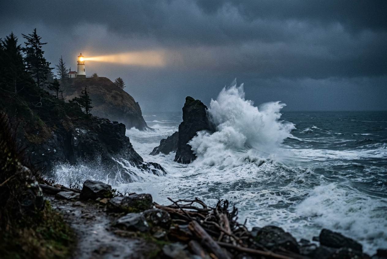
Stand on the wind-scoured basalt cliffs of Cape Disappointment, where the Columbia River empties its churning silt into the grey expanse of the North Pacific. The air does not merely blow; it leans against you with a physical density born of thousands of miles of open ocean. The barometer in your pocket drops with a steady, sickening slide—three millibars in an hour, then four—as the maritime boundary layer saturates. Overhead, the sky loses its pale morning texture, dissolving into a seamless ceiling of slate-grey altostratus that rapidly lowers into ragged, scudding fractostratus.
The scent of ozone, atomized sea salt, and cold, deep-ocean brine arrives on a gale that veers inexorably from south-southeast to southwest. Far out on the horizon, swells that began as ripples beneath a monstrous low-pressure vortex south of the Aleutian Islands rear up into fifteen-foot breakers. The warmth in this wind is deceptive: it carries the tropical vapor of the subtropics, entrained into an atmospheric firehose aimed directly at the coastal ranges of North America.
Long before this tempest crashes into the temperate rainforests of the Olympic Peninsula, its trajectory, moisture content, and longevity were dictated by a vast oceanic pattern operating across decades. You are standing in the crosshairs of a coupled planetary system: the intimate, basin-scale dance between the Aleutian Low and the immense thermal reservoir known as the Pacific Decadal Oscillation.
2. What’s Actually Happening — Plain English First
To understand why a winter storm behaves the way it does over Seattle, San Francisco, or Denver, one must understand that the atmosphere does not operate over a passive canvas. The ocean is the planet's long-term thermal memory.
Think of the global atmosphere as a fast-spinning, restless child and the Pacific Ocean as an enormous cast-iron bathtub filled with water. While the atmosphere changes its mood in a matter of hours or days—spawning squalls, cold fronts, and heatwaves—the cast-iron tub takes months or even decades to warm up or cool down.
In the tropical Pacific, this interaction occurs on an interannual cadence of two to seven years through the El Niño–Southern Oscillation (ENSO), where warm water sloshes between Indonesia and South America. But poleward of 20°N, in the vast expanses of the North Pacific, the ocean operates on a far slower rhythm. Here, thermal anomalies persist for twenty to thirty years at a stretch. This decadal-scale pattern is what climatologists designate the Pacific Decadal Oscillation (PDO).
The PDO manifests in two distinct spatial flavors: * The Positive (Warm) Phase: The central and western North Pacific turns anomalously cold, while a horseshoe-shaped ribbon of unusually warm water hugs the west coast of North America from Alaska down to the tip of Baja California. * The Negative (Cool) Phase: The pattern flips completely. The central ocean becomes a warm reservoir, while coastal waters along the Pacific Rim turn uncharacteristically cool.
These sea surface temperature (SST) anomalies are not just passive markers. They dictate where storm systems are born, where they feed on latent heat, and how the polar jet stream is steered across continents.
When the coastal waters are warm and the subpolar ocean is cold (the positive phase), the natural temperature contrast across the North Pacific steepens. This contrast invigorates the Aleutian Low—a semi-permanent low-pressure center that dominates the winter skies of the sub-Arctic Pacific. A deeper Aleutian Low acts like a massive atmospheric pump, hoovering up warm, moisture-laden maritime air from the subtropics and hurling it straight into California, Oregon, and Washington via narrow corridors of torrential water vapor known as atmospheric rivers.
3. The Science: Mathematical Formulations & Dynamical Teleconnections
For meteorologists and dynamicists, the Pacific Decadal Oscillation is not merely an index; it is an intrinsic mode of coupled ocean-atmosphere variability characterized as the leading Empirical Orthogonal Function (EOF) of monthly SST anomalies in the North Pacific.
3.1 Foundational Definition: EOF Analysis
Statistically, the PDO is defined by decomposing the spatio-temporal field of monthly sea surface temperature anomalies, $\mathrm{SST}'(x, y, t)$, poleward of $20^\circ\text{N}$, after the global mean warming trend has been removed. The field is expanded into a set of orthogonal spatial basis functions weighted by temporal principal components:
$$\mathrm{SST}'(x,y,t) = \sum_{k=1}^{N} \mathrm{PC}_k(t) \, \mathbf{EOF}_k(x,y)$$
The PDO Index is precisely the standardized leading principal component, $\mathrm{PC}_1(t)$, corresponding to the primary spatial pattern $\mathbf{EOF}_1(x,y)$, which typically explains 20% to 30% of the total low-frequency variance across the North Pacific basin.
While ENSO is driven by internal tropical equatorial wave dynamics (such as oceanic Kelvin and Rossby waves with periods of 2 to 7 years), the PDO’s multi-decadal longevity arises from the integrated effect of: 1. Low-frequency atmospheric forcing (the "atmospheric bridge"), 2. Deep oceanic mixed-layer thermal inertia, 3. Decadal-scale geostrophic adjustments of the North Pacific subpolar and subtropical gyres governed by long Rossby wave propagation across the basin.
3.2 Ocean-Atmosphere Coupling: The Atmospheric Bridge and Wind-Stress Curl
The coupling between the ocean and the atmosphere in the mid-latitudes operates through what dynamicist Michael Alexander termed the Atmospheric Bridge. The state of the Aleutian Low is the atmospheric engine of this bridge.
During a positive PDO phase, an intensified Aleutian Low generates anomalous cyclonic surface wind stress ($\boldsymbol{\tau}$). The vertical velocity at the base of the oceanic surface Ekman layer—known as the Ekman pumping velocity ($w_E$)—is driven directly by the curl of this wind stress:
$$w_E = \frac{1}{\rho_0 f} \left( \nabla \times \boldsymbol{\tau} \right) = \frac{1}{\rho_0 f} \left( \frac{\partial \tau_y}{\partial x} - \frac{\partial \tau_x}{\partial y} \right)$$
Where: * $\rho_0 \approx 1025 \text{ kg m}^{-3}$ is the reference density of seawater, * $f = 2\Omega \sin\phi$ is the Coriolis parameter at latitude $\phi$, * $\boldsymbol{\tau} = (\tau_x, \tau_y)$ is the surface wind stress vector (in $\text{N m}^{-2}$).
Worked Example: Calculating Anomalous Oceanic Upwelling
Consider a wintertime positive PDO regime where the Aleutian Low deepens over the central Gulf of Alaska at $\phi = 50^\circ\text{N}$.
-
Calculate the Coriolis Parameter: $$f = 2 \times (7.2921 \times 10^{-5} \text{ s}^{-1}) \times \sin(50^\circ) \approx 1.117 \times 10^{-4} \text{ s}^{-1}$$
-
Determine the Wind-Stress Curl ($\nabla \times \boldsymbol{\tau}$): Suppose an intensified cyclonic storm track induces an anomalous zonal wind stress gradient where the eastward stress $\tau_x$ varies meridionally by $\Delta \tau_x = -0.06 \text{ N m}^{-2}$ over a distance $\Delta y = 500\text{ km} = 5 \times 10^5\text{ m}$, while the meridional stress gradient $\frac{\partial \tau_y}{\partial x} \approx 0.08 \times 10^{-6}\text{ N m}^{-3}$.
$$\nabla \times \boldsymbol{\tau} = \frac{\partial \tau_y}{\partial x} - \frac{\partial \tau_x}{\partial y} = 0.8 \times 10^{-7} - \left( \frac{-0.06}{5 \times 10^5} \right) = 0.8 \times 10^{-7} + 1.2 \times 10^{-7} = 2.0 \times 10^{-7} \text{ N m}^{-3}$$
-
Calculate the Resulting Ekman Pumping Velocity ($w_E$): $$w_E = \frac{2.0 \times 10^{-7} \text{ N m}^{-3}}{(1025 \text{ kg m}^{-3}) \times (1.117 \times 10^{-4} \text{ s}^{-1})} = \frac{2.0 \times 10^{-7}}{0.1145} \approx 1.747 \times 10^{-6} \text{ m s}^{-1}$$
-
Convert to Vertical Displacement over Time: $$w_E \approx 1.747 \times 10^{-6} \text{ m s}^{-1} \times 86,400 \text{ s day}^{-1} \approx 0.151 \text{ m day}^{-1} \approx 4.53 \text{ m month}^{-1}$$
This positive (upward) Ekman pumping dynamically upwells cold, nutrient-rich, sub-thermocline waters to the surface across the central North Pacific, reinforcing the cold pool anomaly.
Concurrently, anomalous southerly winds along the western flank of North America drive onshore Ekman transport, inducing coastal downwelling. Downwelling depresses the coastal thermocline, insulating surface waters and locking in the anomalous warm coastal ribbon of the positive PDO.
3.3 Rossby Wave Dispersion and Jet Stream Steering
The thermodynamic feedback between North Pacific SST anomalies and the Aleutian Low perturbs the mid-troposphere, exciting equivalent barotropic planetary Rossby waves that propagate downstream across North America. This dynamical connection is formalized through the stationary Rossby wave dispersion relation on a mid-latitude beta-plane:
$$\omega = \bar{u} k - \frac{\beta k}{k^2 + l^2 + \frac{f_0^2}{g H_e}}$$
For stationary atmospheric planetary waves ($\omega = 0$), the total stationary horizontal wavenumber $K_s = \sqrt{k^2 + l^2}$ is governed by the mean background westerly flow $\bar{u}$ and the planetary vorticity gradient $\beta = \frac{\partial f}{\partial y}$:
$$K_s = \sqrt{\frac{\beta}{\bar{u}}}$$
When the Aleutian Low deepens and shifts southward during a warm PDO phase, it induces an anomalous diabatic and baroclinic heating source. This source generates an upper-level divergent outflow that excites an arching Rossby wave train—the classic Pacific-North American (PNA) pattern—spanning from the central Pacific, across the Gulf of Alaska, over western Canada, and down into the southeastern United States.
This wave train creates: 1. A Deep Trough over the North Pacific (amplifying the Aleutian vortex), 2. A Persistent High-Pressure Ridge over northwestern Canada and the Pacific Northwest, 3. An Enhanced Downstream Trough over the southeastern United States.
Consequently, the Pacific storm track is split and deflected. The subpolar jet stream weakens or migrates north over Alaska, while the subtropical jet stream intensifies and straightens across the eastern Pacific. This configuration acts as a pipeline, firing atmospheric rivers directly into Central and Southern California.
Conversely, during the negative PDO phase, the Aleutian Low weakens and is displaced northwestward. A broad ridge of high pressure builds across the eastern North Pacific, deflecting the storm track poleward into the Gulf of Alaska and coastal British Columbia, while starving the southwestern United States of winter precipitation.
3.4 Constructive and Destructive Interference with ENSO
The Pacific Decadal Oscillation does not operate in isolation; it functions as a low-frequency, decadal background state upon which the higher-frequency variations of the NOAA Climate Prediction Center's ENSO cycles are superposed.
Mathematically, continental climate anomalies ($A_{\text{total}}$) can be approximated to first order as a linear superposition of the two indices, modulated by a non-linear interaction term:
$$A_{\text{total}}(t) = \alpha \, \mathrm{PDO}(t) + \beta \, \mathrm{ENSO}(t) + \gamma \left[ \mathrm{PDO}(t) \times \mathrm{ENSO}(t) \right] + \epsilon(t)$$
Where $\alpha$ and $\beta$ are the linear teleconnection coefficients, $\gamma$ is the non-linear coupling coefficient, and $\epsilon(t)$ represents internal atmospheric noise.
When the PDO and ENSO are in phase (constructive interference): * Positive PDO + El Niño: The tropical warm pool anomalies in the central-eastern equatorial Pacific reinforce the anomalous eastward displacement of the Aleutian Low. The jet stream over the eastern Pacific extends zonally to the North American coast, generating catastrophic winter flooding, coastal erosion, and high-elevation rain-on-snow events in the Sierra Nevada. * Negative PDO + La Niña: The anomalous cold tongue in the tropical Pacific merges dynamically with the cool coastal waters of the negative PDO. The North Pacific high-pressure cell strengthens and expands, forming an immovable blocking ridge that locks the American Southwest into persistent, multi-year megadroughts while driving record-breaking, low-elevation cold snaps and massive snow accumulation into the Cascades and Northern Rockies.
When the two patterns are out of phase (destructive interference)—such as a positive PDO coinciding with a La Niña—the atmospheric teleconnections partially cancel each other out. The jet stream behaves erratically, exhibiting high weekly variability and confounding seasonal forecasters who rely solely on tropical ENSO predictors.
4. Practical Outdoor Guidance: Reading the Decadal Sky
While global climate models run on supercomputers to isolate these modes, an attentive field observer, mountaineer, or coastal mariner can read the physical signatures of the PDO phase directly from synoptic weather dynamics and seasonal landscape patterns.
4.1 What to Look for in the Sky
-
Winter Storm Approach Vectors: * In a positive PDO regime, incoming frontal cloud bands approach from the south-southwest. Watch for high, fast-moving cirrostratus streamers emanating from the subtropical latitudes (the "Pineapple Express" trajectory). These systems feature deep, warm, tropical sectors where the sky remains overcast with diffuse, rain-bearing nimbostratus for days on end. * In a negative PDO regime, storm systems drop out of the north-northwest from the Gulf of Alaska. These fronts are characterized by sharp, turbulent cold-frontal boundaries, towering cumulonimbus clouds, violent squall lines with graupel, and rapid post-frontal clearing into crystal-clear, frigid polar air.
-
Summer Marine Boundary Layer and Fog: * Watch the behavior of coastal advection fog along the Pacific coast (from British Columbia to Southern California). During the negative PDO phase, enhanced coastal upwelling chills the near-surface marine air below its dew point, creating thick, persistent stratocumulus decks (the classic "June Gloom") that can linger unbroken for weeks. * During the positive PDO phase, warmer coastal waters reduce condensation rates and destabilize the boundary layer, leading to patchy, quickly burning-off morning fog.
4.2 Instrument Readings to Track
- The Coastal Barometer: Keep a continuous record of winter storm minimum pressures. When the PDO is in its positive phase, central pressures of synoptic systems hitting the Pacific Northwest regularly bottom out below $965 \text{ hPa}$, exhibiting rapid pressure falls ($\frac{dp}{dt} < -4 \text{ hPa} / 3\text{ hr}$).
- Surface Water Thermometers: Coastal anglers, sailors, and surfers should track localized sea surface temperatures against long-term climatological baselines published by the UK Met Office Hadley Centre. Persistent coastal sea surface anomalies of $+1.5^\circ\text{C}$ to $+2.5^\circ\text{C}$ persisting across spring and autumn indicate that the regional marine ecosystem is locked in a warm PDO phase.
4.3 Mountain Snowpack Metrics: The Sierra and Cascade Rule
For skiers, backcountry travelers, and hydrologists: * The Snow-to-Liquid Ratio (SLR): Track the density of winter snowfall. Positive PDO winters are characterized by warm atmospheric river events where freezing levels hover between 6,000 and 8,000 feet (1,800–2,400 m). Snow-to-liquid ratios will be low (typically $8:1$ to $10:1$), producing dense, heavy snow known regionally as "Cascade Concrete." * Negative PDO Winters: Cold polar trajectories drive freezing levels down to sea level, yielding high SLR values ($15:1$ to $25:1$), deep dry powder, and a significantly lower avalanche risk related to rain-on-snow instability layers.
5. Today's Meteorological Rule of Thumb
The next time you step outside and feel the barometer tumble while a warm, moisture-laden southwesterly gale strips the leaves from coastal pines, look past the immediate radar loop. You are not just experiencing a passing frontal boundary; you are witnessing the physical manifestation of a coupled planetary giant—the Pacific Decadal Oscillation—flexing its oceanic memory across thousands of miles of sky.
Authoritative References and Deep-Reading Resources
- NOAA Physical Sciences Laboratory: Pacific Decadal Oscillation Overview
- NOAA National Centers for Environmental Information: Monthly PDO Indices
- World Meteorological Organization (WMO): Climate Teleconnections and Atmospheric Waves
- UK Met Office: North Pacific Decadal Variability & Jet Stream Dynamics
- American Meteorological Society: Definition and Dynamics of the Aleutian Low
- NOAA Climate.gov: Atmospheric Rivers and Western US Precipitation