Subtropical Jet & Polar Front Jet Superposition: How Dual-Jet Coupling and Transverse Circulations Supercharge Severe Outbreaks
By Antigravity Meteorological Correspondent
1. Opening Scene: The Calm Before the Stratospheric Engine Ignites
Standing across an open ridge in early spring, the atmosphere does not initially present itself as a violent engine. The air at the surface is strangely tepid, thick with moisture imported overnight from maritime latitudes, smelling faintly of damp loam, crushed clover, and the static tang of distant petrichor. A feather-light breeze drafts from the south-southeast, warm against the nape of your neck. Yet, an uncanny physical tension pervades the landscape. Songbirds have ceased calling from the hedgerows, settling low into the scrub, sensitive to the invisible collapse of barometric weight pressing upon the earth.
You reach into your pocket and check the analog needle of a handheld aneroid barometer. Over the past ninety minutes, the dial has not merely drifted; it has plunged by nearly six hectopascals, its brass arm trembling downward like an elevator whose cable has just been sheared.
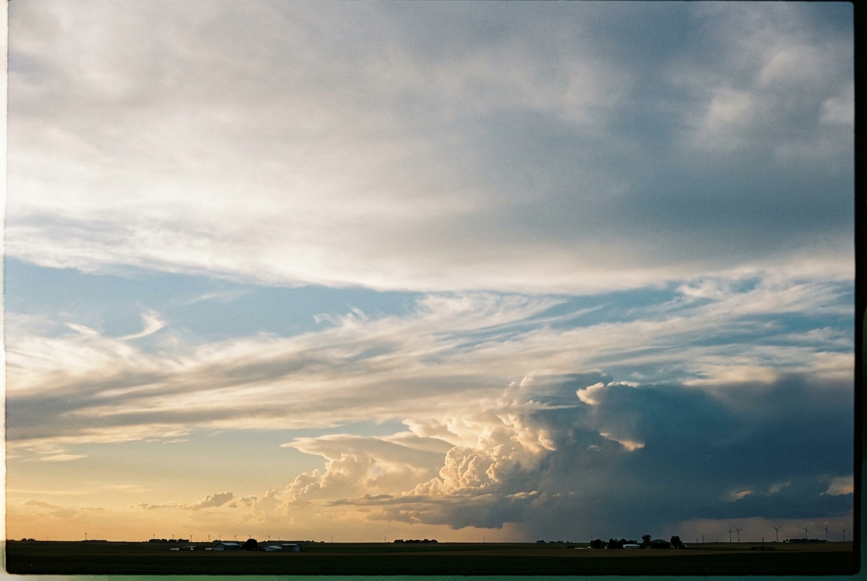
Look up toward the zenith. The troposphere is revealing its internal architecture. The sky is not the uniform azure of an ordinary afternoon. High overhead—beyond the cruising altitudes of transatlantic airliners, nearly twelve kilometers into the freezing lower stratosphere—a sheet of brilliant, fibrous cirrus is migrating northeastward at terrifying speed. The ice crystals do not form a shapeless veil. Instead, they are carved into razor-sharp transverse bands: long, rippled, washboard-like ribs of cirrostratus that run perpendicular to an invisible, roaring current.
Beneath them, around eight or nine kilometers up, a second, darker tier of mid-level clouds races along a slightly different vector, tearing eastward with ragged urgency. You are witnessing an extraordinary celestial convergence: two separate rivers of stratospheric wind, born thousands of miles apart under entirely different laws of planetary physics, have vertically aligned directly above your head.
A shadow falls across the valley as the leading edge of a towering cloud mass advances. The wind on your face suddenly backs toward the east, sharpening, turning cool. High above, two stratospheric titans have locked together, forming a thermodynamic pump that is evacuating trillions of tons of air from the column directly above you, priming the boundary layer for explosive convective ascent.
2. What Is Actually Happening: The Tale of Two Stratospheric Rivers
To understand the immense power of this celestial engine, one must first dismantle the machinery that drives the upper winds of our planet. The atmosphere is not a homogenous cauldron; it is a stratified fluid wrapped around a spinning spheroid, constantly attempting to redistribute the colossal solar heat received at the equator toward the frozen, radiationally depleted poles.
To accomplish this thermodynamic chore, the planet operates two fundamentally distinct upper-level wind currents, known to meteorologists as jet streams: the Subtropical Jet (STJ) and the Polar Front Jet (PFJ).
The Subtropical Jet (STJ): The Spinning Ice Skater
Think of the atmosphere near the equator as a massive tropical greenhouse. Solar heating causes massive parcels of hot, buoyant air to rise into the upper troposphere within the Intertropical Convergence Zone. Once lofted to roughly 12 kilometers altitude (the 200 hectopascal pressure level), this air is forced to diverge poleward, forming the upper branch of the Hadley Cell circulation.
As this equatorial air journeys northward away from the equator, it travels closer to Earth's axis of rotation. Because our planet is spinning, the parcel must conserve its absolute angular momentum.
Picture a spinning figure skater pulling her arms tightly inward toward her chest: even without pushing off the ice, her rotation accelerates dramatically. In precisely the same manner, air migrating from the broad circumference of the equator toward the narrower latitudes of 30° North must spin faster and faster eastward relative to the ground beneath it.
By the time this poleward-moving air reaches roughly 30° latitude, conservation of angular momentum has accelerated it into a blistering, persistent ribbon of westerly winds exceeding 130 knots: the Subtropical Jet Stream.
The Polar Front Jet (PFJ): The Great Density Clash
Farther north, an entirely different physical mechanism constructs a second great atmospheric river. The Polar Front Jet does not owe its existence primarily to tropical momentum transport. Instead, it is born out of an abrupt, violent clash of densities along the boundary where bitter Arctic air masses collide with temperate, mid-latitude air.
Think of the atmosphere as a stack of warm and cold fluid layers. Cold air is dense and compact; its pressure drops off rapidly as you ascend. Warm air is light, buoyant, and expanded; its pressure decreases much more gradually with height. If you stand in a cold air mass and look horizontally toward a warm air mass at high altitude, you will find high pressure in the warm air and low pressure in the cold air.
Nature abhorring an unbalanced pressure slope, the air accelerates down this gradient, only to be deflected to the right by the Coriolis effect. The result is a fierce, narrow current of wind perched at the boundary of the polar front, typically found near 9 kilometers altitude (the 300 hectopascal level). This fundamental balance between horizontal temperature contrasts and vertical wind shear is known as thermal wind balance.
+-------------------------------------------------------------------------+
|                      THE JET STREAM DUALITY                             |
+----------------------+--------------------+-----------------------------+
| Feature              | Subtropical Jet    | Polar Front Jet             |
+----------------------+--------------------+-----------------------------+
| Typical Pressure Alt | ~200 hPa (~12 km)  | ~300 hPa (~9 km)            |
| Primary Driver       | Hadley Momentum    | Baroclinic Thermal Gradient |
| Primary Latitude     | 25°N – 35°N        | 45°N – 65°N                 |
| Thermodynamic Role   | Tropics limit      | Frontal boundary marker     |
+----------------------+--------------------+-----------------------------+
The Superposition Event: The Stacking of the Giants
Under ordinary global weather patterns, these two jets remain geographically sequestered: the Subtropical Jet glides lazily across the subtropics near 12 kilometers altitude, while the Polar Front Jet meanders through higher latitudes at 9 kilometers altitude.
However, during periods of extreme planetary wave amplification—when massive troughs in the Rossby wave spectrum carve deep, sweeping curves across continents—the Polar Front Jet is dragged uncharacteristically far south. Simultaneously, a potent subtropical ridge can pump the Subtropical Jet northward.
When these planetary waves phase together, the two jets do not merely brush past one another; they vertically align, stacking the 200 hPa Subtropical Jet directly atop the 300 hPa Polar Front Jet. This meteorological phenomenon is known as Jet Superposition.
When these two currents merge into a single, hyper-concentrated tropospheric corridor, the atmosphere constructs a dynamic vacuum pump of unimaginable power.
3. The Science: The Mathematics of Secondary Circulations and Dynamic Vacuum
To rigorously dissect why jet superposition triggers explosive cyclogenesis and extreme weather outbreaks, we must turn to the governing equations of dynamic meteorology, developed through the foundational work of the World Meteorological Organization and academic dynamicists.
Concept 1: Thermal Wind Balance and the Polar Jet Core
The vertical variation of the geostrophic wind is coupled directly to horizontal temperature gradients through the Thermal Wind Relation. In pressure coordinates, assuming hydrostatic equilibrium and ideal gas behavior, the mathematical formulation is expressed as:
$$\frac{\partial \mathbf{v}_g}{\partial \ln p} = -\frac{R_d}{f} \mathbf{k} \times \nabla_p T$$
Where: - $\mathbf{v}_g = (u_g, v_g)$ is the geostrophic wind vector ($\text{m s}^{-1}$) - $p$ is atmospheric pressure ($\text{Pa}$) - $R_d = 287.05 \text{ J kg}^{-1} \text{K}^{-1}$ is the specific gas constant for dry air - $f = 2\Omega \sin\phi$ is the Coriolis parameter at latitude $\phi$ ($\text{s}^{-1}$) - $\mathbf{k}$ is the vertical unit vector pointing outward from Earth's surface - $\nabla_p T = \left(\frac{\partial T}{\partial x}, \frac{\partial T}{\partial y}\right)_p$ is the horizontal temperature gradient on an isobaric surface ($\text{K m}^{-1}$)
In plain terms, this equation states that whenever an intense horizontal temperature gradient exists across an air mass boundary ($\nabla_p T$), the westerly wind speed must increase with height.
Worked Example 1: Calculating the Polar Jet Core Velocity
Consider an intense late-winter baroclinic zone over the central United States at latitude $\phi = 38^\circ\text{N}$, where the Coriolis parameter is:
$$f = 2(7.292 \times 10^{-5}\text{ s}^{-1})\sin(38^\circ) \approx 8.98 \times 10^{-5}\text{ s}^{-1}$$
An Arctic air mass creates an intense meridional temperature gradient between the surface and the tropopause across the $y$-axis (north-south), such that:
$$\frac{\partial T}{\partial y} = -4.0 \text{ K} / 100\text{ km} = -4.0 \times 10^{-5} \text{ K m}^{-1}$$
We wish to calculate the geostrophic westerly wind shear $\Delta u_g$ generated between the 850 hPa pressure level ($p_1 = 85000\text{ Pa}$) and the 300 hPa polar jet core ($p_2 = 30000\text{ Pa}$).
Integrating the thermal wind balance component:
$$u_g(p_2) - u_g(p_1) = -\frac{R_d}{f} \left(-\frac{\partial T}{\partial y}\right) \ln\left(\frac{p_1}{p_2}\right)$$
Substituting our values:
$$\Delta u_g = \frac{287.05}{8.98 \times 10^{-5}} \times (4.0 \times 10^{-5}) \times \ln\left(\frac{850}{300}\right)$$
$$\Delta u_g = (3.1965 \times 10^6) \times (4.0 \times 10^{-5}) \times \ln(2.8333)$$
$$\Delta u_g = 127.86 \times 1.0415 \approx 53.16 \text{ m s}^{-1} \approx 103.3 \text{ knots}$$
If the low-level geostrophic wind at 850 hPa is a modest 15 m/s (29 kt), the thermal wind balance demands that at 300 hPa, the Polar Front Jet must roar at:
$$u_g(300\text{ hPa}) = 15 + 53.16 = 68.16 \text{ m s}^{-1} \quad (132.5 \text{ knots})$$
+-------------------------------------------------------------------------+
|                  THERMAL WIND INTEGRATION SUMMARY                       |
+------------------------------------+------------------------------------+
| Parameter                          | Calculated Value                   |
+------------------------------------+------------------------------------+
| Latitude ($\phi$)                  | 38.0° N                            |
| Coriolis Parameter ($f$)           | 8.98 × 10⁻⁵ s⁻¹                    |
| Meridional Thermal Gradient (dT/dy)| -4.0 K / 100 km                    |
| Layer Boundary Pressures           | 850 hPa to 300 hPa                 |
| Geostrophic Wind Shear (Δu_g)      | 53.16 m/s (103.3 kt)               |
| Resultant Jet Core Speed           | 68.16 m/s (132.5 kt)               |
+------------------------------------+------------------------------------+
Concept 2: Ageostrophic Wind and Transverse Secondary Circulations
Air entering and exiting localized wind speed maxima along a jet stream (known as jet streaks) cannot remain in pure geostrophic balance. As an air parcel rapidly accelerates into the rear of a jet streak (the entrance region), the forward momentum requires a force balance that the Coriolis force cannot immediately supply.
This creates an ageostrophic wind component ($\mathbf{v}_{ag}$), directed perpendicular to the flow toward the left-hand side (lower geopotential height):
$$\mathbf{v}_{ag} = \frac{1}{f} \mathbf{k} \times \frac{d\mathbf{v}_g}{dt}$$
This cross-stream ageostrophic flow establishes closed vertical circulation loops in the vertical-meridional plane: 1. Entrance Region: Creates a Thermally Direct Circulation (rising warm air in the Right-Entrance quadrant; sinking cold air in the Left-Entrance quadrant). 2. Exit Region: As parcels decelerate upon leaving the streak, the Coriolis force overcompensates, deflecting air toward the right. This establishes a Thermally Indirect Circulation (rising cold air in the Left-Exit quadrant; sinking warm air in the Right-Exit quadrant).
Crucially, dynamic lift (ascent) is concentrated in two locations: the Right-Entrance and the Left-Exit quadrants.
The Mathematics of Jet Superposition and Vertical Lift
When a southern Subtropical Jet streak and a northern Polar Front Jet streak undergo vertical superposition, the atmospheric geometry aligns the Right-Entrance quadrant of the STJ directly above or alongside the Left-Exit quadrant of the PFJ.
Through the continuity equation in isobaric coordinates:
$$\nabla \cdot \mathbf{v}h + \frac{\partial \omega}{\partial p} = 0 \implies \frac{\partial \omega}{\partial p} = -\nabla \cdot \mathbf{v}{ag}$$
Where $\omega = \frac{dp}{dt}$ is the vertical velocity in pressure coordinates ($\text{Pa s}^{-1}$, where negative $\omega$ represents upward motion).
Integrating from the surface ($p_s$) to the upper-tropospheric divergence level ($p_t$):
$$\omega(p) = \int_{p}^{p_s} \left( \nabla \cdot \mathbf{v}_{ag} \right) dp$$
When both the STJ right-entrance and PFJ left-exit ageostrophic divergence fields superimpose, the term $-\nabla \cdot \mathbf{v}_{ag}$ aloft becomes extraordinarily positive, driving unprecedented upward vertical velocity ($-\omega \gg 0$) throughout the entire depth of the troposphere.
Worked Example 2: Dynamic Surface Pressure Fall via Upper Divergence
The surface pressure tendency equation, neglecting boundary layer friction and density variations, can be approximated by the vertical integration of horizontal mass divergence:
$$\frac{\partial p_s}{\partial t} \approx -\int_{0}^{p_s} \left( \nabla \cdot \mathbf{v} \right) dp$$
Suppose an uncoupled single jet creates an upper-level divergence of $\nabla \cdot \mathbf{v}_{ag} \approx 2.0 \times 10^{-5} \text{ s}^{-1}$ concentrated in a layer between 400 hPa and 150 hPa ($\Delta p = 250\text{ hPa} = 25000\text{ Pa}$).
Under superposition, the constructive interference of the STJ Right-Entrance and PFJ Left-Exit quadrants doubles the effective divergence to:
$$\nabla \cdot \mathbf{v}_{ag,\text{super}} = 4.5 \times 10^{-5} \text{ s}^{-1}$$
Assuming low-level mass convergence compensates for only 60% of this upper-level mass evacuation, the net column mass divergence is:
$$\text{Net Divergence Rate} = 0.40 \times (4.5 \times 10^{-5}\text{ s}^{-1}) = 1.80 \times 10^{-5}\text{ s}^{-1}$$
We calculate the instantaneous rate of surface pressure drop:
$$\frac{\partial p_s}{\partial t} = -\left(1.80 \times 10^{-5}\text{ s}^{-1}\right) \times 25000\text{ Pa} = -0.45\text{ Pa s}^{-1}$$
Converting this rate to hourly and 24-hour pressure falls:
$$\text{Hourly Pressure Fall} = -0.45\text{ Pa s}^{-1} \times 3600\text{ s hr}^{-1} = -1620\text{ Pa hr}^{-1} = -16.2\text{ hPa hr}^{-1}$$
Over an active 6-hour phase of dynamic alignment, even after accounting for non-linear atmospheric resistance and low-level infilling, this dynamic vacuum easily produces a 24-hour pressure crash exceeding 35 to 50 hPa. This vastly exceeds the classical Sanders-Gyakum criterion for "bombogenesis" or explosive cyclogenesis ($24\text{ hPa} / 24\text{ hr}$).
+-------------------------------------------------------------------------+
|                  SUPERPOSITION PRESSURE TENDENCY PROOF                  |
+------------------------------------+------------------------------------+
| Variable                           | Value / Magnitude                  |
+------------------------------------+------------------------------------+
| Upper Layer Thickness (Δp)         | 250 hPa (25,000 Pa)                |
| Superimposed Divergence aloft      | +4.5 × 10⁻⁵ s⁻¹                    |
| Low-level Convergence Infill Ratio | 60% (0.60)                         |
| Net Column Evacuation Divergence   | +1.8 × 10⁻⁵ s⁻¹                    |
| Unchecked Pressure Tendency        | -0.45 Pa/s (-16.2 hPa/hr)          |
| 24-Hour Equivalent Fall            | > 35.0 hPa (Explosive Bombogenesis)|
+------------------------------------+------------------------------------+
The Kinematic Consequence: Extreme Deep-Layer Wind Shear
Jet superposition does not merely evacuate surface mass; it alters the fundamental kinematic wind profile of the troposphere.
Because the Subtropical Jet imports 60–80 m/s winds at 200 hPa from the southwest, while the Polar Front Jet drives 50–70 m/s winds at 300 hPa from the west-northwest, the vector difference between the surface wind $\mathbf{v}0$ (often backing to the south-southeast at 10–15 m/s) and the superimposed upper flow $\mathbf{v}{200}$ yields immense bulk wind shear:
$$\text{Bulk Wind Shear}_{0-6\text{km}} = |\mathbf{v}(6\text{km}) - \mathbf{v}(\text{surface})| \ge 40\text{ m s}^{-1} \quad (\approx 80\text{ knots})$$
According to kinematic studies by the NOAA Storm Prediction Center, 0–6 km bulk shear values exceeding 50 knots are fully sufficient to organize ordinary convective updrafts into long-lived, rotating supercells. When superposition pushes shear values beyond 75 to 90 knots, convective updrafts are violently tilted, evacuated, and sustained, unlocking historical tornado outbreaks, catastrophic serial derechos, and crippling blizzard wind-fields.
4. Practical Outdoor Guidance: Decoding the Sky and the Barometer
For the mountaineer, sailor, storm spotter, or serious naturalist, understanding jet superposition transforms an abstract meteorological concept into an invaluable, life-saving field tool. When these two great currents align, the atmosphere provides clear sensory and visual signatures long before regional radar mosaics turn crimson.
                   OUTDOOR IDENTIFICATION CHECKLIST

   [SKY]        Transverse Cirrus Bands (Ribbed "Fishbone" Structure aloft)
   [BAROMETER]  Rapid, Unbroken Fall (Rate > 3 hPa per 3 Hours)
   [WIND]       Veering with Height (SE Surface Wind -> SW Upper Flow)
   [HUMIDITY]   Rapid Dewpoint Surge (Boundary Layer Uncapped from South)
1. What to Look for in the Sky (Cloud Morphology)
- Transverse Cirrus Banding: Inspect high-altitude ice clouds (10–12 km). If you observe razor-sharp, parallel "ribs" or "herringbone" wave patterns aligned perpendicular to the cirrus trajectory, you are viewing gravity waves generated by extreme vertical wind shear along the boundary of a superimposed jet streak. This is a primary visual hallmark of severe upper-level divergence.
- Dual-Tier Cloud Vectors: Watch two separate cloud decks simultaneously. If low cumulus fractus clouds are rushing rapidly from the southeast while high cirrostratus is racing from the southwest or west-southwest at triple the speed, the troposphere is experiencing severe directional and speed shear driven by upper jet coupling.
- The Dry Slot Clear-Cut: In satellite water vapor channels (available via NOAA Weather Prediction Center), look for an intensely dark, pitch-black wedge driving directly into the back of the cloud shield. This represents the stratospheric intrusion: dry, ozone-rich air descending along the dynamic tropopause fold created where the two jets overlap.
2. Instrument Readings to Monitor
- Barometer Tendency: A standard barometric drop of 1 to 2 hPa over three hours indicates ordinary diurnal fluctuation or a weak frontal passage. A drop of $\ge 4.0\text{ hPa}$ in three hours—or any continuous hourly fall exceeding $1.5\text{ hPa}/\text{hr}$—is a definitive indicator that strong upper-level divergence is actively evacuating mass overhead.
- Surface Wind Veering: Pay close attention to wind shifts. A surface wind that steadily backs (turns counter-clockwise, e.g., from southwest to south-southeast) while temperatures and dew points rise confirms that low-level mass is rushing inward toward a rapidly deepening dynamic cyclone center.
- Temperature Inversion Breakdown: If you operate a personal weather station or carry a digital thermometer, note the rate of thermal change. Rapid warming during morning hours under overcast skies indicates vigorous turbulent mixing and low-level warm air advection (WAA) driven by the coupled jet's secondary circulation.
+-------------------------------------------------------------------------+
|                  OUTDOOR FIELD OBSERVATION MATRIX                       |
+----------------------+--------------------+-----------------------------+
| Instrument / Target  | Normal Condition   | Superposition Warning State |
+----------------------+--------------------+-----------------------------+
| Barometer (3-hr Δp)  | -0.5 to -1.5 hPa   | ≤ -4.0 hPa (Rapid Fall)     |
| Surface Wind Vector  | Steady Westerly    | Backed SE / Accelerating    |
| Cirrus Structure     | Diffuse / Wispy    | Transverse Ribbed Banding   |
| Surface Dewpoint     | Steady / Diurnal   | Surging +3°C to +8°C in 6hr |
| Cloud Layers         | Unidirectional     | Crossed Paths (>45° Shear)  |
+----------------------+--------------------+-----------------------------+
3. Practical Decision Rules for Field Enthusiasts
- The High-Shear Safety Rule for Hikers and Campers: If you observe transverse cirrus bands combined with a barometric drop exceeding 3 hPa over two consecutive hours, descend immediately from exposed ridgelines and alpine passes. The vertical wind shear overhead will translate to catastrophic ridge-top wind gusts (>60 kt) and severe, rapidly organizing deep convection within 4 to 8 hours.
- The Mariner’s Gale Axiom: When navigating coastal or open waters, if the upper cirrus veil moves at an angle greater than $60^\circ$ to the right of the surface wind under a rapidly falling glass, prepare for explosive gale development. The cross-frontal circulation will violently tighten the surface pressure gradient within 12 hours.
5. Today's Meteorological Rule of Thumb
When high cirrus clouds are carved into ribbed, washboard bands while your barometer plunges more than a hectopascal an hour, the planet's great jet streams have merged above you—evacuating the troposphere and priming the sky for explosive storm generation.
Authoritative Technical References & Further Reading
- NOAA National Weather Service: Jet Stream Dynamics and Structure
- NOAA Storm Prediction Center: Upper-Air Dynamics and Deep-Layer Shear
- World Meteorological Organization: Atmospheric Circulation and Rossby Waves
- UK Met Office: Global Atmospheric Circulation & Jet Stream Fundamentals
- Thermal Wind Balance and Isobaric Dynamics (Wikipedia Comprehensive Guide)
- NOAA Weather Prediction Center: Synoptic Surface and Upper-Air Analysis