Cut-Off Low Dynamics & Upper-Level Cold Pools: How Jet Stream Pinch-Offs and Cold-Core Isolation Fuel Stagnant Deluges
1. Opening Scene
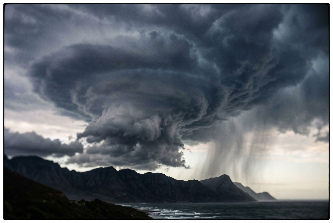
The morning across the valley breaks with a deceptive, porcelain stillness. Early sunlight filters through a pale, milky glaze of cirrostratus, warming the orchards and the clay soils until a rich, loamy petrichor rises unprompted from the earth. The barometer hanging on the veranda wall has scarcely budged; its needle sits pinned in an unmoving trance, neither dropping with the steep plunge characteristic of an advancing Atlantic squall line nor rising under the heavy dome of an azure anticyclone. To an untrained eye, the day promises nothing more severe than a lazy, humid afternoon.
Yet, something in the fluid dynamics of the upper atmosphere has gone quietly and dangerously awry. By eleven o’clock, the breeze along the ground dies completely. The ambient air feels soupy, uncomfortably thick, and oppressive, even though the thermometer registers a modest 24°C.
Look straight up, and the visual architecture of the sky begins to warp.
  Upper Atmosphere (~30,000 ft): Polar Air (-30°C to -40°C) [ISOLATED COLD POOL]
  ---------------------------------------------------------------------------------
  Mid-Levels (~18,000 ft):       Violent Destabilization & Extreme Lapse Rates
  ---------------------------------------------------------------------------------
  Surface Layer:                 Warm, Saturated Subtropical Air (24°C, High Moisture)
Without the warning herald of a sweeping cold front—no dark, linear shelf cloud marching across the horizon, no sudden 90-degree veer in the ground wind—isolated convective towers erupt vertically like nuclear blossoms. Small, ragged tufts of altocumulus castellanus, resembling miniature turreted battlements, coalesce into gigantic anvil-topped cumulonimbus clouds. They do not drift downwind; they simply inflate in situ, anchored to the landscape.
The first heavy, silver raindrops strike the dust with explosive force, spaced inches apart, each drop chilling the sweltering ground. Within twenty minutes, the tranquil valley is submerged beneath a stationary, slate-grey curtain of water. The deluge does not pass. It feeds upon itself, churning and regenerating over the exact same coordinates as the afternoon bleeds into dusk. You are standing beneath a cut-off low: a severed, spinning island of high-altitude polar air marooned in a subtropical sea.
2. What's Actually Happening — Plain English First
To understand why a cut-off low can paralyze regional weather systems and unload weeks of precipitation in a single afternoon, imagine the atmosphere not as a chaotic blender, but as a vast, multi-layered cake gliding across the curvature of the planet.
In normal weather patterns, the mid-latitudes are ruled by the polar jet stream—a high-altitude ribbon of roaring westerly winds that acts like a celestial river. This river separates the bitter, dense polar air masses to the north from the buoyant, sun-baked subtropical air masses to the south. Embedded within this river are giant waves, known to meteorologists as Rossby waves.
Normal Jet Stream:          Meandering Wave:            Cut-Off Low Pinch-Off:
=================           ====\      /====            ====\            /====
 (Zonal Westerlies)              \    /                      \  Jet Stream /
                                  \__/                        \___________/
                               (Deep Trough)                     [ (L) ]  <- Cut-Off Low
                                                                Cold Pool
Occasionally, these planetary waves grow so monstrous in amplitude that they buckle. Think of a meandering river carving through a flood plain: when an oxbow bend becomes too exaggerated, the main current cuts a straight channel across the neck, abandoning a looping ring of water that becomes an isolated oxbow lake.
In the atmosphere, a similar fluid instability occurs. An enormous trough of low pressure dips deep into equatorial latitudes until its neck is pinched off by surrounding high pressure. The main jet stream current zips eastward far to the north, leaving behind a detached, self-contained vortex of freezing, upper-tropospheric polar air stranded over warm latitudes. This orphaned vortex is a cut-off low—known across the Mediterranean basin and Spanish meteorological literature as a DANA (Depresión Aislada en Niveles Altos).
Once isolated, two distinct physics engines govern its catastrophic behavior:
The Atmospheric Fridge Door: Extreme Vertical Lapse Rates
Imagine leaving your home freezer wide open directly above a steaming sauna. The bottom of the atmosphere remains warm and laden with moisture, while five to nine kilometers above, the core of the cut-off low holds an immense pool of Arctic air at temperatures sinking below -30°C or -40°C.
Warm air is naturally less dense than cold air. When you place an intensely cold air mass directly atop a warm, moisture-saturated ground layer, the vertical temperature drop—what atmospheric physicists term the environmental lapse rate—becomes exceptionally steep. The warm air at the surface has immense positive buoyancy; it screams upward in unstoppable convective updrafts, like an inflated beach ball forced to the bottom of a swimming pool and suddenly released.
The Stagnant Engine: Vanishing Steering Winds
Most summer squalls or winter depressions travel briskly across the map because they are embedded in the conveyor belt of the jet stream. A typical low-pressure system might travel at 30 to 50 km/h, meaning even a ferocious downpour passes over a given town in an hour or two.
A cut-off low, however, has severed its umbilical cord to the jet stream. It sits in a synoptic dead zone where the background steering flow ($U$) drops near zero. Because there is no broad planetary current to push it along, the system stalls. It hovers over the same river catchments, coastal plains, and mountain ranges for days, continuously ingesting moisture from nearby seas and converting it into relentless, banded precipitation.
3. The Science (For Those Who Want to Go Deeper)
To rigorously diagnose the birth and mechanical maintenance of a cut-off low, dynamic meteorologists inspect the atmosphere through the lens of isentropic potential vorticity and hydrostatic vertical structure.
Rossby Wave Breaking and Dynamic Tropopause PV Pinch-Off
The genesis of a cut-off depression is fundamentally an irreversible hydrodynamic wave-breaking event. In the upper troposphere and lower stratosphere, air possesses high values of Potential Vorticity (PV), a conserved tracer in adiabatic, frictionless flow formulated by Carl-Gustaf Rossby and Hans Ertel:
$$PV = -g \left( \boldsymbol{\zeta}_\theta + f \right) \frac{\partial \theta}{\partial p}$$
Where: * $g$ is the acceleration due to gravity ($9.81 \text{ m s}^{-2}$), * $\boldsymbol{\zeta}_\theta$ is the relative vorticity evaluated along an isentropic surface (surfaces of constant potential temperature $\theta$), * $f = 2\Omega \sin\phi$ is the Coriolis parameter, * $\frac{\partial \theta}{\partial p}$ is the static stability parameter (the vertical gradient of potential temperature with respect to pressure).
In the stratosphere, static stability ($\partial \theta / \partial p$) is enormous, giving stratospheric air characteristic PV values well above $2.0 \text{ PVU}$ ($1 \text{ PVU} = 10^{-6} \text{ m}^2 \text{ s}^{-1} \text{ K kg}^{-1}$). The boundary marking $PV = 1.5 - 2.0 \text{ PVU}$ defines the dynamic tropopause, as detailed by the European Centre for Medium-Range Weather Forecasts (ECMWF).
During large-amplitude Rossby wave breaking—either Cyclonic Wave Breaking (CWB) or Anticyclonic Wave Breaking (AWB)—a tongue of high-PV stratospheric air penetrates equatorward. As the wave thins and filaments, advection of low-PV tropospheric air on its flanks pinches off the neck of the intrusion. This dynamic tropopause fold isolates a high-PV, cold-core anomaly within the lower-PV troposphere. In response to the inverted PV anomaly, cyclonic circulation is dynamically induced throughout the depth of the troposphere below it, pulling the upper-level cold pool down into the middle troposphere.
Stratosphere (High PV > 2.0 PVU)
========================\        /========================  <- Dynamic Tropopause
                         \      /
  Troposphere             \ PV /   <- Tropopause Fold (High-PV Filament)
  (Low PV < 1.0 PVU)       \__/

                       [ CUT-OFF ] -> Isolated Cyclonic Vortex & Cold Pool
Cold-Core Depressions Versus Warm-Core Cyclones
A cut-off low is the thermodynamic inverse of a tropical cyclone (such as a hurricane). We can demonstrate this mathematically using the Thermal Wind Equation in pressure coordinates, which links vertical wind shear to horizontal temperature gradients:
$$\frac{\partial \mathbf{v}_g}{\partial \ln p} = -\frac{R_d}{f} \left( \mathbf{k} \times \nabla_p T \right)$$
- Tropical Cyclone (Warm-Core): The center of the vortex is warmer than the surrounding environment ($\nabla_p T$ points outward from the center). Consequently, the geostrophic wind $\mathbf{v}_g$ and horizontal pressure gradient are strongest at the surface and decay rapidly with height. The depression weakens as one ascends into the upper troposphere.
- Cut-Off Low (Cold-Core): The center of the vortex is colder than the surrounding environment ($\nabla_p T$ points inward toward the cold pool). As a result, the cyclonic circulation and negative geopotential height anomaly intensify with altitude, reaching maximum kinetic and potential amplitude in the mid-to-upper troposphere (between $500 \text{ hPa}$ and $300 \text{ hPa}$).
Equation 1: Localized Hydrostatic Thickness Deficit
The hypsometric equation determines the vertical distance—or geopotential thickness ($\Delta Z$)—between two constant pressure surfaces ($p_1$ and $p_2$). It states that thickness is directly proportional to the layer-mean virtual temperature ($\bar{T}_v$):
$$\Delta Z = Z_2 - Z_1 = \frac{R_d \bar{T}_v}{g_0} \ln\left(\frac{p_1}{p_2}\right)$$
Where: * $R_d = 287.05 \text{ J kg}^{-1} \text{ K}^{-1}$ is the gas constant for dry air, * $g_0 = 9.80665 \text{ m s}^{-2}$ is standard gravitational acceleration, * $\bar{T}_v$ is the mean virtual temperature of the column in Kelvin ($\text{K}$), * $p_1$ is the lower pressure boundary ($1000 \text{ hPa}$ at sea level), * $p_2$ is the upper pressure boundary ($500 \text{ hPa}$ in the middle troposphere).
What This Equation Predicts
When an isolated upper-level cold pool enters a region, the average temperature of the column drops precipitously. The hypsometric equation predicts that the physical distance between the $1000 \text{ hPa}$ level and the $500 \text{ hPa}$ level must contract (compress downward). This downward collapse creates a profound, localized negative geopotential height anomaly at $500 \text{ hPa}$, forming the distinct closed contours seen on upper-air synoptic charts.
Worked Example with Realistic Numbers
Let us calculate the reduction in $1000\text{--}500 \text{ hPa}$ thickness when an upper-level cold pool cools a standard subtropical tropospheric column:
-
Undisturbed Subtropical Environment: * Mean column temperature: $\bar{T}{v,1} = 265 \text{ K}$ (approx. $-8^\circ\text{C}$ column average). * Ratio of pressures: $\ln(1000 / 500) = \ln(2) \approx 0.69315$. * Scaling factor: $\frac{R_d}{g_0} = \frac{287.05}{9.80665} \approx 29.271 \text{ m K}^{-1}$. * Undisturbed Thickness ($\Delta Z{\text{warm}}$): $$\Delta Z_{\text{warm}} = 29.271 \times 265 \times 0.69315 = 5,376.6 \text{ m}$$
-
Invasion of the Cut-Off Cold Pool: * Severe high-altitude cooling drops the mean layer temperature by $12 \text{ K}$: $\bar{T}{v,2} = 253 \text{ K}$. * Cold Pool Thickness ($\Delta Z{\text{cold}}$): $$\Delta Z_{\text{cold}} = 29.271 \times 253 \times 0.69315 = 5,133.2 \text{ m}$$
-
Geopotential Anomaly: $$\text{Height Deficit} = \Delta Z_{\text{cold}} - \Delta Z_{\text{warm}} = 5,133.2 - 5,376.6 = -243.4 \text{ meters}$$
Equation 2: Quasi-Stationary Precipitation Accumulation Kinematics
Total localized rainfall accumulation ($P$, in millimeters) at a fixed geographic point is governed by the product of the instantaneous rainfall rate ($R$, in $\text{mm h}^{-1}$) and the total duration of the precipitation event ($t$, in hours):
$$P = \int_0^T R(t) \, dt \approx \bar{R} \times \left( \frac{L}{c_{\text{prop}}} \right)$$
Where: * $\bar{R}$ is the average rain rate produced by the convective cells, * $L$ is the along-track dimension (length) of the convective complex or mesoscale convective system (MCS) train ($\text{km}$), * $c_{\text{prop}}$ is the ground propagation speed of the convective system ($\text{km h}^{-1}$), determined by the vector sum of cell translation ($\mathbf{v}{\text{cell}}$) and new cell regeneration/propagation ($\mathbf{v}{\text{prop}}$):
$$\mathbf{c}{\text{prop}} = \mathbf{v}{\text{cell}} + \mathbf{v}{\text{prop}} \approx \mathbf{U}{500\text{--}300} + \mathbf{v}_{\text{prop}}$$
What This Equation Predicts
Rainfall accumulation does not depend solely on how intensely it rains, but on how fast the storm moves across the watershed. If the background upper-level steering flow ($\mathbf{U}{500\text{--}300}$) approaches zero within the calm core of a cut-off low, cell translation ($\mathbf{v}{\text{cell}}$) stalls. If new convective cells continuously back-propagate over the same terrain (a phenomenon known as convective cell training), the propagation speed $c_{\text{prop}} \to 0$, driving the total accumulation $P$ to astronomical, catastrophic values.
Worked Example with Realistic Numbers
Consider an organized convective precipitation band with a length $L = 120 \text{ km}$ and a mean rainfall rate $\bar{R} = 45 \text{ mm h}^{-1}$ moving across a mountain basin under two distinct synoptic regimes:
-
Standard Progressive Trough (Active Jet Stream): * Propagation speed: $c_{\text{prop}} = 40 \text{ km h}^{-1}$. * Duration ($t$): $t = \frac{120 \text{ km}}{40 \text{ km h}^{-1}} = 3.0 \text{ hours}$. * Total Accumulation ($P$): $$P = 45 \text{ mm h}^{-1} \times 3.0 \text{ h} = 135 \text{ mm}$$ (A heavy storm, but manageable for most robust drainage systems.)
-
Stagnant Cut-Off Low (Sluggish Steering Flow): * Steering flow collapses; slow back-building propagation yields $c_{\text{prop}} = 4 \text{ km h}^{-1}$. * Duration ($t$): $t = \frac{120 \text{ km}}{4 \text{ km h}^{-1}} = 30.0 \text{ hours}$. * Total Accumulation ($P$): $$P = 45 \text{ mm h}^{-1} \times 30.0 \text{ h} = 1,350 \text{ mm}$$
4. Practical Outdoor Guidance
When navigating mountainous, coastal, or rural terrain, recognizing the presence of a cut-off low can be the difference between a safe expedition and finding yourself trapped in a flash flood.
       SYNOPTIC DIAGNOSTIC CHECKLIST:
       [x] 500 hPa Chart: Closed circular isohypses disconnected from main westerlies.
       [x] Satellite: Swirling comma cloud or persistent circular vortex over fixed zone.
       [x] Barometer: Flatline/sluggish pressure trace; absence of sharp frontal jumps.
       [x] Sky: Castellanus turrets before noon, explosive multi-directional anvils.
       [x] Surface Wind: Persistent backing (counter-clockwise turning) or dead calm.
What to Look for in the Sky
- Mid-Morning Turreted Clouds (Altocumulus castellanus): Look for small, elevated cloud rows that look like castle battlements between 9:00 AM and 11:00 AM. This is visual confirmation of steep mid-level lapse rates and elevated instability before ground heating has fully peaked.
- Explosive, Radial Anvil Growth: Unlike standard cold-front storms that tilt sharply downwind along the shear vector, cut-off low cumulonimbus clouds mushroom nearly vertically. Their cirrus anvils expand symmetrically like giant umbrellas because upper-level horizontal winds are weak.
- Sluggish, Omnidirectional Storm Paths: Watch the motion of rain curtains against distant ridges. If one storm cell builds to the south while a neighboring cell appears to drift westward, you are situated inside the cyclonic circulation envelope of an isolated vortex.
Classic Frontal Storm (Fast Shear):      Cut-Off Low Storm (Weak Shear / High Instability):
         ==========>> (Jet Stream)                        (Cold Pool Aloft)
               /                                            .-'""'-.
             /   (Tilted Anvil)                            /  /\/\  \   (Symmetric Anvil)
           /                                              |  /__\ |
       [CB Tower]                                         \       /
         /                                                [CB Tower]
       /   ==> (Fast Propagation)                             || (Stationary Downpour)
Instrument Readings: Barometer, Thermometer, and Wind
- The Barometer's "Stagnation Trap": Do not wait for a dramatic pressure drop before seeking shelter. In a cut-off low, surface pressure anomalies are often broad, shallow, and diffuse ($1010\text{--}1016 \text{ hPa}$). The deepest dynamic pressure deficit resides high overhead at $500 \text{ hPa}$. A flat or gently wavering barograph trace does not indicate stable weather.
- Backing Winds (Counter-Clockwise Shift): If your compass and wind vane reveal surface winds shifting from south to east, and then to northeast (backing) while the temperature remains cool and damp, you are caught in the eastern or northern quadrant of the cut-off vortex—the prime sector for warm-conveyor-belt moisture advection and torrential rainbands.
- Anomalous Diurnal Temperature Dampening: If the afternoon thermometer fails to climb despite broken sun, but humidity climbs toward saturation, cool air is being maintained dynamically aloft while the surface boundary layer saturates from below.
Synoptic Chart Diagnostic Cues
For mariners, aviators, and mountaineers consulting numerical weather prediction models (such as those from NOAA's National Weather Service or the Met Office): 1. 500 hPa Geopotential Height Charts: Look for at least one or two completely closed, circular contour lines (isohypses, e.g., the $552 \text{ dam}$ or $546 \text{ dam}$ lines) severed south of the continuous polar jet isolines. 2. Negative Geopotential Height Anomalies: On anomaly charts, identify intense blue or purple bullseyes where the $500 \text{ hPa}$ height is $200\text{--}300 \text{ meters}$ below the climatological mean. 3. Upper-Air Soundings (Skew-T Log-P Diagrams): Look for soundings resembling a wide-open pair of scissors: near-surface saturation and warm temperatures transitioning to extremely cold temperatures aloft, yielding massive values of Convective Available Potential Energy (CAPE) paired with weak bulk vertical wind shear.
Real-World Synoptic Case: The October 2024 Mediterranean DANA Catastrophe
The catastrophic potential of stagnant cut-off low dynamics was demonstrated with devastating clarity in late October 2024 across the Valencia region of eastern Spain.
A high-amplitude Rossby wave broke over Western Europe, driving an intense cyclonic PV filament into the western Mediterranean. The upper-level polar vortex detached from the jet stream, establishing a textbook cut-off low centered over southern Spain and the Alboran Sea.
                                  [ HIGH PRESSURE RIDGE ]
                                (Blocking over Central Europe)
                                          \       /
 [ CUT-OFF LOW: -30°C at 500 hPa ]         \     /
   (Stationary over Southern Spain)  <=======   <= [ Moist Easterly Maritime Jet ]
                 ||                                (Very High θe from Mediterranean)
          [ VALENCIA BASIN ]
   Torrential Stagnant Inundation
   (> 600 mm in < 12 Hours)
Because an expansive blocking anticyclone sat anchored over Central Europe, the background steering flow ($U$) across the Iberian Peninsula collapsed to zero. The cut-off low remained anchored in place for over 48 hours.
On its eastern flank, the cyclonic circulation acted as a massive atmospheric pump, driving a low-level easterly jet of warm, saturated Mediterranean air directly into the mountainous coastal topography of Valencia.
With surface temperatures near $22^\circ\text{C}$ and $500 \text{ hPa}$ temperatures plunging below $-28^\circ\text{C}$, the environmental lapse rate exceeded the dry adiabatic rate in the lower-middle troposphere.
Convective cells repeatedly initiated over the same maritime coordinates, steered by local low-level convergence into the Turia and Magro river basins. Because the system was kinematically stationary ($c_{\text{prop}} \approx 0$), localized rainfall accumulations surpassed $600\text{ mm}$ in under 12 hours—a volume equivalent to an entire year’s precipitation falling on steep, clay-dominated catchments, triggering flash floods of historic scale.
5. Today's Meteorological Rule of Thumb
When an upper-level cold pool cuts off from the jet stream, disregard the surface barometer: if the sky boils vertically without a breeze to move it, expect the storm to stay until it empties the sky.
Authoritative Meteorological References & Further Reading
- World Meteorological Organization (WMO) Dynamic Meteorology Concepts
- ECMWF Diagnostic Guidelines on Potential Vorticity and Cut-Off Lows
- Met Office Technical Guide to Atmospheric Stability and Lapse Rates
- NOAA / NWS Weather Prediction Center: Synoptic Dynamics Glossary
- American Meteorological Society (AMS) Glossary: Cut-Off Cyclone Dynamics