Wet-Bulb Temperature & Psychrometric Cooling: How Evaporative Thermodynamics Dictates Rain-Snow Transitions and Extreme Heat Stress Limits
1. The Gathering Chill: An Outdoor Sensory Prelude
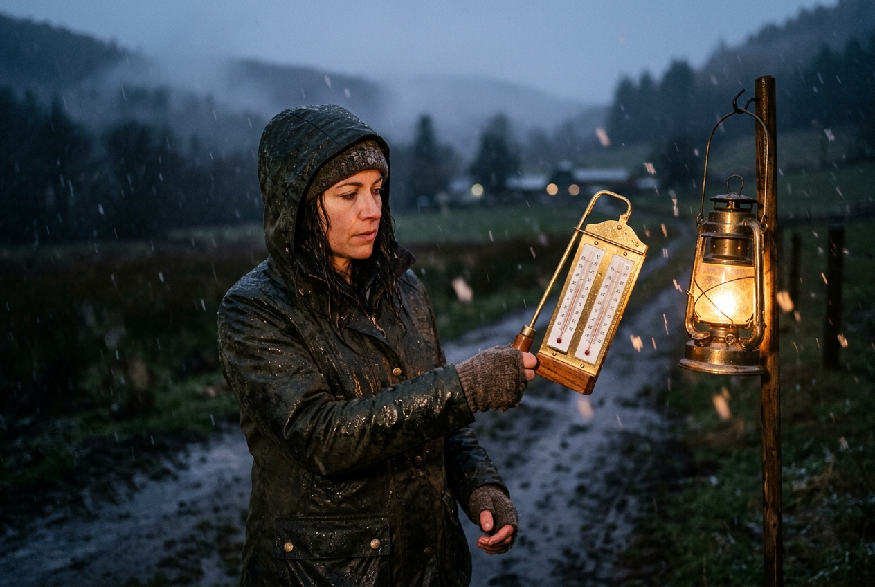
Late afternoon across the open moorland begins with a deceptive serenity. The autumn sun, hanging low over the western ridge, casts long, amber shadows across the heather and dry peat. Your digital field thermometer reads a comfortable $+4.0^\circ\text{C}$ ($39.2^\circ\text{F}$). The air is crisp, biting, and remarkably dry; your breathing produces faint puffs of vapor that disperse almost instantaneously into the thin air. Overhead, however, the sky tells a starkly different story. A dense, steely shield of altostratus has thickened into an ominous nimbostratus canopy, blotting out the low sun and turning the landscape into a study of slate and charcoal.
       [ Nimbus Cloud Base: Saturated Region (T = Tw = Td) ]
                         |   |   |   |   |
                         |   |   |   |   |  Falling Hydrometeors
                         v   v   v   v   v  (Rain / Melting Crystals)
      - - - - - - - - - - - - - - - - - - - - - - - - - - - - - - - - - -
       [ Unsaturated Sub-Cloud Layer: Dry Ambient Air (T = +4°C, RH = 35%) ]
            ~ ~ ~ Evaporative Latent Heat Extraction ~ ~ ~
            Sensible Heat -> Latent Heat  |  Air Collapses to Tw ~ +0.5°C
      - - - - - - - - - - - - - - - - - - - - - - - - - - - - - - - - - -
       [ Surface Boundary: Abrupt Phase Transition to Heavy Snow ]
Beneath the belly of this dark cloud deck, ragged, fibrous curtains hang suspended in the mid-air. These are trails of virga—shafts of liquid precipitation falling from the cloud base two thousand metres above, yet vanishing hundreds of metres before reaching the ground. They appear like grey jellyfish tentacles drifting across the horizon, dissolving into empty space.
As you walk, the barometric pressure on your altimeter ticks downward, and the wind, previously a gentle westerly drift, abruptly halts. A profound, expectant silence settles over the plateau. Then, within seconds, the wind shifts ninety degrees, surging outward in a brisk, shuddering gust that carries the pungent, metallic scent of petrichor—the aerosolized essence of geosmin and dry earth struck by falling water.
With that first gust comes a shock of intense cold that cuts straight through your outer shell. The air feels suddenly dense and heavy, yet your thermometer was reading four degrees above freezing only moments ago. A scattering of icy raindrops strikes your jacket. Within two minutes, the rain thickens; within five, the liquid droplets transform into soft, translucent pellets of sleet. Before ten minutes have elapsed, the liquid rain has vanished entirely, replaced by a blinding, horizontal curtain of massive, interlocking dendrite snowflakes. The heather turns white under an accumulating blanket of snow, while your thermometer plunges downward toward the freezing mark, bottoming out at $+0.5^\circ\text{C}$.
No cold front has passed; no Arctic air mass has swept across the ridge. The sudden freeze was engineered entirely from within the local air column itself—a violent, rapid thermodynamic transformation known to meteorologists as "wet-bulbing down."
2. What Is Actually Happening: The Three Temperatures of the Air
To comprehend why a dry, above-freezing atmosphere can spontaneously plunge itself into a snowstorm, we must deconstruct our everyday understanding of temperature. The ambient atmosphere possesses not one, but three distinct thermodynamic temperatures: the dry-bulb temperature ($T$), the dew point temperature ($T_d$), and the wet-bulb temperature ($T_w$).
    THERMODYNAMIC TEMPERATURE HIERARCHY IN UNSATURATED AIR:

    [ Dew Point: Td ]  <======  [ Wet-Bulb: Tw ]  <======  [ Dry-Bulb: T ]
    (Condensation point)    (Evaporative limit)       (Sensible kinetic heat)

    * Note: At 100% Relative Humidity (Saturation): Td = Tw = T
The Invisible Atmospheric Sponge
Think of any given parcel of air as a vast, invisible sponge. The dry-bulb temperature ($T$) is simply what an ordinary, shielded thermometer measures: the average kinetic energy of the vibrating nitrogen, oxygen, and trace gas molecules darting through space. It tells us how hot the air feels in the absence of moisture exchange.
The dew point ($T_d$), by contrast, measures the absolute amount of moisture actually residing within that sponge. It represents the temperature to which the air parcel would have to be cooled—at constant barometric pressure and constant moisture content—for its invisible water vapor to condense into liquid dew, mist, or cloud droplets. If the air holds very little moisture, the dew point sits far below the dry-bulb temperature.
The wet-bulb temperature ($T_w$) is the mediator between these two extremes. It represents the lowest temperature to which an air parcel can be cooled solely through the natural evaporation of water into it at constant pressure.
Sensible Heat versus Latent Heat
Whenever water evaporates from liquid into vapor, it does not disappear passively; it undergoes a demanding energetic phase transition. Water molecules are held together in the liquid state by strong hydrogen bonds. To liberate a molecule into the gaseous phase, energy must be absorbed to break these intermolecular bonds. This energetic tax is known as the latent heat of vaporization ($L_v \approx 2.501 \times 10^6 \text{ J/kg}$).
Where does this colossal quantity of energy come from? In the open atmosphere, it is drawn directly from the surrounding air molecules and from the evaporating surface itself. The thermal energy that was once causing air molecules to move rapidly—their sensible heat—is converted directly into the latent chemical potential energy of gaseous water vapor.
As sensible heat is drained from the air to fuel evaporation: 1. The kinetic energy of the air decreases, causing its dry-bulb temperature to fall. 2. The added water vapor increases the moisture content of the air, causing its dew point to rise. 3. Both temperatures march inexorably toward one another, meeting at the wet-bulb temperature ($T_w$), which serves as the absolute thermodynamic floor for evaporative cooling.
In any unsaturated volume of air, these three metrics strictly obey the fundamental psychrometric inequality:
$$T_d \le T_w \le T$$
Only when the relative humidity reaches absolute saturation ($100\%$) do all three values converge into a single number: $T = T_w = T_d$.
3. The Science: Mathematical Formulations and Meteorological Dynamics
For those seeking to quantify these atmospheric phase changes, atmospheric physics relies on the discipline of psychrometrics—the study of the thermodynamic properties of moist gas mixtures.
3.1 The Psychrometric Equation
When a wet surface (such as a rain droplet or a saturated thermometer wick) is exposed to an unsaturated airflow, a dynamic steady state is established. Sensible heat conducts into the water droplet from the warmer ambient air at exactly the same rate that latent heat is carried away by evaporating water molecules.
Balancing these boundary-layer heat and mass flux equations yields the classical psychrometric equation, first formalized in foundational meteorological literature and codified by the World Meteorological Organization (WMO):
$$e = e_s(T_w) - \gamma P (T - T_w)$$
Where: - $e$ is the actual partial vapor pressure of the ambient air ($\text{hPa}$). - $e_s(T_w)$ is the saturation vapor pressure of water calculated at the wet-bulb temperature ($\text{hPa}$). - $P$ is the local barometric atmospheric pressure ($\text{hPa}$). - $(T - T_w)$ is the wet-bulb depression ($\text{K}$ or $^\circ\text{C}$)—the difference between the dry air temperature and the wet-bulb limit. - $\gamma$ is the psychrometric constant, defined as:
$$\gamma = \frac{c_p}{\epsilon L_v} \approx 6.6 \times 10^{-4} \text{ K}^{-1} \quad (\text{or } 0.00066 \text{ hPa}^{-1}\text{K}^{-1} \text{ at standard pressure})$$
Here, $c_p \approx 1005 \text{ J}\cdot\text{kg}^{-1}\text{K}^{-1}$ represents the specific heat capacity of dry air at constant pressure, and $\epsilon \approx 0.622$ represents the ratio of the molecular mass of water vapor to that of dry air.
To compute the saturation vapor pressure $e_s$ at any temperature $T$ (in $^\circ\text{C}$), meteorology commonly uses the empirical August-Roche-Magnus approximation:
$$e_s(T) = 6.112 \exp\left( \frac{17.67 T}{T + 243.5} \right)$$
3.2 The Rain-Snow Phase Transition: A Worked Atmospheric Scenario
To see the psychrometric equation unfold in nature, let us analyze the exact physical mechanics of the sudden moorland snowstorm described earlier.
Consider an unsaturated sub-cloud surface boundary layer under standard sea-level pressure ($P = 1013.25\text{ hPa}$): - Surface Dry-Bulb Temperature: $T = +4.0^\circ\text{C}$ - Surface Relative Humidity: $\text{RH} = 35\%$ ($0.35$)
================================================================================
                    PSYCHROMETRIC EQUILIBRIUM COMPUTATION
================================================================================
Step 1: Calculate Saturation Vapor Pressure at Ambient T (+4.0°C)
        e_s(4.0) = 6.112 * exp((17.67 * 4.0) / (4.0 + 243.5))
        e_s(4.0) = 6.112 * exp(70.68 / 247.5) = 6.112 * 1.3305 = 8.132 hPa

Step 2: Calculate Ambient Actual Vapor Pressure (e)
        e = RH * e_s(T) = 0.35 * 8.132 hPa = 2.846 hPa

Step 3: Solve Psychrometric Equation for Wet-Bulb Temperature (Tw)
        2.846 = e_s(Tw) - (0.00066 * 1013.25 * (4.0 - Tw))
        2.846 = e_s(Tw) - 0.6687 * (4.0 - Tw)

Step 4: Iterative Convergence for Tw
        Testing Tw = +0.5°C:
        e_s(0.5) = 6.112 * exp((17.67 * 0.5) / (0.5 + 243.5)) = 6.335 hPa
        Right Side = 6.335 - 0.6687 * (4.0 - 0.5)
                   = 6.335 - 0.6687 * 3.5 = 6.335 - 2.340 = 3.995 hPa (Too high)

        Testing Tw = +0.55°C:
        Precise numerical root yields:
        Tw ≈ +0.52°C  |  Wet-Bulb Depression (T - Tw) = 3.48°C
================================================================================
Result: The absolute thermodynamic floor of the air column is +0.52°C.
================================================================================
When rain starts falling from the high cloud base into this dry layer, the falling hydrometeors encounter air with a vapor pressure of only $2.85\text{ hPa}$. The liquid droplets rapidly evaporate into the unsaturated air. Every single kilogram of evaporated rainwater extracts approximately $2.5\text{ megajoules}$ of sensible heat from the air column.
As the falling precipitation saturates the sub-cloud air, the dry-bulb temperature collapses from $+4.0^\circ\text{C}$ down toward the wet-bulb temperature of $+0.52^\circ\text{C}$.
Because the wet-bulb temperature is near freezing ($+0.5^\circ\text{C}$), falling ice crystals and snowflakes descending from the upper atmosphere no longer melt into rain. Although the air is marginally above zero, the snowflakes themselves are undergoing subtle sublimation and surface evaporation, which maintains the snowflake's surface temperature at exactly $T_w$ ($+0.5^\circ\text{C}$). The crystalline bridges within the snowflake survive the brief descent through the shallow chilled layer, reaching the ground as thick, wet snow. A forecaster looking only at the dry-bulb reading of $+4^\circ\text{C}$ would have predicted cold rain; a psychrometrically literate observer anticipating the wet-bulb depression accurately forecasts a heavy snow event.
For deeper analysis on atmospheric soundings and temperature profiles, consult the NOAA National Weather Service Skew-T Psychrometric Resource.
3.3 Biometeorology & Human Thermoregulation Limits
The wet-bulb temperature is not merely a predictor of winter precipitation; it represents the most critical biometeorological boundary condition for human survival on Earth.
The human body functions as an endothermic thermodynamic engine, continuously generating between $100\text{ W}$ of metabolic heat at rest and upwards of $500\text{ to }1000\text{ W}$ during vigorous physical labor. To maintain internal homeostasis at a core temperature of $\sim 37.0^\circ\text{C}$ ($98.6^\circ\text{F}$), this metabolic heat must be continuously evacuated to the surrounding environment through four mechanisms: radiation, conduction, convection, and evaporative perspiration.
       HUMAN THERMAL DISSIPATION REGIMES

       Ambient Tw < 25°C:       Efficient evaporative cooling via sweat.
       Ambient Tw = 28°C - 31°C: Severe heat stress during exertion; heat cramps/exhaustion.
       Ambient Tw = 32°C - 34°C: Extreme danger; physical labor becomes lethal.
       Ambient Tw >= 35°C:      ABSOLUTE PHYSIOLOGICAL LIMIT. Evaporative cooling fails.
                                Core body temperature rises uncontrollably -> Fatal heat stroke.
When the dry-bulb ambient temperature ($T$) exceeds our mean skin temperature—which stabilizes at approximately $35.0^\circ\text{C}$ ($95.0^\circ\text{F}$)—radiation, conduction, and convection reverse direction. The environment begins pumping heat into the body rather than absorbing it. Under these conditions, cutaneous evaporation of sweat becomes the body's sole remaining pathway for heat dissipation.
Sweat cooling operates on the identical psychrometric principle governing the wet-bulb thermometer: latent heat of vaporization is drawn from the skin's capillary bed as sweat evaporates into the air. However, the rate of sweat evaporation is governed strictly by the vapor pressure gradient between saturated skin ($\approx 56.2\text{ hPa}$ at $35^\circ\text{C}$) and the ambient air ($e$).
When the environmental wet-bulb temperature reaches $35.0^\circ\text{C}$ ($95.0^\circ\text{F}$): 1. The ambient air is completely saturated with moisture at human skin temperature ($e = e_s(35^\circ\text{C})$). 2. The vapor pressure gradient between skin and atmosphere drops to absolute zero. 3. Sweat production continues profusely, but the liquid sweat can no longer evaporate; it merely pools and rolls off the skin without extracting any latent heat. 4. Convective and radiative cooling are impossible because the ambient air is at or above skin temperature.
Under an ambient wet-bulb temperature of $35^\circ\text{C}$, a human being—even stripped naked, seated in the shade, supplied with unlimited drinking water, and positioned directly in front of a high-speed electric fan—cannot dissipate a single watt of metabolic heat. Metabolic heat accumulates within the body core at a rate of approximately $1^\circ\text{C}$ every 45 to 60 minutes. Within 3 to 6 hours, core body temperature reaches hyperthermic levels ($> 42^\circ\text{C}$ / $107.6^\circ\text{F}$), inducing cellular degradation, multiorgan failure, and death.
Recent biometeorological empirical research by institutions such as the Met Office and NOAA National Weather Service indicates that the practical physiological threshold for young, healthy adults undertaking light activity is even lower—around $T_w \approx 30.5^\circ\text{C}$ to $31.5^\circ\text{C}$.
4. Practical Field Observation and Psychrometry
Understanding the mechanics of evaporative cooling allows field observers, mountaineers, sailors, and agriculturalists to make critical atmospheric predictions using simple, robust instruments.
4.1 Constructing and Operating a Sling Psychrometer
The premier instrument for field psychrometry is the sling psychrometer, an elegant mechanical tool consisting of two matched mercury or spirit thermometers mounted side by side on an articulated swivel handle.
       SLING PSYCHROMETER CONFIGURATION & AIRFLOW DYNAMICS

         [ Swivel Handle / Spindle Mechanism ]
                     |
            +--------+--------+
            |                 |
      [ Dry-Bulb ]      [ Wet-Bulb ]
      (Bare bulb)       (Wrapped in clean, demineralized water muslin wick)
            |                 |
            +--------+--------+
                     |
       ~~~ Airflow Velocity: 4.0 to 5.0 m/s ~~~ (Whirled in rapid circle)
To operate a sling psychrometer in the field: 1. Saturate the Wick: Moisten the cotton muslin wick covering the wet-bulb thermometer with pure, distilled or demineralized water. Tap water or stream water containing dissolved minerals will leave saline deposits on the wick as water evaporates, skewing vapor pressure equations and introducing systematic errors. 2. Ventilate the Instrument: Whirl the instrument smoothly through the air at a constant speed of $4.0 \text{ to } 5.0\text{ m/s}$ (approximately two to three revolutions per second). Rapid ventilation is critical: air velocity must exceed $3.0\text{ m/s}$ to minimize boundary-layer stagnation and ensure that convective heat exchange overwhelms stray thermal radiation from the operator's body or the sun. 3. Whirl and Record: Whirl for 60 seconds, stop, and immediately read the wet-bulb temperature. Repeat the whirling for another 30 seconds until the wet-bulb reading reaches a steady, minimum value. 4. Calculate Depression: Subtract the stabilized wet-bulb reading from the dry-bulb reading to find the wet-bulb depression:
$$\Delta T = T - T_w$$
4.2 Interpreting Field Signs and Boundary-Layer Profiles
A psychrometrically literate outdoor observer does not need to wait for instruments to sense imminent evaporative cooling events. The sky provides continuous visual telemetry:
| Visual Sky Observation | Underlying Atmospheric Physics | Ground-Level Impact |
|---|---|---|
| High Virga Ribbons (Fibrous, hanging grey cloud streaks) | Liquid hydrometeors evaporating into a deep, dry sub-cloud layer ($T \gg T_d$). | Latent heat extraction in mid-levels; potential development of violent, dry microbursts. |
| Rapid Cloud Base Lowering | Evaporating rain increases sub-cloud absolute humidity, lowering the Lifting Condensation Level (LCL). | Sub-cloud layer approaches $100\%$ RH; evaporative cooling process is nearing completion. |
| Dark, Jagged Pannus / Scud Clouds (Fractus clouds forming rapidly below main deck) | Air below cloud base has chilled to its new wet-bulb temperature, condensing newly humidified air into ragged clouds. | Imminent rain-snow line drop; surface temperatures will drop to $T_w$ within minutes. |
| Sharp Micro-Barometric Pressure Jump | Cold, dense air created by evaporative cooling aloft rushes downward to the surface, creating an outflow dome. | Sudden $20\text{–}40\text{ knot}$ gust front; temperature drops sharply by several degrees. |
4.3 Practical Rules of Thumb for Outdoor Decision Making
1. The Winter Hiker’s "One-Third Depression" Rule
If precipitation is approaching and you want to know if cold rain will turn to heavy snow, determine the current dry-bulb temperature ($T$) and dew point ($T_d$). The wet-bulb temperature ($T_w$) can be approximated in the field using the linear psychrometric rule of thirds:
$$T_w \approx T - \frac{T - T_d}{3}$$
Example: If your thermometer reads $+6.0^\circ\text{C}$ and your weather app or hygrometer reports a dew point of $-6.0^\circ\text{C}$:
$$T_w \approx 6.0 - \frac{6.0 - (-6.0)}{3} = 6.0 - \frac{12.0}{3} = 6.0 - 4.0 = +2.0^\circ\text{C}$$
Because $T_w$ is $+2.0^\circ\text{C}$, evaporative cooling alone will not drop the surface column to freezing, but will bring it close enough that high-intensity precipitation can drive the boundary layer down to snow. If $T_w \le +1.0^\circ\text{C}$, prepare immediately for an abrupt change to accumulating snow.
2. The Gardener’s Evaporative Frost Warning
Clear, dry spring evenings with high dry-bulb temperatures (e.g., $+5.0^\circ\text{C}$) can induce lethal plant frost if the air is exceptionally dry (e.g., dew point $-4.0^\circ\text{C}$). If evening winds pick up or irrigation mist is introduced, surface vegetation will cool toward the wet-bulb temperature ($T_w \approx -1.0^\circ\text{C}$), freezing tender shoots even while an ambient wall thermometer several feet above the ground reads safely above zero.
5. Today's Meteorological Rule of Thumb
The Wet-Bulb Golden Rule: The atmosphere’s dry-bulb temperature tells you where the weather is right now; its wet-bulb temperature tells you where the weather will crash the moment rain begins to fall.
Never trust an above-freezing thermometer when the sky is gray and the air is dry: evaporation is nature’s most efficient refrigerator, and the wet-bulb temperature is the floor it will always find.
Recommended Scientific References & Field Manuals
- Met Office UK: Understanding Wet-Bulb and Heat Stress
- NOAA / National Weather Service: Psychrometric and Skew-T Sounding Principles
- World Meteorological Organization: Guide to Meteorological Instruments (WMO-No. 8)
- Wikipedia: Psychrometric Equations and Thermodynamics
- Wikipedia: Wet-Bulb Temperature & Phase Transitions
- NOAA NWS Wet Bulb Globe Temperature (WBGT) Atmospheric Index