Urban Heat Island (UHI) Dynamics & Canopy Layer Microclimates: How Impervious Thermal Mass and Sky View Factors Reshape Local Weather
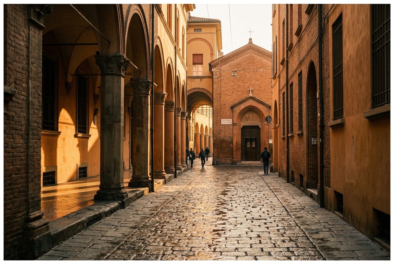
1. Opening Scene: Crossing the Thermal Frontier
If you cycle out of the countryside toward a metropolitan core at eleven o'clock on a cloudless July night, the atmosphere does not change incrementally; it shifts with the visceral abruptness of crossing a physical threshold. In the open farmland ten miles beyond the ring road, the evening air is crisp, damp, and scented with moist loam and green chlorophyll. Here, the grass underfoot is already slick with nocturnal dew, and your bicycle lamp cuts through faint ribbons of ground mist pooling in shallow hollows where the cold air has settled. The ambient temperature hovers near 14°C (57°F).
As you pedal past the arterial beltway, across the threshold where suburban hedges give way to distribution warehouses and continuous swathes of asphalt, the atmospheric texture changes. The coolness evaporates within a hundred yards. In its place enters a dry, baking draft that feels as though it were being exhaled from a subterranean kiln. By the time you reach the central avenue—flanked on both sides by eight-storey granite and glass facades—the temperature gauge on your handlebars has surged past 22°C (72°F).
The air smells faintly of ozone, desiccated dust, and hot bitumen. There is no dew on the pavements; the stones remain warm to the bare palm, radiating heat gathered over twelve hours of unmitigated solar exposure. Looking overhead, the starry firmament is framed by a narrow slit between rooflines. If you look downwind of the city toward the eastern horizon, an anomalous cluster of towering cumulus clouds glows under the city lights—a solitary nocturnal convective cell born entirely of the invisible thermal updraught rising from the city streets.
2. What Is Actually Happening: Plain English First
To make sense of why a city becomes a nocturnal heat trap while its surrounding countryside chills to the dew point, think of the atmosphere not as an undifferentiated expanse of air, but as a multi-tiered layer cake resting upon radically different thermodynamic foundations.
Atmospheric scientists divide the city’s immediate microclimate into two distinct vertical domains: 1. The Urban Canopy Layer (UCL): The microscale air layer extending from the street pavement up to the average level of the building rooftops. This is the immediate human habitat—an intricate maze of street canyons, courtyards, walls, and asphalt ribbons where micro-advection, shade, and building geometry govern thermal sensations. 2. The Urban Boundary Layer (UBL): The mesoscale atmospheric dome or thermal plume that sits atop the canopy, stretching hundreds of metres into the boundary layer. The UBL is generated by the aggregate heat, friction, and pollution exported upward by the entire urban surface, riding downwind across rural terrain like the thermal wake behind a ship.
Why does the urban canopy refuse to cool down when the sun sets?
Think of a rural meadow as a damp cotton towel and a city as a cast-iron skillet. During the day, the rural meadow receives solar energy, but it possesses a built-in evaporative cooling mechanism: vegetation draws groundwater up through root systems and transpires water vapor into the air through microscopic stomata. This process—known to meteorologists as evapotranspiration—converts the sun's radiative energy directly into latent heat, which moisturizes the air without raising its sensible temperature.
The modern city core, conversely, has systematically paved over its natural sponges. Precipitation hits impervious concrete and is directed straight into subterranean storm drains before it can evaporate. Denied the cooling release of evaporation, the sun's energy is channeled into sensible heat (energy you can feel) and substrate storage. The massive masonry, asphalt, and concrete structures function as thermal capacitors, soaking up gigajoules of thermal energy during daylight hours.
When night falls, rural soils radiate their heat directly out into space through unrestricted longwave radiation, forming a cold ground inversion. In a narrow city street, however, a phenomenon called the Sky View Factor (SVF) traps this thermal energy.
Imagine trying to cool off on a hot night while standing inside an oven lined with hot clay bricks: your body radiates heat, but the opposing walls simply radiate that heat straight back at you. In a narrow street canyon, tall buildings restrict the amount of open sky visible from the ground. Instead of escaping into the cold upper atmosphere, the longwave infrared radiation emitted by the pavement strikes the opposing building walls, is partially absorbed, and is re-radiated back down to the pavement in a continuous cycle of radiative entrapment.
3. The Science: Energy Budgets, Canyon Geometry, and Downwind Storms
For meteorologists and urban climatologists, the thermal behavior of any landscape is governed by the conservation of energy at the surface interface. We formalize this through the altered Surface Energy Balance Equation:
$$Q^* + Q_F = Q_H + Q_E + \Delta Q_S$$
Where: * $Q^$ = Net all-wave radiative flux (the net sum of incoming and outgoing shortwave solar and longwave thermal radiation). * $Q_F$ = Anthropogenic heat flux (energy injected directly into the canopy by combustion engines, HVAC condensation exhausts, industrial processes, and human metabolism). * $Q_H$ = Sensible turbulent heat flux (energy transferred to or from the air via thermal conduction and convection, driving temperature rises). * $Q_E$ = Latent heat flux (energy consumed by the phase change of water during evaporation and transpiration). * $\Delta Q_S$ = Net substrate heat storage rate* (the physical rate of conductive heat accumulation or release within building fabrics, pavements, and soil).
In pristine rural environments, $Q_F \approx 0$, vegetation and moist soil ensure that latent heat flux $Q_E$ dominates the budget, and the substrate storage term $\Delta Q_S$ remains small because soils have relatively low thermal conductivities and heat capacities compared to solid granite or concrete.
The thermodynamic partitioning between sensible and latent heat is quantified by the Bowen Ratio ($\beta$):
$$\beta = \frac{Q_H}{Q_E}$$
In temperate grasslands and agricultural pastures, $\beta$ typically ranges between 0.2 and 0.5, reflecting an atmosphere dominated by evaporative cooling. In heavily built-up downtown environments, where the impermeable surface fraction frequently exceeds 90%, $\beta$ skyrockets to values between 4.0 and 10.0. Under such conditions, nearly all net radiation is converted directly into turbulent sensible heat that drives up the canopy air temperature.
Quantitative Mechanics of the Nocturnal Canopy
The magnitude of the nocturnal heat island is heavily controlled by the Sky View Factor ($\psi_s$ or SVF), a dimensionless geometric parameter ranging from $0$ (a completely enclosed tunnel) to $1$ (an unobstructed flat plain):
$$\psi_s = \cos^2 \theta = \frac{1}{2} \left( 1 + \cos \left( 2 \arctan \left( \frac{2H}{W} \right) \right) \right)$$
where $H$ is the average building height and $W$ is the street canyon width.
In a landmark series of empirical field validations, atmospheric scientist T.R. Oke (1981) established that the maximum nocturnal urban-rural temperature differential ($\Delta T_{u-r(\max)}$) under clear, calm anticyclonic conditions scales directly with the canyon aspect ratio ($H/W$) and population density ($P$):
$$\Delta T_{u-r(\max)} = 7.45 + 15.27 \log_{10}\left(\frac{H}{W}\right)$$
or, expressed in terms of regional settlement population for North American and European cities:
$$\Delta T_{u-r(\max)} = 2.01 \ln(P) - 4.06 \quad \text{[European Typologies]}$$ $$\Delta T_{u-r(\max)} = 2.96 \ln(P) - 11.2 \quad \text{[North American Typologies]}$$
Let us evaluate this using a realistic worked example.
Worked Thermodynamic Example: Deep Canyon vs. Rural Meadow
Consider an urban street canyon in a central business district with building heights $H = 45\text{ m}$ and street width $W = 15\text{ m}$, yielding an aspect ratio:
$$\frac{H}{W} = \frac{45}{15} = 3.0$$
Applying Oke’s aspect ratio formulation:
$$\Delta T_{u-r(\max)} = 7.45 + 15.27 \log_{10}(3.0)$$ $$\log_{10}(3.0) \approx 0.4771$$ $$\Delta T_{u-r(\max)} = 7.45 + (15.27 \times 0.4771) = 7.45 + 7.286 = 14.74^\circ\text{C}$$
Under idealized, cloudless conditions with near-zero gradient wind, the canopy layer within this canyon can sustain a midnight air temperature up to 14.7°C (26.5°F) warmer than an undisturbed rural grassland ten miles away.
This urban-rural thermal gradient weakens as wind speed increases. Advective mixing flushes the trapped warm air from the canyon and homogenizes the boundary layer. The critical wind speed ($u_{\text{crit}}$) required to completely eliminate the canopy heat island is given empirically by:
$$u_{\text{crit}} = 3.4 \log_{10}(P) - 11.6 \quad [\text{m s}^{-1}]$$
For a city of $P = 1,500,000$ residents:
$$\log_{10}(1,500,000) \approx 6.176$$ $$u_{\text{crit}} = (3.4 \times 6.176) - 11.6 = 21.0 - 11.6 = 9.4\text{ m s}^{-1} \approx 33.8\text{ km/h (18.3 knots)}$$
Until regional surface winds exceed ~9.4 m/s (a fresh-to-strong breeze on the Beaufort scale), the city will maintain a distinct, self-contained microthermal dome.
Mesoscale Teleconnections: The Urban Rainfall Effect and METROMEX
The thermodynamic influence of the Urban Heat Island extends well beyond elevated thermometer readings at street level. As the canopy layer continuously pumps sensible heat ($Q_H$) and mechanical turbulence into the overlying Urban Boundary Layer, it destabilizes the regional lower troposphere.
In the landmark METROMEX (Metropolitan Meteorological Experiment) investigations conducted around St. Louis, Missouri, researchers from the American Meteorological Society and the Illinois State Water Survey proved that large urban complexes trigger and enhance thunderstorm activity downwind.
This urban rainfall effect is driven by three coupled mechanisms: 1. Thermodynamic Updraft Forcing: The city acts as a stationary mesoscale heat source, creating localized low pressure at the surface and forcing a steady convective updraught that lifts the local lifting condensation level (LCL). 2. Aerodynamic Roughness Convergence: The sudden transition from smooth rural terrain to the high aerodynamic roughness ($z_0$) of the building canopy slows surface winds, creating mechanical convergence along the city's upwind flank that pushes warm air vertically. 3. Cloud Condensation Nuclei (CCN) Enrichment: Anthropogenic aerosol emissions provide a dense population of hygroscopic nuclei, accelerating cloud droplet coalescence within destabilized plumes.
As a result, areas situated 20 to 50 kilometres downwind of major metropolitan centers consistently record a 15% to 30% increase in warm-season precipitation, alongside higher frequencies of localized hailstorms and nocturnal lightning strikes compared to upwind rural baselines.
4. Practical Outdoor Guidance: Field Observations for the Curious Naturalist
You do not need a university research vehicle to map these canopy microclimates. With a basic set of digital tools and an understanding of urban micrometeorology, any observant outdoor enthusiast, gardener, or cyclist can track the Urban Heat Island across their hometown.
What to Look for in the Sky
- The Downwind Cloud Anchor: On warm, humid summer afternoons with light background winds, watch where the first cumulus humilis clouds aggregate. They will frequently align not directly above the city center, but directly over the downwind suburban-rural transition zone, anchored by the city's thermal plume.
- The Dawn Haze Hood: Climb a hill or high vantage point just after sunrise. Look back toward the city center. You will often observe a well-defined, dome-shaped lid of trapped aerosols and brownish photochemical haze hovering between 200 and 500 metres above the skyline. This marks the top of the shallow nocturnal urban boundary layer, capped by a subsidence inversion.
What Instrument Readings to Watch
- Digital Fast-Response Thermistors with Radiation Shields: If you mount a fast-response digital thermistor (shielded in a ventilated white housing to prevent radiative bias) to a bicycle or vehicle roof rack, you can conduct a mobile transect. Drive or cycle at a constant speed along a straight cross-section from rural pasture into the urban core at midnight.
- Barometric Pressure Fluctuations: High-resolution digital barometers will register subtle drops (often 0.5 to 1.5 hPa after correcting for elevation) over the city center, reflecting the lower density of the warm, buoyant urban air column.
- Canopy Wind Reversals: In deep street canyons under calm regional synoptic weather, look for light surface breezes blowing inward toward the central business district from surrounding peripheral parks. This represents an urban heat island circulation—a miniature sea-breeze-like inflow converging on the central thermal core.
Microclimate Guidelines for Everyday Decisions
- For the Urban Gardener: Cities extend the frost-free growing season by 14 to 30 days relative to rural surroundings. Tender Mediterranean or subtropical perennials that would perish in outlying pastures can often overwinter safely against south-facing brick walls within deep canopy street canyons ($H/W > 1.5$).
- For the Long-Distance Runner or Cyclist: During summer heatwaves, avoid exercising in narrow, deep street canyons after 8:00 PM. While rural trails drop rapidly toward comfortable night-time temperatures, the urban canopy will maintain peak Wet-Bulb Globe Temperatures (WBGT) well past midnight as the stored substrate heat ($\Delta Q_S$) pours back into the breathing zone. Seek out expansive public parks: a vegetated greenspace greater than 10 hectares creates an "urban cool island" that can be 3°C to 5°C cooler than adjacent paved streets.
5. Essential References & Further Reading
To explore urban boundary layer dynamics and micrometeorology in greater detail, consult the following foundational programs and resources: * Learn more about urban boundary layer classification and measurement standards via the World Meteorological Organization (WMO). * Access comprehensive educational modules on surface energy fluxes through the National Oceanic and Atmospheric Administration (NOAA). * Review operational urban climate models and forecasting tools at the Met Office Urban Climate Research Center. * Explore the historical data and mesoscale findings of the METROMEX Project on Wikipedia. * Consult authoritative definitions of canopy layer parameters via the American Meteorological Society Glossary of Meteorology.
6. Today's Meteorological Rule of Thumb
The Midnight Pavement Rule:
When walking through a city on a calm, clear summer night, if the sky visible between the rooftops is narrower than the height of the buildings flanking you ($H/W > 1.0$), you are standing inside an active radiative furnace—expect the air around you to stay up to 8°C to 12°C hotter than the countryside until the morning sun resets the cycle.