Atmospheric Blocking & Omega Blocks: How Jet Stream Bifurcation and Anticyclonic Wave Breaking Lock Weather Patterns in Place
1. Opening Scene: The Unmoving Sky
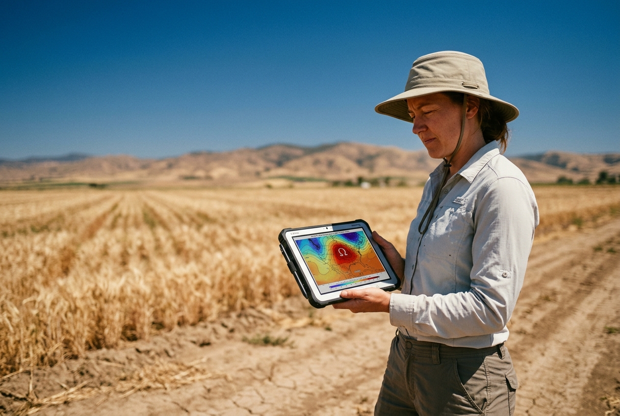
Step outside into the late afternoon heat of the tenth consecutive cloudless day. The atmosphere does not merely feel hot; it feels strangely, unnervingly motionless. In an ordinary mid-latitude summer, the sky is an ever-shifting theatre of dynamic equilibrium: high cirrus gives way to altocumulus, westerly breezes temper the afternoon sun, and the gentle fall and rise of atmospheric pressure marks the rhythmic passage of invisible synoptic waves thousands of metres overhead.
Today, that rhythm has completely vanished.
The air close to the earth is thick, dry, and stagnant, carrying the sharp, resinous tang of parched grass and sun-cured pine needles. High above, the sky is not the crisp cerulean of a fresh polar air mass, but a bleached, milky azure—veiled by a persistent aerosol haze of dust and photochemical smog trapped beneath an invisible, immovable ceiling. Watch the treetops: not a single leaf stirs. If you tap an analogue aneroid barometer mounted on the porch wall, the needle refuses to waver from 1028 hectopascals, where it has remained pinned since the beginning of last week.
       STATIONARY RIDGE (WARM / STAGNANT)
                .-''''-.
              .'   __   '.
             /   /    \   \
            |   | HEAT |   |
            |   | DOME |   |
            |    \ __ /    |
 CUT-OFF    \              /     CUT-OFF
   LOW       '.          .'        LOW
 (FLOODING)    '-......-'      (FLOODING)
   <--- JET STREAM DIVERTS NORTH / SOUTH --->
Far to the west, along the distant horizon, you might spot the faint, anvil-shaped summits of towering cumulonimbus clouds. Yet they do not drift towards you. Day after day, they erupt over the exact same mountain peaks, unload torrential deluges upon the same saturated valleys, and collapse in place as dusk falls. The westerly winds that normally ferry Atlantic weather systems across the continents have ground to a halt. You are standing directly beneath an atmospheric monolith—a synoptic traffic jam of planetary scale known to meteorologists as an Omega block.
2. What's Actually Happening — Plain English First
To understand why the weather can freeze in place for weeks on end, we must first picture how air typically circulates around our planet.
Think of the mid-latitude atmosphere as a fast-flowing, wide mountain river. In this river, the current flows relentlessly from west to east. Embedded within this current are large, gentle ripples and swirling eddies—the high- and low-pressure systems that bring us alternating days of sunshine, drizzle, and brisk winds. Propelling this entire conveyor belt is the polar jet stream, a narrow ribbon of ferocious wind carving its path near the cruising altitude of commercial airliners, some 9 to 12 kilometres above our heads.
Under normal conditions, this river keeps everything moving. A rainstorm might soak your garden on Tuesday morning, but by Wednesday afternoon the jet stream has swept the storm eastward toward the continent, pulling a fresh ridge of mild, clear air into its wake.
NORMAL ZONAL FLOW (WEST TO EAST):
===================================================================> Jet Stream
     [ Low ]         [ High ]        [ Low ]         [ High ]
    (Rain/Wind)     (Fair/Mild)     (Rain/Wind)     (Fair/Mild)
===================================================================>
An atmospheric block occurs when this smooth, eastward-flowing river encounters the meteorological equivalent of a colossal boulder dropped into mid-channel.
Instead of sweeping straight across the map, the jet stream is forced to brake abruptly. As the forward momentum stalls, the river of air begins to meander violently, bending into enormous north-south loops known as planetary or Rossby waves. If one of these northward loops swells large enough, it balloons poleward, bends back upon itself, and completely breaks away from the main current—much like an oxbow lake pinching off from a meandering lowland river.
When viewed on a high-altitude weather chart, this contorted flow traces the unmistakable outline of the Greek uppercase letter Omega ($\Omega$).
THE OMEGA BLOCK CONFIGURATION (Ω):

.--.  [ HIGH PRESSURE CORE ]  .--.
                    /    \    (Warm, Sinking Air)  /    \
                   /      '----------------------'      \
                  /                                      \
    NORTHERN     /                                        \    NORTHERN
    BRANCH ====='                                          '===== BRANCH
    ----->                                                        ----->
               \                                            /
    SOUTHERN    \   [ CUT-OFF LOW ]      [ CUT-OFF LOW ]   /   SOUTHERN
    BRANCH ======'   (Stalled Rain)       (Stalled Rain)  '====== BRANCH
    ----->                                                        ----->
At the centre of the letter sits an immense, towering dome of warm, high-pressure air. Flanking this central ridge on either flank—trapped beneath the two downward-curving "legs" of the Greek letter—are two stationary low-pressure systems, known as cut-off lows.
Once this triad locks into place, the planetary conveyor belt splits in two. One branch of the jet stream is deflected thousands of kilometres to the north over the Arctic Circle, while the other branch is shunted far to the south across the subtropics. The vast region caught in the middle becomes an island of complete synoptic stagnation.
Inside the central dome, the air is gently but relentlessly sinking—a process meteorologists call subsidence. Think of this sinking air as a heavy invisible blanket. As the air descends from the freezing upper troposphere toward the surface, it is compressed by the increasing weight of the atmosphere above it. Compression naturally warms air (just as the base of a bicycle pump heats up when you inflate a tire). This descending, warming lid evaporates any nascent clouds before they can form, preventing cool ocean air or storm fronts from penetrating the dome.
Meanwhile, solar radiation bakes the dry soil beneath day after day, turning the land surface into a giant convection heater. The resulting phenomenon is what modern forecasters call a heat dome.
Crucially, an Omega block is not a passive, dying system. It is dynamically self-sustaining. The stalled storm systems on its western flank act like mechanical paddle wheels: as they spin counter-clockwise, they continually scoop up warm, buoyant, low-density air from the subtropics and inject it directly into the crest of the high-pressure ridge. This continuous feeding mechanism offsets the natural tendency of high pressure to dissipate, locking continental weather patterns into stubborn, life-threatening standstills for weeks at a time.
3. The Science: Hydrodynamics, Potential Vorticity, and Blocking Indices
For atmospheric dynamicists, blocking represents one of the most profound non-linear instabilities in geophysical fluid dynamics. It is the physical manifestation of anticyclonic Rossby wave breaking (AWB) arresting the hemispheric mid-latitude westerly zonal flow ($u$).
Hydrodynamic Foundations: The Rossby Wave Dispersion Relation
Planetary-scale atmospheric waves owe their existence to the latitudinal variation of the Coriolis parameter, termed the planetary vorticity gradient:
$$\beta = \frac{\partial f}{\partial y} = \frac{2\Omega_E \cos\phi}{a}$$
where $\Omega_E$ is the angular rotation rate of the Earth ($7.292 \times 10^{-5} \text{ rad s}^{-1}$), $\phi$ is latitude, and $a$ is the mean radius of the Earth ($6.371 \times 10^6 \text{ m}$).
In a barotropic, non-divergent atmosphere, the dispersion relation governing the eastward phase speed ($c_x$) of a linearized Rossby wave is given by:
$$c_x = \bar{u} - \frac{\beta}{K^2} = \bar{u} - \frac{\beta}{k_x^2 + k_y^2}$$
Here, $\bar{u}$ represents the mean background westerly zonal wind, while $k_x = 2\pi / \lambda_x$ and $k_y = 2\pi / \lambda_y$ denote the zonal and meridional wavenumbers, respectively ($K$ being the total horizontal wavenumber).
Synoptic Insight: This equation predicts that long waves (small $K$, long wavelength $\lambda$) propagate westward relative to the background flow ($\beta/K^2 > 0$). When the background westerly flow $\bar{u}$ matches the intrinsic westward phase speed of the wave:
$$\bar{u} = \frac{\beta}{K^2} \implies c_x = 0$$
The wave becomes stationary with respect to the Earth's surface. If localized thermal or orographic forcing continues to pump energy into this stationary wave mode, its amplitude grows nonlinearly until the wave "breaks" in the upper troposphere.
Potential Vorticity Inversion and Eddy Feedback
The most elegant framework for diagnosing atmospheric blocking is Ertel Potential Vorticity (EPV), a fundamental conserved tracer for adiabatic, frictionless fluid motions:
$$PV = -g \left( \zeta_\theta + f \right) \frac{\partial \theta}{\partial p}$$
where $g$ is gravitational acceleration, $\zeta_\theta = \left( \frac{\partial v}{\partial x} - \frac{\partial u}{\partial y} \right)_\theta$ is the relative vorticity evaluated on an isentropic (constant potential temperature $\theta$) surface, $f = 2\Omega_E \sin\phi$ is the Coriolis parameter, and $\frac{\partial \theta}{\partial p}$ is the static stability parameter in pressure coordinates.
A blocking anticyclone manifests as an intense, isolated pool of low potential vorticity air ($PV < 1.5 \text{ PVU}$, where $1 \text{ PVU} = 10^{-6} \text{ m}^2 \text{ s}^{-1} \text{ K kg}^{-1}$) displaced far poleward into a climatological high-PV environment.
According to the PV Inversion Principle established by Hoskins, McIntyre, and Robertson (1985), this negative upper-tropospheric PV anomaly ($\Delta PV < 0$) induces: 1. An anticyclonic circulation ($\zeta < 0$) throughout the entire depth of the troposphere. 2. A substantial upward displacement of the local dynamic tropopause. 3. Pronounced downward vertical motion (subsidence, $\omega > 0$) beneath the anomaly, generating adiabatic compression and suppressing precipitation.
The structural longevity of the block is maintained against frictional dissipation and radiative cooling by upstream transient eddy vorticity flux convergence. Synoptic-scale storm systems traveling along the southern jet branch deform along the upstream flank of the block. In doing so, their asymmetric horizontal velocity fields ($\overline{u'v'}$) and potential vorticity fluxes ($\overline{v'q'}$) pump low-PV subtropical air into the anticyclonic core, continuously reinforcing the block's negative PV anomaly.
Quantifying Synoptic Stagnation: The Tibaldi–Molteni Blocking Index
To objectively identify atmospheric blocking from numerical weather prediction grids, operational agencies like the European Centre for Medium-Range Weather Forecasts (ECMWF) and NOAA's Climate Prediction Center employ synoptic indices. The gold standard is the classic Tibaldi–Molteni (1990) index, an objective algorithm based on 500 hPa geopotential height gradients.
In an undisturbed mid-latitude atmosphere, geopotential height at 500 hPa ($Z_{500}$) decreases monotonically from south to north (producing the westerly geostrophic wind balance via $u_g \approx -\frac{g}{f}\frac{\partial Z}{\partial y}$). A blocking event forces a local reversal of this gradient.
The Tibaldi–Molteni criterion evaluates two simultaneous geopotential height gradients across a specified longitude:
$$\text{GHGS} = \frac{Z_{500}(\phi_0) - Z_{500}(\phi_S)}{\phi_0 - \phi_S}$$
$$\text{GHGN} = \frac{Z_{500}(\phi_N) - Z_{500}(\phi_0)}{\phi_N - \phi_0}$$
where the reference latitudes are: * Central latitude: $\phi_0 = 60^\circ\text{N} \pm \Delta$ (typically evaluated at $56^\circ\text{N}, 60^\circ\text{N}, 64^\circ\text{N}$) * Southern latitude: $\phi_S = 40^\circ\text{N} \pm \Delta$ * Northern latitude: $\phi_N = 80^\circ\text{N} \pm \Delta$
CRITERIA FOR AN ACTIVE BLOCKING REGIME:
-----------------------------------------------------------------------------
1. GHGS > 0 gpm / (° latitude)       [Height gradient reversal: Easterly flow]
2. GHGN < -10 gpm / (° latitude)     [Strong westerly jet present to the north]
3. Persistence: Conditions 1 & 2 must hold across a continuous sector
   for a minimum of 5 consecutive days.
-----------------------------------------------------------------------------
Worked Numerical Example: Diagnosing an Omega Block
Let us evaluate an active synoptic chart over Western Europe ($0^\circ$ longitude) during a suspected summer blocking event. From the raw 500 hPa geopotential height field ($Z_{500}$ in geopotential metres, gpm), our sounding network extracts the following values:
- Southern latitude ($\phi_S = 40^\circ\text{N}$ - Madrid, Spain): $Z_{500}(40^\circ\text{N}) = 5,640\text{ gpm}$ (influenced by a flanking cut-off low)
- Central latitude ($\phi_0 = 60^\circ\text{N}$ - Oslo, Norway): $Z_{500}(60^\circ\text{N}) = 5,860\text{ gpm}$ (core of the warm anticyclonic ridge)
- Northern latitude ($\phi_N = 80^\circ\text{N}$ - Svalbard): $Z_{500}(80^\circ\text{N}) = 5,460\text{ gpm}$ (polar trough)
Step 1: Calculate the Southern Geopotential Height Gradient ($\text{GHGS}$)
$$\text{GHGS} = \frac{Z_{500}(60^\circ\text{N}) - Z_{500}(40^\circ\text{N})}{60^\circ\text{N} - 40^\circ\text{N}} = \frac{5,860\text{ gpm} - 5,640\text{ gpm}}{20^\circ\text{ lat}} = \frac{+220\text{ gpm}}{20^\circ\text{ lat}} = +11.0\text{ gpm } (^\circ\text{lat})^{-1}$$
Evaluation: $\text{GHGS} = +11.0 > 0$. The southern gradient is strongly reversed. Under the geostrophic wind approximation ($u_g \propto -\partial Z / \partial y$), this positive gradient indicates that the upper-level mid-latitude winds have flipped from westerly ($u_g > 0$) to intense easterly ($u_g < 0$). Criterion 1 is satisfied.
Step 2: Calculate the Northern Geopotential Height Gradient ($\text{GHGN}$)
$$\text{GHGN} = \frac{Z_{500}(80^\circ\text{N}) - Z_{500}(60^\circ\text{N})}{80^\circ\text{N} - 60^\circ\text{N}} = \frac{5,460\text{ gpm} - 5,860\text{ gpm}}{20^\circ\text{ lat}} = \frac{-400\text{ gpm}}{20^\circ\text{ lat}} = -20.0\text{ gpm } (^\circ\text{lat})^{-1}$$
Evaluation: $\text{GHGN} = -20.0 < -10.0\text{ gpm } (^\circ\text{lat})^{-1}$. The northern gradient confirms a powerful, contracted westerly jet stream screaming across the high Arctic. Criterion 2 is satisfied.
Morphological Typology: Omega Blocks vs. Rex Blocks
Not all synoptic blocks share the classic $\Omega$ geometry. Atmospheric dynamicists classify blocking patterns into distinct morphological families based on their wave-breaking symmetry:
| Characteristic | Omega Block ($\Omega$) | Rex (Dipole) Block | Cut-Off Low Evolution |
|---|---|---|---|
| Geometry | Single high-pressure ridge flanked by two symmetric low-pressure troughs. | High-pressure anticyclone positioned directly north of a low-pressure cyclone. | Deep trough tears away entirely from the westerly flow, becoming an isolated vortex. |
| Wave Breaking | Symmetric/Anticyclonic Rossby Wave Breaking (AWB). | Cyclonic Rossby Wave Breaking (CWB) or intense meridional overturning. | Extreme cyclonic shear roll-up; potential vorticity filamentation. |
| Jet Stream Structure | Distinct bifurcated jet: split flow loops north and south around the massive high. | Complete flow reversal: easterly jet stream between the high and low centres. | Jet stream reforms to the north, leaving the cold low stranded in the subtropics. |
| Primary Weather Hazard | Protracted heatwaves/droughts in centre; catastrophic flooding on both flanks. | Extreme temperature gradient: hot/dry north, unseasonably cold/wet south. | Severe convective storms, flash flooding, and unseasonable hail/snow. |
Historic Case Studies: Synoptic Stagnation in Action
-
The 2010 Eurasian Teleconnection: In July and August 2010, an unprecedented Omega block stalled over European Russia for nearly two months. Beneath the sinking core of the high, Moscow recorded temperatures exceeding $38^\circ\text{C}$, sparking massive peat bog fires that blanketed the region in toxic smoke, resulting in an estimated 55,000 heat- and smog-related deaths (documented by the Met Office). Simultaneously, the eastern flanking cut-off low of this exact same Omega block remained anchored over northern Pakistan. This stationary low continuously steered tropical moisture from the Arabian Sea directly into the Himalayan foothills, triggering catastrophic monsoon floods that inundated one-fifth of Pakistan's land area and affected more than 20 million people.
-
The June 2021 Pacific Northwest Heat Dome: An extreme anticyclonic wave-breaking event over Western North America formed a textbook Omega block. Geopotential heights at 500 hPa exceeded $5,980\text{ gpm}$—values previously unheard of at $50^\circ\text{N}$ latitude. The resulting adiabatic compression combined with intense soil moisture depletion drove the mercury to a staggering $49.6^\circ\text{C}$ ($121.3^\circ\text{F}$) in Lytton, British Columbia, breaking Canada's all-time national temperature record by a mind-boggling $4.6^\circ\text{C}$ before the entire village was destroyed by wildfire the following day (analyzed extensively by NOAA).
4. Field-Ready Practical Outdoor Guidance
You do not need access to a supercomputer running a spectral atmospheric model to detect the establishment or imminent collapse of a blocking pattern. A thoughtful observer armed with an aneroid barometer, a wind vane, and an eye on the sky can diagnose synoptic stagnation directly from the field.
1. What to Look for in the Sky
- The "Dirty" Horizon and Bleached Sky: Under an active block, the subsidence inversion acts as an impenetrable physical ceiling between 1,000 and 2,500 metres above ground level. Particulates, agricultural dust, and industrial emissions cannot escape. If the midday sky shifts from deep blue to a pale, milky white, and the horizon is bounded by a brownish-grey band of haze that never clears, you are beneath a subsidence lid.
- The "Flat-Topped" Cumulus Failure: Watch fair-weather cumulus clouds (cumulus humilis) in the early afternoon. In normal weather, they bubble upward into cumulus mediocris or congestus. Under a block, they will rise, hit the warm subsidence inversion layer, instantly flatten out into thin pancaked sheets (stratocumulus cumulogenitus), and evaporate by mid-afternoon.
- Cirrus Deflection Vectors: Look at the highest wisps of ice-crystal clouds (cirrus uncinus). If high-altitude cirrus is moving from the east or south-east—or if contrails left by transatlantic passenger jets remain perfectly stationary for hours without drifting eastward—the jet stream has split or reversed.
2. Barometric and Meteorological Instrument Signatures
- Barometric Pinning: A standard mid-latitude station experiences barometric swings of 10 to 30 hPa over a 48-hour cycle as cyclones and anticyclones pass. Under a block, the barometer will sit pinned at an elevated value (typically between 1022 hPa and 1032 hPa). The only movement will be a subtle, twice-daily wobble of 1 to 2 hPa caused by the atmospheric solar thermal tide (peaking around 10:00 AM and 10:00 PM local time).
- Wind Direction Inversion: In the Northern Hemisphere mid-latitudes, the prevailing wind is almost exclusively from the southwest, west, or northwest. If your local winds shift to a persistent, dry breeze from the northeast, east, or south-east for more than four consecutive days, you are sitting in the southern flank of a blocked anticyclone.
+---------------------------------------------------------------------------+
|               OUTDOOR OBSERVER'S SYNOPTIC CHECKLIST                       |
+===========================================================================+
| [ ] Barometer: Pinned above 1022 hPa with no synoptic-scale trend         |
| [ ] Winds: Persistent Easterly/Southeasterly quadrant (NH)                |
| [ ] Visual: Horizon obscured by dense, flat-topped haze layer             |
| [ ] Clouds: Absence of vertical convective development by 15:00 local     |
| [ ] Upper Air: High contrails drift westward or remain frozen in place    |
+---------------------------------------------------------------------------+
3. Interpreting Synoptic 500 hPa Height Charts
When planning an expedition, sailing passage, or agricultural harvest, look at the operational 500 hPa geopotential height charts produced by ECMWF or NOAA:
HOW TO READ THE 500 hPa CHART FOR BLOCKING:
1. Locate the 576 dam, 582 dam, and 588 dam (decametre) contour lines.
2. If the 582 dam contour forms an inverted 'U' or 'horseshoe' arching
   northward past 60°N, you have an active ridge.
3. Look for closed circular contour lines with numbers LOWER than 560 dam
   sitting south of the high-pressure ridge: these are cut-off lows.
4. Check the wind vectors (isotachs): If the 300 hPa jet stream divides
   into two distinct branches west of the ridge, the block is mature.
4. Detecting the Breakdown: Signs the Block is About to Collapse
An atmospheric block does not fade away quietly; it collapses when an unusually powerful upstream trough undergoes intense cyclogenesis, injecting high-PV air into the core and re-linking the split jet branches. Watch for these field indicators:
- Rapid Barometric Fall: If the barometer, after days of absolute stability, suddenly drops by more than $1.0\text{ hPa hr}^{-1}$ ($> 6\text{ hPa}$ in 6 hours), the upstream dynamic barrier has ruptured.
- The Southwest Cirrus Surge: A sudden invasion of high, dense cirrostratus invading from the southwest that produces an optical halo around the sun indicates that the southern split branch of the jet stream is migrating northward, overrunning the stagnant surface dome.
- Explosive "Breakdown" Convection: When a blocking dome collapses, the sudden removal of the subsidence cap releases weeks of accumulated surface heat and moisture into the upper atmosphere, frequently producing severe, damaging derecho-producing squall lines and supercells.
5. Today's Meteorological Rule of Thumb
When you step outside tomorrow morning, look closely at the highest clouds. If they have stopped marching eastward, remember that the atmosphere above you has not merely paused—it has contorted itself into a massive, self-reinforcing hydrodynamic fortress, holding the weather of an entire continent completely hostage.
Authoritative References & Real-Time Monitoring
- American Meteorological Society (AMS) Glossary of Meteorology: Atmospheric Blocking
- World Meteorological Organization (WMO): Global Weather & Climate Extremes
- European Centre for Medium-Range Weather Forecasts (ECMWF): Medium-Range Synoptic Charts
- NOAA Physical Sciences Laboratory: Atmospheric Blocking Indices and Dynamics
- Met Office UK: Synoptic Meteorology and Rossby Waves Guide