Monsoon Dynamics & Somali Jet Dynamics: How Cross-Equatorial Flow and Land-Sea Thermal Contrasts Drive Continental-Scale Deluges
1. Opening Scene: The Gathering on the Malabar Coast
On the rocky headlands of southern Kerala, late in the month of May, the air ceases to circulate. The Arabian Sea lies flat, heavy, and oily beneath a blinding haze, its surface temperature hovering near 31 degrees Celsius. For weeks, the interior plains of peninsular India and the elevated deserts of the Tibetan Plateau have baked under an unyielding pre-solstice sun, heating the lower troposphere into an expansive, shimmering thermal furnace. Along the coast, the atmosphere feels thick enough to chew. The relative humidity climbs past 85 percent, yet not a single leaf on the coastal palms stirs. Your skin prickles with constant, un-evaporating perspiration; the pressure in your inner ear shifts almost imperceptibly as the regional barometer continues a week-long, relentless slide downward.
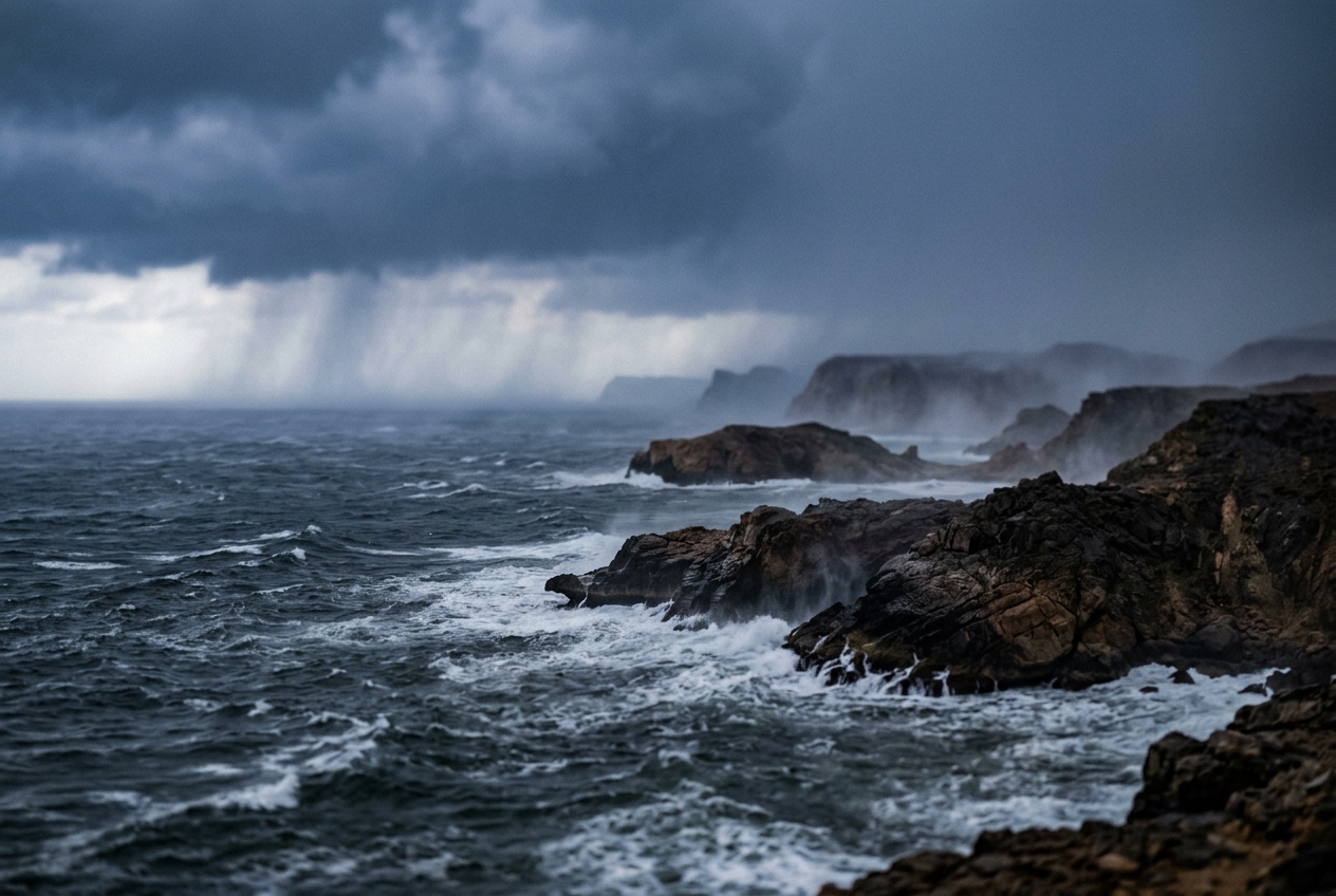
Then, on the western horizon, the haze begins to curdle. A bruised, indigo rampart of cloud builds upward from the sea, blotting out the bleached sky. Within hours, the oppressive calm is shattered by an abrupt, cool gust—the outflow boundary of an immense, approaching squall line. The scent arrives before the first drop: the sharp, metallic tang of ozone forged by intra-cloud lightning discharges, instantly followed by the rich, earthy fragrance of petrichor as dry, mineral-rich laterite soils absorb the first violent downpour.
The wind rapidly shifts and locks into a howling southwesterly gale. This is not a transient afternoon thunderstorm; it is the physical arrival of the Southwest Asian Monsoon. The air rushing over the coastline was, merely four days earlier, skimming across the cool waters of the southern Indian Ocean, thousands of kilometers to the south. Squeezed through narrow African mountain corridors and hurled across the equator, this vast planetary current has arrived on the shores of the subcontinent to unload millions of tons of water vapor per second.
2. What's Actually Happening — Plain English First
To understand why billions of tons of moisture-laden air cross thousands of miles of ocean each summer, we must first look at how water and rock respond to the sun.
Think of the Earth's surface as a kitchen stove with a heavy cast-iron skillet sitting next to a deep stockpot filled with water. When you turn on both burners with equal heat, the dry iron skillet gets scorching hot within minutes. The pot of water, however, warms so slowly that you can still rest your finger in it long after the skillet is too hot to touch.
Land has a low specific heat capacity and conducts heat only through a thin upper crust of dirt and rock. The sun's energy concentrates directly at the surface, driving soil temperatures high and heating the air directly above it. Oceans, by contrast, have a massive heat capacity; solar radiation penetrates tens of meters deep, and ocean currents constantly churn and mix that heat downward.
As summer approaches the Northern Hemisphere, the Asian landmass—dominated by the massive, elevated tableland of the Tibetan Plateau—absorbs vast quantities of solar radiation. The air above the plateau expands, becomes buoyant, and rises, acting like a giant chimney venting into the upper atmosphere. This evacuation of air leaves behind a sprawling area of low atmospheric pressure at the surface, known as a thermal low.
Meanwhile, south of the equator, the southern Indian Ocean remains relatively cool, maintaining a dense, high-pressure dome of air known as the Mascarene High.
Nature abhorring a vacuum, air from the high-pressure southern ocean begins to surge northward toward the low-pressure Asian continent. But the atmosphere is not a flat, static table; it sits on a spinning planet.
As air parcels cross the equator, they encounter a profound hydrodynamic transformation: the Earth's rotation, which curves wind to the left in the Southern Hemisphere, disappears at the equator and flips to curve wind to the right in the Northern Hemisphere. Trapped against the towering volcanic mountain chains of East Africa, this cross-equatorial wind is squeezed into a high-speed atmospheric channel—the Somali Jet (or Findlater Jet).
Once this jet crosses the equator into the Northern Hemisphere, the newly reversed rotational force slingshots it eastward, steering an ocean-wide river of saturated tropical air directly toward India and Southeast Asia.
3. The Science: Hydrodynamics and Cross-Equatorial Flow
To rigorously describe the monsoon, we must examine the planetary circulation through the lens of geophysical fluid dynamics.
The Solenoidal Engine and Thermal Wind Balance
The large-scale monsoon is driven by a non-aligned distribution of density ($\rho$) and pressure ($p$) surfaces—a state known as a baroclinic atmosphere. The circulation acceleration $\frac{dC}{dt}$ around a closed atmospheric loop is governed by Bjerknes' Circulation Theorem:
$$\frac{dC}{dt} = -\oint \frac{dp}{\rho} = -\iint_A \left( \nabla p \times \nabla \alpha \right) \cdot d\mathbf{A}$$
where $\alpha = 1/\rho$ is the specific volume and $A$ is the area bounded by the loop. When surfaces of constant pressure (isobars) and constant density (isopycnals) intersect rather than lie parallel, they form solenoids. Over the summer subcontinent, intensely warm continental air produces widely spaced isobars, while cool oceanic air produces tightly packed isobars. The resulting solenoidal vector drives a direct thermodynamic overturning cell: surface air accelerates toward the continent, rises over the thermal low, diverges aloft, and sinks over the subtropical ocean.
Absolute Vorticity Conservation Across the Equator
The most striking feature of the Southwest Monsoon is the cross-equatorial Somali Jet, documented by meteorological pioneer John Findlater and cataloged by the World Meteorological Organization.
Consider a parcel of air originating in the Southern Hemisphere trade wind belt at latitude $\phi_1 = 10^\circ\text{S}$, traveling northward toward $\phi_2 = 10^\circ\text{N}$. In the absence of strong frictional dissipation above the marine boundary layer, the parcel approximately conserves its shallow-water absolute vorticity $\eta$:
$$\eta = \zeta + f = \text{constant}$$
where $\zeta = \left( \frac{\partial v}{\partial x} - \frac{\partial u}{\partial y} \right)$ is the relative vorticity (the local spin of the air parcel) and $f = 2\Omega \sin\phi$ is the Coriolis parameter ($\Omega \approx 7.292 \times 10^{-5}\,\text{rad/s}$).
At $\phi_1 = 10^\circ\text{S} = -10^\circ$: $$f_1 = 2(7.292 \times 10^{-5})\sin(-10^\circ) \approx -2.533 \times 10^{-5}\,\text{s}^{-1}$$
Assuming the air parcel starts in a broad, uniform southeasterly trade-wind flow with negligible relative vorticity ($\zeta_1 \approx 0$), its conserved absolute vorticity is: $$\eta = f_1 = -2.533 \times 10^{-5}\,\text{s}^{-1}$$
As this parcel charges across the equator ($\phi = 0^\circ, f = 0$), down-gradient pressure forces accelerate it ageostrophically. Upon reaching $\phi_2 = 10^\circ\text{N} = +10^\circ$, the planetary vorticity becomes positive: $$f_2 = 2(7.292 \times 10^{-5})\sin(+10^\circ) \approx +2.533 \times 10^{-5}\,\text{s}^{-1}$$
Because $\eta$ is conserved: $$\zeta_2 = \eta - f_2 = -2.533 \times 10^{-5} - 2.533 \times 10^{-5} = -5.066 \times 10^{-5}\,\text{s}^{-1}$$
The parcel has acquired an enormous negative (anticyclonic) relative vorticity in the Northern Hemisphere coordinate frame. In the Northern Hemisphere, anticyclonic relative vorticity corresponds to strong clockwise curvature. The air parcel, which entered the equator as a southerly wind, is violently bent to the right, transforming into a high-speed southwesterly jet that targets the Indian coastline.
When air crosses the equator with a meridional velocity $v = 25\,\text{m/s}$ and encounters an average Coriolis parameter $\bar{f} \approx 2.5 \times 10^{-5}\,\text{s}^{-1}$ near $10^\circ\text{N}$, its inertial radius of turning $R_i$ can be calculated directly:
$$R_i = \frac{v}{\bar{f}} = \frac{25\,\text{m/s}}{2.533 \times 10^{-5}\,\text{s}^{-1}} \approx 9.87 \times 10^5\,\text{m} \approx 987\,\text{km}$$
This confirms that within roughly 1,000 kilometers of crossing the equator, the air stream must complete a 90-degree turn from a northward-directed flow into an eastward-directed, zonal monsoon blast.
Topographic Channeling and the 850 hPa Core
The intense concentration of this jet along the East African coast is not solely a rotational phenomenon; it is an orographic boundary current. The East African Highlands—stretching from Ethiopia through Kenya to Madagascar—form a continuous 2,000-meter wall that blocks the westward progression of the planetary flow.
Because the boundary layer over the tropical ocean is capped by a strong subsidence inversion near the 850 hPa level (~1.5 km altitude), the incoming flow is vertically confined from above and horizontally blocked to the west. The air mass is forced through a natural topographic nozzle over Kenya and Somalia. Velocity profiles documented by the UK Met Office Monsoon Guide and the NOAA Physical Sciences Laboratory show the jet core at 850 hPa routinely exceeding 30 m/s (approx. 60 knots), making it one of the lowest-altitude, highest-speed non-storm jet streams on Earth.
Coastal Upwelling and Ekman Pumping
As the Somali Jet parallels the coast of the Horn of Africa, it exerts tremendous cyclonic wind stress $\boldsymbol{\tau}$ on the ocean surface. The net transport of surface water in the oceanic Ekman layer is directed 90 degrees to the right of the wind in the Northern Hemisphere (offshore, toward the southeast):
$$\mathbf{M}_E = \frac{\boldsymbol{\tau} \times \hat{\mathbf{k}}}{\rho_w f}$$
This offshore movement of warm surface water forces intense coastal upwelling of deep, cold, nutrient-dense water ($T < 18^\circ\text{C}$) along the Somali and Omani coastlines. This creates a fascinating feedback loop: the cold water stabilizes the lower marine boundary layer, preventing deep convection over the western Arabian Sea, while preserving the full moisture payload within the lower 2 kilometers until the jet slams into the Western Ghats of India.
Moisture Flux Convergence and Latent Heat Feedbacks
The total column water vapor flux $\mathbf{Q}$ carried by the monsoon flow across a unit width of the coastline is given by integrating specific humidity $q$ and wind velocity vector $\mathbf{v}$ from the surface pressure $p_{\text{sfc}}$ to the top of the troposphere $p_{\text{top}}$:
$$\mathbf{Q} = \frac{1}{g} \int_{p_{\text{top}}}^{p_{\text{sfc}}} q \mathbf{v} \, dp$$
Consider a simplified layer between $1000\,\text{hPa}$ and $700\,\text{hPa}$ ($\Delta p = 300\,\text{hPa} = 30,000\,\text{Pa}$) with an average specific humidity $\bar{q} = 16\,\text{g/kg} = 0.016\,\text{kg/kg}$ and an average perpendicular wind speed $\bar{v} = 20\,\text{m/s}$.
The horizontal moisture flux per meter of width is:
$$Q \approx \frac{1}{g} \bar{q} \bar{v} \Delta p = \frac{1}{9.81\,\text{m/s}^2} \times 0.016\,\text{kg/kg} \times 20\,\text{m/s} \times 30,000\,\text{Pa}$$
$$Q \approx \frac{9.6}{9.81} \approx 978.6\,\text{kg}\cdot\text{m}^{-1}\cdot\text{s}^{-1}$$
Across a 1,000-kilometer transect of the Arabian Sea, this single low-level atmospheric river transports nearly one billion kilograms of water vapor every second.
When this moist current strikes the Western Ghats of India, it is forced upward. As the air rises, it cools dry-adiabatically until it reaches its lifting condensation level (LCL). Latent heat of condensation is released at a rate of $L_v \approx 2.5 \times 10^6\,\text{J/kg}$. This massive latent heat release warms the mid-to-upper troposphere, lowering surface pressures further and strengthening the land-sea thermal gradient. This mechanism, known as Conditional Instability of the Second Kind (CISK) or moisture-vortex coupling, acts as a self-sustaining thermodynamic accelerator for the monsoon.
4. Practical Outdoor Guidance
While the global monsoon is analyzed using supercomputer reanalyses at centers like the European Centre for Medium-Range Weather Forecasts (ECMWF), its onset can be tracked using standard instruments and careful visual observations.
What to Look for in the Sky
- The Pre-Monsoon Veil: Five to seven days before monsoon onset, look for high, thin cirrostratus clouds migrating from east to west. These ice-crystal clouds are the upper-tropospheric outflow from deep convection already occurring over Southeast Asia, carried by the Tropical Easterly Jet (TEJ) at 150 hPa.
- Fractocumulus Scud: As the low-level jet accelerates, watch the lowest cloud layer. Low, ragged cloud fragments (pannus or scud) will race rapidly from south-southwest to north-northeast at altitudes under 600 meters, even if higher clouds appear motionless.
- The Approaching Arcus / Shelf Cloud: The leading edge of monsoon onset typically arrives as an organized mesoscale convective system (MCS) with a dark shelf cloud spanning the entire horizon. Unlike mid-latitude squall lines that pass within an hour, the monsoon front is backed by a continuous, gray stratiform rain shield that persists for days.
Instrument Readings to Monitor
- Aneroid or Digital Barometer: Track mean sea level pressure (MSLP). A steady, diurnal-corrected fall of 4 to 8 hPa over 72 hours—dropping below 1004 hPa in tropical latitudes—signals that the monsoon trough is migrating overhead.
- Psychrometer / Hygrometer: Watch the dew point temperature. During the pre-monsoon dry phase, the dew point fluctuates wildly with daily sea breezes. In the 48 hours before onset, the dew point locks into a near-constant range between $26^\circ\text{C}$ and $29^\circ\text{C}$, indicating a deeply saturated maritime boundary layer.
- Wind Vane and Anemometer: Note directional veering. The transition from light, variable land-sea breezes (northeasterly at night, northwesterly by day) to a sustained, gusty southwesterly flow ($>15\,\text{m/s}$) marks the hydrodynamic arrival of the cross-equatorial stream.
Rules of Thumb for Outdoor Professionals
- The Sailor's Upwelling Rule: If navigating the western Arabian Sea or the Gulf of Aden during June or July, expect sudden drops in sea surface temperature (from $30^\circ\text{C}$ down to $19^\circ\text{C}$) within 50 nautical miles of the Somali and Omani coasts. This cold upwelling generates dense sea fog (advection fog) right beneath gale-force southwesterly winds.
- The Hiker's Wind-Shear Index: When climbing coastal ranges like the Western Ghats or the Cameroon Line during the monsoon transition, observe the motion of mid-level clouds relative to the surface wind. If low-level scud is flying from the southwest while mid-level clouds are drifting from the northeast, the atmosphere is experiencing severe directional vertical wind shear. Rapid, catastrophic flash flooding along windward canyons is imminent as orographic lifting triggers training thunderstorms.
- The Gardener's Soil Saturation Principle: Do not fertilize or cultivate dry topsoil during the first 48 hours of monsoon onset. The initial rainfall rate typically exceeds the hydraulic conductivity of baked tropical soils ($>50\,\text{mm/hr}$), leading to high surface runoff and soil stripping before deep infiltration begins.
5. Summary Reference
| Atmospheric Feature | Key Dynamics & Equations | Primary Observational Signal |
|---|---|---|
| Planetary Thermal Low | Solar heating of land vs. ocean; Solenoidal circulation: $\frac{dC}{dt} = -\oint \frac{dp}{\rho}$ | Continuous barometric pressure drop below 1004 hPa over interior landmasses. |
| Somali Jet (Findlater Jet) | Absolute vorticity conservation across equator: $\zeta_2 = \eta - f_2$; Topographic blocking | Sustained 850 hPa southwesterly gales ($>25\,\text{m/s}$); rapid scud cloud drift. |
| Coastal Upwelling | Offshore Ekman transport: $\mathbf{M}_E = \frac{\boldsymbol{\tau} \times \hat{\mathbf{k}}}{\rho_w f}$ | Sea surface temperatures plummeting to $18^\circ\text{C}$ near Horn of Africa; dense advection fog. |
| Moisture Convergence | Column water vapor transport: $\mathbf{Q} = \frac{1}{g} \int q \mathbf{v} \, dp$ | Dew point locking at $26\text{–}29^\circ\text{C}$; towering cumulonimbus with torrential rain. |
For further reading on classical monsoon definitions and dynamic meteorology, refer to the American Meteorological Society Glossary of Meteorology and the comprehensive historical overview of the Somali Jet.
6. Today's Meteorological Rule of Thumb
When the wind locks relentlessly into the southwest and the dew point refuses to drop below 26°C even through the coolest hours of the dawn, you are no longer breathing local air—you are standing inside a cross-equatorial river of oceanic vapor propelled by a planetary thermal engine.