Maximum Potential Intensity (MPI) & Hurricane Carnot Cycle: How Air-Sea Enthalpy Fluxes and Outflow Temperatures Set the Theoretical Limits of Severe Tropical Cyclones
1. The Gathering Caldera
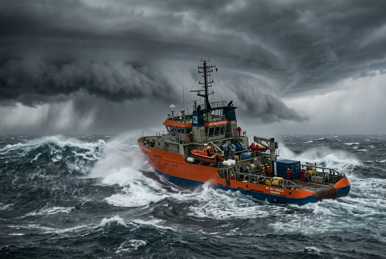
Stand on the teak foredeck of a research cutter sixty miles south of the Dry Tortugas in late August, and the atmosphere ceases to feel like empty space; it becomes an active, suffocating medium. The air does not merely circulate—it presses against the skin with the weight of an unventilated greenhouse. At thirty-one degrees Celsius, the sea is bathwater-warm, flat and viscous, undulating with long, glassy swells whose crests are spaced hundreds of yards apart. These rhythmic groundswells arrive from an invisible horizon, born from an immense disturbance still three hundred miles to the southeast.
                  [ 10-18 km Altitude: Tropopause Outflow ]
                     T_outflow ≈ -70°C to -80°C (Cold Exhaust)
                             <-------|------->
                            /        |        \
                           /         |         \
   Isothermal             /          |          \            Adiabatic
   Exhaust               /           |           \           Subsidence
                        /   EYEWALL  |  EYEWALL   \         (Environmental
                       /   (Updraft) | (Updraft)   \           Sinking)
                      /        |     |     |        \
                     /         |    [EYE]  |         \
                    /          |   (Calm)  |          \
                   /           |     |     |           \
  ~~~~~~~~~~~~~~~~~~~~~~~~~~~~~~~~~~~~~~~~~~~~~~~~~~~~~~~~~~~~~~~~~~~~~~~~~
          ---> ---> ---> [ Inflow Boundary Layer ] ---> ---> --->
             Isothermal Expansion over Warm Ocean Surface: T_sea ≈ +28°C to +31°C
The sensory cues precede the instruments. The scent of dry salt and sun-baked timber gives way to a heavy, metallic tang—a cocktail of aerosolized brine, damp ozone, and the faint, organic musk of deep-water upwelling. The barometer in the deckhouse, a precision aneroid instrument, does not merely drift down; its brass needle exhibits a steady, rhythmic quiver, sinking two millibars in four hours while the sky overhead remains deceptively clear.
Look higher, and the true geometry of the impending system reveals itself. The deep cobalt of the midday sky is gradually varnished over by a translucent veil of cirrostratus so thin that the sun appears surrounded by an iridescent, 22-degree halo. This milky canopy is the frozen exhaust of a giant atmospheric machine: billions of tons of moisture, boiled off the tropical Atlantic, vaulted ten miles into the stratosphere, and cast outward across hundreds of square leagues. Beneath this shroud, the wind begins to hum through the vessel’s rigging—a low, resonant frequency that shifts from an easterly zephyr to a steady, moisture-laden gale.
2. What Is Actually Happening: The Ocean as an Open-Cycle Boiler
To understand the monstrous power of a mature hurricane, one must look past the chaotic imagery of flying debris and crashing storm surges and view the storm through the lens of classical thermodynamics. Strip away the rainbands, and a tropical cyclone is fundamentally an open-cycle heat engine—a natural machine operating on the exact principles formulated by French physicist Nicolas Léonard Sadi Carnot in 1824.
Think of the tropical atmosphere as a colossal, multi-story heat exchanger. The warm ocean surface acts as the boiler, while the frozen upper troposphere—some twelve to sixteen kilometers above our heads—serves as the radiator.
                               THE HURRICANE CARNOT CYCLE

           State 2: Eyewall Base -----------------> State 3: Tropopause Outflow
                     |                                       |
  Isothermal Moisture |                                       | Isothermal Radiative
  & Enthalpy Flux     |                                       | Heat Exhaust to Space
  from Warm Ocean     |                                       | at Ambient Temperature
  at Temperature T_s  |                                       | T_o (-70°C)
                     V                                       V
           State 1: Distant Boundary <------------- State 4: Distant Environmental
                    Layer Inflow                      Subsidence & Radiative Cooling
In ordinary weather, warm air rises, cools, condenses its moisture, and falls back to Earth in localized showers. But when conditions align over a deep pool of tropical water, this process organizes into a closed thermodynamic loop consisting of four distinct, sequential stages:
- Stage 1: Isothermal Expansion (The Surface Inflow). Low-level air spirals inward toward the storm’s low-pressure center across hundreds of kilometers of warm water. Normally, when gas expands into lower pressure, it cools. Here, however, the ocean acts as an infinite thermal reservoir. As the air rushes inward over boiling spray, it absorbs vast quantities of sensible heat and water vapor directly from the sea. The sea surface temperature ($T_s$) keeps this expanding air at a nearly constant temperature, steadily charging it with latent thermal energy.
- Stage 2: Adiabatic Ascent (The Eyewall Updraft). Upon reaching the eyewall—the chimney of the storm—the supercharged air turns violently upward. As it ascends into the thinning upper atmosphere, it expands rapidly. Because this ascent is swift, the air parcel exchanges virtually no heat with its surrounding environment; it ascends adiabatically. As it expands, it cools dramatically, causing the enormous cargo of water vapor it gathered at sea level to condense into torrential rain, releasing latent heat that sustains the upward buoyancy of the chimney.
- Stage 3: Isothermal Exhaust (The Tropopause Outflow). At the top of the storm, near the tropopause, the air reaches an altitude of nearly fifty thousand feet where ambient temperatures plunge to $-70^\circ\text{C}$ or lower ($T_o$). Here, the exhausted air spreads outward radially, shedding its remaining thermal energy into the cold void of the upper atmosphere via infrared radiation.
- Stage 4: Adiabatic Subsidence (The Environmental Return). Far away from the storm’s core—often hundreds of miles distant—the cold, dry air gently sinks back toward the sea surface. As it descends, compression warms it back up adiabatically, completing the circuit and resetting the atmospheric engine.
The maximum intensity this engine can ever achieve is not limitless. Just as a steam turbine is strictly constrained by the temperature of its boiler and its condenser, a hurricane is constrained by the temperature difference between the tropical ocean below and the stratospheric exhaust above.
3. The Science: Deriving the Ceilings of Atmospheric Fury
The definitive thermodynamic foundation for tropical cyclone strength was formulated by atmospheric scientist Kerry Emanuel of the Massachusetts Institute of Technology. Emanuel demonstrated that a hurricane’s absolute upper speed limit—termed its Maximum Potential Intensity (MPI)—can be derived directly from the balance between the thermodynamic energy generated by the air-sea heat engine and the mechanical energy dissipated by turbulent surface friction.
The Theoretical Formulation
The theoretical ceiling for the maximum tangential surface wind speed ($V_{\max}$) in a steady-state tropical cyclone is given by:
$$V_{\max} = \sqrt{\frac{C_k}{C_D} \left(\frac{T_s - T_o}{T_o}\right) (k_s^* - k)}$$
To understand this elegant equation, we must dissect its four constituent parameters:
- $\mathbf{T_s}$ (Sea Surface Temperature): The thermodynamic temperature of the warm ocean boundary layer, measured in Kelvin ($\text{K}$).
- $\mathbf{T_o}$ (Outflow Temperature): The thermodynamic temperature of the exhaust layer at the tropical tropopause, also in Kelvin ($\text{K}$).
- $\mathbf{\frac{T_s - T_o}{T_o}}$ (Carnot Thermodynamic Efficiency Factor): The efficiency with which the engine converts ocean thermal energy into mechanical kinetic energy. Notice that the denominator is $T_o$ (modified from the classical Carnot efficiency denominator $T_s$) because the mechanical dissipation of kinetic energy occurs entirely within the boundary layer at temperature $T_s$, recycling frictional heat back into the surface inflow.
- $\mathbf{\frac{C_k}{C_D}}$ (Exchange Coefficient Ratio): The dimensionless ratio of the bulk exchange coefficient of enthalpy ($C_k$, the rate at which heat and moisture transfer from sea to air) to the aerodynamic drag coefficient ($C_D$, the rate at which surface friction drains momentum from the swirling winds).
- $\mathbf{(k_s^ - k)}$ (Air-Sea Enthalpy Disequilibrium): The thermodynamic fuel supply, measured in Joules per kilogram ($\text{J}\cdot\text{kg}^{-1}$). Here, $k_s^$ is the saturation specific enthalpy of air at the sea surface temperature and central pressure, while $k$ is the actual specific enthalpy of the ambient boundary-layer air. This term quantifies how far the near-surface air is from thermodynamic saturation with the sea beneath it.
       ==================================================================
                          CARNOT EFFICIENCY OF A HURRICANE
       ==================================================================
         Boiler Temperature (Sea Surface, T_s)       :  +29.0°C  (302.15 K)
         Condenser Temperature (Tropopause, T_o)     :  -73.0°C  (200.15 K)

         Carnot Efficiency Fraction: (T_s - T_o) / T_o = 102.0 / 200.15 ≈ 0.5096
       ==================================================================
Worked Numerical Calculation: The Baseline Ceiling
Let us evaluate the theoretical maximum wind speed for a storm traversing the Gulf of Mexico under typical high-summer thermodynamic conditions:
-
Environmental Parameters: * Sea surface temperature: $T_s = 29^\circ\text{C} = 302.15\text{ K}$ * Tropopause outflow temperature: $T_o = -73^\circ\text{C} = 200.15\text{ K}$ * Bulk exchange ratio: $C_k / C_D = 0.90$ (a typical empirical value for hurricane-force wind regimes established by field observational campaigns) * Enthalpy disequilibrium: $(k_s^* - k) = 21,500\text{ J}\cdot\text{kg}^{-1}$
-
Step 1: Calculate the Modified Carnot Efficiency: $$\varepsilon = \frac{T_s - T_o}{T_o} = \frac{302.15 - 200.15}{200.15} = \frac{102.00}{200.15} \approx 0.5096$$
-
Step 2: Compute Maximum Kinetic Energy per Unit Mass: $$V_{\max}^2 = \frac{C_k}{C_D} \cdot \varepsilon \cdot (k_s^* - k)$$ $$V_{\max}^2 = 0.90 \times 0.5096 \times 21,500\text{ J}\cdot\text{kg}^{-1} = 9,860.76\text{ m}^2\cdot\text{s}^{-2}$$
-
Step 3: Solve for Maximum Surface Wind Velocity ($V_{\max}$): $$V_{\max} = \sqrt{9,860.76} \approx 99.30\text{ m/s}$$ Converting to standard units: $$V_{\max} = 99.30 \times 3.6 \approx 357.5\text{ km/h} \quad (\approx 222.1\text{ mph}, \text{ or } 193.0\text{ knots})$$
This calculation establishes that under these thermodynamic boundary conditions, the atmosphere cannot support a sustained surface wind exceeding $357\text{ km/h}$. At this exact velocity, the rate of kinetic energy generation by the Carnot heat engine is completely consumed by frictional dissipation against the churning sea.
       ==================================================================
                 CALCULATED MAXIMUM POTENTIAL INTENSITY (MPI)
       ==================================================================
         Theoretical Wind Ceiling (V_max) : 99.3 m/s | 357.5 km/h | 193.0 kt
         Saffir-Simpson Category Equivalent: Category 5 Super-Typhoon
       ==================================================================
The Sensitivity to Warming: A 1°C Ocean Shift
What happens when sea surface temperatures rise by just one degree Celsius while the upper atmosphere remains constant?
Let $T_s$ increase to $30^\circ\text{C}$ ($303.15\text{ K}$). According to the Clausius-Clapeyron relation, the saturation vapor pressure of water rises nonlinearly—by approximately seven percent per degree Celsius of warming. Consequently, the enthalpy disequilibrium term $(k_s^* - k)$ expands disproportionately, rising from $21,500\text{ J}\cdot\text{kg}^{-1}$ to approximately $23,800\text{ J}\cdot\text{kg}^{-1}$.
-
Recalculate Efficiency: $$\varepsilon_{\text{new}} = \frac{303.15 - 200.15}{200.15} = \frac{103.00}{200.15} \approx 0.5146$$
-
Recalculate Maximum Wind Velocity: $$V_{\max, \text{new}}^2 = 0.90 \times 0.5146 \times 23,800 \approx 11,022.73\text{ m}^2\cdot\text{s}^{-2}$$ $$V_{\max, \text{new}} = \sqrt{11,022.73} \approx 104.99\text{ m/s} \approx 378.0\text{ km/h} \quad (204.1\text{ knots})$$
A single degree of ocean warming increases the theoretical speed ceiling by more than twenty kilometers per hour. Because the destructive mechanical power (dynamic pressure) of wind scales with the square of its velocity ($P_{\text{dyn}} = \frac{1}{2}\rho V^2$), this modest $5.7\%$ increase in peak wind velocity results in an $11.8\%$ increase in the destructive kinetic force exerted against coastal infrastructure.
Theoretical MPI Versus Observed Reality
In the operational forecasts published by the NOAA National Hurricane Center and the Met Office, only about twenty percent of tropical cyclones ever attain their theoretical Maximum Potential Intensity. The gap between theoretical ceiling and observed reality is governed by four primary environmental spoilers:
                            ENVIRONMENTAL SPOILERS OF MPI

     [ Vertical Wind Shear ]       [ Dry Air Entrainment ]       [ Ocean Cold Wake ]
     Tilted vortex structure;      Mid-level dry air cuts        Ekman pumping dredges up
     exhaust vent decoupled        off latent heat supply        cold thermocline water;
     from heat core.               in core eyewall.              reduces T_s by 2-5°C.
- Vertical Wind Shear: The Emanuel Carnot cycle assumes an upright, axisymmetrical vortex where the heat released in the eyewall remains concentrated directly above the surface low. Strong upper-level winds tilt this atmospheric vortex. When tilted, the latent heat exhaust is blown downwind, breaking the thermodynamic chimney and allowing cooler, drier air to ventilate the core.
- Dry Air Entrainment: If a storm ingests a layer of dry, continental air—or the desert air of the Saharan Air Layer—evaporative cooling occurs within the rainbands. This creates dense downdrafts of low equivalent potential temperature ($\theta_e$) air that flush into the boundary layer, neutralizing the $(k_s^* - k)$ fuel supply.
- Ocean Upwelling and Cold Wakes: The violent surface winds of a hurricane exert massive cyclonic stress on the sea surface, inducing divergence in the ocean mixed layer through Ekman transport. This dredges up cold, deep water from below the thermocline. If a storm moves slowly (less than $15\text{ km/h}$), it churns up its own "cold wake," dropping $T_s$ beneath the eyewall by two to five degrees Celsius and effectively turning off its own boiler.
- Eyewall Replacement Cycles (ERCs): In hyper-intense systems approaching their Maximum Potential Intensity, outer rainbands coalesce into a concentric ring of thunderstorms outside the primary eyewall. This secondary ring intercepts the inward flux of moisture and angular momentum, causing the inner eyewall to starve, collapse, and temporarily downgrade the storm's peak surface winds until the outer ring consolidates.
4. Practical Outdoor Guidance: Reading the Engine in the Field
For the mariner, coastal resident, or field observer, understanding the thermodynamic limits of a cyclone transforms raw observation into predictive intelligence. Long before radar networks lock onto a storm, physical instruments and environmental indicators reveal the strength and efficiency of the approaching heat engine.
       ==================================================================
                 DIAGNOSTIC CRITERIA FOR CYCLONE INTENSIFICATION
       ==================================================================
         OBSERVATION CHANNEL     HEALTHY ENGINE         DEGRADED ENGINE
         --------------------    --------------------   --------------------
         Barometer 3-hr Trend    Steep drop (>3 hPa)    Oscillating / Flat
         Satellite IR Cloud Top  Colder than -75°C      Warming (> -55°C)
         Buoy SST Profile        > 28.5°C deep pool     < 26.0°C (Cold wake)
         Swell Period            T > 14 seconds         T < 8 seconds
       ==================================================================
1. What to Look for in the Sky and Marine Horizons
- The Cirrus Outflow Shield: Track the movement of the high-altitude cirrus veil. If high clouds radiate symmetrically in all directions from the central core, the upper-level outflow exhaust ($T_o$) is unimpeded. If the cirrus canopy is sheared off abruptly on one flank, strong upper-level winds are tilting the chimney, signaling that the storm cannot reach its Carnot potential.
- Long-Period Swell Trains: Ocean waves travel faster than the atmospheric storm that generates them. Swells with wave periods ($T$) exceeding fourteen to eighteen seconds indicate winds of extreme velocity acting across a vast oceanic fetch. Use a stopwatch on a coastline: time the interval between consecutive crests breaking on an outer reef. An increasing period accompanied by an invariant wind direction confirms an intensifying system over the horizon.
2. Interpreting Instruments in Real-Time
- The Barometric Tendency (Aneroid Barometer): Standard diurnal atmospheric tides cause pressure to rise and fall by roughly $1.5\text{ to }2.5\text{ hPa}$ every twelve hours (peaking around 10:00 and 22:00 local solar time). A steady decline that overrides this diurnal rhythm—specifically a drop exceeding $3.0\text{ hPa}$ within a three-hour window—is the classic maritime benchmark signaling that you are entering the circulation field of an organized tropical cyclone.
- Wind Direction and Backing/Veering Rules (Buys Ballot's Law): Stand with your back to the wind in the Northern Hemisphere; the storm's lowest pressure center lies directly to your left and slightly forward ($10^\circ\text{ to }30^\circ$ toward the center due to frictional cross-isobar flow). If the wind direction backs (shifts counter-clockwise, e.g., from Northeast to North to Northwest), you are in the weaker, left-hand semi-circle of the storm. If the wind veers (shifts clockwise, e.g., from Northeast to East to Southeast), the dangerous right-hand semi-circle and core eyewall are tracking toward your coordinates.
                 BUYS BALLOT'S LAW OF CYCLONIC WIND GEOMETRY

                           WIND BLOWING AT YOUR BACK
                                      |
                                      |
                                      V
           [ LOW PRESSURE ] <--- [ YOUR POSITION ]
           (Core Center is 10°-30°
            forward of your left)
3. Utilizing Modern Meteorological Data
- Satellite Infrared (IR) Brightness Temperatures: Modern geostationary satellites measure the infrared emission temperature of cloud tops. When satellite feeds show the central dense overcast (CDO) cooling below $-80^\circ\text{C}$ (193 K), the eyewall updrafts are penetrating through the tropical tropopause into the lower stratosphere. This confirms an exceptionally low $T_o$, maximizing the Carnot efficiency factor $\varepsilon$.
- Moored Ocean Buoy Data: Monitor real-time marine buoys operated by the NOAA National Data Buoy Center. Look specifically at the continuous water temperature at a depth of one meter. If the water remains above $28.5^\circ\text{C}$ despite high seas, the ocean heat content (OHC) is deep enough to resist wind-induced upwelling, providing an uninterrupted enthalpy flux $(k_s^* - k)$ to fuel rapid intensification.
- Dropsonde Thermodynamic Profiles: Meteorologists aboard hurricane reconnaissance aircraft deploy GPS dropwindsondes through the storm's eyewall. These instrument packages measure pressure, temperature, humidity, and GPS-derived winds twice every second during descent. A profile showing constant moist static energy ($h = c_p T + g z + L_v q$) throughout the lowest two kilometers confirms an intact, unventilated boundary layer operating at peak thermodynamic output.
5. Today's Meteorological Rule of Thumb
The Hurricane Carnot Principle: A hurricane's maximum fury is dictated by the thermal chasm between sea and sky: for every single degree Celsius the ocean warms, or the tropopause cools, the storm's theoretical speed ceiling expands by roughly twenty kilometers per hour.
Next time you look out across a sunlit, glass-calm tropical sea, remember that you are not merely looking at water; you are looking at a vast, charged thermodynamic battery waiting for an atmospheric spark to ignite its circuit.