Gap Winds & Bernoulli Channelling Dynamics: How Synoptic Pressure Gradients and Topographic Constrictions Unleash High-Velocity Pass Gales
I. The Outdoor Observer’s Encounter
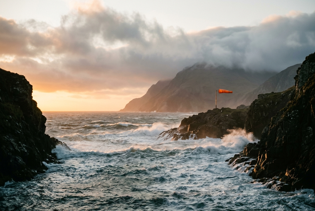
To the sea kayaker navigating the glassy waters of the eastern Strait of Juan de Fuca on a tranquil summer afternoon, the atmosphere appears to be a model of thermodynamic rest. The ocean reflects a pale, unblemished sky; cedar-scented air drifts languidly off the Olympic Peninsula; and the vessel’s paddle strikes water undisturbed by anything stronger than a two-knot tidal eddy. Yet, upon rounding the basalt bluffs of Cape Flattery or drifting past the narrowing throat of Race Rocks, the world violently reorganizes itself. Within three boat-lengths, the air drops four degrees Celsius. The placid surface is shredded into a chaotic field of white-crested standing waves, and a screaming, localized westerly gale of thirty-five knots barrels out from the gap, ripping the paddle blades from careless grips and hurling brine into the eyes of the mariner.
A parallel shock awaits the alpine trekker descending through the Columbia River Gorge or traversing the Chivela Pass in southern Mexico. In the lee of sheltering ridgelines, one walks in still warmth. But step across an invisible threshold into the axial channel of the gorge, and the wind strikes with hydraulic ferocity—a relentless, horizontal torrent roaring under a cloudless sky, cold and dense as river water. There is no accompanying frontal squall, no thunderhead, no traditional synoptic harbinger of foul weather. The barometer in your pocket indicates a steep, steady spatial gradient across the terrain, and your inner ear perceives a subtle, thrumming pressure shift.
You have crossed into a classic gap wind: an atmospheric jet born when macroscale pressure systems meet impermeable topographic barriers, forcing air to shed its rotational equilibrium and cascade violently downhill through narrow geographic notches.
II. What Is Actually Happening: Decoupling from Geostrophic Balance
To understand why gap winds behave with such unbridled violence, one must first recognize the fundamental compromise that governs ordinary winds in the free atmosphere. In typical synoptic weather patterns across the mid-latitudes, air does not flow directly from high pressure to low pressure. Instead, the moment a parcel of air begins moving down a pressure gradient, the rotation of the Earth exerts an apparent sideways acceleration known as the Coriolis force.
Over smooth plains or the open ocean, this deflection continues until the pressure gradient force pushing the air is exactly counterbalanced by the Coriolis force pulling it to the right (in the Northern Hemisphere). The wind settles into what dynamic meteorologists call geostrophic balance, blowing parallel to lines of constant pressure (isobars) rather than across them. In effect, the Earth’s rotation acts as a celestial brake, preventing air from rapidly equalizing atmospheric pressure deficits.
Topography radically upends this delicate truce. Imagine the atmosphere as a layered fluid dammed behind a massive, continuous mountain chain such as the Cascade Range, the European Alps, or the Sierra Madre. When a continental high-pressure system parks on one side of the barrier and an oceanic low-pressure trough forms on the other, a profound cross-barrier pressure differential ($\Delta P$) is established across a distance of merely tens of kilometres.
If the mountain wall is solid, the trapped air can do little more than bank against the windward slopes, building an elevated, cold, dense pool. But if there is a breach—a sea-level river canyon, a tectonic fault line, or a maritime strait—the physics changes instantly:
- Lateral Containment Neutralizes Coriolis Deflection: As air enters the gorge and attempts to veer sideways under the influence of the Coriolis force, it collides with the immovable granite walls of the canyon. The canyon wall pushes back, generating a normal physical reaction force (a lateral boundary pressure gradient) that cancels the Coriolis acceleration.
- Pure Ageostrophic Acceleration: With the planetary rotational constraint neutralized by the terrain, the air parcel responds solely to the along-gap pressure gradient force: $$-\frac{1}{\rho}\frac{\partial p}{\partial x}$$ The fluid uncouples from geostrophic balance and accelerates directly from high pressure toward low pressure down the axial fall-line of the gorge.
- The Fluid Funnel: Released from rotational braking, the air accelerates continuously along the entire length of the topographic constriction, converting accumulated potential energy into blistering kinetic velocity until it discharges into the low-pressure basin as a high-speed atmospheric jet.
According to the official American Meteorological Society definition of gap winds, these flows are characterized by low-level ageostrophic winds flowing nearly parallel to the gap axis, driven primarily by the imposed synoptic-scale pressure gradient across the mountain barrier.
III. The Fluid Mechanics of Topographic Acceleration
To quantify the magnitude of this acceleration, atmospheric scientists rely on three foundational pillars of classical fluid dynamics: streamline energy conservation (the Bernoulli theorem), mass continuity (the Venturi effect), and shallow-water hydraulic theory (Froude number transitions).
1. The Along-Streamline Bernoulli Equation
Along an idealized, steady, frictionless, and incompressible atmospheric streamline traversing a sea-level gap (where geopotential height variations $g z$ along the channel floor are negligible), the total mechanical energy remains invariant. The sum of the static pressure energy and kinetic energy per unit volume at the entrance (state 1) must equal that at the exit (state 2), less frictional boundary dissipation ($\Delta P_{\text{loss}}$):
$$P_1 + \frac{1}{2}\rho v_1^2 = P_2 + \frac{1}{2}\rho v_2^2 + \Delta P_{\text{loss}}$$
Where: - $P_1, P_2$ = Static atmospheric pressure at the gap entrance and exit ($\text{N/m}^2$ or $\text{Pa}$) - $\rho$ = Mean air density ($\approx 1.225 \text{ kg/m}^3$ at standard sea level) - $v_1, v_2$ = Flow velocity at the gap entrance and exit ($\text{m/s}$) - $\Delta P_{\text{loss}}$ = Head loss due to skin drag and turbulent wall shear stress
Assuming the reservoir of air upstream of the barrier is broad and relatively stagnant ($v_1 \approx 0$), and considering an idealized frictionless channel ($\Delta P_{\text{loss}} \to 0$), we isolate the terminal exit velocity ($v_{\text{exit}} = v_2$):
$$P_1 - P_2 = \Delta P = \frac{1}{2}\rho v_{\text{exit}}^2$$
$$v_{\text{exit}} \approx \sqrt{\frac{2\,\Delta P}{\rho}}$$
- Across-barrier pressure difference: $\Delta P = 102,800 - 102,000 = 800\text{ Pa}$ ($8\text{ hPa}$ or $\text{mbar}$)
- Cold air density: $\rho \approx 1.25\text{ kg/m}^3$
Calculating theoretical exit velocity: $$v_{\text{exit}} = \sqrt{\frac{2 \times 800\text{ Pa}}{1.25\text{ kg/m}^3}} = \sqrt{\frac{1600}{1.25}} = \sqrt{1280} \approx 35.78\text{ m/s}$$
Converting to nautical and imperial units: - $35.78\text{ m/s} \times 1.94384 \approx 69.5\text{ knots}$ - $35.78\text{ m/s} \times 3.6 \approx 128.8\text{ km/h}$ ($80.0\text{ mph}$)
In nature, surface turbulent shear and internal friction reduce this theoretical ceiling by roughly $30\%$ to $40\%$. Even with turbulent dissipation, the resulting surface wind settles at a ferocious $42\text{ to }48\text{ knots}$—a sustained Storm Force 9 to 10 on the Beaufort scale, erupting out of an otherwise unremarkable synoptic afternoon.
2. Mass Continuity and the Venturi Constriction
When the topographic channel narrows geometrically in horizontal width or is capped vertically by a rigid subsidence temperature inversion, the conservation of mass dictates that the mass flux across any perpendicular cross-sectional area $A$ must remain constant:
$$\dot{m} = \rho_1 A_1 v_1 = \rho_2 A_2 v_2$$
For incompressible airflow ($\rho_1 \approx \rho_2$), this reduces to the classical kinematic continuity relation:
$$A_1 v_1 = A_2 v_2 \implies v_2 = v_1 \left(\frac{A_1}{A_2}\right)$$
As the gap constricts to a narrow gorge throat ($A_2 \ll A_1$), the flow must accelerate proportionally simply to satisfy continuity. This kinematic constriction works in tandem with the dynamic pressure-gradient acceleration, turning mountain notches into atmospheric nozzles.
3. Hydraulic Transitions and the Froude Number
Gap winds cannot be fully understood as simple pipe flows; they are stratified, shallow-layer fluid phenomena bounded aloft by a stable temperature inversion that behaves dynamically like the free surface of a river. The flow is governed by shallow-water hydraulic theory and characterized by the non-dimensional Hydraulic Froude Number ($Fr$):
$$Fr = \frac{U}{\sqrt{g' H}}$$
Where: - $U$ = Layer-averaged wind velocity ($\text{m/s}$) - $H$ = Depth of the cold, dense air layer within the gap ($\text{m}$) - $g' = g \left(\frac{\Delta \theta}{\theta_0}\right)$ = Reduced gravity ($\text{m/s}^2$), accounting for the buoyancy difference across the inversion - $\Delta \theta$ = Potential temperature jump across the inversion capping the gap flow - $\theta_0$ = Mean reference potential temperature of the lower layer
The Froude number determines the state of the fluid: - Subcritical Flow ($Fr < 1$): Flow is deep, slow-moving, and controlled by downstream conditions. Gravity waves can propagate upstream against the flow. - Critical Flow ($Fr = 1$): Occurs at the geometric throat or topographic crest of the gap, where flow velocity matches the phase speed of internal shallow-water gravity waves. - Supercritical Flow ($Fr > 1$): Flow is shallow, hyper-accelerated, and shooting. Information cannot propagate upstream. As this shooting flow emerges from the exit of the gap, it frequently terminates in a turbulent hydraulic jump—a wall of standing waves, violent vortices, and sudden vertical mixing where the air abruptly decelerates and thickens.
IV. Synoptic Archetypes: The Earth’s Great Wind Turbines
Topographic gap flows are not anomalies; they are permanent geographic features of global weather dynamics. Several planetary locations showcase this mechanism with textbook purity.
1. The Columbia River Gorge (Pacific Northwest, USA)
Cutting an 80-mile, near-sea-level path directly through the volcanic barrier of the Cascade Range, the Columbia River Gorge is arguably the world's most famous natural wind tunnel. In winter, an intense cold anticyclone settles over the elevated Columbia Plateau of eastern Washington and Oregon, while mid-latitude depressions transit the Pacific coast. The resulting $10\text{ to }16\text{ hPa}$ cross-barrier pressure deficit unleashes screaming easterly gap flows, freezing river navigation and generating severe glaze ice storms at the western portal near Portland.
Conversely, in summer, the thermal trough shifts inland into the baking desert basin, reversing the gradient and drawing cool marine air eastward at gale force—a phenomenon exploited by windsurfers at Hood River.
2. The Strait of Juan de Fuca (Washington, USA / British Columbia, Canada)
Separating the rugged mountains of Vancouver Island from the Olympic Peninsula, this 150-kilometre-long, 20-kilometre-wide maritime strait acts as the primary atmospheric conduit between the Pacific Ocean and the inland Salish Sea.
As documented by the Met Office and North American research networks, summer afternoon marine pushes occur when a swelling Pacific subtropical high drives cold, marine-layer air eastward through the strait. The flow undergoes a critical hydraulic transition near Race Rocks, exiting into the Salish Sea as a concentrated, fan-shaped supercritical jet that regularly overwhelms recreational mariners.
3. The Tehuantepecer Jets (Chivela Pass, Mexico)
Perhaps the most powerful gap wind on Earth is the Tehuano or Tehuantepecer. The Sierra Madre mountain chain forms a continuous, towering wall across Central America, broken only by the narrow, low-elevation (250-metre) Chivela Pass across the Isthmus of Tehuantepec.
When cold, Canadian continental anticyclones plunge southward over the Gulf of Mexico (a Norte), an enormous cross-isthmus pressure gradient is established between the Gulf of Mexico and the Pacific Ocean. Air cascades through the Chivela Pass, accelerating to hurricane-force velocities ($60\text{ to }90\text{ knots}$) and blowing out over the Pacific Ocean.
According to satellite scatterometer data from the NOAA Ocean Prediction Center, these offshore jets push surface waters away from the coast so violently that they trigger intense oceanic upwelling, dropping sea surface temperatures by as much as $10^\circ\text{C}$ in a matter of hours and churning up cold-core oceanic eddies that persist for hundreds of miles into the open Pacific.
4. The Rhône Valley and the Mistral (Southern France)
The Mistral represents the European archetype of gap channelling. When an Atlantic high-pressure ridge builds over the Bay of Biscay while a dynamic lee cyclone forms over the Gulf of Genoa in the Mediterranean, polar maritime air is drawn into the wedge between the French Massif Central and the Western Alps.
The wide plains of Burgundy funnel the air south into the narrow trench of the Rhône Valley. As the valley contracts south of Lyon, mass continuity and along-gap pressure gradients accelerate the flow to sustained speeds exceeding $100\text{ km/h}$. The jet discharges into the Gulf of Lion as a dry, biting, clear-sky gale that dominates the oceanography and microclimate of the northwestern Mediterranean basin, an atmospheric phenomenon tracked closely by the World Meteorological Organization.
V. Field Observer's Toolkit & Microclimate Forecasting
For the mountaineer, pilot, coastal sailor, or outdoor field researcher, relying on generalized regional forecasts in complex terrain is an invitation to disaster. Gap winds are intensely localized microclimatic phenomena that standard coarse-resolution weather models frequently underestimate.
By understanding the underlying mechanics, an observer can anticipate gap flow events using simple instruments and visual environmental indicators.
1. The Paired Barometer Rule of Thumb
The most reliable predictor of impending gap winds is the paired barometric pressure difference ($\Delta P$) measured between mesonet stations situated at the entrance and exit of the gap.
Using the simplified empirical friction-adjusted formula:
$$v_{\text{estimated}} \approx C \times \sqrt{\Delta P_{\text{hPa}}}$$
Where $C \approx 15 \text{ to } 18$ for narrow coastal straits and mountain gorges (yielding speed in knots): - A pressure differential of $\Delta P = 3\text{ hPa}$ indicates localized winds of $25\text{ to }30\text{ knots}$. - A pressure differential of $\Delta P = 6\text{ hPa}$ warns of sustained gales exceeding $40\text{ to }45\text{ knots}$. - A differential $\Delta P \ge 9\text{ hPa}$ indicates violent, damaging storm-force flows of $55\text{ knots}$ or greater with hurricane-force gusts.
2. Visual and Environmental Cues
Even without internet access to automated weather networks, the atmosphere displays unmistakable visual warnings when gap dynamics are active: - The Crest Cloud ("Cloud Head"): A dense, low-hanging stratocumulus cap forms over the entrance or flanking ridges of the pass, appearing to spill downward like an ethereal waterfall before vanishing mid-slope. This dissipation marks the dry adiabatic warming of air plunging down-gradient into the constriction. - The Clear Axial Trench: While surrounding highlands may be shrouded in cloud, the core of the gap often exhibits a pristine, cloud-free slot caused by the strong subsidence and divergence of the accelerating horizontal jet. - The "Wind Line" on Water: Sailors approaching a gap exit will notice a razor-sharp, distinct line drawn across the water’s surface. Upstream of the line lies glass-calm water; downstream, the sea is an erupting sheet of frothing spindrift and short, steep, high-frequency chop generated by the sudden blast of ageostrophic momentum. - Microbarographic Jumps: If carrying a digital altimeter or barometric smartwatch, monitor the trend carefully. Moving into the gap, you will observe a rapid drop in ambient pressure accompanied by a distinct plunge in relative humidity and an abrupt, gusty wind shift oriented strictly parallel to the local canyon contours.
VI. Summary of Didactic Principles
To synthesize the fluid dynamics of gap flows for field analysis, recall the governing mechanical sequence:
$$\text{Synoptic Barrier Blockage} \implies \text{Coriolis Cancellation by Wall Reaction} \implies \text{Direct Ageostrophic Down-Gradient Fall } \left(-\frac{1}{\rho}\frac{\partial p}{\partial x}\right) \implies \text{Bernoulli/Venturi Amplification}$$
When navigating mountainous coastlines or hiking deep interior gorges, remember that the atmosphere is not a uniform ocean of air, but a dynamic, compressible fluid coursing over complex terrain. Where mountains build a dam, gaps forge a nozzle.
Today’s Meteorological Rule of Thumb
Whenever a mountain barrier separates two distinct pressure systems, do not look to the sky for your weather—look to the barometer across the range. A cross-barrier gradient of just $5\text{ hPa}$ is enough to turn an otherwise serene valley pass into a screaming, ageostrophic gale.