Froude Number & Atmospheric Hydraulic Jumps: How Supercritical Flow Transitions and Wave Breaking Unleash Extreme Downslope Windstorms
1. The Anatomy of a Gale: Standing at the Mountain’s Foot
To stand at the base of the Colorado Front Range, beneath the jagged spine of the Dinaric Alps, or in the lee of the Bernese Oberland during a midwinter downslope wind event is to witness fluid mechanics operating at a terrifying, visceral scale.
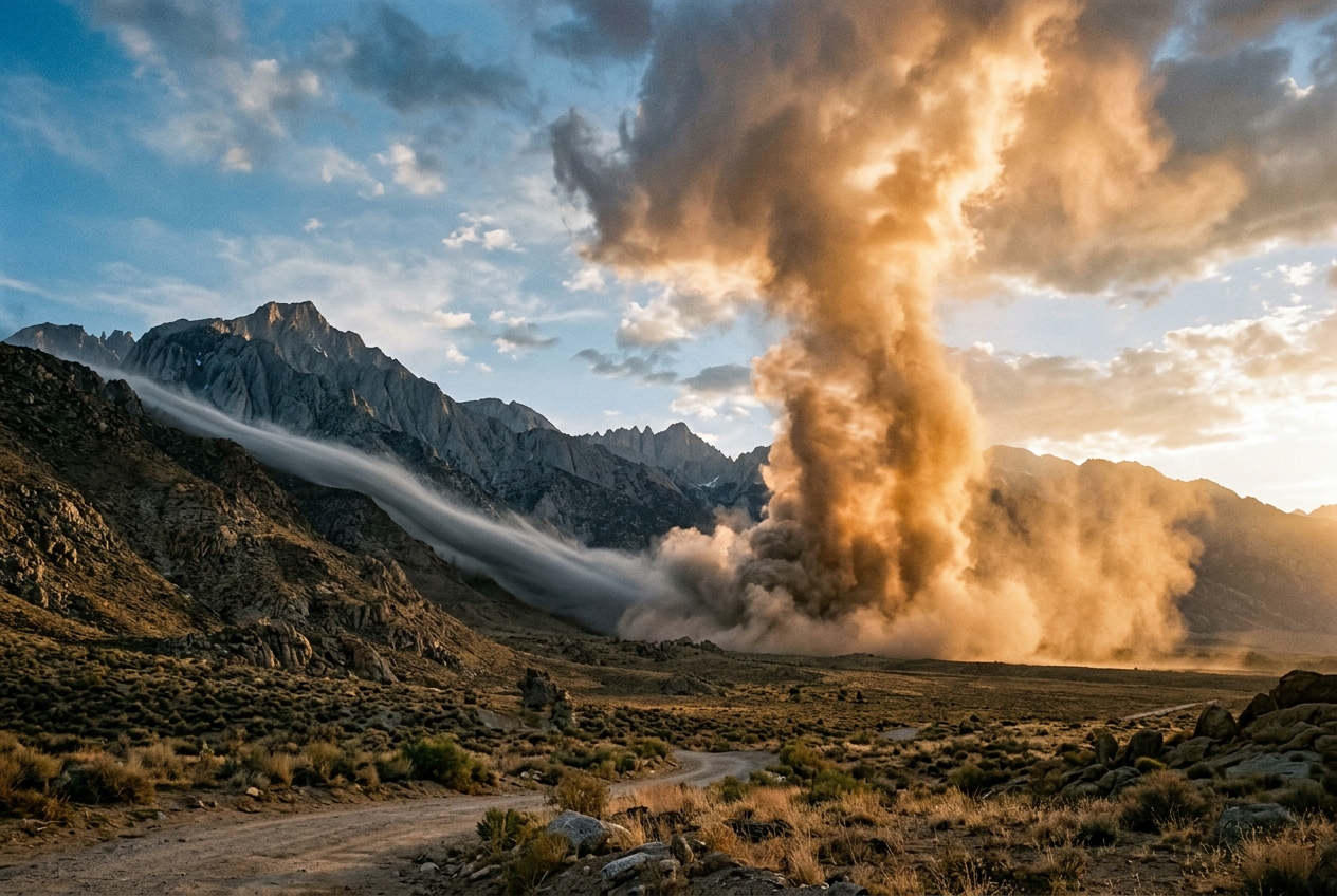
Imagine standing on a gravel road just outside a foothills town on an otherwise crisp morning. Up on the crest, five miles west, the peaks are smothered beneath a dense, blinding white crest cloud—a turbulent cap that spills over the granite summits like milk poured over a rim, only to vanish into dry air halfway down the slope. Down where you stand, the atmosphere is screaming. A ferocious westerly gale, howling at upwards of ninety miles per hour, tears shingles from roofs, snaps mature ponderosa pines like matchsticks, and fills the air with a blinding spray of gravel and pulverised dry grass. The air is startlingly warm and parched, carrying the sharp, static scent of dry pine resin and desiccated earth. Your eardrums throb with low-frequency infrasound—a rhythmic, subterranean thrum generated by hundreds of thousands of tonnes of air being forced through a topographic nozzle.
Then, you take a hundred steps to the east.
Abruptly, without warning or gradual deceleration, the wind dies. You cross an invisible, shimmering threshold no wider than a suburban street. Behind you, the trees are bent double, their branches thrashing violently; ahead of you, the air is dead calm. A solitary autumn leaf drifts serenely to the asphalt. You feel an instantaneous drop in temperature of ten degrees Celsius as your boots carry you into a stagnant, cold pool of valley air.
Looking directly overhead at this demarcation boundary, you see the architect of this madness: a colossal, churning cylinder of cloud rolling furiously along a horizontal axis. It does not drift across the sky; it hangs stationary in space, tumbling violently upon itself like an inverted waterfall of vapor. You are standing directly beneath a planetary shockwave—an atmospheric hydraulic jump and its attendant surface rotor.
2. What Is Actually Happening: The Waterfall in the Sky
To understand how a silent mass of mountain air can transform into a localized hurricane, one must discard the notion that air is merely an empty void. To a physicist, the troposphere is a vast, continuous ocean of fluid governed by density, momentum, and gravity.
The Kitchen Sink Analogy
You have almost certainly created a hydraulic jump yourself without realizing it. Turn on your kitchen tap so that a smooth, solid stream of water hits the flat bottom of the stainless-steel sink. Where the column strikes the basin, it splatters outward in a paper-thin, glassy sheet of water rushing rapidly across the metal surface.
   Water Stream
        |
        v
  ==============  <-- Thin, fast "shooting" sheet (Supercritical: Fr > 1)
  --------------
        \________/  <-- Foaming, turbulent ridge: HYDRAULIC JUMP
         ~~~~~~~~~  <-- Deep, slow pool (Subcritical: Fr < 1)
Look closely at what happens a few inches away from the impact point. The thin, fast-moving sheet cannot expand outward forever. Suddenly, it hits an abrupt, circular ring where the water violently thickens, boils into a turbulent ridge of foam, and transitions into a deep, slow-moving pool that drains quietly away.
That sudden, foaming circular step is a classical hydraulic jump. Within the thin inner circle, the water was traveling faster than the speed of surface ripples (the natural wave speed of the fluid). Because surface waves could not propagate upstream to warn the incoming water of the obstruction ahead, the fast water collided with the slow pool like a speeding train slamming into a stationary carriage. The only way the fluid could reconcile this mismatch was to violently shed its kinetic energy, decelerate, and expand upward into a thicker, turbulent layer.
The Atmosphere as a Stratified Liquid
How does this apply to the sky? Think of the atmosphere as a layered cake. In an undisturbed, stable atmosphere, cold, dense air sits at the bottom, and warmer, lighter air rests above it. This vertical variation in density is known as static stability.
When an approaching wind field encounters an imposing mountain range, it cannot simply ignore the rock. If the air is stably stratified, pushing a parcel of heavy lower air up the windward slope requires mechanical work against gravity. As that dense parcel crosses the summit, it finds itself lifted high above its equilibrium level. Gravity immediately pulls it downward, and it plunges down the leeward slope.
Under specific conditions, this descending air accelerates dramatically down the lee face, thinning out into a shallow, high-velocity atmospheric torrent—the atmospheric analogue to the glassy sheet of water in your sink. It roars down the mountain flank as a supercritical current, generating destructive chinook, foehn, or bora winds. But upon reaching the valley floor, this roaring torrent encounters a dense, stagnant reservoir of cold valley air. Unable to push this heavy air mass out of the way smoothly, the shooting current slams into it, detonates upward in an atmospheric hydraulic jump, and creates a stationary, violently turbulent vortex known as a rotor.
3. The Science: Deconstructing the Froude Number and Mountain Waves
To predict whether an approaching air mass will gently glide over a ridge, dam up on the windward side, or detonate into a hurricane-force downslope windstorm, atmospheric scientists rely on dimensionless numbers. The cornerstone of orographic flow dynamics is the Froude number ($Fr$), named after the nineteenth-century British naval architect William Froude.
The Dimensionless Metric: Shallow-Water and Internal Froude Numbers
In classical hydraulics, the Froude number represents the ratio of inertial forces (the speed of the flow) to gravitational forces (the speed at which gravity waves or ripples can travel through the fluid).
For a discrete layer of air of thickness $H$ flowing beneath a sharp temperature inversion (such as a warm layer capping a cold surface layer), we define the shallow-water Froude number:
$$Fr = \frac{U}{\sqrt{g' H}}$$
Where: * $U$ is the mean horizontal wind velocity perpendicular to the mountain range ($\text{m s}^{-1}$). * $H$ is the depth of the dense flowing layer ($\text{m}$). * $g'$ is the reduced gravity ($\text{m s}^{-2}$), defined as:
$$g' = g \left( \frac{\theta_2 - \theta_1}{\bar{\theta}} \right) = g \left( \frac{\Delta \theta}{\bar{\theta}} \right)$$
Here, $g \approx 9.81\text{ m s}^{-2}$, $\theta_1$ is the potential temperature of the dense lower layer, $\theta_2$ is the potential temperature of the overlying warm layer, and $\bar{\theta}$ is the mean reference potential temperature. The term $\sqrt{g' H}$ represents the phase speed $c$ of an internal shallow-water gravity wave.
+-------------------------------------------------------------------------+
|                        THE THREE FROUDE REGIMES                         |
+-------------------------------------------------------------------------+
| Fr < 1 : Subcritical Flow   | Waves travel faster than wind. Flow is    |
|                             | tranquil; upstream blocking occurs.       |
+-------------------------------------------------------------------------+
| Fr = 1 : Critical Flow      | Flow velocity matches wave speed.         |
|                             | Critical transition over the crest.       |
+-------------------------------------------------------------------------+
| Fr > 1 : Supercritical Flow | Wind outruns wave speed. Flow is shallow, |
|                             | shooting, accelerating downslope.         |
+-------------------------------------------------------------------------+
When considering an atmosphere with continuous, smooth stratification rather than a single sharp inversion, meteorologists use the internal Froude number ($Fr_i$) or its reciprocal, the non-dimensional mountain height ($\hat{h}$), formulated using the Brunt–Väisälä frequency ($N$):
$$N = \sqrt{\frac{g}{\theta} \frac{\partial \theta}{\partial z}}$$
$$Fr_i = \frac{U}{N h_m} \quad \Longleftrightarrow \quad \hat{h} = \frac{N h_m}{U}$$
Where $h_m$ is the physical height of the mountain barrier ($\text{m}$), and $N$ represents the buoyancy frequency (the frequency at which a displaced parcel oscillates in a stable atmosphere, typically $\sim 0.01\text{ to }0.02\text{ s}^{-1}$ in stable tropospheric air).
Step-by-Step Mathematical Walkthrough: The Genesis of a Windstorm
Let us follow an air mass as it encounters a major mountain ridge, evaluating the equations step by step using realistic atmospheric values.
Step 1: Upstream Conditions and Blocking Potential
Consider a mountain range of height $h_m = 1,500\text{ m}$ (roughly 5,000 feet above the surrounding terrain). An approaching winter air mass has an upstream cross-barrier wind speed $U = 15\text{ m s}^{-1}$ ($\sim 54\text{ km/h}$) and a robust static stability $N = 0.015\text{ s}^{-1}$.
We calculate the non-dimensional mountain height $\hat{h}$:
$$\hat{h} = \frac{N h_m}{U} = \frac{0.015\text{ s}^{-1} \times 1500\text{ m}}{15\text{ m s}^{-1}} = \frac{22.5}{15} = 1.5$$
The corresponding ambient internal Froude number is:
$$Fr_i = \frac{1}{\hat{h}} = \frac{1}{1.5} \approx 0.67$$
Because $Fr_i < 1$ ($\hat{h} > 1$), the kinetic energy of the upstream low-level flow is insufficient to overcome the potential energy barrier of the mountain. The lowest layers of the air mass lack the momentum to climb the peak; they stagnate and become blocked on the windward side, deflecting along the range as a barrier jet.
Step 2: Critical Transition at the Crest
However, the air layer situated near the level of the mountain crest is pushed over the top. As this layer constricts over the summit ridge, it accelerates. At the very crest, the flow reaches the critical threshold:
$$Fr = 1.0 \quad \implies \quad U_{\text{crest}} = \sqrt{g' H_{\text{crest}}}$$
Passing the crest acts like passing through the throat of a convergent-divergent supersonic de Laval nozzle or over a broad-crested weir in a river. Once the fluid crosses the crest into the descending lee slope, the flow regime transitions from subcritical ($Fr < 1$) to supercritical ($Fr > 1$).
Step 3: Supercritical Lee-Slope Acceleration
On the leeward slope, the layer of dense air plunges down the mountain face under gravity. In a supercritical regime, counterintuitively, as the layer thins ($H$ decreases), its velocity ($U$) increases dramatically to satisfy the conservation of mass and Bernoulli energy:
$$\frac{1}{2} U^2 + g' z + g' H = \text{Constant}$$
Suppose the flowing layer thins from an initial thickness of $H_0 = 800\text{ m}$ at the crest to $H_1 = 200\text{ m}$ on the lower foothills. With a temperature inversion of $\Delta \theta = 6\text{ K}$ across $\bar{\theta} = 290\text{ K}$:
$$g' = 9.81 \times \left(\frac{6}{290}\right) \approx 0.203\text{ m s}^{-2}$$
The local gravity wave phase speed in this thinned layer is:
$$c_1 = \sqrt{g' H_1} = \sqrt{0.203\text{ m s}^{-2} \times 200\text{ m}} = \sqrt{40.6} \approx 6.37\text{ m s}^{-1}$$
If the shooting downslope wind accelerates to $U_1 = 38\text{ m s}^{-1}$ ($\sim 137\text{ km/h}$ or $85\text{ mph}$), we evaluate the local Froude number on the lower lee slope:
$$Fr_1 = \frac{U_1}{c_1} = \frac{38\text{ m s}^{-1}}{6.37\text{ m s}^{-1}} \approx 5.97$$
With $Fr_1 \gg 1$, the flow is intensely supercritical. It is roaring down the mountain slope at nearly six times the speed of its own internal gravity waves. No information from downstream can travel back upstream against this roaring current.
Momentum Conservation and Energy Dissipation Across the Jump
The shooting flow cannot expand indefinitely across the flat plains. Downstream, the plains are occupied by a deeper pool of dense air with layer depth $H_2$. When the momentum flux of the incoming shooting layer balances the downstream hydrostatic pressure gradient, an atmospheric hydraulic jump forms.
To calculate the violent transition across the jump, we apply the Bélanger hydraulic jump equation, derived from the conservation of momentum:
$$\frac{H_2}{H_1} = \frac{1}{2} \left( \sqrt{1 + 8 Fr_1^2} - 1 \right)$$
Substituting our calculated value of $Fr_1 = 5.97$:
$$\frac{H_2}{H_1} = \frac{1}{2} \left( \sqrt{1 + 8(5.97)^2} - 1 \right) = \frac{1}{2} \left( \sqrt{1 + 8(35.64)} - 1 \right) = \frac{1}{2} \left( \sqrt{286.1} - 1 \right) \approx \frac{1}{2} (16.91 - 1) \approx 7.96$$
+-------------------------------------------------------------------------+
|                  HYDRAULIC JUMP CALCULATED RESULTS                      |
+-------------------------------------------------------------------------+
| Upstream Inversion Thickness (H1) : 200 m                               |
| Supercritical Lee Velocity (U1)   : 38 m/s (137 km/h / 85 mph)          |
| Local Froude Number (Fr1)         : 5.97                                |
| Downstream Jump Thickness (H2)    : 1,592 m                             |
| Layer Expansion Factor (H2 / H1)  : ~ 8.0x                              |
+-------------------------------------------------------------------------+
In a matter of a few hundred meters horizontally, the flowing layer explodes upward from a shallow sheet of $200\text{ m}$ to a massive, boiling wall of air nearly $1,600\text{ m}$ deep.
Because total mechanical energy is not conserved across a hydraulic jump (momentum is conserved, but energy is dissipated through turbulent mixing), the loss of mechanical head is converted directly into violent Turbulent Kinetic Energy (TKE):
$$\Delta E = \frac{g' (H_2 - H_1)^3}{4 H_1 H_2}$$
This dissipated energy drives the severe boundary-layer separation and violent, counter-rotating surface circulation known to aviators and meteorologists as a rotor.
               INTERNAL STRUCTURE OF THE ROTOR

                     Wave Crest / Jump Apex
                         [ ROTOR CLOUD ]
                           . - ~ ~ - .
                       . '    -->    ' .
                     /        | |        \
                    |   <--   | |   -->   |  <-- Intense Horizontal
                    |         | |         |      Vorticity (Roll Axis)
                     \   <--   ^   <--   /
                       . _     |     _ .
                           ' - v - '
                 ~~~~~~~~~~~~~~~~~~~~~~~~~~~~~
                 Reversed Surface Flow (Easterly)
At the surface directly beneath the jump, the severe horizontal shear creates an eddy where the surface wind reverses direction entirely—blowing back toward the mountain at $20\text{ to }40\text{ km/h}$, directly opposite to the gale just a short distance away.
4. Practical Outdoor Guidance: Reading the Sky and Instruments
For the hiker, mountaineer, pilot, or field observer, understanding the visual and instrumental anatomy of mountain waves and hydraulic jumps is essential for safety. According to guidance from the National Oceanic and Atmospheric Administration (NOAA) and the UK Met Office, downslope windstorms and their attendant rotors represent some of the most dangerous non-convective aviation and outdoor hazards in the world.
What to Look for in the Sky
- The Foehn Wall (Cap Cloud): Look toward the mountain crest. A smooth, dense cloud bank clinging tightly to the peaks and terminating abruptly on the upper lee slope indicates forced orographic condensation followed by rapid adiabatic warming and evaporation during descent. This confirms that air is being forced over the ridge in an active wave state.
- The "Shooting Lane" (Föhn Gap): Above the lower lee slopes and immediate foothills, the sky will often be startlingly clear, blue, and transparent. This cloudless corridor corresponds precisely to the zone of supercritical flow, where powerful subsidence (downward motion) warms the air and annihilates relative humidity.
- The Rotor Cloud (Roll Cloud): Look just downstream of the clear shooting lane. A ragged, elongated, turbulent cloud band aligned parallel to the mountain range marks the apex of the hydraulic jump. Unlike benign cumulus clouds, a rotor cloud does not drift smoothly with the prevailing upper winds; it remains semi-stationary, churning aggressively along a horizontal axis. The World Meteorological Organization (WMO) International Cloud Atlas classifies these extreme orographic rotors as severe aviation hazards capable of producing instantaneous structural failure in aircraft.
What Instrument Readings to Watch
If you are monitoring a home weather station, a handheld microbarometer, or an expedition watch, watch for these distinct signatures:
- The Microbarograph Jump: As a hydraulic jump oscillates back and forth across the terrain, the barometric pressure will exhibit violent, step-like spikes. When the jump moves over your station, replacing the shallow, fast layer with the deep, dense column of air, the barometer will jump upward by $2\text{ to }6\text{ hPa}$ within minutes.
- The Thermal Plunge/Spike:
- In a Chinook or Foehn event (warm downslope wind), moving from the stagnant valley pool into the shooting lane causes a sudden temperature surge of $10^\circ\text{C to }20^\circ\text{C}$ accompanied by a plummeting relative humidity (often dropping below $15\%$).
- In a Bora event (cold downslope wind from an elevated cold plateau, common in the Adriatic), the shooting air is colder than the marine air it displaces, causing temperatures to plummet rapidly as the wind ramps up.
- Wind Vector Bifurcation: An anemometer placed near the jump line will record extreme variability. You may record a $130\text{ km/h}$ westerly gale for ten minutes, followed by five minutes of dead calm, followed by an abrupt $40\text{ km/h}$ easterly gust as the rotor foot meanders back and forth across your location.
For in-depth educational modules on orographic flow dynamics and wave prediction, explore the UCAR COMET MetEd Mountain Waves Program and the National Weather Service Mountain Wave Guidance.
Practical Safety Rules for Field Observers
+-------------------------------------------------------------------------+
|                  OUTDOOR FIELD ACTION PROTOCOLS                         |
+-------------------------------------------------------------------------+
| FOR HIKERS & MOUNTAINEERS:                                              |
| If you observe a cap cloud over the crest paired with a stationary roll |
| cloud over the valley, avoid ridgelines and lee-slope gullies. Seek     |
| shelter well out on the plains or in deep windward recesses.            |
+-------------------------------------------------------------------------+
| FOR GENERAL AVIATION PILOTS:                                            |
| NEVER attempt to penetrate a rotor cloud. Vertical gusts within the     |
| jump boundary can exceed +/- 25 m/s (5,000 ft/min), far exceeding the   |
| structural limits and roll-control authority of standard aircraft.      |
+-------------------------------------------------------------------------+
| FOR DRIVERS & HOMEOWNERS:                                               |
| The boundary between the shooting lane and the jump is dynamic; sudden  |
| lateral shifts of the jump line can strike a calm neighborhood with     |
| 100 mph crosswinds in less than sixty seconds.                          |
+-------------------------------------------------------------------------+
5. Today’s Meteorological Rule of Thumb
When a cap cloud crowns the mountain crest and a stationary roll cloud churns in the valley sky, the atmosphere is behaving as a supercritical cataract: expect hurricane-force downslope gales in the clear slot between them, terminating in violent, bone-jarring turbulence at the rotor line.
References and Further Reading
- National Oceanic and Atmospheric Administration (NOAA) - Mountain Waves & Downslope Winds
- UK Met Office - Orographic Waves and Mountain Weather Hazards
- World Meteorological Organization (WMO) - Rotor Clouds and Orographic Turbulence
- UCAR COMET Program - Mountain Meteorology and Fluid Regimes
- National Weather Service (NWS) - Aviation Weather Safety: Mountain Waves
- Wikipedia: Detailed Fluid Mechanics of the Hydraulic Jump
- Wikipedia: Theoretical Foundations of the Froude Number