Convective Boundary Layer Growth & Entrainment Zone Dynamics: How Solar Heat Fluxes and Turbulent Thermals Erode Nocturnal Inversions
1. Opening Scene: The Stillness Before the Stirring
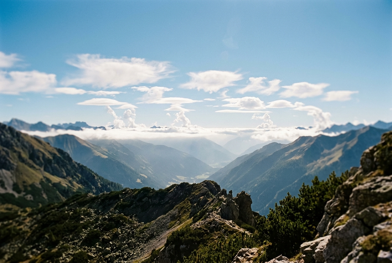
Stand in a broad valley just before daybreak in early autumn. The air against your skin is biting, stagnant, and impossibly still. Every breath hangs suspended in the freezing gloom, condensing into a pale vapour that refuses to disperse. Down in the hollows, milky ribbons of ground mist cling to the saturated soil, pooling like water in the lowest contours of the terrain. A chimney in the distance sends up a solitary thread of woodsmoke; it climbs perhaps fifty or eighty metres vertically, perfectly straight, before flattening abruptly against an invisible, rigid ceiling, spreading horizontally in an eerie, paper-thin sheet across the horizon. Not a leaf quivers on the birch trees. The earth is locked in an acoustic and dynamic hush, isolated from the vast atmospheric currents cruising silently only a few hundred metres above.
Then, the first brilliant rim of the solar disk breaches the eastern ridge.
  PRE-DAWN (Stagnant Inversion)           MID-MORNING (Convective Mixing)
  ==============================          ===============================
  Free Troposphere (Warm, Dry)            Free Troposphere (Warm, Dry)
  ------------------------------          ~~~~~~~~~~~~~~~~~~~~~~~~~~~~~~~  <-- Entrainment Zone
  /\/\/\ Capping Inversion /\/\/              |   ^   |   ^   |   ^   |
  ==============================              v   |   v   |   v   |   v    <-- Vigorous Thermals
  Cool, Stagnant Nocturnal Pool               |   |   |   |   |   |   |        (Mixed Layer)
  ------------------------------          -------------------------------
  //////////////////////////////          ///////////////////////////////
      Cold Ground (Radiating)                 Solar-Heated Ground (Hot)
Within minutes, the sensory fabric of the landscape undergoes a profound transformation. As sunlight strikes the dark, ploughed loam and dew-soaked grass, the frozen stillness begins to tremble. You feel the sudden, radiant warmth against your jacket, yet the ambient air around your face remains sharp and cold. Half an hour later, the sheet of smoke that had hovered undisturbed begins to buckle and fray, warped by invisible subterranean forces.
A faint rustle stirs the crowns of the trees—not a steady synoptic gale, but a rhythmic, pulsing breeze that breathes outward, relaxes, and breathes again. The acrid tang of the woodsmoke suddenly descends to ground level, hitting your nostrils in a sharp, transient wave. High overhead, where the sky was an immaculate, featureless azure, tiny white flecks of cloud appear as if conjured from nothingness: crisp, flat-bottomed tufts of cotton-wool, pulsing with life, expanding in rhythm with the warming earth. The nocturnal atmosphere has broken its shackles; the convective boundary layer has awakened.
2. What Is Actually Happening: The Mechanics in Plain English
To understand the morning transition, one must discard the intuitive notion that the sun heats the atmosphere directly. Pure air is largely transparent to incoming shortwave solar radiation. The atmosphere is not heated from above like an oven; rather, it is heated from below like a pot of soup simmering on an induction stove.
During a clear, cloudless night, the surface of the Earth acts as an unshielded radiator, beaming its longwave infrared energy straight out into the void of space. The ground cools rapidly, chilling the ultra-thin layer of air in immediate contact with it through molecular conduction. Because cold air is denser than warm air, this chilled fluid settles into the valleys and hollows, creating what meteorologists term a nocturnal radiation inversion.
Altitude (z)
    ^
    |          Free Atmosphere: Potential Temperature increases with height (Stable)
    |         /
    |        /  <-- Capping Inversion (Sharp temperature jump: ΔΘ)
  h |-------/
    |       |
    |       |   Convective Mixed Layer: Uniform Potential Temperature (Neutral)
    |       |
  0 +-------+------------------------> Potential Temperature (Θ)
           Θ_m
Think of the atmosphere under an inversion as a layered cocktail. The heaviest, densest liquid sits at the bottom, with progressively lighter, warmer layers resting placidly on top. This configuration is inherently stable: if a parcel of cold air near the ground is nudged upward, it finds itself surrounded by lighter, warmer air and immediately sinks back down to its resting place. Vertical motion is violently suppressed. Smoke, moisture, automotive exhaust, and industrial pollutants become trapped beneath this invisible lid, held down by the sheer weight of their own density.
When sunrise occurs, this stable architecture is dismantled from the bottom up. As incoming solar photons strike the soil, the surface absorbs this radiative energy and surges in temperature. The ground, now drastically hotter than the air immediately overlying it, begins transferring heat upward.
Initially, this heat moves across a microscopic millimeter-thick skin via molecular conduction. But air is a notoriously poor thermal conductor; heat cannot diffuse through it efficiently by molecular collisions alone. As the lowest centimetres of air become superheated, their density plummets. They become buoyant, like blobs of hot wax in a lava lamp or air bubbles forming at the base of a boiling kettle.
These hot buoyant parcels detach from the ground in pulses, forming turbulent plumes known as convective thermals. Rising at speeds of several metres per second, these thermals churn the lower atmosphere into a vigorously boiling, well-mixed cauldron—the planetary boundary layer.
Crucially, the rising mixed layer does not merely push upward against the cold morning inversion like a rigid piston; it devours it. As the buoyant plumes strike the base of the capping inversion, they overshoot, splash against the stable ceiling, and create turbulent shear eddies. These eddies tear off chunks of the warm, dry air from above and engulf them downward into the churning soup below—a physical process known as interfacial entrainment.
Like a hot flame under a pot of iced broth, the morning sun drives a boundary layer that simultaneously heats from the bottom and incorporates warm air from the top, eroding the nocturnal inversion until the lower atmosphere is thoroughly homogenized.
3. The Science: Turbulent Fluxes, Slab Models, and the Entrainment Ratio
To formalise this diurnal thermodynamic evolution, atmospheric physicists employ Reynolds decomposition, separating continuous turbulent variables into mean background states and instantaneous turbulent fluctuations:
$$u = \overline{u} + u', \quad w = \overline{w} + w', \quad \theta = \overline{\theta} + \theta'$$
where $\theta$ represents the potential temperature—the temperature a parcel of air would attain if brought adiabatically to a standard reference pressure of $1000\text{ hPa}$.
The Engine: Surface Sensible Heat Flux
The primary driver of daytime boundary layer convection is the upward transfer of thermal energy, quantified as the surface sensible heat flux ($Q_H$), expressed in Watts per square metre ($\text{W m}^{-2}$):
$$Q_H = \rho c_p \overline{w'\theta'}_0$$
- $\rho$ (Air Density): Typically $\approx 1.225\text{ kg m}^{-3}$ at sea level.
- $c_p$ (Specific Heat Capacity of Dry Air): $1005\text{ J kg}^{-1}\text{ K}^{-1}$.
- $\overline{w'\theta'}_0$ (Kinematic Surface Sensible Heat Flux): The covariance between instantaneous vertical velocity fluctuations ($w'$) and potential temperature fluctuations ($\theta'$) evaluated at the surface ($z = 0$), measured in $\text{K m s}^{-1}$.
When a warm thermal ascends ($w' > 0$ and $\theta' > 0$), the product is positive. When cooler air sinks to replace it ($w' < 0$ and $\theta' < 0$), the product is likewise positive. Thus, $\overline{w'\theta'}_0 > 0$ represents a net upward transport of heat into the atmospheric column.
Altitude (z)
    ^
    |
  h |------- (<w'θ'>_h = -A * <w'θ'>_0)  <-- Entrainment Flux (Negative: downward heat)
    |      /
    |     /
    |    /   Linear decrease of turbulent heat flux through the mixed layer
    |   /
  0 +--+----------------------------------> Kinematic Heat Flux <w'θ'>
       0   (<w'θ'>_0 > 0)
The Lilly-Tennekes Slab Model and the 20% Entrainment Rule
Within the convective boundary layer (between the ground $z=0$ and the inversion base $z=h$), vigorous turbulent mixing ensures that potential temperature is vertically uniform: $\frac{\partial \overline{\theta}}{\partial z} \approx 0$. Above the boundary layer summit $h$, the free troposphere is stably stratified with a positive background lapse rate $\gamma = \frac{\partial \Theta}{\partial z} > 0$ (typically $3\text{ to }6\text{ K km}^{-1}$).
At the boundary layer ceiling $z = h(t)$, a sharp discontinuity or "jump" in potential temperature exists:
$$\Delta \Theta(t) = \Theta_{\text{free}}(h) - \Theta_{\text{mixed}}$$
As the mixed layer deepens, it incorporates air from the overlying stable layer. The rate of mixed layer growth is governed by the Tennekes-Lilly Entrainment Equation, derived from the conservation of heat and turbulent kinetic energy across the interfacial jump:
$$\frac{dh}{dt} = \frac{-\overline{w'\theta'}_h}{\Delta \Theta}$$
where $\overline{w'\theta'}_h$ is the kinematic heat flux at the inversion interface ($z = h$).
Herein lies one of the most counterintuitive and elegant paradoxes of boundary layer meteorology: $\overline{w'\theta'}_h$ is strictly negative.
Why? Because vigorous thermals overshooting into the inversion carry cooler mixed-layer air upward ($w' > 0$, $\theta' < 0$), while entrained free-tropospheric air drawn downward is warmer than the mixed layer mean ($w' < 0$, $\theta' > 0$). In both instances, the covariance product $w'\theta'$ is negative. Downward entrainment acts as an effective downward flux of heat into the mixed layer ceiling.
Through extensive laboratory experiments, large-eddy simulations (LES), and field observations documented by the World Meteorological Organization, atmospheric dynamicists have established that the interfacial entrainment flux is directly proportional to the surface buoyancy flux via the dimensionless entrainment ratio $A$:
$$\overline{w'\theta'}_h = -A \cdot \overline{w'\theta'}_0 \quad \text{where } A \approx 0.20$$
This fundamental constant signifies that roughly 20% of the thermal energy driving the boundary layer is consumed by interfacial turbulence and downward entrainment at the upper inversion cap.
       CONVECTIVE TURBULENCE PROFILE
=============================================
Free Troposphere: Laminar, Stably Stratified (γ > 0)
~~~~~~~~~~~~~~~~~~~~~~~~~~~~~~~~~~~~~~~~~~~~~
Entrainment Zone: Shear billows & eddy engulfment (Flux = -0.2 <w'θ'>_0)
---------------------------------------------
Mixed Layer:      Vigorous convective plumes
                  Uniform potential temperature
---------------------------------------------
Surface Layer:    Superadiabatic conduction & high shear (Flux = <w'θ'>_0)
=============================================
Pure Encroachment vs. Turbulent Entrainment
To appreciate the mechanical vitality of this interfacial zone, one must contrast two distinct modes of mixed layer growth:
- Thermodynamic Encroachment ($A = 0$): An idealized, passive scenario where the surface heat flux simply fills the nocturnal cold pool from the bottom up like water filling a basin. No turbulent overshooting occurs; the boundary layer ceiling advances purely by heating the air column to match the ambient profile.
- Active Turbulent Entrainment ($A \approx 0.20$): The realistic physical state. As convective thermals powered by the Deardorff convective velocity scale: $$w_* = \left( \frac{g}{\Theta_0} \overline{w'\theta'}_0 h \right)^{1/3}$$ slam into the inversion interface, they trigger Kelvin-Helmholtz shear instabilities and eddy engulfment. This process physically pulls warm, dry air downward across the interface, accelerating the erosion of the capping lid.
Mathematical Derivation of Mixed Layer Deepening
Under the slab approximation, the rate of change of the temperature jump $\Delta \Theta$ across the entrainment interface is governed by the geometric difference between the background potential temperature gradient $\gamma$ and the uniform heating rate of the mixed layer:
$$\frac{d\Delta \Theta}{dt} = \gamma \frac{dh}{dt} - \frac{d\Theta_m}{dt}$$
The bulk thermodynamic energy budget for the vertically well-mixed layer of depth $h$ dictates that the rate of warming is driven by the net convergence of turbulent heat flux from both the surface and the entrainment interface:
$$\frac{d\Theta_m}{dt} = \frac{\overline{w'\theta'}_0 - \overline{w'\theta'}_h}{h}$$
Substituting the entrainment parameterization $\overline{w'\theta'}_h = -A \overline{w'\theta'}_0$ into this energy conservation equation yields:
$$\frac{d\Theta_m}{dt} = \frac{\overline{w'\theta'}_0 - (-A \overline{w'\theta'}_0)}{h} = \frac{(1 + A)\overline{w'\theta'}_0}{h}$$
In a quasi-steady morning boundary layer undergoing self-similar growth, the temperature jump $\Delta \Theta$ remains in local equilibrium with the background lapse rate ($\Delta \Theta \approx \frac{A}{1+2A} \gamma h$). Differentiating the geometric relationship $\Theta_{\text{top}} = \Theta_0 + \gamma h$ and combining the flux divergence equations, the fundamental differential equation governing mixed layer growth simplifies to:
$$h \frac{dh}{dt} = \frac{(1 + 2A)\overline{w'\theta'}_0(t)}{\gamma}$$
Separating variables and integrating from sunrise ($t = 0$, where initial depth $h(0) \approx h_0$) to time $t$:
$$\int_{h_0}^{h(t)} h \, dh = \frac{1 + 2A}{\gamma} \int_{0}^{t} \overline{w'\theta'}_0(t') \, dt'$$
$$\frac{1}{2}\left[ h(t)^2 - h_0^2 \right] = \frac{1 + 2A}{\gamma} \int_{0}^{t} \overline{w'\theta'}_0(t') \, dt'$$
Assuming an initially shallow nocturnal surface layer ($h_0 \approx 0$), we arrive at the classic Diurnal Boundary Layer Growth Equation:
$$h(t) = \sqrt{ \frac{2(1 + 2A)}{\gamma} \int_{0}^{t} \overline{w'\theta'}_0(t') \, dt' }$$
This elegant relation reveals that the depth of our atmosphere’s turbulent mixing layer expands proportionally to the square root of the accumulated solar thermal energy divided by the ambient background stability ($\gamma$).
Step-by-Step Worked Example: Calculating Morning Boundary Layer Growth
Let us apply this mathematical framework to a realistic mid-latitude spring morning scenario.
Initial Atmospheric Sounding & Surface Conditions:
- Background Free Tropospheric Lapse Rate ($\gamma$): $\gamma = 4.0\text{ K km}^{-1} = 0.004\text{ K m}^{-1}$ (measured via dawn radiosonde).
- Mean Surface Sensible Heat Flux ($Q_H$): Sustained average of $Q_H = 184\text{ W m}^{-2}$ over a 4-hour morning warming period ($\Delta t = 4\text{ hours} = 14,400\text{ seconds}$).
- Air Density ($\rho$): $1.20\text{ kg m}^{-3}$.
- Specific Heat Capacity ($c_p$): $1005\text{ J kg}^{-1}\text{ K}^{-1}$.
- Entrainment Ratio ($A$): $0.20$.
Step 1: Calculate the Kinematic Surface Sensible Heat Flux ($\overline{w'\theta'}_0$)
$$\overline{w'\theta'}_0 = \frac{Q_H}{\rho c_p} = \frac{184\text{ W m}^{-2}}{(1.20\text{ kg m}^{-3})(1005\text{ J kg}^{-1}\text{ K}^{-1})} = \frac{184}{1206} \approx 0.1526\text{ K m s}^{-1}$$
Step 2: Compute the Integrated Morning Heat Input ($\int \overline{w'\theta'}_0 dt$)
Assuming a mean kinematic flux of $0.1526\text{ K m s}^{-1}$ across the 14,400-second window:
$$\int_{0}^{14400} \overline{w'\theta'}_0 \, dt' = 0.1526\text{ K m s}^{-1} \times 14,400\text{ s} = 2,197.44\text{ K m}$$
Step 3: Compute the Mixed Layer Height under Active Turbulent Entrainment ($A = 0.20$)
Applying the complete growth equation:
$$1 + 2A = 1 + 2(0.20) = 1.40$$
$$h(t) = \sqrt{ \frac{2 \times 1.40 \times 2197.44\text{ K m}}{0.004\text{ K m}^{-1}} }$$
$$h(t) = \sqrt{ \frac{6152.832}{0.004} } = \sqrt{1,538,208} \approx 1,240.2\text{ metres}$$
Step 4: Compare with Pure Encroachment ($A = 0$)
If turbulent entrainment were absent and growth occurred purely by thermodynamic encroachment:
$$h_{\text{encroach}}(t) = \sqrt{ \frac{2 \times 1.00 \times 2197.44\text{ K m}}{0.004\text{ K m}^{-1}} } = \sqrt{ \frac{4394.88}{0.004} } = \sqrt{1,098,720} \approx 1,048.2\text{ metres}$$
🔬 Physical Insight: The Entrainment Dividend
In this standard scenario, interfacial turbulent entrainment accounts for an additional $192\text{ metres}$ of vertical boundary layer growth ($1,240\text{ m}$ vs. $1,048\text{ m}$)—an increase of over 18% in total mixed volume. By violently dragging down warm, dry air from the free troposphere, boundary layer turbulence accelerates its own ascent into the sky.
4. Practical Field Guidance for Outdoor Observers
For the field naturalist, mountaineer, glider pilot, or sailor, the diurnal growth of the convective boundary layer is not an abstract mathematical exercise; it is a visible, tactile reality that dictates local wind regimes, thermal velocity, visibility, and severe weather potential.
       THE MORNING INVERSION BURN-OFF SEQUENCE
=================================================================
Time        Visual & Physical Signs             Atmospheric State
-----------------------------------------------------------------
07:00       Flat smoke sheets, pooled mist,     Strong surface inversion;
            glassy calm, freezing air.          laminar, decoupled flow.
-----------------------------------------------------------------
09:30       Smoke loops downwards; sudden       Inversion "burn-off";
            odor of exhaust; gusty breezes.     plume fumigation occurring.
-----------------------------------------------------------------
11:30       Crisp, flat-bottomed cumulus form;  Mixed layer summit strikes
            haze clears; glider lift active.    the LCL; CBL fully coupled.
=================================================================
1. The Sky: Reading the Sounding and Spotting Inversion "Burn-Off"
Before heading into the field, modern observers can inspect early morning radiosonde soundings (such as the 00Z and 12Z skew-T log-P diagrams published by the NOAA National Weather Service or the Met Office).
Altitude
    |
    |      / (Dewpoint Line: T_d)     / (Temperature Line: T)
    |     /                          /
    |    /                          / <-- Inversion Cap (Temperature increases with height)
    |   /                          /
    |  | <--- Deep Moist Layer    |
    |  |                          |
    +--+--------------------------+--------> Temperature
Look specifically at the lowest $100\text{ to }500\text{ metres}$: * The Inversion Cap: Identified by a sharp deflection where the environmental temperature curve leans to the right (temperature increasing with height). * The Convective Temperature: Trace a dry adiabat from the inversion cap down to the surface pressure level. The corresponding ground temperature is the exact threshold required to completely shatter the inversion—the moment of inversion burn-off.
2. Ground Diagnostics: The Phenomenon of Plume Fumigation
If you are hiking near an industrial valley, a highway, or a wood-burning settlement, watch the behaviour of emission plumes.
In the early morning, smoke exhibits fanning or lofting—travelling horizontally in a coherent, narrow ribbon within the stable air.
However, as the expanding mixed layer height $h(t)$ reaches the stack or chimney altitude, the intense vertical turbulence instantly captures the concentrated effluent, violently mixing it straight down to the valley floor in a process known as fumigation.
If you notice a sudden, overwhelming smell of vehicle exhaust, woodsmoke, or sulfur accompanied by erratic surface gusts, you are experiencing the exact moment the convective boundary layer envelope has engulfed the emission layer.
NOCTURNAL "LOFTING" (Stable)          MORNING "FUMIGATION" (Convective)
============================          =================================
             -----------------> Smoke                  \  |  /  Turbulent
Chimney ====/  (Trapped Layer)        Chimney ====\     \/ \/   Downward
============================                       \===> / \    Mixing
Cold Ground (Laminar)                 Warming Ground    /   \   To Ground
3. Surface Instruments: Micro-Barometrics and Thermal Coupling
Keep a close eye on your outdoor barometer, digital thermometer, and anemometer:
- Wind Speed & Direction: Early morning air is dynamically "decoupled" from the gradient winds aloft. As $h(t)$ deepens, it mechanically couples the surface to the faster, geostrophic momentum of the upper troposphere. When the morning calm abruptly breaks into gusty, veering winds (typically swinging clockwise in the Northern Hemisphere), the mixed layer has bridged the nocturnal shear zone.
- Dew Point Collapse: As dry air from the free troposphere is entrained downward through the interfacial zone ($A \approx 0.20$), the surface dew point will often drop several degrees in mid-morning despite steady surface evaporation.
4. Fair-Weather Cumulus and the Lifting Condensation Level (LCL)
The crowning visual manifestation of boundary layer thermodynamics occurs when the mixed layer height $h(t)$ intersects the Lifting Condensation Level ($h_{\text{LCL}}$)—the altitude at which an ascending surface parcel cools to its dewpoint and achieves water vapour saturation.
Altitude
    ^
    |          ☁☁☁ CUMULUS HUMILIS CLOUD BASE ☁☁☁
    |       =========================================  <-- z = h_LCL = h(t)
    |          ^           ^           ^
    |          | Thermal   | Plume     | Updraft
    |          |           |           |
    |       -----------------------------------------
    |       /////////////////////////////////////////  <-- Earth Surface (T, T_d)
  0 +------------------------------------------------
For a well-mixed boundary layer, an observer can compute the base of fair-weather Cumulus humilis using the classic Hennig-Espy Psychrometric Approximation:
$$h_{\text{LCL}} \approx 125 \times (T - T_d) \quad \text{[metres]}$$
where $T$ is the dry-bulb air temperature ($^\circ\text{C}$) and $T_d$ is the dew point ($^\circ\text{C}$) at surface level.
🥾 Field Estimator: Predicting Cloud Onset
If your morning base-station thermometer reads $18^\circ\text{C}$ with a dew point of $6^\circ\text{C}$:
$$h_{\text{LCL}} \approx 125 \times (18 - 6) = 125 \times 12 = 1,500\text{ metres AGL}$$
As you monitor the rising mixed layer $h(t)$ via your mathematical slab growth rate, you can anticipate the exact hour when $h(t) = 1,500\text{ m}$. At that precise moment, the very tops of the most vigorous convective plumes will cross their saturation vapor threshold, and the first flat-bottomed cumulus clouds of the day will ignite across the sky.
To explore further technical definitions and thermodynamic diagrams, consult the comprehensive American Meteorological Society Glossary.
5. Today’s Meteorological Rule of Thumb
The 125-Metre Spread & Morning Gust Rule:
When the morning calm breaks into sudden, erratic gusts and surface humidity dips, the convective boundary layer has successfully breached the nocturnal inversion; multiply the spread between your thermometer and dew point $(T - T_d)$ in degrees Celsius by $125$ to find the precise altitude in metres where fair-weather cumulus clouds will strike the sky.