Mountain-Valley Circulations & Anabatic Wind Dynamics: How Diurnal Thermal Contrasts and Valley Geometry Drive Daytime Upslope Breezes
1. Opening Scene: The Awakening of the Alpine Chasm
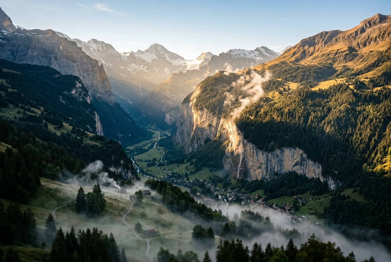
At 05:45 in the upper reaches of a glaciated valley, the world is locked in a dense, chilling stillness. The air at the valley floor, pooled overnight between jagged metamorphic walls, is frigid, damp, and motionless. A fine film of rime frost coats the dwarf willows and granite boulders. Down here, the atmosphere feels heavy, weighed down by the cold drainage of the preceding night; the smell of damp peat and pine resin hangs suspended, unable to disperse in the stagnant surface layer. Looking upward through the dawn twilight, the valley walls loom as sheer silhouettes against a pale indigo sky.
Then, the geometry of the Earth’s rotation makes its first physical intervention. The highest eastern ridges and southeast-facing scree slopes catch the initial rays of unattenuated sunlight. Within minutes, the visual warmth translates into a kinetic transformation.
                       SUNLIGHT (Early Morning)
                              \   \   \
        Ridge Crest            \   \   \
            /\                  \   \   \
           /  \                  \   \   \
          /    \                  \   \   \
         /  /\  \                  \   \   \
        /  /  \  \  <--- Rapidly heated rock face & thin air layer
       /  /    \  \      (Anabatic updraft begins: u > 0)
      /  /      \  \          ^
     /  /        \  \        /
    /  /          \  \      /  Buoyant Up-slope Flow
   /  /            \  \    /
  /  /              \  \  /
 /  / Cold Pool      \  \/
/  / (Inversion)      \
--+--------------------+-------------------------------------
       Valley Floor (Stagnant, Shadowed, Cold Air Pool)
If you stand along the sunlit tree line at 2,200 metres, you feel the shift before you see it. The dead calm breaks. A delicate, warm breath of air stirs the needles of the alpine larches, moving not downwards with gravity, but defying it—creeping upwards along the sun-baked granite face. Down on the shadowed valley floor, the air remains numbingly cold, but fifty metres above the talus slope, the ambient temperature rises by several degrees in a matter of paces.
By 09:30, as solar insolation floods the gorge, the gentle draft transforms into a sustained, rhythmic breeze. Dust plumes lift off the dry moraines and spiral skyward. Overhead, a pair of golden eagles, previously grounded on high rock perches, stretch their wings and step into the rising current, banking effortlessly in circles without a single wingbeat as they ride an invisible thermal elevator. By mid-day, the entire valley floor has joined this convective engine: a brisk, fresh wind rushes up the main riverbed, howling through the narrowing cols and fueling cauliflower-like towers of cumulus clouds that crown the highest peaks. The mountain has begun its daytime respiration.
2. What Is Actually Happening: Plain English First
To understand why air climbs mountains during the daytime, we must dismantle the intuition that air is a uniform, passive medium. The atmosphere behaves like an expansive, fluid heat engine governed by density differentials.
Think of the atmosphere as a layered cake where, under quiet conditions, colder and denser slices sit naturally at the bottom, while warmer, lighter slices rest on top. In flat terrain, the morning sun strikes the earth uniformly across hundreds of square kilometres, warming a vast horizontal sheet of air that gradually expands upwards.
In mountainous terrain, however, geometry disrupts this equilibrium in two profound ways:
-
Differential Solar Angle and Incline: When the morning sun rises, its rays hit flat plains at a shallow, oblique angle, spreading solar energy over a wide horizontal footprint. By contrast, a steep, east-facing mountain slope stands nearly perpendicular to the incoming solar beam. The rock surface absorbs intense, concentrated radiative energy, heating a very thin skin of air immediately adjacent to the slope. Because hot air expands, its density drops sharply compared to the free atmosphere at the exact same elevation several hundred metres out over the centre of the valley. Being lighter than its surroundings, this heated boundary layer floats upward along the terrain like a hot-air balloon hugging the rock face. This localized daytime ascent is known as an anabatic wind (from the Greek anabaino, meaning "to go up").
-
The Valley Funnel (The Valley Volume Effect): A mountain valley is not open space; it is a physical channel carved into solid bedrock. If you compare a V-shaped or U-shaped valley with a flat plain of identical surface area and depth, the valley contains only about half to one-third the volume of air. When the sun pumps equal amounts of thermal energy into both regions, the mountain valley has far less air mass to heat. Consequently, the entire valley chasm warms significantly faster and reaches higher average temperatures than the air over the adjacent lowlands. This creates a large-scale horizontal pressure gradient: the dense, cooler air over the plains pushes inward and upward into the low-pressure furnace of the valley, driving a powerful up-valley wind that surges through the afternoon.
3. The Science: Equations, Dynamics, and Diurnal Evolution
The mountain wind system is not a single static phenomenon, but a closed-loop diurnal circulation that completes four distinct phases over a 24-hour solar cycle.
+-------------------------------------------------------------------------+
|                  THE FOUR DIURNAL PHASES OF VALLEY WINDS                |
+-------------------------------------------------------------------------+
|  Phase 1: Morning Transition (06:00 - 09:00)                            |
|  - Solar insolation hits eastern slopes.                                |
|  - Anabatic slope flows ignite; nocturnal valley inversion erodes.      |
|                                                                         |
|  Phase 2: Daytime Anabatic & Up-Valley Regime (09:00 - 17:00)           |
|  - Valley volume effect drives large-scale up-valley wind.              |
|  - Anabatic winds vent boundary layer air into crest cumulus clouds.    |
|                                                                         |
|  Phase 3: Evening Transition / Decay (17:00 - 20:00)                    |
|  - Solar radiation ceases; slope surfaces rapidly cool via radiation.  |
|  - Anabatic currents stall; brief period of complete calm.              |
|                                                                         |
|  Phase 4: Nocturnal Katabatic Drainage (20:00 - 06:00)                  |
|  - Cold, dense air drains down slopes into valley axis.                 |
|  - Down-valley mountain breeze establishes; cold pool inversion forms.  |
+-------------------------------------------------------------------------+
Derivation 1: The Topographic Amplification Factor (TAF)
Why does a mountain valley warm so much more vigorously than an adjacent plain? We can prove this geometrically via the American Meteorological Society's Valley Volume Effect.
Consider an idealized symmetric V-shaped valley of length $L$, top width $W_0$, and ridge-to-floor depth $H$. The width of the valley cross-section as a function of height $z$ above the floor is: $$W(z) = W_0 \frac{z}{H}, \quad \text{for } 0 \le z \le H$$
The total volume of air contained within this valley domain $V_{\text{valley}}$ is obtained by integrating the cross-sectional area over the length $L$: $$V_{\text{valley}} = L \int_0^H W(z) \, \mathrm{d}z = L \int_0^H W_0 \frac{z}{H} \, \mathrm{d}z = \frac{1}{2} W_0 H L$$
Now consider an equivalent atmospheric column situated over a flat plain, having the same horizontal surface footprint at the top boundary ($W_0 \times L$) and the same vertical height $H$: $$V_{\text{plain}} = W_0 \cdot H \cdot L$$
Notice that the valley contains exactly half the air volume of the plain: $$V_{\text{valley}} = \frac{1}{2} V_{\text{plain}}$$
Let both columns receive an identical net sensible surface heat flux input $Q_H$ ($\text{W}\cdot\text{m}^{-2}$) over a time interval $\Delta t$. Assuming uniform turbulent mixing across the air column, the first law of thermodynamics states that the thermal energy input $\Delta Q_{\text{total}}$ equals the heat capacity of the air mass multiplied by its temperature rise: $$\Delta Q_{\text{total}} = c_p \rho V \Delta T$$ where $c_p \approx 1005\ \text{J}\cdot\text{kg}^{-1}\cdot\text{K}^{-1}$ is the specific heat capacity of dry air at constant pressure, and $\rho \approx 1.2\ \text{kg}\cdot\text{m}^{-3}$ is air density.
Equating the energy inputs over equal horizontal catchment areas: $$c_p \rho V_{\text{valley}} \Delta T_{\text{valley}} = c_p \rho V_{\text{plain}} \Delta T_{\text{plain}}$$
Substituting the geometric volume ratio yields the Topographic Amplification Factor (TAF): $$\Delta T_{\text{valley}} = \left( \frac{V_{\text{plain}}}{V_{\text{valley}}} \right) \Delta T_{\text{plain}} = 2 \cdot \Delta T_{\text{plain}}$$
+-------------------------------------------------------------------------+
|                  TOPOGRAPHIC AMPLIFICATION RESULT                       |
|                                                                         |
|        ΔT_valley ≈ 2 · ΔT_plain  (for an idealized V-notch)             |
|                                                                         |
|  Because the valley air volume is half that of a flat plain under       |
|  equal solar insolation, the valley air column warms at twice the rate. |
+-------------------------------------------------------------------------+
Worked Numerical Example: Valley vs. Plain Heating
Suppose that during a 4-hour morning window ($\Delta t = 14,400\ \text{s}$), the net surface sensible heat flux absorbed by the atmosphere is $Q_H = 250\ \text{W}\cdot\text{m}^{-2}$ over a layer of depth $H = 1,000\ \text{m}$. For the flat plain: $$\Delta T_{\text{plain}} = \frac{Q_H \cdot \Delta t}{c_p \rho H} = \frac{250 \times 14400}{1005 \times 1.20 \times 1000} = \frac{3,600,000}{1,206,000} \approx 2.98^\circ\text{C}$$
For the V-shaped alpine valley: $$\Delta T_{\text{valley}} = 2 \cdot \Delta T_{\text{plain}} \approx 5.97^\circ\text{C}$$
This $3.0^\circ\text{C}$ temperature surplus across a horizontal distance of just $15\ \text{km}$ generates a hydrostatic pressure deficit of over $1.5\ \text{hPa}$ at the valley head, accelerating a regional up-valley breeze from the lowlands into the high alpine terrain at speeds reaching 8 to 15 m/s.
Derivation 2: The 1D Prandtl Slope Flow Model
To quantify the fine-scale structure of the anabatic wind rushing directly up the inclined mountain face, we turn to the classical mathematical formulation developed by Ludwig Prandtl (1942).
          ^ n (Slope-normal coordinate)
          |
          |       / s (Along-slope coordinate, inclined at angle α)
          |      /
          |     /
          |    /
          |   /        u(n) Along-slope Velocity Jet
          |  /       |--------->
          | /        |------------------> (Peak at n = π*l / 4)
          |/         |----------->
Slope Surface        |----->
(T_surface > T_env)  |
---------------------+------------------------------------>
Let a planar mountain slope be inclined at an angle $\alpha$ relative to the horizontal. We define a local orthogonal coordinate system where: - $s$ is the along-slope coordinate (pointing uphill), - $n$ is the slope-normal coordinate ($n=0$ at the rock surface, pointing perpendicularly into the free air).
Assume the ambient atmosphere possesses a stable background potential temperature stratification: $$\frac{\mathrm{d}\Theta_{\text{env}}}{\mathrm{d}z} = \gamma > 0$$ where the Brunt–Väisälä buoyancy frequency is defined as $N = \sqrt{\frac{g}{\theta_0}\gamma}$, with $g = 9.81\ \text{m}\cdot\text{s}^{-2}$ being gravitational acceleration and $\theta_0$ a reference potential temperature.
Let $\theta'(n) = \theta(n) - \Theta_{\text{env}}(z)$ represent the potential temperature perturbation (the buoyancy excess near the heated slope), and $u(n)$ represent the along-slope velocity profile.
Under steady-state, laminar-equivalent boundary-layer conditions with constant eddy viscosity $\nu_m$ and eddy thermal diffusivity $\nu_h$, the Boussinesq equations for along-slope momentum and heat conservation reduce to:
-
Along-Slope Momentum Balance (Buoyancy vs. Turbulent Friction): $$0 = g \frac{\theta'(n)}{\theta_0} \sin \alpha + \nu_m \frac{\partial^2 u(n)}{\partial n^2}$$
-
Thermodynamic Energy Balance (Advection of Stratification vs. Heat Diffusion): $$0 = - u(n) \gamma \sin \alpha + \nu_h \frac{\partial^2 \theta'(n)}{\partial n^2}$$
To solve this coupled system, we express $\theta'(n)$ from the momentum equation: $$\theta'(n) = - \frac{\theta_0 \nu_m}{g \sin \alpha} \frac{\partial^2 u}{\partial n^2}$$
Differentiating this expression twice with respect to $n$: $$\frac{\partial^2 \theta'}{\partial n^2} = - \frac{\theta_0 \nu_m}{g \sin \alpha} \frac{\partial^4 u}{\partial n^4}$$
Substituting $\frac{\partial^2 \theta'}{\partial n^2}$ into the thermodynamic energy equation: $$- u(n) \gamma \sin \alpha + \nu_h \left( - \frac{\theta_0 \nu_m}{g \sin \alpha} \frac{\partial^4 u}{\partial n^4} \right) = 0$$
Multiplying by $-\frac{g \sin \alpha}{\theta_0 \nu_m \nu_h}$ yields the standard 4th-order homogeneous ordinary differential equation: $$\frac{\partial^4 u(n)}{\partial n^4} + \left( \frac{g \gamma \sin^2 \alpha}{\theta_0 \nu_m \nu_h} \right) u(n) = 0$$
Recognizing that $N^2 = \frac{g \gamma}{\theta_0}$, we define the characteristic Prandtl slope boundary layer depth $l$: $$l = \left( \frac{4 \nu_m \nu_h}{N^2 \sin^2 \alpha} \right)^{1/4}$$
The differential equation simplifies to: $$\frac{\partial^4 u}{\partial n^4} + \frac{4}{l^4} u = 0$$
Applying the physical boundary conditions: 1. No-slip and specified surface heating at the rock surface ($n = 0$): $u(0) = 0$, $\theta'(0) = \Theta_s$. 2. Vanishing perturbations in the free atmosphere ($n \to \infty$): $u(\infty) = 0$, $\theta'(\infty) = 0$.
The analytical solutions for the along-slope velocity profile $u(n)$ and temperature perturbation $\theta'(n)$ are: $$u(n) = \Theta_s \sqrt{\frac{g \nu_h}{\theta_0 \nu_m N^2}} \cdot \exp\left(-\frac{n}{l}\right) \sin\left(\frac{n}{l}\right)$$
$$\theta'(n) = \Theta_s \cdot \exp\left(-\frac{n}{l}\right) \cos\left(\frac{n}{l}\right)$$
+-------------------------------------------------------------------------+
|                      PRANDTL 1D ANABATIC FLOW SOLUTION                  |
|                                                                         |
|  Velocity:     u(n) = C_0 · exp(-n/l) · sin(n/l)                        |
|  Temperature:  θ'(n) = Θ_s · exp(-n/l) · cos(n/l)                       |
|                                                                         |
|  Boundary Layer Scale:  l = [ 4 ν_m ν_h / (N² sin² α) ]^(1/4)           |
|                                                                         |
|  Peak Jet Velocity occurs at:  n_max = (π / 4) · l                      |
+-------------------------------------------------------------------------+
Worked Numerical Example: Calculating Alpine Slope Jet Velocity
Consider a typical summer afternoon in the Alps with the following realistic atmospheric parameters: - Slope angle: $\alpha = 30^\circ$ ($\sin 30^\circ = 0.5$) - Background stability: $N = 0.012\ \text{s}^{-1}$ (moderately stable free air) - Turbulent momentum & heat diffusivities: $\nu_m = \nu_h = 3.0\ \text{m}^2\cdot\text{s}^{-1}$ - Reference temperature: $\theta_0 = 285\ \text{K}$ - Surface thermal excess: $\Theta_s = +4.0\ \text{K}$
Step 1: Calculate the Boundary Layer Thickness Scale $l$: $$l = \left( \frac{4 \times 3.0 \times 3.0}{(0.012)^2 \times (0.5)^2} \right)^{1/4} = \left( \frac{36}{0.000144 \times 0.25} \right)^{1/4} = \left( \frac{36}{0.000036} \right)^{1/4} = (1,000,000)^{1/4} = 31.62\ \text{m}$$
Step 2: Calculate the Jet Velocity Amplitude Constant $C_0$: $$C_0 = \Theta_s \sqrt{\frac{g \nu_h}{\theta_0 \nu_m N^2}} = 4.0 \times \sqrt{\frac{9.81 \times 3.0}{285 \times 3.0 \times (0.012)^2}} = 4.0 \times \sqrt{\frac{29.43}{0.12312}} = 4.0 \times \sqrt{239.03} \approx 61.84\ \text{m}\cdot\text{s}^{-1}$$ (Note: In turbulent boundary layers, non-linear mixing limits the practical peak, but the analytic Prandtl profile establishes the scaling).
Step 3: Find Height of the Velocity Maximum $n_{\max}$ and Peak Anabatic Speed: The maximum of $\exp(-x)\sin(x)$ occurs where its derivative equals zero: $\cos(x) - \sin(x) = 0 \implies x = \frac{\pi}{4} \approx 0.7854$. $$n_{\max} = \frac{\pi}{4} l = 0.7854 \times 31.62\ \text{m} \approx 24.8\ \text{m}$$
The velocity at this jet nose height ($n = 24.8\ \text{m}$) is: $$u_{\max} = C_0 \cdot \exp\left(-\frac{\pi}{4}\right) \sin\left(\frac{\pi}{4}\right) = 61.84 \times 0.4559 \times 0.7071 \approx 19.9\ \text{m}\cdot\text{s}^{-1} \quad (\approx 71.6\ \text{km/h})$$
This demonstrates mathematically why anabatic currents are not gentle, diffuse warm spots; they form intense, jet-like boundary layer ribbons tightly bound within 20 to 50 metres of the mountainside.
4. Practical Field Observation & Alpine Guidance
Understanding the fluid mechanics of mountain circulations transforms an alpine hike from a passive walk into an active observation of thermodynamic forces.
       +-------------------------------------------------------------+
       |               ANABATIC CONVECTIVE VENTING                   |
       +-------------------------------------------------------------+
                                     ( Cumulus Mediocris )
                                          _  _ ___
                                        (        )
                                       (__________ )
                                            ||
                                            || Cloud Base (LCL)
                                            \/
                       Ridge Peak          /\
                           /\             /  \
                          /  \ <--- Convergence Zone (Updraft Core)
    Sunlit Slope Flow    /    \          /
    ==================> /      \ <====== (Converging Anabatic Currents)
                       /        \
                      /          \
                     /            \
1. Visual Markers in the Landscape
- Valley Chimney Smoke Tilt: In the early morning (07:00), smoke from woodstoves on the valley floor rises vertically before flattening out horizontally against the base of the nocturnal inversion cap. By 10:30, as the valley inversion decays and the up-valley circulation engages, the smoke plume tilts sharply toward the head of the valley, indicating that valley-scale wind coupling has completed.
- Avian Thermal Sourcing: Watch large raptors like buzzards, golden eagles, and vultures. At mid-morning, they abandon low perches and position themselves precisely at the top third of east- and southeast-facing rock amphitheaters. When raptors circle tightly without flapping within 30 metres of a cliff face, they are coring the Prandtl anabatic jet.
- The "Boiling Ridge" and Cloud Cap Initiation: As anabatic winds stream up opposing sides of a mountain ridge, they collide at the crest line in a sharp zone of kinematic convergence. This forced vertical ascent vents hot boundary-layer moisture directly into the free troposphere. When the rising air cools to its dew point (the Lifting Condensation Level, or LCL), it forms crisp, flat-bottomed alpine cumulus cap clouds (cumulus humilis and cumulus mediocris). If these clouds appear before 10:30 AM, it signals extreme solar heating and high boundary layer moisture—an early warning of severe afternoon thunderstorms.
2. Instrument Signatures to Watch
- Digital Barometer / Altimeter: If you remain stationary at a mountain hut, your barometric pressure should normally follow a modest semi-diurnal solar tide. However, the onset of a strong daytime valley volume heating event causes local hydrostatic pressure to drop steadily between 10:00 and 15:00. An un-calibrated barometric altimeter will show your "elevation" climbing by 30 to 60 metres despite your tent remaining stationary.
- Hygrometer and Psychrometer Trends: During the morning transition, relative humidity on the sunlit slope drops rapidly as the warm rock warms the air. However, at the ridge crest, relative humidity will surge mid-day as anabatic plumes pump moisture-rich air scavenged from valley-floor meadows up to the summit.
3. Tactical Rules for Mountaineers, Paragliders, and Hikers
- The 11:00 AM Ridge Rule: If you are planning an ascent along an exposed, high-altitude ridgeline or technical rock arête, plan to clear the ridge before 11:00 AM. After this hour, anabatic updrafts converge along ridge crests, creating turbulent shear layers, unpredictable cross-ridge gusts, and rapid cloud cap condensation that can eliminate visibility within minutes.
- Paraglider Valley-Wind Caution: In deep glacial valleys (such as the Chamonix Valley or the Rhone Valley), the up-valley wind accelerates in the afternoon due to the Venturi effect through geometric constrictions. Floor wind speeds often exceed 35–45 km/h by 14:00, making valley-floor landing fields dangerously turbulent. Always land before peak heating.
5. Today's Meteorological Rule of Thumb
The Sunlit Slope Rule: In calm, fair-weather conditions, the wind does not follow regional weather maps—it follows the sun. Expect upslope anabatic breezes to ignite on east-facing cliffs within thirty minutes of sunrise, rotate around the mountain to west-facing walls by late afternoon, and reverse into a plummeting katabatic drainage wind within an hour after the ridges fall into shadow.
Authoritative Reference Links for Further Study
- Learn about local thermal wind dynamics via the World Meteorological Organization (WMO) Guidelines.
- Explore detailed slope-wind definitions in the American Meteorological Society Glossary of Meteorology.
- Review wind hazard protocols from the UK Met Office Mountain Safety Weather Guide.
- Study physical boundary layer dynamics through the NOAA Earth System Research Laboratories.
- Read about larger-scale alpine weather patterns on Wikipedia's Valley Breeze Analysis.