African Easterly Waves & African Easterly Jet Dynamics: How Combined Barotropic-Baroclinic Instability Seeds Atlantic Tropical Cyclones
1. Opening Scene: The Rhythmic Pulse of the Sahelian Sky
Stand upon the windswept cliffs of the Cap-Vert peninsula near Dakar, where the westernmost knuckle of the African continent thrusts into the Atlantic, and the atmosphere reveals itself not as an inert void, but as a vast, rhythmic respiratory organ.
On a late August morning, the world is wrapped in a dry, ochre-tinted silence. The sun appears not as a sharp golden orb, but as a bleached, copper disc suspended in an opaque shroud of microscopic silt. This is the forward limb of the Saharan Air Layer—a desiccating, mineral-laden atmospheric river lofted from the Grand Erg and driven westward across the Sahel. The air bites with an astringent, electrostatic dryness; relative humidity plunges below twenty percent, and fine grit crunches softly between the teeth. The breeze is steady, blowing out of the north-east, parching the skin and suppressing every whisper of cloud development.
Yet, over the course of thirty-six hours, an invisible celestial mechanism begins to turn.
By the third afternoon, the persistent northerly wind stumbles and falls calm. The mercury, which had climbed toward forty degrees Celsius under the dusty sky, pauses. The barometric pressure, measured on a precision aneroid dial, exhibits a subtle, systematic downward drift, slipping three hectopascals below its diurnal baseline. The dry desert air is abruptly displaced by a heavy, marine airmass creeping inland from the south. The skin turns slick with sweat as the dew point climbs by more than fifteen degrees Celsius.
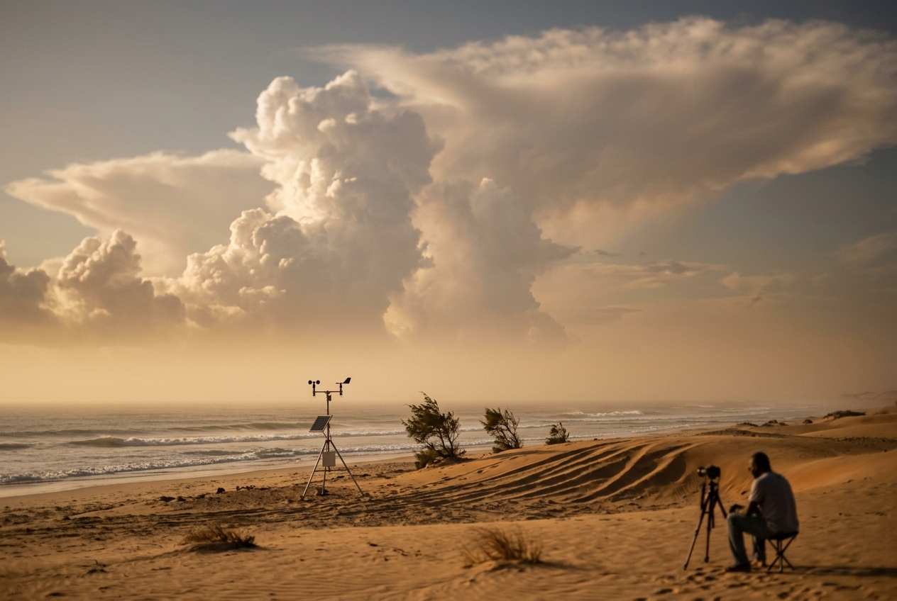
Look eastward toward the continental interior. Along the horizon, the pale dust veil is suddenly severed by a towering, charcoal-hued escarpment: a massive multi-cellular convective squall line, marching west at forty kilometers per hour. A razor-sharp shelf cloud—an arcus of bruised slate and indigo—stretches from horizon to horizon, underbelly churned by turbulent eddies.
As the gust front strikes, the temperature collapses by ten degrees in under two minutes. The wind veers violently into the south-west, shrieking at forty-five knots and lofting a stinging wall of red laterite dust. Then comes the deluge: enormous, fat tropical raindrops that strike the baked earth with an intoxicating burst of geosmin and petrichor, quickly transforming dry wadis into foaming torrents.
By dawn the following day, the sky is washed clean, glowing with a pure maritime blue, before the north-easterly dust veil gradually returns. Local mariners and Sahelian pastoralists know this cadence intimately: an unyielding, three-to-five-day pulse between desert aridity and monsoonal fury. This synoptic heartbeat is the passage of an African Easterly Wave, sculpted by the most powerful mid-tropospheric jet stream in the tropical world.
2. What is Actually Happening: Plain English First
To grasp why the West African atmosphere throbs with this clockwork rhythm, one must understand that the atmosphere is a giant heat engine designed to eliminate extreme temperature differences.
Think of northern Africa during the boreal summer as two completely different worlds pressed tightly against one another like adjacent rooms in a house:
- The Saharan Furnace (The Attic): North of roughly $15^\circ\text{N}$ latitude lies millions of square kilometers of sun-scorched sand and rock. Under the unrelenting summer sun, the desert surface heats to over fifty degrees Celsius. This superheats the air immediately above it, creating a deep, dry, turbulent reservoir of scorching air known as the Saharan Convective Boundary Layer, reaching up to five kilometers into the sky.
- The Equatorial Marine Refrigerator (The Cellar): South of roughly $10^\circ\text{N}$ latitude lies the equatorial Atlantic Ocean and the dense, moisture-choked rainforests of the Gulf of Guinea. The ocean waters remain near twenty-six degrees Celsius, continuously chilled by equatorial upwelling, while the rainforests shade the ground and transpire immense quantities of water vapor.
Because hot air expands and occupies more volume than cold air, a column of air over the Sahara expands upward like an inflated hot-air balloon. Over the Gulf of Guinea, the cooler, denser air remains compressed near the surface.
If you travel up to three kilometers above sea level (around the 700 to 600 hectopascal pressure level), you encounter an enormous sideways pressure hill. At this altitude, the air pressure over the hot Sahara is significantly higher than the air pressure over the cool Gulf of Guinea. Air naturally wants to cascade down this slope from north to south, flowing from high pressure to low pressure.
However, because the Earth is spinning on its axis, any parcel of air that attempts to move across lines of latitude is deflected by the Coriolis force—to the right in the Northern Hemisphere. As the air accelerates southward down the temperature slope, the Coriolis deflection twists it ninety degrees to the right. Instead of flowing north-to-south, it forms a high-speed, localized ribbon of air racing from east to west: the African Easterly Jet (AEJ).
This jet stream, cruising between three and four kilometers altitude at speeds of thirty to fifty knots, acts as a high-altitude conveyor belt. But a fluid ribbon traveling this fast through a calmer environment cannot remain straight.
Just as a taught guitar string vibrates when plucked, or a fast-flowing river develops swirling eddies along its banks, the African Easterly Jet becomes mechanically unstable. It begins to wobble and snake from north to south. These continent-scale, serpentine kinks in the easterly current are African Easterly Waves (AEWs).
As these waves drift westward into the Atlantic Ocean, they organize clusters of thunderstorms within their troughs. When conditions align over warm ocean waters, these wobbles become the rotational seeds from which over eighty percent of major Atlantic hurricanes germinate, as monitored by the NOAA National Hurricane Center.
3. The Science: Thermal Wind, Dynamic Instability, and Cyclogenesis
For those seeking mathematical rigor, the dynamics governing the African Easterly Jet and its associated wave perturbations represent a classic geophysical fluid dynamics problem governed by the balance between baroclinic and barotropic instability.
A. Genesis of the AEJ via Thermal Wind Balance
The vertical wind shear supporting the African Easterly Jet is governed by the Thermal Wind Equation. In pressure coordinates, assuming hydrostatic and geostrophic balance, the vertical shear of the zonal geostrophic wind $u_g$ with respect to the logarithm of pressure $p$ is directly proportional to the horizontal meridional temperature gradient:
$$\frac{\partial u_g}{\partial \ln p} = \frac{R_d}{f} \left( \frac{\partial T_v}{\partial y} \right)_p$$
Converting this to height coordinates $z$ yields the standard form:
$$\frac{\partial u_g}{\partial z} = -\frac{g}{f T_0} \left( \frac{\partial T_v}{\partial y} \right)_z$$
Where: * $g = 9.81 \text{ m s}^{-2}$ is the acceleration due to gravity, * $f = 2\Omega \sin\phi$ is the Coriolis parameter at latitude $\phi$, * $T_0$ is the mean layer virtual temperature (in Kelvin), * $R_d = 287.05 \text{ J kg}^{-1}\text{ K}^{-1}$ is the gas constant for dry air, * $\partial T_v / \partial y$ is the meridional virtual temperature gradient.
Worked Numerical Example: The Vertical Jet Acceleration
Consider a typical late-summer synoptic setup across West Africa centered at $\phi = 15^\circ\text{N}$.
-
Compute the Coriolis parameter at $15^\circ\text{N}$: $$f = 2(7.2921 \times 10^{-5} \text{ rad s}^{-1}) \sin(15^\circ) \approx 3.774 \times 10^{-5} \text{ s}^{-1}$$
-
Define the meridional thermal contrast across the Sahel: Between the Gulf of Guinea coast ($y = 5^\circ\text{N} \approx 555 \text{ km}$) and the central Sahara ($y = 20^\circ\text{N} \approx 2220 \text{ km}$), the distance $\Delta y = 1.665 \times 10^6 \text{ m}$. The average boundary-layer temperature over the ocean/rainforest is $T_1 = 297 \text{ K}$ ($24^\circ\text{C}$), whereas the Saharan boundary layer reaches $T_2 = 315 \text{ K}$ ($42^\circ\text{C}$). $$\frac{\partial T_v}{\partial y} \approx \frac{315 - 297}{1.665 \times 10^6 \text{ m}} = \frac{+18 \text{ K}}{1.665 \times 10^6 \text{ m}} \approx +1.081 \times 10^{-5} \text{ K m}^{-1}$$
-
Compute the resulting vertical shear of the zonal wind: Let $T_0 \approx 305 \text{ K}$. Substituting these values into the thermal wind equation: $$\frac{\partial u_g}{\partial z} = -\frac{9.81}{(3.774 \times 10^{-5})(305)} \times (1.081 \times 10^{-5}) \approx -\frac{9.81 \times 1.081 \times 10^{-5}}{1.151 \times 10^{-2}} \approx -9.21 \times 10^{-3} \text{ s}^{-1}$$
Integrating over the lowest $3.5 \text{ km}$ (from the surface to the $650 \text{ hPa}$ level): $$\Delta u_g = (-9.21 \times 10^{-3} \text{ s}^{-1}) \times (3500 \text{ m}) \approx -32.2 \text{ m s}^{-1}$$
Assuming a weak surface westerly monsoon inflow of $+3 \text{ m s}^{-1}$, the resulting mid-tropospheric wind speed reaches: $$u(z = 3.5\text{ km}) = +3 - 32.2 = -29.2 \text{ m s}^{-1} \quad (\approx 57 \text{ knots easterly})$$
In practice, surface friction and turbulent entrainment moderate this value, producing the observed mean AEJ core speeds of $15 \text{ to } 22 \text{ m s}^{-1}$ ($30 \text{ to } 45 \text{ knots}$) centered between $600 \text{ and } 700 \text{ hPa}$ near latitude $14^\circ\text{N}$.
B. Wave Triggering via Mixed Barotropic-Baroclinic Instability
The African Easterly Jet is a concentrated jet core possessing both intense horizontal shear ($\partial \bar{u}/\partial y$) and vertical shear ($\partial \bar{u}/\partial z$). Under the theoretical framework established by Charney, Stern, and Kuo, an unforced zonally symmetric basic state flow is dynamically unstable to small wave perturbations if and only if the meridional gradient of quasi-geostrophic potential vorticity (QGPV), denoted $\partial \bar{q}/\partial y$, changes sign within the domain.
The full expression for the meridional QGPV gradient on a $\beta$-plane is formulated as:
$$\frac{\partial \bar{q}}{\partial y} = \beta - \frac{\partial^2 \bar{u}}{\partial y^2} - \frac{1}{\rho_0} \frac{\partial}{\partial z} \left( \frac{\rho_0 f_0^2}{N^2} \frac{\partial \bar{u}}{\partial z} \right)$$
Where: * $\beta = \frac{2\Omega \cos\phi_0}{a}$ is the planetary vorticity gradient ($\approx 2.2 \times 10^{-11} \text{ m}^{-1}\text{ s}^{-1}$ at $15^\circ\text{N}$), * $-\frac{\partial^2 \bar{u}}{\partial y^2}$ is the barotropic instability term (curvature of the horizontal jet profile), * $-\frac{1}{\rho_0} \frac{\partial}{\partial z} \left( \frac{\rho_0 f_0^2}{N^2} \frac{\partial \bar{u}}{\partial z} \right)$ is the baroclinic instability term (vertical structure of thermal stratification and shear), * $N = \sqrt{\frac{g}{\theta}\frac{\partial \theta}{\partial z}}$ is the Brunt-Väisälä buoyancy frequency.
Across northern Africa, the AEJ satisfies the Charney-Stern instability condition in two distinct ways:
- North of the Jet Core ($15^\circ\text{N} - 18^\circ\text{N}$): The horizontal shear term $-\partial^2 \bar{u}/\partial y^2$ is strongly negative and exceeds $\beta$, driving $\partial \bar{q}/\partial y < 0$. This provides a purely barotropic source of energy, extracting kinetic energy from the horizontal shear of the mean jet ($CK \rightarrow AKE$).
- South of the Jet Core ($8^\circ\text{N} - 12^\circ\text{N}$): The lower-tropospheric vertical wind shear coupled with the strong moisture and temperature gradient makes the baroclinic term dominate, driving another sign reversal. Here, the growing wave extracts available potential energy from the mean background thermal state ($APE \rightarrow EKE$).
Because the background state continually satisfies this dual instability condition, infinitesimal perturbations grow spontaneously into finite-amplitude waves with characteristic synoptic scales: * Wavelength ($\lambda$): $2,500 \text{ to } 3,000 \text{ km}$ * Period ($T$): $3.5 \text{ to } 5.0 \text{ days}$ * Phase Speed ($c$): $\approx 8 \text{ m s}^{-1}$ ($15 \text{ knots}$) directed westward.
Worked Numerical Example: Wave Dispersion and Kinematic Phase Matching
The westward phase speed $c$ of a Rossby-type wave embedded in a background mean zonal easterly flow $\bar{u}$ can be approximated via the modified dispersion relation:
$$c = \bar{u} - \frac{\beta^*}{k^2 + l^2 + \frac{f_0^2}{4 N^2 H^2}}$$
Where: * Zonal wavenumber $k = \frac{2\pi}{\lambda_x} = \frac{2\pi}{2.8 \times 10^6 \text{ m}} \approx 2.24 \times 10^{-6} \text{ m}^{-1}$, * Meridional wavenumber $l = \frac{2\pi}{\lambda_y} = \frac{2\pi}{1.5 \times 10^6 \text{ m}} \approx 4.19 \times 10^{-6} \text{ m}^{-1}$, * Mean steering flow at $700 \text{ hPa}$: $\bar{u} \approx -10.0 \text{ m s}^{-1}$ (easterly), * Effective vorticity gradient $\beta^* \approx 2.3 \times 10^{-11} \text{ m}^{-1}\text{ s}^{-1}$.
Neglecting the internal deformation term for simplicity at first order: $$K_H^2 = k^2 + l^2 = (2.24 \times 10^{-6})^2 + (4.19 \times 10^{-6})^2 \approx 5.02 \times 10^{-12} + 17.56 \times 10^{-12} = 2.258 \times 10^{-11} \text{ m}^{-2}$$
$$\frac{\beta^*}{K_H^2} = \frac{2.3 \times 10^{-11} \text{ m}^{-1}\text{ s}^{-1}}{2.258 \times 10^{-11} \text{ m}^{-2}} \approx 1.02 \text{ m s}^{-1}$$
The westward phase propagation speed is: $$c = \bar{u} - \frac{\beta^*}{K_H^2} = -10.0 - 1.02 = -11.02 \text{ m s}^{-1} \quad (\approx 21.4 \text{ knots westward})$$
Under real-world conditions where the lower-level monsoonal drag exerts a moderating influence, the steering level settles precisely near the $700 \text{ hPa}$ level where $u \approx -8 \text{ m s}^{-1}$, yielding an observed westward translation of approximately $700 \text{ to } 800 \text{ km per day}$.
C. Tropical Cyclogenesis: The Transition to Closed Warm-Core Depressions
How does an open, undulating wavy trough line transform into a destructive, closed, warm-core tropical cyclone as recognized by research from the European Centre for Medium-Range Weather Forecasts (ECMWF)?
The transformation relies on the Quasi-Geostrophic Omega Equation coupled with Diabatic Latent Heat Release:
$$\left( \nabla^2 + \frac{f_0^2}{\sigma} \frac{\partial^2}{\partial p^2} \right) \omega = -\frac{f_0}{\sigma} \frac{\partial}{\partial p} \left[ -\mathbf{v}_g \cdot \nabla (\zeta_g + f) \right] - \frac{R_d}{\sigma p} \nabla^2 \left( -\mathbf{v}_g \cdot \nabla T \right) - \frac{R_d}{\sigma p} \nabla^2 \left( \frac{J}{c_p} \right)$$
Where $\omega = dp/dt$ is the vertical motion in pressure coordinates ($\omega < 0$ denotes ascent), $\sigma$ is the static stability parameter, and $J$ is the diabatic heating rate ($\text{W kg}^{-1}$).
- Vorticity Advection Ahead of the Trough: Downstream (west) of the $700 \text{ hPa}$ wave trough axis, differential cyclonic vorticity advection ($\partial/\partial p [-\mathbf{v}_g \cdot \nabla (\zeta_g + f)] > 0$) forces broad synoptic-scale upward motion ($\omega < 0$).
- Moisture Ingestion & Convective Coupling: As the wave's southerly flow behind the trough taps into the hyper-moist boundary layer of the Gulf of Guinea, moist static energy ($h = c_p T + g z + L_v q$) surges northward.
- Diabatic PV Pinching: Inside the resulting Mesoscale Convective Systems (MCSs), massive condensation releases latent heat ($J/c_p > 0$) in the middle and upper troposphere ($400 - 250 \text{ hPa}$). In accordance with Haynes and McIntyre's PV impermeability theorem, latent heat release acts as a powerful non-conservative source of potential vorticity below the level of maximum heating: $$\frac{D q}{D t} \approx \frac{1}{\rho} \left( \boldsymbol{\omega}_a \cdot \nabla \dot{\theta} \right)$$ This generates a concentrated, mid-tropospheric cyclonic potential vorticity anomaly ($q > 0$).
- Vortex Alignment & Tropical Depression Genesis: When the wave emerges off the coast of Senegal or Mauritania over warm sea-surface temperatures ($SST > 26.5^\circ\text{C}$) in an environment characterized by low vertical wind shear ($VWS < 10 \text{ knots}$), the mid-level vortex aligns vertically with the low-level convergence center. The resulting hydro-thermodynamic feedback collapses central surface pressures, generating a closed, symmetric, warm-core tropical depression.
4. Practical Outdoor Guidance: Field Diagnostics for Observers
Whether tracking synoptic systems along the coast of West Africa, traversing the Cabo Verde archipelago, or observing long-period swells on the eastern seaboard of North America, an observer can diagnose the approach and passage of an African Easterly Wave using fundamental field instruments and keen visual sky-watching.
A. What to Look for in the Sky
- The Saharan Dust Ceiling (Forward Ridge): Look for a distinctive milky-orange, copper hue near the horizon during sunrise and sunset. Cloud formation will be completely suppressed by a severe mid-level temperature inversion (the SAL inversion), leaving only flat, dirty hazes.
- The Anvil Blow-Off: Twelve to eighteen hours before the wave trough axis arrives, watch the eastern horizon. High-altitude cirrostratus streamers (dense ice-crystal blowoff from squall lines over 300 kilometers inland) will begin to invade the upper troposphere, creating halos around the sun.
- The Arcus / Shelf Cloud (Trough Passage): As the wave axis crosses, look for a long, menacing horizontal roll or shelf cloud extending across the eastern sky, signifying the outflow boundary (gust front) of the associated squall line.
- The Post-Trough Scouring: Following the squall, the sky transitions to crystalline clarity, with vibrant white towering cumulus clouds developing over land, unimpeded by Saharan dust.
B. Instrument Readings to Track
- The Precision Barometer (Filtering the Diurnal Tide): Tropical atmospheres are dominated by a predictable semi-diurnal solar atmospheric tide ($\sim 2.5 \text{ hPa}$ oscillations peaking at 10:00 and 22:00 local time). To detect an AEW:
- Record barometric pressure at the same tidal peak each day (e.g., exactly at 10:00 AM local time).
- A true synoptic drop of $2.0 \text{ to } 3.5 \text{ hPa}$ across two successive 24-hour cycles indicates the central trough axis of an African Easterly Wave is within 250 kilometers.
- The Wind Vane (The Cyclonic Veer):
- Ahead of the wave (in the northern ridge): Winds blow steadily from the East-Northeast to Northeast.
- As the trough axis arrives: Winds drop light and variable, then abruptly back to the North-Northwest before exploding from the South-Southwest with the gust front.
- Behind the wave: Winds settle into a steady, moist Southeasterly to Southerly flow.
- The Psychrometer (Wet-Bulb and Dewpoint Jumps): In the dry forward limb, the dewpoint depression ($T - T_d$) can exceed $20^\circ\text{C}$. Within two hours of wave axis passage, the dewpoint will surge upward by $8^\circ \text{ to } 15^\circ\text{C}$, pushing relative humidity above eighty-five percent.
C. Rules of Thumb for Field Decision-Making
- For Hikers and Field Observers in the Sahel: When a dry, dusty week abruptly turns calm and sweat fails to evaporate from your skin, you have less than six hours before the gust front of an AEW-induced squall arrives. Seek sturdy shelter immediately; dust squalls can reduce visibility to zero in seconds, followed by flash flooding.
- For Coastal Mariners & Sailors: If the steady north-easterly trade wind backs to the north-northwest while the 24-hour barometric trend turns negative, the trough axis of an Easterly Wave is approaching from the east. Prepare for sudden squalls from the southern quadrant with wind speeds often double the prevailing ambient forecast.
- For Atlantic Tropical Observers: Track the exit of wave troughs off the Dakar coast via EUMETSAT / NOAA satellite imagery. A wave whose mid-level circulation center aligns over an open-ocean water patch with sea surface temperatures exceeding $27^\circ\text{C}$ and vertical wind shear below 15 knots has an eighty percent probability of developing into a tropical cyclone within seventy-two hours. Consult the Met Office and the World Meteorological Organization for regional tropical wave advisories.
5. Today's Meteorological Rule of Thumb
In the tropical Atlantic, every great hurricane begins not with a roar over the ocean, but with a whisper across the burning sands of the Sahara, where a shift from north-easterly dust to south-westerly squalls marks the passage of Earth's most fertile atmospheric wave.
6. Curricular Synthesis & Diagnostic Summary
The African Easterly Jet and its wave perturbations demonstrate the fundamental unity of geophysical fluid dynamics. The simple thermodynamic imperative of the Earth system—to transport heat poleward and smooth horizontal thermal discrepancies—drives the formation of a localized thermal wind jet. This jet, inherently unstable by virtue of its intense shear, breaks down into synoptic-scale waves. These waves organize the convective cloud clusters of the Intertropical Convergence Zone (ITCZ) into self-sustaining vortices.
Thus, the scorching heat of the hyper-arid Sahara is inextricably linked across thousands of kilometers of ocean to the development of Atlantic hurricanes, underscoring the deep, continuous machinery of our global atmosphere.