Stratospheric Sudden Warming & Polar Vortex Dynamics: How Planetary Wave Flux Shatters the Circumpolar Jet and Triggers Arctic Outbreaks
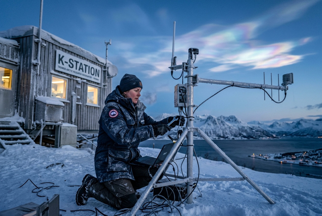
This sudden descent into deep freeze is not born of local dynamics. It is the earthly echo of an atmospheric cataclysm that unfolded thirty kilometres above the North Pole nearly three weeks earlier: a Sudden Stratospheric Warming (SSW). High above the weather systems of the troposphere, in a rarefied realm of ultra-thin air and ozone, the Earth’s winter circumpolar circulation has experienced total dynamical disruption. A high-altitude wind system that ordinarily circumnavigates the pole at velocities exceeding 200 kilometres per hour has been brought to a dead stop, reversed in direction, and warmed by upwards of 40 kelvins in fewer than five days.
What’s Actually Happening: The Stratospheric Flywheel
To understand why the stratosphere collapses, one must first picture how the Arctic atmosphere organizes itself during the long polar night. Between October and March, the high latitudes of the Northern Hemisphere receive zero solar irradiance. Deprived of shortwave heating from the sun, the ozone layer within the polar stratosphere undergoes rapid radiational cooling, plunging to temperatures below $-80^\circ\text{C}$ (193 K). Meanwhile, several thousand kilometres to the south, the sun continues to illuminate the tropics and mid-latitudes, sustaining a warm stratospheric reservoir.
This sharp horizontal contrast in temperature creates a profound imbalance in atmospheric density. Cold air contracts, lowering the geometric height of constant pressure surfaces over the pole, while warm mid-latitude air expands, lifting those same pressure surfaces. The resulting lateral pressure gradient force propels air toward the pole. However, because our planet rotates, the Coriolis force deflects this poleward-moving air to the right in the Northern Hemisphere.
The resulting equilibrium between the pressure gradient and the Coriolis force produces a vast, spinning vortex: the stratospheric polar vortex. Encircling the vortex is the Polar Night Jet, an immense ring of high-altitude westerly winds that acts as an atmospheric containment wall, walling off the super-chilled polar air mass from the rest of the hemisphere.
Think of the polar vortex as a spinning top perched atop the globe. So long as it spins rapidly and symmetrically, it remains stable, locking Arctic air tightly over Greenland and the polar basin. But the atmosphere is not a smooth, isolated chamber; it is a layered fluid continuous with the planetary surface below.
When immense tropospheric weather systems encounter major geographical barriers—such as the Rocky Mountains, the Tibetan Plateau, or the sharp thermal boundary between the warm Gulf Stream and cold Eurasian landmasses—they generate planetary-scale ripples known as Rossby waves.
Under specific atmospheric configurations, these planetary waves channel their kinetic energy vertically, surging up through the tropopause and into the stratosphere. As they ascend into thinner air, their amplitudes swell until, much like ocean swells breaking against a shallow shoreline, they crest and break against the Polar Night Jet.
When these planetary waves break, they transfer westward (easterly) momentum directly into the eastward (westerly) jet. This wave drag applies a powerful mechanical brake to the spinning stratospheric flywheel. If the wave forcing is sufficiently intense, the vortex is knocked off its axis, distorted, or split entirely into two daughter vortices.
As the westerly jet decelerates, the geostrophic balance holding the polar vortex aloft disintegrates. Air over the polar cap is forced to sink rapidly toward the lower stratosphere. As this air descends into regions of higher ambient pressure, it undergoes intense adiabatic compression: the compression of the gas molecules generates internal heat without any external heat source. In a matter of days, stratospheric temperatures over millions of square kilometres surge from $-80^\circ\text{C}$ to $-30^\circ\text{C}$ or higher. The polar vortex has undergone a Major Sudden Stratospheric Warming.
The Mathematical Framework of Vortex Collapse
For those seeking dynamical precision, the life cycle of a Sudden Stratospheric Warming is governed by two foundational principles of geophysical fluid dynamics: the thermal wind relation and the Transformed Eulerian Mean (TEM) momentum equations.
1. Thermal Wind Balance and the Polar Night Jet
The magnitude of the Polar Night Jet is tied directly to the meridional (north-south) temperature gradient across the hemisphere through the thermal wind balance. In log-pressure coordinates $(x, y, z^)$, where $z^ = -H \ln(p/p_0)$ with scale height $H \approx 7\text{ km}$, thermal wind balance in a geostrophic system is expressed as:
$$\frac{\partial \bar{u}}{\partial z^*} = -\frac{R}{f H} \frac{\partial \bar{T}}{\partial y}$$
Here, $\bar{u}$ is the zonal-mean westerly wind speed ($\text{m s}^{-1}$), $z^*$ is the log-pressure vertical coordinate ($\text{m}$), $R \approx 287\text{ J kg}^{-1}\text{ K}^{-1}$ is the specific gas constant for dry air, $f = 2\Omega \sin\phi$ is the Coriolis parameter ($\approx 1.26 \times 10^{-4}\text{ s}^{-1}$ at $\phi = 60^\circ\text{N}$), and $\partial \bar{T}/\partial y$ is the meridional temperature gradient ($\text{K m}^{-1}$).
THERMAL WIND CALCULATION: VERTICAL SHEAR OF THE JET
-------------------------------------------------------------------------
Input Parameters:
  • Latitude (φ): 60°N  ==>  f = 1.263 × 10⁻⁴ s⁻¹
  • Gas Constant (R): 287 J kg⁻¹ K⁻¹
  • Scale Height (H): 7,000 m
  • Polar Cap Distance (Δy): 3,330 km (from 30°N to 60°N = 3.33 × 10⁶ m)
  • Temperature Difference (ΔT): -40 K (Polar stratosphere is 40 K colder)

Step 1: Compute the meridional temperature gradient
  ∂T/∂y ≈ (-40 K) / (3.33 × 10⁶ m) = -1.201 × 10⁻⁵ K m⁻¹

Step 2: Compute the vertical wind shear
  ∂u/∂z* = - [287 / (1.263 × 10⁻⁴ × 7000)] × (-1.201 × 10⁻⁵)
  ∂u/∂z* = - [287 / 0.8841] × (-1.201 × 10⁻⁵)
  ∂u/∂z* = - (324.62) × (-1.201 × 10⁻⁵) = +3.90 × 10⁻³ s⁻¹
  ∂u/∂z* = +3.90 m s⁻¹ per kilometer of altitude

Step 3: Integrate over the Stratospheric Column (from 10 km to 30 km, Δz* = 20 km)
  u(30 km) = u(10 km) + (∂u/∂z* × 20,000 m)
  Assuming u(10 km) = 15 m s⁻¹ (tropopause jet core):
  u(30 km) = 15 m s⁻¹ + (3.90 × 10⁻³ × 20,000 m)
  u(30 km) = 15 m s⁻¹ + 78.0 m s⁻¹ = 93.0 m s⁻¹ (~335 km/h)
-------------------------------------------------------------------------
Conclusion: Strong poleward cooling dictates an intense, accelerating
westerly jet in the unperturbed winter stratosphere.
2. Wave Drag and the Eliassen-Palm Flux Divergence
The deceleration and destruction of this powerful jet is quantified by the Transformed Eulerian Mean (TEM) zonal momentum equation:
$$\frac{\partial \bar{u}}{\partial t} = \bar{v}^* \left( f - \frac{1}{a \cos \phi} \frac{\partial (\bar{u} \cos \phi)}{\partial \phi} \right) + \frac{1}{\rho_0 a \cos \phi} \nabla \cdot \mathbf{F} + \bar{X}$$
where $\bar{v}^$ is the residual meridional circulation velocity, $a$ is the radius of the Earth, $\rho_0$ is background air density, $\bar{X}$ represents unresolved friction, and $\mathbf{F} = (F_\phi, F_z)$ is the Eliassen-Palm (EP) flux vector*, defined by:
$$F_\phi = \rho_0 a \cos \phi \left( \frac{\partial \bar{u}}{\partial z^} \frac{\overline{v' \theta'}}{\partial \bar{\theta}/\partial z^} - \overline{u' v'} \right)$$
$$F_z = \rho_0 a \cos \phi \left( \left[ f - \frac{1}{a \cos \phi} \frac{\partial (\bar{u} \cos \phi)}{\partial \phi} \right] \frac{\overline{v' \theta'}}{\partial \bar{\theta}/\partial z^*} - \overline{u' w'} \right)$$
The EP flux vector $\mathbf{F}$ maps the propagation of planetary wave activity through the atmosphere. The vertical component $F_z$ is dominated by the poleward eddy heat flux ($\overline{v' \theta'}$), representing upward wave energy propagation from the troposphere into the stratosphere.
The divergence of this flux vector, $\nabla \cdot \mathbf{F}$, represents the net dynamical forcing exerted by the waves on the background mean flow: - When waves pass through without breaking, $\nabla \cdot \mathbf{F} = 0$, leaving the mean flow undisturbed. - When planetary waves dissipate and break in the stratosphere, they converge: $\nabla \cdot \mathbf{F} < 0$.
DYNAMICAL MOMENTUM DECELERATION WORKED EXAMPLE
-------------------------------------------------------------------------
Suppose intense upward planetary wave activity (wavenumber-1 and 2) produces
an EP flux convergence of:
  (1 / (ρ₀ a cos φ)) ∇ · F = -12.0 m s⁻¹ day⁻¹  at 10 hPa, 60°N

Neglecting residual advection over a 5-day wave-breaking pulse:
  Initial Zonal Wind: u_initial = +45.0 m s⁻¹ (Westerly)
  Rate of Deceleration: ∂u/∂t = -12.0 m s⁻¹ day⁻¹
  Duration: Δt = 5 days

Total Wind Change:
  Δu = (-12.0 m s⁻¹ day⁻¹) × (5 days) = -60.0 m s⁻¹

Final Zonal Wind:
  u_final = u_initial + Δu = 45.0 m s⁻¹ - 60.0 m s⁻¹ = -15.0 m s⁻¹ (Easterly)
-------------------------------------------------------------------------
Result: The wave drag halts the 160 km/h westerly jet and reverses it
into a 54 km/h easterly wind, satisfying the primary criterion for a Major SSW.
The thermodynamic consequence of this deceleration is dictated by mass continuity within the residual mean circulation. The wave-induced torque drives an anomalous poleward mass transport ($\bar{v}^ > 0$), which forces strong downward vertical motion ($\bar{w}^ < 0$) directly over the polar cap. The descending air undergoes adiabatic heating governed by the thermodynamic energy equation:
$$\frac{\partial \bar{T}}{\partial t} \approx -\bar{w}^ \left( \frac{\partial \bar{T}}{\partial z^} + \frac{R \bar{T}}{c_p H} \right) = -\bar{w}^* S$$
where $S$ is the static stability parameter ($\approx 10\text{ to }15\text{ K km}^{-1}$ in the lower stratosphere). A sustained descent rate of $\bar{w}^* \approx -0.8\text{ cm s}^{-1}$ (roughly $-700\text{ m day}^{-1}$) induces an adiabatic warming rate of:
$$\frac{\partial \bar{T}}{\partial t} \approx -(-700\text{ m day}^{-1}) \times (12\text{ K km}^{-1}) = +8.4\text{ K day}^{-1}$$
Over five days of continuous wave-driven compression, polar stratospheric temperatures rise by more than $40\text{ K}$.
Morphologies of Vortex Destruction: Displacement vs. Split
The World Meteorological Organization (WMO) establishes a strict operational threshold for a Major Sudden Stratospheric Warming: 1. The zonal-mean zonal wind at the $10\text{ hPa}$ isobaric surface (approximately $30\text{ km}$ altitude) and $60^\circ\text{N}$ latitude must reverse from westerly ($\bar{u} > 0$) to easterly ($\bar{u} \le 0$). 2. The zonal-mean temperature gradient between $60^\circ\text{N}$ and the North Pole must reverse, such that the polar cap becomes warmer than the mid-latitudes.
If the stratospheric temperatures rise dramatically without a complete reversal of the $10\text{ hPa}$ zonal wind at $60^\circ\text{N}$, the event is classified as a Minor SSW.
When a Major SSW occurs, the geometric transformation of the vortex follows one of two distinct dynamical modes, determined by the dominant planetary wavenumber forced from the troposphere:
1. Vortex Displacement (Wavenumber-1 Dominated)
When the tropospheric wave field is dominated by Planetary Wavenumber-1 (a single giant wave trough and ridge encircling the hemisphere), an immense anticyclone—frequently the stratospheric extension of the Aleutian High—surges poleward. The main polar vortex is shoved entirely off the geographical pole, shifting over northern Canada or Eurasia.
While the vortex is distorted and compressed, its core remains largely intact. Displacement events typically produce rapid temperature spikes, but their downward impacts on surface weather tend to be more localized and shorter-lived.
2. Vortex Split (Wavenumber-2 Dominated)
When Planetary Wavenumber-2 is dominant (two distinct troughs and ridges positioned roughly $180^\circ$ apart, typically over the Rockies and the Eurasian landmass), wave energy converges on the vortex from opposing sides.
A warm ridge of stratospheric high pressure cuts across the polar cap, bifurcating the vortex into two separate, smaller daughter vortices—one typically settling over North America and the other over Siberia.
Vortex splits represent the most catastrophic disruption of the winter stratosphere. The total surface area of the vortex edges increases, accelerating mixing and dissipation. Split events show a higher statistical correlation with severe, persistent mid-latitude cold spells, as the dual vortex fragments anchor cold air over continental landmasses for weeks.
Downward Coupling: How the Stratosphere Dictates Surface Freezes
A breakdown in the stratosphere at $30\text{ km}$ altitude does not immediately freeze the ground beneath your feet. The atmospheric signal must propagate downward through a process known as stratosphere-troposphere dynamical coupling.
As conceptualized by atmospheric scientists Mark Baldwin and Timothy Dunkerton in their classic "dripping paint" paradigm, the easterly wind anomalies and associated geopotential height rises develop first in the upper stratosphere and descend toward the tropopause over a period of 10 to 20 days.
This downward migration occurs via two interconnected mechanisms: 1. Wave-Mean Flow Feedbacks: The reversed easterly winds prevent additional planetary waves from propagating into the upper stratosphere (according to the Charney-Drazin criterion, planetary waves can only propagate vertically through westerly winds below a critical speed). Consequently, subsequent upward-propagating waves break at progressively lower altitudes, forcing the easterly wind shear lower and lower. 2. Non-Local Geostrophic Adjustment: The accumulation of mass over the polar cap alters the broad-scale potential vorticity distribution. In adjusting to this high-altitude mass anomaly, the pressure fields of the lower stratosphere and upper troposphere adjust dynamically.
When this descending signal reaches the troposphere ($8\text{ to }12\text{ km}$), it induces a transition into a strongly negative phase of the Northern Annular Mode (NAM), also known as the Arctic Oscillation (AO).
Under a strongly negative Arctic Oscillation: - The tropospheric polar jet stream weakens and decelerates. - The jet transitions from a taut, linear "zonal" configuration (blowing west-to-east) into a highly amplified, undulating "meridional" wave pattern with towering ridges and deep troughs. - Atmospheric "blocking patterns"—most notably Scandinavian Blocks and Greenland Highs—become established.
These massive, persistent high-pressure blocks act as atmospheric boulders in a stream. They deflect mild Atlantic storm tracks south toward the Mediterranean, while their clockwise rotation draws freezing continental air westward across northern and western Europe.
This exact sequence triggered the infamous February–March 2018 "Beast from the East." Following a major vortex split in mid-February, a descending negative NAM signal locked a 1045 hPa Scandinavian anticyclone in place for weeks, funneling Arctic air from the Russian interior directly into the UK and Western Europe, resulting in widespread blizzards and prolonged sub-zero temperatures.
Observing the Invisible: Diagnostic Maps and Field Indicators
Meteorologists track the initiation and descent of an SSW using a combination of remote-sensing platforms, numerical weather models, and surface diagnostics.
1. Interpreting 10 hPa Synoptic Charts
To identify an SSW in real-time, meteorologists consult the $10\text{ hPa}$ geopotential height and temperature charts generated by agencies such as the UK Met Office and the European Centre for Medium-Range Weather Forecasts (ECMWF).
- Normal State: Concentric circular height contours centered over the pole with values below $28,000\text{ gpm}$ (geopotential meters) and a cold core below $-75^\circ\text{C}$.
- Major SSW State: The polar low is replaced by a broad anticyclone (heights exceeding $31,000\text{ gpm}$). The temperature contours show an intense thermal ridge, with temperatures over the pole rising to between $-30^\circ\text{C}$ and $-15^\circ\text{C}$.
2. Radiosonde Ascent Profiles
Weather balloon (radiosonde) data launched from Arctic stations (e.g., Sodankylä, Finland or Alert, Canada) provide in-situ verification of the event. Under normal conditions, the radiosonde records temperatures dropping through the troposphere, stabilizing in the lower stratosphere, and remaining cold up to its burst altitude ($30\text{ to }35\text{ km}$).
During an SSW, the radiosonde trajectory reveals a profound stratospheric temperature inversion: after reaching minimum temperature near the tropopause ($-55^\circ\text{C}$ at $10\text{ km}$), the temperature profile climbs steeply with altitude, reaching $-20^\circ\text{C}$ at $25\text{ km}$ as it passes through the wave-compressed descending air mass.
3. Optical Sky Phenomena: Polar Stratospheric Clouds
One of the most striking visual signatures of vortex dynamics occurs in the weeks preceding an SSW, when the polar vortex is at its coldest and most stable.
When lower stratospheric temperatures drop below $-78^\circ\text{C}$, nitric acid and water vapor condense into Type I Polar Stratospheric Clouds (PSCs). Below $-85^\circ\text{C}$, pure water-ice crystals form Type II PSCs, commonly known as nacreous or "mother-of-pearl" clouds.
Viewed from high latitudes (Scotland, Scandinavia, Canada) during civil twilight when the ground is in shadow but the stratosphere remains sunlit, nacreous clouds scatter light through diffraction, displaying vivid, shimmering pastel iridescence.
Paradoxically, the appearance of nacreous clouds indicates that the stratosphere is at peak vulnerability: the hyper-cold vortex provides the steep temperature gradients that prime the Polar Night Jet for planetary wave disruption. Once the SSW occurs and temperatures surge, PSCs vaporize within hours.
Practical Outdoor Guidance: Reading the Surface Signals
While the breakdown begins $30\text{ km}$ overhead, an observant individual on the ground can track the descending aftermath using basic instruments and environmental cues:
- Monitor the Barometric Trend for "Sticky" Highs: Under typical conditions, mid-latitude barometers rise and fall every 48 to 72 hours as Atlantic depressions pass through. When a post-SSW blocking pattern establishes itself, the barometer will climb above $1035\text{ hPa}$ and remain fixed there for days or weeks. This barometric stability is a hallmark of a high-latitude block.
- Watch the Dew Point Rather Than Just Temperature: Maritime cold fronts rarely drop surface dew points below $0^\circ\text{C}$ due to moisture flux from the ocean. However, continental air masses drawn westward by a post-SSW block originate in the frozen interior of Siberia or the Arctic basin. If your thermometer reads $+1^\circ\text{C}$ but the hygrometer reveals a dew point of $-12^\circ\text{C}$, the air mass is dry, dense, and continental. Any subsequent precipitation will fall as dry, powdery snow.
- The Forester’s and Gardener’s Rule of Thumb: If atmospheric monitoring agencies confirm a Major SSW in late January or February, expect a delayed freeze window opening roughly 14 to 21 days later. Gardeners and agriculturalists should prepare for deep ground frosts, as post-SSW continental air masses lack cloud-trapped oceanic moisture, promoting intense nighttime radiational cooling that penetrates deep into bare soil.
- The Mariner’s and Aviator’s Rule of Thumb: For sailors in the North Sea, Baltic, or North Atlantic, a post-SSW transition replaces long, rolling Atlantic ocean swells with short-period, wind-driven seas. The sudden shift to persistent easterly gales introduces severe structural icing risks, as sub-freezing, low-salinity surface spray freezes instantaneously upon contact with vessel superstructures.
Meteorological Rule of Thumb
"When planetary waves shatter the stratospheric flywheel above the pole, look to the east two to three weeks later: the higher the high-altitude warming, the deeper the continental freeze."
The next time mid-winter brings a prolonged, biting easterly wind that freezes water pipes and coats the landscape in rime frost, cast your gaze upward. The quiet freeze at the surface is the thermodynamic footprint of a massive wave-breaking event that unfolded weeks earlier at the edge of space, reminding us that the atmosphere is an interconnected fluid column spanning from the surface beneath our feet to the upper reaches of the stratosphere.