Dual-Polarization Radar & Hydrometeor Classification: How Differential Reflectivity and Correlation Coefficients Unmask Hail Cores and Tornadic Debris
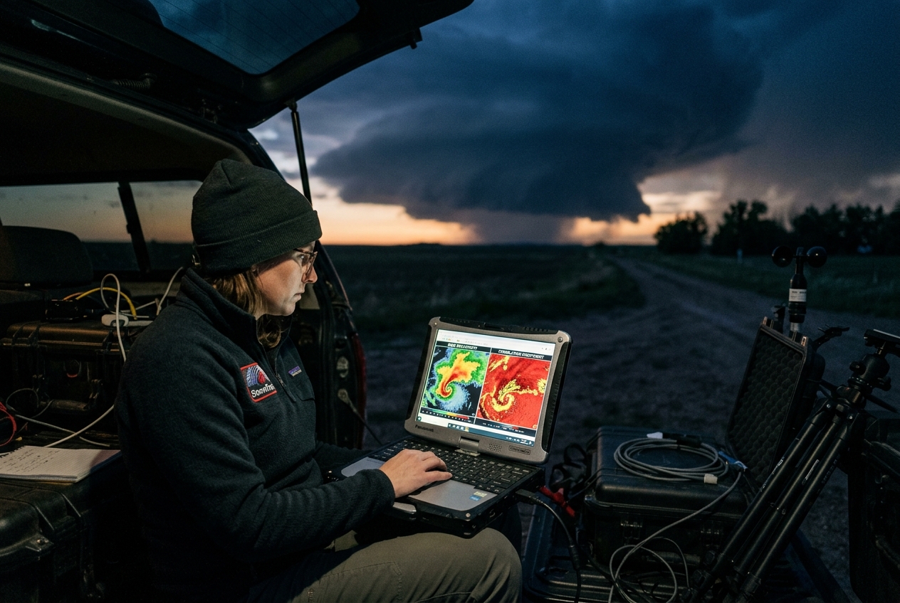
1. Opening Scene: The Anatomy of a Prairie Sky
On a late July afternoon across the high plains of eastern Colorado, the atmosphere possesses a palpable, heavy stillness. The ambient air temperature hovers near 34°C, and the air feels less like an invisible gas than a damp wool blanket pressed against the skin. At ground level, the soil is baked dry, radiating shimmering heat waves that distort the distant silhouettes of grain elevators. Then, almost imperceptibly, the barometer begins a steady, rhythmic descent.
                       UPWARD MESOCYCLONIC DRAFT
                                 ^^^
                               /     \
    [ Anvil Outflow ]         /       \        [ Forward Flank Rain / Hail ]
   <------------------       /  CORE   \      ----------------------------->
                            |  UPDRAFT  |     * * *  Giant Hail Core (Z_DR ~ 0 dB)
                            |           |    . . . . Heavy Rain Core (High K_DP)
       Inflow Jet           \           /   o o o o  Z_DR Arc (Large Oblate Drops)
   ===================>      \         /
                              \_______/
                           TORNADIC VORTEX
                         (TDS: Low RhoHV < 0.8)
To the southwest, the horizon undergoes a rapid, violent metamorphosis. What began as innocent, cauliflower-topped cumulus towers merges into an impenetrable wall of slate-grey and bruised indigo. A low, ragged shelf cloud carves its way across the sky, churning like a horizontal waterfall of condensed vapor. As the gust front breaches the dry farmland, the ambient temperature plummets by twelve degrees Celsius in under two minutes. The air carries the sharp, mineral scent of petrichor—geosmin liberated from parched soil—mingled with the electric, metallic tang of ozone forged by intra-cloud lightning.
Then come the first hydrometeors. They do not arrive as a uniform curtain of rain. Instead, monstrous, isolated impacts splatter against the baked earth at intervals of several feet: individual, flattened disks of liquid water the size of grapes, striking with sufficient kinetic energy to kick up miniature plumes of dust. Overhead, the cloud base assumes a sinister, greenish-teal luminescence—an optical signature of sunlight scattered through billions of suspended ice particles and liquid water cores. To the human eye, the storm is a chaotic spectacle of moisture and momentum. Yet to a dual-polarized electromagnetic pulse sweeping through the cloud at the speed of light, every single constituent of this tempest—from the pancake-flat raindrops to tumbling hail, shredded tree foliage, and suspended ice needles—reveals its exact geometry, orientation, and physical state.
2. What’s Actually Happening: Plain English First
For more than half a century, weather surveillance relied on conventional single-polarization radar. To understand its fundamental limitation, imagine exploring a pitch-black room with a flashlight that emits only a horizontal slit of light. When the beam strikes an object—be it a suspended basketball, a dinner plate held horizontally, a swarm of locusts, or a cloud of dust—the sensor measures only the raw intensity of the light bouncing back. A million microscopic droplets can return the exact same total energy as a single chunk of hail or a flock of migrating geese. The radar operator knows something is there and can gauge its bulk volume, but remains entirely blind to what that something actually is.
Dual-polarization radar, formalized across modern forecasting networks through initiatives overseen by the National Oceanic and Atmospheric Administration (NOAA) and the Met Office Radar Applications Group, solves this ambiguity by transmitting two simultaneous, orthogonal electromagnetic waves: one vibrating horizontally and the other vertically.
CONVENTIONAL (SINGLE-POL):              DUAL-POLARIZATION:
Horizontal Wave Only                    Simultaneous Horizontal & Vertical Waves
--------------------->                  ---------------------> (Horizontal)
                                        |  |  |  |  |  |  |  | (Vertical)
(Detects bulk power only;              (Measures horizontal vs. vertical dimensions;
 blind to particle geometry)            resolves cross-sectional aspect ratios)
By comparing how these two perpendicular pulses interact with particles in the atmosphere, the radar interrogates the horizontal width versus the vertical height of every target in its sampling volume.
This capability is revolutionary because hydrometeors exhibit distinct geometric behaviors dictated by fluid dynamics:
- The Myth of the Teardrop: In popular culture, falling raindrops are depicted as tapered teardrops. In reality, surface tension pulls small drops ($< 1\text{ mm}$) into near-perfect spheres. However, as raindrops grow larger and fall through the air at terminal velocity, upward aerodynamic drag exerts pressure on their bottom surface. The droplet flattens out, assuming the shape of an oblate spheroid—resembling a hamburger bun. The larger the raindrop, the flatter it becomes. Consequently, a large raindrop presents a wider profile to the horizontal radar wave than to the vertical wave.
- The Chaos of Tumbling Hail: Unlike raindrops, hailstones are rigid solids. While individual stones may possess irregular, knobby, or ellipsoidal geometries, they tumble, gyrate, and wobble chaotically as they plummet through turbulent updrafts and downdrafts. Because they rotate across all axes, their time-averaged cross-section appears roughly isotropic (spherical) to the radar beam.
- Non-Meteorological Debris: When a tornado makes landfall and rips apart structures, it lofts a chaotic slurry of plywood, insulation, corrugated metal, tree branches, and sheetrock. These objects tumble violently and lack any uniform physical alignment, returning wildly mismatched electromagnetic signals.
By measuring the subtle discrepancies in amplitude, timing, and phase between horizontal and vertical waves, dual-pol radar transforms raw backscatter into a precise, real-time hydrometeor classification engine.
3. The Science: Polarimetric Moments and Equations
To decode the microphysical architecture of a storm, radar meteorology relies on four fundamental polarimetric moments: Base Reflectivity ($Z_H$), Differential Reflectivity ($Z_{DR}$), Correlation Coefficient ($\rho_{hv}$), and Specific Differential Phase ($K_{DP}$). Comprehensive technical definitions are cataloged in the American Meteorological Society Glossary of Meteorology and operational courses at the NOAA Warning Decision Training Division.
The Polarimetric Moments Defined
- Horizontal Reflectivity Factor ($Z_H$, units: $\text{dBZ}$): Measures the total power backscattered from the horizontal pulse. In the Rayleigh scattering regime (where particle diameter $D \ll \lambda$, the radar wavelength), reflectivity is proportional to the sixth power of drop diameter: $$Z = \int N(D) D^6 \, dD$$ Because of this $D^6$ dependence, a single $5\text{ mm}$ raindrop reflects the same energy as $15,625$ raindrops of $1\text{ mm}$ diameter ($5^6 = 15,625$).
- Differential Reflectivity ($Z_{DR}$, units: $\text{dB}$): The logarithmic ratio of the backscattered horizontal power reflectivity ($Z_H$) to the vertical power reflectivity ($Z_V$). It provides a direct measure of the median aspect ratio (oblateness) of the targets: $$Z_{DR} = 10 \log_{10}\left(\frac{Z_H}{Z_V}\right)$$
- $Z_{DR} > 0\text{ dB}$: Targets are wider than they are tall (e.g., medium to large liquid raindrops).
- $Z_{DR} \approx 0\text{ dB}$: Targets are isotropic/spherical on average (e.g., small cloud droplets, tumbling hail, or dry spherical graupel).
- $Z_{DR} < 0\text{ dB}$: Targets are vertically oriented (e.g., vertically aligned ice crystals in strong electrostatic fields aloft, or vertically tumbling structural debris).
- Correlation Coefficient ($\rho_{hv}$ or RhoHV, dimensionless: $0 \text{ to } 1$): Measures the statistical consistency between the horizontal and vertical backscattered signals from pulse to pulse within a single radar volume.
- $\rho_{hv} > 0.98$: Highly uniform hydrometeor populations (pure rain or pure pristine snow).
- $0.85 \le \rho_{hv} \le 0.95$: Mixed-phase precipitation (rain mixed with melting hail or wet snow).
- $\rho_{hv} < 0.80$: Highly non-uniform, irregularly shaped targets (tornadic debris, birds, bats, insects, or wildfire ash).
- Specific Differential Phase ($K_{DP}$, units: $\text{deg/km}$): The range derivative of the differential phase shift ($\Phi_{DP}$) between horizontal and vertical waves. Because liquid water has a high dielectric constant ($\epsilon_r \approx 81$) and large raindrops are oblate, the horizontal electromagnetic pulse travels slightly slower through heavy liquid water than the vertical pulse. This accumulates a relative phase lag over distance. Unlike $Z_H$ and $Z_{DR}$, $K_{DP}$ is impervious to radar beam attenuation, partial beam blockage, and absolute antenna calibration errors.
Key Mathematical Formulations and Worked Examples
Equation 1: Differential Reflectivity & Median Drop Size Estimation
In pure liquid rain, differential reflectivity scales directly with the median volume diameter $D_0$ (in millimeters) of the raindrop size distribution. A widely utilized empirical relationship (developed by Brandes et al. and referenced across World Meteorological Organization (WMO) radar microphysics standards) relates $D_0$ to $Z_{DR}$:
$$D_0 = 0.035 Z_{DR}^3 - 0.281 Z_{DR}^2 + 1.48 Z_{DR} + 0.71 \quad (\text{for } Z_{DR} > 0.2\text{ dB})$$
For rapid analytical approximation, an exponential power-law form is frequently applied: $$D_0 \approx 1.529 \cdot Z_{DR}^{0.468}$$
Worked Example:
Suppose a storm cell over the radar site produces a horizontal reflectivity factor $Z_H = 100,000\text{ mm}^6\text{m}^{-3}$ ($50.0\text{ dBZ}$) and a vertical reflectivity factor $Z_V = 39,810\text{ mm}^6\text{m}^{-3}$ ($46.0\text{ dBZ}$).
- Compute Differential Reflectivity ($Z_{DR}$): $$Z_{DR} = 10 \log_{10}\left(\frac{100,000}{39,810}\right) = 10 \log_{10}(2.5118) \approx +4.00\text{ dB}$$
- Estimate the median raindrop diameter ($D_0$): Using the polynomial relationship: $$D_0 = 0.035(4.0)^3 - 0.281(4.0)^2 + 1.48(4.0) + 0.71$$ $$D_0 = 0.035(64) - 0.281(16) + 5.92 + 0.71$$ $$D_0 = 2.24 - 4.496 + 5.92 + 0.71 = 4.374\text{ mm}$$
A median diameter exceeding $4.3\text{ mm}$ indicates exceptionally large, aerodynamically flattened drops characteristic of an intense convective rain core or melted graupel near the storm inflow.
Equation 2: Specific Differential Phase and Liquid Rain Rate ($R$)
Specific differential phase ($K_{DP}$) quantifies the liquid water mass aligned along the horizontal axis. While reflectivity ($Z$) depends on the sixth power of drop size ($D^6$)—making it hypersensitive to a few large raindrops or rogue hail stones—$K_{DP}$ is approximately proportional to the fourth power of diameter ($D^{4.24}$), correlating directly with the actual Liquid Water Content ($\text{g/m}^3$).
The rain rate $R(K_{DP})$ in millimeters per hour ($\text{mm/h}$) is modeled via polarimetric power laws (e.g., Ryzhkov & Zrnić):
$$R(K_{DP}) = 50.7 \cdot |K_{DP}|^{0.85}$$
where $K_{DP}$ is calculated across a radial path length $\Delta r = r_2 - r_1$ (in kilometers) from the one-way differential phase $\Phi_{DP}$:
$$K_{DP} = \frac{\Phi_{DP}(r_2) - \Phi_{DP}(r_1)}{2 \cdot (r_2 - r_1)}$$
Worked Example:
A radar pulse traverses a torrential convective rain shaft. At range $r_1 = 30\text{ km}$, the recorded differential propagation phase is $\Phi_{DP}(r_1) = 42.0^\circ$. At range $r_2 = 33\text{ km}$, the phase has shifted to $\Phi_{DP}(r_2) = 66.0^\circ$.
-
Compute the Specific Differential Phase ($K_{DP}$): $$\Delta \Phi_{DP} = 66.0^\circ - 42.0^\circ = 24.0^\circ$$ $$\Delta r = 33\text{ km} - 30\text{ km} = 3\text{ km}$$ $$K_{DP} = \frac{24.0^\circ}{2 \cdot 3\text{ km}} = \frac{24.0^\circ}{6\text{ km}} = 4.0^\circ/\text{km}$$
-
Compute the instantaneous Rain Rate ($R$): $$R = 50.7 \cdot (4.0)^{0.85}$$ $$(4.0)^{0.85} = 10^{0.85 \cdot \log_{10}(4.0)} = 10^{0.85 \cdot 0.60206} = 10^{0.51175} \approx 3.249$$ $$R = 50.7 \cdot 3.249 \approx 164.7\text{ mm/hour}$$
A rain rate of $\approx 165\text{ mm/hr}$ represents severe, flash-flood-producing precipitation. If hail were mixed into this core, $Z_H$ would spike artificially, but $K_{DP}$ isolates the true liquid water volume with high fidelity.
Severe Weather Polarimetric Signatures
Modern Hydrometeor Classification Algorithms (HCA) deploy fuzzy logic systems across these polarimetric spaces to distinguish between over a dozen hydrometeor categories. Within severe convective storms, three polarimetric signatures stand as critical diagnostic markers:
========================================================================================
POLARIMETRIC SIGNATURE SUMMARY TABLE
========================================================================================
Signature Name             Reflectivity (Z_H)   Diff. Reflectivity (Z_DR)   Correlation Coeff (RhoHV)
----------------------------------------------------------------------------------------
Tornadic Debris (TDS)      High (> 35-45 dBZ)   Low to Negative (< 0.5 dB)  Precipitous Drop (< 0.80)
Giant Hail Core            Extreme (> 65 dBZ)   Near Zero (~ -0.5 to 0.5 dB) High/Mod (0.88 - 0.96)
Z_DR Arc (Inflow Flank)    Mod/High (40-55 dBZ) Extremely High (> 4.0 dB)   Very High (> 0.98)
Three-Body Spike (TBSS)    Low/Mod (Radial)     Artifact Variable           Low / Non-meteorological
========================================================================================
1. The Tornadic Debris Signature (TDS)
As documented extensively by the NOAA Storm Prediction Center and academic literature on the Tornadic Debris Signature, a TDS provides unequivocal electromagnetic proof that a tornado is on the ground lofting structural and vegetative debris. * Physical Mechanism: Debris particles (shingles, splintered trees, metal siding) possess chaotic shapes and tumble randomly. They do not share a common liquid water dielectric constant or uniform orientation. * Radar Criteria: 1. Co-located with a tight, velocity-derived rotational couplet (Tornadic Vortex Signature / TVS). 2. High Reflectivity: $Z_H \ge 35\text{ to } 45\text{ dBZ}$. 3. Depressed $Z_{DR}$: Typically $-1.0\text{ to } +0.5\text{ dB}$ due to random tumbling. 4. Sharp Collapse in Correlation Coefficient: $\rho_{hv} < 0.80$ (often plummeting below $0.60$).
2. Three-Body Scatter Spikes (TBSS / Hail Spikes)
A TBSS is a prominent artifact appearing as a radial spike of weak reflectivity extending down-radial behind an intense convective core. * Physical Mechanism: Electromagnetic energy hits giant, wet hail ($D > 4-5\text{ cm}$), scatters down to the wet ground, reflects back up to the hail, and is finally scattered back to the radar antenna. * Diagnostic Value: Because this three-body journey introduces a time delay, the radar records the delayed signal at an artificially long range. The presence of a TBSS is near-certain confirmation of large, destructive hail aloft within the storm core.
3. The $Z_{DR}$ Arc
Located along the southern and eastern periphery of a supercell's forward-flank downdraft (FFD), the $Z_{DR}$ Arc manifests as a slender ribbon of exceptionally high differential reflectivity ($Z_{DR} > 4.0\text{ to } 6.0\text{ dB}$) co-located with moderate reflectivity ($Z_H \approx 40-50\text{ dBZ}$). * Physical Mechanism: The supercell’s rotating updraft acts as a giant aerodynamic centrifuge. Deep-layer environmental storm-relative winds perform size-sorting: smaller raindrops are carried farther downstream into the main precipitation core, whereas the heaviest, most oblate raindrops fall immediately along the inflow gradient.
4. Practical Outdoor Guidance: The Observer's Field Protocol
For storm trackers, emergency managers, and outdoor observers equipped with mobile polarimetric radar feeds (e.g., Level-II radar interfaces), reading dual-polarization data in tandem with visual sky observations provides decisive situational awareness.
                  THE POLARIMETRIC DECISION MATRIX
                                 |
         Is Reflectivity (Z_H) > 55 dBZ in the Storm Core?
                        /                 \
                      YES                  NO
                      /                     \
       Check Z_DR in Core:            Check RhoHV at Velocity Couplet:
     /                    \                       /              \
 Z_DR > 3.0 dB       Z_DR ~ 0 dB           RhoHV < 0.80      RhoHV > 0.98
      |                   |                     |                  |
Torrential Rain       GIANT HAIL          TORNADIC DEBRIS     Pure Rain/Wind
(Flash Flood Risk)  (Extreme Hazard)     (Active Tornado)     (No Lofted Debris)
Visual and Sensory Indicators in the Field
- The "Vault" and Inflow Banding: Observe the cloud base adjacent to the main updraft. Smooth, laminar striations (barber-pole structures) indicate a rapidly rotating, unobstructed updraft. If a low-hanging "wall cloud" exhibits sustained vertical motion and rapid rotation, consult radar correlation coefficient ($\rho_{hv}$) immediately.
- Green Sky Optical Scattering: If the sky turns an intense shade of olive green or cyan, you are positioned in or near the forward-flank downdraft where severe liquid water loading and large hail are scattering the reddish wavelengths of low-angle sunlight, leaving only deep blue/green spectrums.
- The Sudden "Calm Before the Blast": A rapid cessation of wind followed by a backing of surface flow (winds shifting from westerly to southeasterly toward the updraft base) signals that you are entering the storm's inflow notch—the zone where $Z_{DR}$ Arcs and tornadic circulations develop.
Live Radar Interpretation Workflow
- Differentiating Flash Flood Rains from Severe Hail: * If Base Reflectivity shows an intense core of $62\text{ dBZ}$: * Switch to $Z_{DR}$. If $Z_{DR} = +4.5\text{ dB}$, the core is composed of warm-rain coalescence forming massive raindrops—prepare for catastrophic local street flooding. * If $Z_{DR} = +0.1\text{ dB}$ and $\rho_{hv} = 0.90$, you are looking at baseball-sized tumbling hail—seek rigid structural shelter immediately.
- Validating Tornado Ground-Impact (The Zero-Visibility Scenario): * During nocturnal or rain-wrapped storm events where visual spotting is impossible, switch your radar display to a two-panel mode: Storm-Relative Velocity on the left, Correlation Coefficient ($\rho_{hv}$) on the right. * If a tight velocity couplet exhibits a co-located circle of $\rho_{hv} \le 0.70$ and $Z_H \ge 40\text{ dBZ}$, confirm a life-threatening tornado actively lofting debris. Do not wait for visual verification.
5. Today's Meteorological Rule of Thumb
Reflectivity ($Z_H$) tells you how much matter is in the sky; Differential Reflectivity ($Z_{DR}$) tells you whether it is shaped like a hamburger bun or a sphere; but the Correlation Coefficient ($\rho_{hv}$) tells you whether it is made of water or the splintered remnants of the earth below.
Whenever you evaluate a violent thunderstorm, never rely on reflectivity alone: look for the drop in $\rho_{hv}$ to confirm debris, the collapse of $Z_{DR}$ to identify giant hail, and the surge of $K_{DP}$ to measure true liquid water deluge.