Roman Bononia: Engineering the Via Aemilia and the Urban Grid of Imperial Northern Italy
[!NOTE]
Executive Summary: This comprehensive monograph explores the transformation of Etruscan Felsina into the Latin military colony of Bononia in 189 BC following the defeat of the Gallic Boii. It examines the construction of the Via Aemilia in 187 BC by Consul Marcus Aemilius Lepidus, the geometry of Roman centuriation across Cisalpine Gaul, the hydraulic engineering of the subterranean Setta Valley aqueduct, and the continuous structural impact of the classical grid on modern Bologna.
INTRODUCTION: THE STRATEGIC NEXUS OF CISALPINE GAUL
Situated at the exact ecotone where the northern foothills of the Apennine Mountains yield to the alluvial expanse of the Po Valley (Padania), the city of Bologna occupies one of the most critical geopolitical choke points on the Italian peninsula. Long before it emerged as the vibrant intellectual powerhouse of medieval Europe or the gastronomic capital of modern Italy, the site was defined by its role as a strategic transit node connecting the Tyrrhenian basin to the transalpine plains.
The historical trajectory of Bologna is a masterclass in urban continuity. Over two and a half millennia, the site evolved through distinct cultural strata: from the proto-urban iron-age settlements of the Villanova culture, to the wealthy Etruscan metropolis of Felsina, through the tumultuous era of Celtic occupation by the Boii, to its formal deductio as the Roman military colony of Bononia in 189 BC. Following the Roman pacification of Northern Italy, Consul Marcus Aemilius Lepidus laid down the Via Aemilia in 187 BC, an artery that not only served as a military highway from Ariminum (Rimini) to Placentia (Piacenza) but also functioned as the decumanus maximus around which the surrounding territory was surveyed, divided, and organized through centuriation.
This study presents a rigorous historical and engineering examination of classical Bononia, detailing how Roman land-surveying (agrimensura), civil engineering, and hydraulic infrastructure created an urban layout that persists to this day in the street grid of contemporary Bologna.
SECTION 1: HISTORICAL OVERVIEW & CONTEXT: FROM ETRUSCAN FELSINA TO PAPAL LEGATION
     +-----------------------------------------------------------------------+
     |                    CHRONOLOGICAL STRATIGRAPHY                         |
     +-----------------------------------------------------------------------+
     |  IX - VIII c. BC | Villanovan Proto-Urban Settlements                 |
     |  VI - IV c. BC   | Etruscan Felsina (Metropolis of Etruria Padana)    |
     |  IV - II c. BC   | Celtic Boii Settlement (Gallic Incursion)          |
     |  189 BC          | Foundation of Roman Colony of Bononia              |
     |  187 BC          | Construction of Via Aemilia (M. Aemilius Lepidus)  |
     |  V - XI c. AD    | Late Antique Decay & Early Medieval Rebuilding     |
     |  1088 AD         | Foundation of Studium (University of Bologna)     |
     |  XII - XIV c. AD | Free Commune Era & Construction of Urban Towers    |
     |  XV c. AD        | Bentivoglio Signoria                               |
     |  1506 - 1860 AD  | Papal Legation State                              |
     +-----------------------------------------------------------------------+
1.1 The Etruscan Genesis: Velzna / Felsina and Villanova Culture
Between the 9th and 6th centuries BC, the central Po Plain witnessed the consolidation of the Villanova culture, characterized by distinctive biconical cinerary urns and advanced bronze metallurgy. By the late 6th century BC, under the expansionist impulse of the Etruscan thalassocracy, the settlement evolved into Felsina (Etruscan: Velzna or Velsu).
Felsina served as the paramount capital of Etruria Padana, an urban network established to harness the agricultural abundance of the Po basin and control trade routes across the Apennines toward Etruscan hearthlands in Tuscany. Archaeological excavations conducted by the Museo Civico Archeologico di Bologna demonstrate that Etruscan Felsina possessed sophisticated burial grounds (such as the Giardini Margherita necropolis), imported Attic black- and red-figure pottery, and refined metalwork, establishing the site as a prosperous, cosmopolitan trade center. For further historical context on Etruscan urbanism, see the Treccani Enciclopedia entry on Felsina.
1.2 The Celtic Incursion: The Boii Tribe and the Battle of Telamon
During the early 4th century BC (c. 390–350 BC), transalpine Celtic tribes breached the Alpine passes and swept into Cisalpine Gaul. The Boii, a powerful Celtic tribe originating from Central Europe, displaced the Etruscan elite of Felsina and occupied the region. While the Boii adopted aspects of Etruscan material culture, their arrival transformed the political landscape from centralized urban statecraft to a tribal chieftaincy network.
For over a century, the Boii posed a direct existential threat to the expanding Roman Republic. Rome's military confrontation with the Boii reached a climax during the Gallic Wars of the 3rd century BC. Following the decisive Roman victory at the Battle of Telamon in 225 BC and the subsequent campaigns of the Second Punic War—during which the Boii allied with Hannibal Barca against Rome—the Roman Senate resolved to systematically subjugate and depopulate the Gallic territories south of the Po River.
1.3 The Roman Conquest and Colonial Foundation (189 BC)
Following campaigns led by consuls Publius Cornelius Scipio Nasica and Lucius Valerius Flaccus between 196 and 191 BC, the Boii were decisively defeated. The Roman Senate confiscated approximately half of the tribal territory to establish fortified Latin colonies designed to secure Cisalpine Gaul against future insurrections.
In 189 BC, the Senate formally decreed the foundation of Bononia (deductio coloniae). The new colony received 3,000 Latin families (coloni), who were granted land allotments scaled according to military rank: standard infantrymen received 50 jugera (approx. 12.5 hectares), while horsemen (equites) received up to 70 jugera. The name Bononia was likely derived from the Celtic root *bona (meaning "fortress" or "settlement"), representing a deliberate synthesis of local toponymy with Roman colonial law. Details on this colonial decree are documented on Wikipedia: Bologna.
1.4 Medieval Free Commune, Guelph-Ghibelline Conflicts, and the Bentivoglio Dynasty
With the collapse of the Western Roman Empire in the 5th century AD, Bononia experienced urban contraction. Under the episcopate of Saint Petronius (431–450 AD), the urban focus shifted toward the San Stefano complex, constructed to mirror the Holy Sepulchre of Jerusalem.
By the 11th century, Bologna re-emerged as an autonomous Free Commune (Comune Libero). The city became embroiled in the ferocious political rivalries between the Guelphs (supporting the Papacy) and the Ghibellines (supporting the Holy Roman Emperor). Bologna took a firm pro-Guelph stance, joining the Lombard League and famously capturing King Enzo of Sardinia (son of Emperor Frederick II) at the Battle of Fossalta in 1249, imprisoning him for life within Palazzo Re Enzo.
During the 15th century, internal factionalism yielded to the autocratic rule of the Bentivoglio dynasty. Under Giovanni II Bentivoglio (r. 1463–1506), Bologna experienced a golden Renaissance, adorning its public spaces with humanist art and architectural masterpieces before direct papal control was forcefully re-established.
1.5 Papal Rule and Integration into the Early Modern State
In 1506, Pope Julius II marched into Bologna at the head of a papal army, ousting Giovanni II Bentivoglio and incorporating the city directly into the Papal States (Stato Pontificio). For more than three centuries, Bologna functioned as the second city of the Papal States, governed jointly by a Papal Legate and the Senate of Bologna (Senato Bolognese). This political equilibrium lasted until the Napoleonic invasion of 1796 and the city's ultimate integration into the unified Kingdom of Italy in 1861.
SECTION 2: CIVIL ENGINEERING MARVELS OF ROMAN BONONIA
           +-------------------------------------------------------+
           |       SCHEMATIC LAYOUT OF ROMAN BONONIA (189 BC)       |
           +-------------------------------------------------------+
                                 North (N)
                                     ^
                                     |
                Cardo Maximus (Modern Via Galliera / Val d'Aposta)
                                     |
   West (W) <------------------------+------------------------> East (E)
                   Decumanus Maximus (Via Aemilia / Via Ugo Bassi / Strada Maggiore)
                                     |
                                     |
                                 South (S)
2.1 The Via Aemilia (187 BC) and the Mechanics of Centuriation
Two years after the colonial charter of Bononia, Consul Marcus Aemilius Lepidus oversaw the construction of the Via Aemilia in 187 BC. Spanning 176 Roman miles (approx. 260 km) from Ariminum to Placentia, this paved military artery transformed the Po Valley into an integrated economic and defensive corridor. For primary source details on the road's construction, consult Wikipedia: Via Aemilia.
Within Bononia, the Via Aemilia was integrated into the municipal grid as the decumanus maximus (the primary east-west axis). Perpendicular to it, Roman land surveyors (gromatici) established the cardo maximus (the primary north-south axis).
To distribute surrounding agricultural lands to incoming colonists, the gromatici implemented centuriation (centuriatio), a geometric surveying system that imposed a strict orthogonal grid upon the natural landscape.
[!IMPORTANT]
Spatial Surveying Mechanics: The primary surveying tool was the groma, a cross-instrument with plumb lines that enabled land surveyors to sight perfect right angles over long distances. Using the decumanus maximus and cardo maximus as baseline axes, surveyors established parallel secondary roads (limites) spaced at intervals of 20 actus.
Mathematical Proof & Geometry of Roman Centuriation
The standard unit of Roman territorial planning was the centuria quadrata. Below is the mathematical formulation governing the area and boundary grid calculations for the centuriation of Cisalpine Gaul surrounding Bononia:
Let the fundamental unit of distance be the Roman foot (pes), where:
$$1\text{ pes} \approx 0.296\text{ m}$$
The basic surveying measure, the actus, is defined as 120 pedes:
$$1\text{ actus} = 120 \times 0.296\text{ m} = 35.52\text{ m}$$
A single centuria forms a square whose sides $L$ measure 20 actus:
$$L = 20\text{ actus} = 20 \times 120\text{ pedes} = 2,400\text{ pedes}$$
Converting side length $L$ into SI metric units yields:
$$L = 2,400 \times 0.296\text{ m} = 710.4\text{ m}$$
The total land area $A_{\text{centuria}}$ bounded by one centuria module is calculated as:
$$A_{\text{centuria}} = L^2 = (710.4\text{ m})^2 = 504,668.16\text{ m}^2 \approx 50.47\text{ hectares}$$
In classical Roman land measurement, 1 juberum equals the area plowed by a yoke of oxen in one day ($1\text{ actus} \times 2\text{ actus} = 28,800\text{ sq. pedes} \approx 2,523\text{ m}^2$). Therefore, a single centuria contains precisely 200 jugera:
$$A_{\text{centuria}} = 20 \times 20\text{ sq. actus} = 400\text{ sq. actus} = 200\text{ jugera}$$
When mapped onto a spatial coordinate grid $(X, Y)$ aligned at an orientation angle $\theta$ relative to geographic North (chosen by gromatici to align with natural hydrologic slopes for drainage), the grid coordinates $(x_k, y_m)$ of any centurial boundary intersection (limes) are expressed as:
$$\begin{pmatrix} x_k \ y_m \end{pmatrix} = \begin{pmatrix} x_0 \ y_0 \end{pmatrix} + k \cdot L \begin{pmatrix} \cos\theta \ \sin\theta \end{pmatrix} + m \cdot L \begin{pmatrix} -\sin\theta \ \cos\theta \end{pmatrix}$$
where $(x_0, y_0)$ represents the umbilicus soli (origin point at the intersection of the decumanus maximus and cardo maximus), and $k, m \in \mathbb{Z}$ represent integer indices of the grid boundary roads.
       +---------------------------------------------------------------+
       |             CENTURIATION GRID MODULE (20 x 20 ACTUS)          |
       +---------------------------------------------------------------+
       |<-------------------- L = 710.4 meters ----------------------->|
       +---------------------------------------------------------------+ ^
       |  Plot 1 (50 jugera)      |  Plot 2 (50 jugera)                | |
       |  Infantry Allotment      |  Infantry Allotment                | |
       |                          |                                    | |
       |--------------------------+------------------------------------| L = 710.4m
       |  Plot 3 (50 jugera)      |  Plot 4 (50 jugera)                | |
       |  Infantry Allotment      |  Equites/Reserve Allotment         | |
       |                          |                                    | |
       +---------------------------------------------------------------+ v
This geometric matrix was so deeply inscribed into the soil through ditches (fossae), boundary stones (cippi), and service roads (limites) that the field patterns across the Bolognese plain retain this Roman grid orientation when viewed in satellite imagery today.
2.2 The Setta Valley Underground Aqueduct: Hydraulic Engineering Analysis
Among the most astonishing civil engineering feats of classical Antiquity is the Roman Aqueduct of Bononia. Constructed during the early Augustan period (late 1st century BC), this subterranean hydraulic system was engineered to deliver clean alpine water from the Setta stream—a tributary of the Reno River—directly to the municipal core of Bononia.
  Sasso Marconi Intake                                Castellum Aquae
  (Setta Stream Valley)                               (Roman Bononia)
    El. ~92m ASL                                       El. ~56m ASL
       |                                                    |
       v                                                    v
       +====================================================+
        \                                                  /
         \-- Tunnel Excavated in Bedrock (~18 km length) --/
          \   Average Gradient S = 0.002 (0.2%)          /
           +--------------------------------------------+
Unlike classical aqueducts that span valleys on elevated stone arcades (such as the Pont du Gard), the Bononia aqueduct was designed as a subterranean gallery (cuniculus) excavated entirely into sandstone rock and alluvial gravel over a continuous distance of 18 kilometers.
[!TIP]
Engineering Innovation: By routing the aqueduct underground at depths ranging from 5 to 20 meters below the surface, Roman hydraulic engineers protected the water supply from seasonal evaporation, thermal fluctuation, biological contamination, and hostile siege operations.
Subterranean Tunneling Technique
The excavation employed vertical inspection and access shafts (putei) spaced at regular intervals of 30 to 50 meters along the line of trajectory. Mining crews worked simultaneously in opposite directions from the base of adjacent shafts using counter-excavation techniques (qanats). The interior tunnel was lined with waterproof hydraulic plaster (opus signinum), consisting of lime mortar mixed with finely crushed earthenware shards.
Hydraulic Gradient & Flow Rate Calculations
To maintain continuous gravity flow without inducing destructive turbulent scouring or stagnating silt accumulation, Roman engineers designed the channel with a precise uniform gradient.
The hydraulic performance of the Setta aqueduct can be evaluated using modern open-channel fluid dynamics principles. Applying Manning's Equation for uniform steady flow in a conduits/channel:
$$Q = A \cdot \frac{1}{n} \cdot R_h^{2/3} \cdot S^{1/2}$$
where:
* $Q$ = Volumetric flow rate ($\text{m}^3/\text{s}$)
* $A$ = Cross-sectional area of water flow ($\text{m}^2$)
* $n$ = Manning roughness coefficient ($\text{s}/\text{m}^{1/3}$)
* $R_h$ = Hydraulic radius ($\text{m}$), defined as $R_h = \frac{A}{P}$ (Area divided by Wetted Perimeter $P$)
* $S$ = Friction slope / hydraulic gradient ($\text{m}/\text{m}$)
Given Architectural & Topographic Parameters:
1. Intake Elevation at Sasso Marconi: $h_{\text{intake}} \approx 92.0\text{ m}$ ASL
2. Terminal Castellum Aquae Elevation in Bononia: $h_{\text{outlet}} \approx 56.0\text{ m}$ ASL
3. Total Length of Conduit: $L = 18,000\text{ m}$
4. Channel Dimensions: Width $w = 0.60\text{ m}$, Height $h = 1.90\text{ m}$
5. Standard Operational Water Depth: $d = 0.80\text{ m}$
6. Surface lining: Smooth opus signinum ($n \approx 0.015\text{ s}/\text{m}^{1/3}$)
Step 1: Calculate Hydraulic Gradient ($S$)
$$S = \frac{\Delta h}{L} = \frac{92.0 - 56.0}{18,000} = \frac{36.0}{18,000} = 0.002\text{ (or } 0.2\%\text{ gradient)}$$
Step 2: Calculate Flow Cross-Sectional Area ($A$) and Wetted Perimeter ($P$)
$$A = w \times d = 0.60\text{ m} \times 0.80\text{ m} = 0.48\text{ m}^2$$
$$P = w + 2d = 0.60\text{ m} + 2(0.80\text{ m}) = 2.20\text{ m}$$
Step 3: Calculate Hydraulic Radius ($R_h$)
$$R_h = \frac{A}{P} = \frac{0.48\text{ m}^2}{2.20\text{ m}} \approx 0.2182\text{ m}$$
Step 4: Execute Manning's Flow Rate Equation
$$R_h^{2/3} = (0.2182)^{0.6667} \approx 0.3626\text{ m}^{2/3}$$
$$S^{1/2} = \sqrt{0.002} \approx 0.04472$$
Substituting these values into Manning's equation:
$$Q = 0.48 \times \frac{1}{0.015} \times 0.3626 \times 0.04472$$
$$Q = 0.48 \times 66.67 \times 0.3626 \times 0.04472 \approx 0.5188\text{ m}^3/\text{s}$$
Converting volumetric discharge to daily supply capacity:
$$Q_{\text{daily}} = 0.5188\text{ m}^3/\text{s} \times 86,400\text{ s/day} \approx 44,824\text{ m}^3/\text{day} \approx 44.8\text{ million liters/day}$$
[!NOTE]
Hydraulic Significance: Delivering nearly 45 million liters of pure mountain water daily, this aqueduct supplied public fountains, domestic domus installations, and private thermal bath complexes (thermae) throughout Roman Bononia, accommodating a estimated population of 15,000 to 25,000 residents with per-capita water volumes rivaling modern urban standards.
Remarkably, after falling into disuse during the Middle Ages, the Setta aqueduct was rediscovered and rehabilitated by municipal engineers in the late 19th century. Portions of this ancient Roman conduit remain integrated into Bologna's municipal water network today.
2.3 The Subterranean Forum Beneath Piazza Maggiore and the Modern Street Grid
The civil layout of modern Bologna offers a compelling example of urban palimpsest, where classical antiquity forms the direct structural bedrock of contemporary city life.
+-------------------------------------------------------------------------+
|                  ROMAN GRID VS MODERN STREET MAPPING                    |
+-------------------------------------------------------------------------+
|  ROMAN URBAN ELEMENT        |  MODERN BOLOGNESE CONTEMPORARY EQUIVALENT |
+-----------------------------+-------------------------------------------+
|  Decumanus Maximus          |  Via Ugo Bassi / Via Rizzoli / Strada Magg.|
|  Cardo Maximus              |  Via Galliera / Via Val d'Aposta          |
|  Forum Romanum              |  Piazza Maggiore / Salaborsa Excavations  |
|  Basilica Civilis           |  Subterranean Floor of Biblioteca Salaborsa|
|  Castellum Aquae            |  Area of Via Ugo Bassi / Via Ca' Selvatica|
+-------------------------------------------------------------------------+
The intersection of the Roman decumanus maximus and cardo maximus established the commercial and civic core of Bononia. Today, the ancient decumanus corresponds directly to the main thoroughfare formed by Via Ugo Bassi, Via Rizzoli, and Strada Maggiore. The cardo maximus follows the North-South alignment of Via Galliera, continuing along Via Val d'Aposta.
The Forum and the Salaborsa Archeological Complex
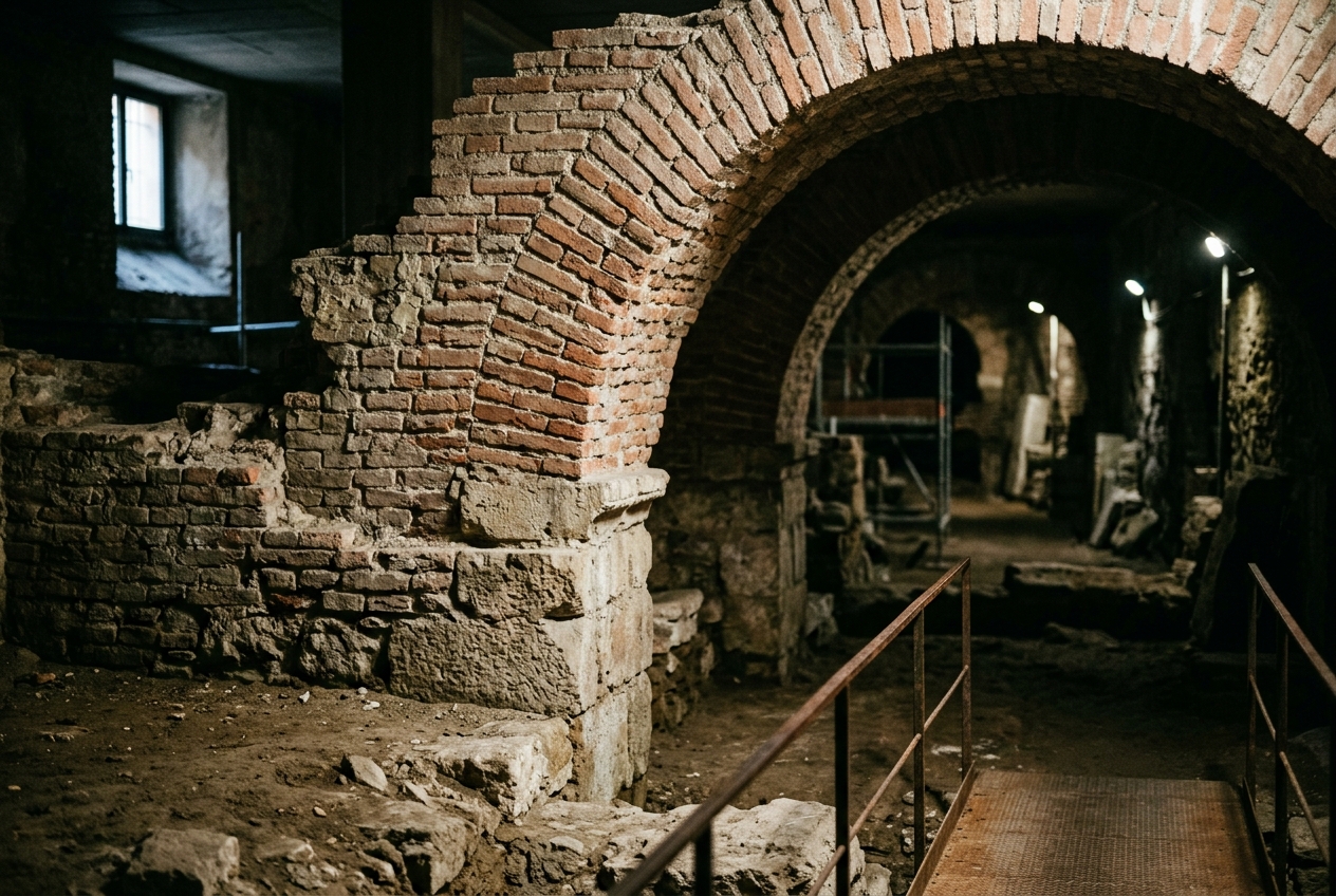
Beneath the central civic plaza of Bologna—Piazza Maggiore—lies the structural footprint of the Roman Forum. Visitors entering the Biblioteca Salaborsa (Bologna's central public library) can peer through reinforced glass flooring to view the excavated remains of classical Bononia:
- The Roman Basilica: A monumental public building that served as the judicial court and commercial exchange of Bononia. The brick foundations, column bases, and marble paving slabs (pavo flooring) dating to the Augustan and Julio-Claudian eras are clearly visible.
- Street Pavements (Silex): Large polygonal basaltic stone blocks (basoli) featuring visible ruts carved by iron-rimmed carriage wheels over centuries of continuous trade.
- Drainage Infrastructure: Subterranean brick vaulted sewers (cloacae) that evacuated rainwater and wastewater from the forum into local stream channels, demonstrating advanced municipal sanitation planning.
For administrative updates on civic heritage preservation, consult the official portal of the Comune di Bologna.
SECTION 3: ARCHITECTURAL & ACADEMIC HERITAGE: THE UNIVERSITY, TOWERS, AND PORTICOES
              +-----------------------------------------------+
              |    THREE PILLARS OF BOLOGNESE ARCHITECTURE    |
              +-----------------------------------------------+
              |   1. THE STUDIUM (University - 1088 AD)       |
              |   2. THE TOWERS (Torri Gentilizie - XII c.)   |
              |   3. THE PORTICOES (UNESCO World Heritage)    |
              +-----------------------------------------------+
3.1 The University of Bologna (1088): Legal Humanism and Scholastic Liberty
In 1088 AD, a guild of scholars (universitas scholarium) established what is recognized as the oldest continuously operating university in the Western world: the Università di Bologna (Alma Mater Studiorum). For official institutional histories, visit the Università di Bologna Portal.
   [1088: Foundation of Studium]
             |
             v
   [Scholars of Civil Law: Irnerius & The Four Doctors]
             |
             v
   [1155: Constitutio Habita issued by Emperor Frederick I Barbarossa]
             |
             v
   [Institutional Autonomy & Birth of Academic Freedom (Authentica Habita)]
Unlike Northern European universities (such as Paris or Oxford), which developed as corporations of masters under ecclesiastical oversight, Bologna originated as a student-run corporation. International students organized into "nations" (nationes) to hire professors, negotiate housing fees, and enforce academic standards.
Legal Revival and the Authentica Habita
The early glory of the Studium was founded on the revival of Roman Jurisprudence. Master Irnerius (c. 1050–1130 AD) pioneered the systematically annotated study of Emperor Justinian's Corpus Juris Civilis. Through the technique of glossing—writing analytical commentaries between the lines (glossae interlineares) and in the margins (glossae marginales) of legal manuscripts—Irnerius and his successors (the "Four Doctors": Bulgarus, Martinus Gosia, Hugo de Porta Ravennate, and Jacobus de Boragine) resurrected classical Roman law to create the foundation of modern European legal science (Ius Commune).
In 1155 AD, Emperor Frederick I Barbarossa promulgated the Constitutio Habita (or Authentica Habita), granting legal protections, freedom of movement, and immunity from local municipal jurisdiction to scholars traveling to Bologna, establishing a foundational precedent for modern academic freedom.
3.2 The Skyward Horizon: Garisenda and Asinelli Towers
During the 12th and 13th centuries, Bologna's skyline was transformed into an urban forest of stone skyscrapers. Wealthy noble families (famiglie gentilizie) constructed over 100 defensive tower-houses (torri gentilizie) across the city core.
                       /\
                      /  \
                     |    |
                     |    |
                     |    |  <- Asinelli Tower
                     |    |     (97.2 meters)
                     |    |
                     |    |
                     |____|
                     |    |   /\
                     |    |  /  \  <- Garisenda Tower
                     |    | |    |    (48 m, Lean: 4°)
                     |____| |____|
                   =================
                     Piazza di Porta Ravegnana
Structural & Tactical Function
The towers served dual roles:
1. Defensive Strongholds: During the bitter street battles between Guelph and Ghibelline factions, towers functioned as vertical fortresses equipped with arrow slits, crenellations, and timber bridges connecting elevated doorways to adjacent family structures.
2. Socio-Economic Status: Tower height directly correlated with familial wealth and political authority.
The Two Towers (Le Due Torri)
The defining icon of Bologna is the side-by-side pair of towers located at the historic Porta Ravegnana:
- Torre degli Asinelli (1109–1119 AD): Constructed by the Asinelli family, this tower stands at an imposing height of 97.2 meters, making it the tallest medieval leaning tower in the world. It contains an internal wooden staircase of 498 steps leading to a panoramic view over the red-tiled roofs of the city.
- Torre Garisenda (1110 AD): Built adjacent to the Asinelli, the Garisenda tower originally reached approximately 60 meters. However, severe ground subsidence during construction caused the tower to lean dangerously. In the 14th century, the tower was shortened to 48 meters to prevent catastrophic structural failure. Today, it exhibits a tilt angle of over 4.0 degrees (an overhang displacement of 3.2 meters at the summit).
[!WARNING]
Structural Monitoring: Dante Alighieri famously compared the giant Antaeus to the leaning Garisenda tower in Canto XXXI of the Inferno. Today, the Garisenda tower is subject to continuous structural monitoring using fiber-optic strain gauges and acoustic emission sensors to mitigate movement caused by historical ground settlement.
3.3 UNESCO World Heritage Porticoes: Urban Covered Walkways
In 2021, UNESCO officially inscribed The Porticoes of Bologna onto the World Heritage list. Stretching over 62 kilometers across the metropolitan territory—including 42 kilometers within the historic center—these covered arcades constitute an unparalleled urban architecture. Read the complete inscription details at the UNESCO World Heritage Centre listing for the Porticoes of Bologna.
   +-----------------------------------------------------------------+
   |              EVOLUTION OF BOLOGNESE PORTICOES                   |
   +-----------------------------------------------------------------+
   |  1. "Sporti" (XI c.): Overhanging wooden upper-floor extensions |
   |  2. Timber Struts (XII c.): Wooden beams supporting extensions  |
   |  3. Regulatory Portico (1288 AD): Civic mandate for public height|
   |  4. Renaissance Masonry (XV c.): Marble and brick vaulting       |
   +-----------------------------------------------------------------+
                   Street / Upper Floor
                     +-----------------+
                     |   Living Unit   |
                     +--------+--------+
                              |
               Overhanging    |  <- Portico Vault
               Structure      |
               (Sporto)       v
                 +------------+
                 |            |  Public Walkway
                 |            |  (Transit Zone)
                 |            |
             +---+------------+---+
             | Masonry Pillar     |
             | / Column Base      |
             +--------------------+
Historical Evolution & Legal Mandate
The origin of the porticoes was driven by demographic pressure. As thousands of foreign law students poured into Bologna during the 12th century, home owners created additional living space by building wooden extensions (sporti) projecting out over the public street.
To prevent private encroachment from blocking traffic and trade, the Commune of Bologna issued a landmark civic ordinance in 1288 AD:
- Compulsory Construction: Property owners were legally mandated to build a portico in front of their buildings.
- Public Servitude: While the land beneath the portico remained privately owned, it was declared a public right-of-way (servitù pubblico) open to all pedestrians free of charge.
- Dimensional Regulations: Porticoes were required to be at least 7 Bolognese feet high (approx. 2.66 meters)—a height sufficient to permit a mounted knight on horseback carrying a lance to ride underneath without striking their head.
Highlights of Portico Architecture
- Casa Isolani (Strada Maggiore): One of the few surviving examples of 13th-century wooden porticoes, constructed from massive dark oak beams (nine meters tall) supporting the upper building structure.
- Portico di San Luca: The longest continuous portico in the world, spanning 3.8 kilometers and comprising 666 vaulted arches. Built between 1674 and 1793 to protect the annual religious procession transporting the icon of the Madonna di San Luca from Piazza Maggiore up to the hilltop sanctuary on Monte Guardia, this monumental structure features 15 devotional chapels along its ascent.
SECTION 4: KEY HISTORICAL FIGURES, TURNING POINTS, AND CULTURAL ARTIFACTS
+-------------------------------------------------------------------------------+
|                      HISTORICAL FIGURES OF DISTINCTION                        |
+-------------------------------------------------------------------------------+
|  PERSONAGE           | ERA      | DISCIPLINE / CONTRIBUTION                   |
+----------------------+----------+---------------------------------------------+
|  Irnerius            | XII c.   | Jurist; Pioneer of Roman Law Commentaries   |
|  Laura Bassi         | XVIII c. | Physicist; First Female University Professor|
|  Ulisse Aldrovandi   | XVI c.   | Naturalist; Father of Modern Natural History|
|  Marcello Malpighi   | XVII c.  | Physician; Pioneer of Microscopic Anatomy   |
|  G. Marconi          | XIX-XX c.| Physicist; Inventor of Wireless Telegraphy  |
+-------------------------------------------------------------------------------+
4.1 Figures of Intellectual and Political Preeminence
Bologna's intellectual environment produced breakthroughs across law, medicine, physical science, and humanities:
- Laura Bassi (1711–1778): A child prodigy in philosophy and mathematics, Bassi became the first woman to be awarded a doctorate from the University of Bologna and the first woman in the world to be appointed a salaried university professor of physics (1732). She conducted experiments in Newtonian mechanics and electricity, maintaining an international correspondence with figures like Voltaire.
- Ulisse Aldrovandi (1522–1605): Renowned Renaissance naturalist who established one of the world's earliest botanical gardens (1568) and systematically cataloged thousands of biological specimens, creating vast visual encyclopedias that laid the foundations of modern taxonomy.
- Marcello Malpighi (1628–1694): Pioneer of microscopic anatomy and histology. Utilizing early compound microscopes, Malpighi discovered capillary blood vessels, demonstrating the anatomical link between arterial and venous circulation, and described the renal corpuscles (Malpighian corpuscles) of the kidney.
4.2 Architectural and Cultural Repositories
  +-------------------------------------------------------------------------+
  |              NOTABLE ARCHITECTURAL & CULTURAL ARTIFACTS                 |
  +-------------------------------------------------------------------------+
  |  INSTITUTION / SITE     | HIGHLIGHT ARTIFACT / ARCHITECTURAL FEATURE    |
  +-------------------------+-----------------------------------------------+
  |  Palazzo dell'Archiginnasio| Teatro Anatomico (1637) & Stemma Heraldry   |
  |  San Petronio Basilica  | Cassini Meridian Line (1655; 66.8m length)    |
  |  Museo Civico Archeologico| Situla Certosa (Etruscan Bronze Vessel)       |
  |  Complex of San Stefano | "Seven Churches" & Holy Sepulchre Replica     |
  +-------------------------------------------------------------------------+
The Palazzo dell'Archiginnasio and the Anatomical Theater
Commissioned in 1562 by Pope Pius IV and designed by architect Antonio Morandi (Il Terribile), the Palazzo dell'Archiginnasio was built to consolidate all university faculties (Law, Medicine, Arts, Philosophy) into a single central edifice.
       +-------------------------------------------------------+
       |         TEATRO ANATOMICO (ARCHIGINNASIO - 1637)       |
       +-------------------------------------------------------+
       |   [Canopy / Baldachin with "Spellati" Statues]        |
       |                           |                           |
       |   [Central Marble Dissection Table (Carrara Marble)]  |
       |                           |                           |
       |   [Tiered Spruce Wood Seating for Medical Students]   |
       +-------------------------------------------------------+
The crown jewel of the Archiginnasio is the Teatro Anatomico (Anatomical Theater), constructed in 1637. Carved entirely from wooden spruce, the chamber is arranged in an amphitheater design centered around a white marble dissection table. The professor's chair is surmounted by a wooden canopy supported by the Spellati ("Flayed Men")—two anatomically precise statues sculpted with exposed muscles and tendons.
The walls and ceilings of the Archiginnasio display a collection of over 6,000 heraldic coats of arms (stemmi) painted by international law students between the 16th and 18th centuries, forming the largest indoor heraldic collection in the world.
The Cassini Meridian Line in San Petronio
Inside the massive Gothic Basilica di San Petronio on Piazza Maggiore lies an astronomical monument: the Cassini Meridian Line.
Designed in 1655 by astronomer Giovanni Domenico Cassini, this brass line inlaid into the marble floor stretches precisely 66.8 meters (equivalent to $1/6000\text{th}$ of the Earth's perimeter).
A tiny pinhole aperture (oculus) set into the basilica's roof 27.07 meters above the floor projects an image of the sun onto the floor line at solar noon each day. This instrument enabled Cassini to calculate the length of the solar year with precision, test planetary orbit eccentricities, and verify Kepler's laws of planetary motion.
SECTION 5: LEGACY & CONTEMPORARY RESONANCE IN MODERN BOLOGNA
                 +---------------------------------------------+
                 |   CONTEMPORARY TRINITY OF BOLOGNA           |
                 +---------------------------------------------+
                 |  1. LA DOTTA   (The Learned - University)   |
                 |  2. LA ROSSA   (The Red - Roofs & Politics) |
                 |  3. LA GRASSA  (The Fat - Gastronomy)       |
                 +---------------------------------------------+
The classical Roman foundation and medieval developments of Bologna continue to define the city's modern identity, summarized in its traditional Italian nicknames:
1. La Dotta ("The Learned")
The presence of over 85,000 university students within a city of 390,000 residents preserves Bologna's role as an academic hub. The University of Bologna remains a leader in international student exchange programs (such as Erasmus+) and scientific research.
2. La Rossa ("The Red")
This epithet operates on two distinct levels:
* Architectural Palette: The visual harmony of the city is characterized by terracotta roof tiles, red-brick masonry, and warm ochre plasterwork—a material tradition rooted in the clay soils of the Po Valley used for Roman brickmaking (lateres).
* Political Tradition: During the 20th century, Bologna became a bastion of anti-fascist resistance during World War II. Following the war, the city established a long-standing tradition of progressive civic governance, co-operative economics, and social movements.
3. La Grassa ("The Fat")
Bologna's geographic position along the Via Aemilia transformed it into the primary agricultural distribution node of Emilia-Romagna. The region's culinary traditions—including Tagliatelle al Ragù, Tortellini in Brodo, Mortadella di Bologna IGP, and Parmigiano Reggiano—reflect centuries of trade flowing through the Roman road network into the city's markets.
SECTION 6: TAKEAWAY BOX: HISTORICAL MILESTONE SUMMARY & VISITOR INSIGHT
[!IMPORTANT]
HISTORICAL MILESTONES: ETRUSCAN FELSINA TO MODERN BOLOGNA
Timeline Historical Event Civic & Architectural Impact VI c. BC Etruscan Expansion (Felsina) Establishment of primary urban grid, metalwork industries, and regional trade routes. c. 350 BC Celtic Invasion (Boii Tribe) Transformation of urban layout into a fortified Gallic tribal territory. 189 BC Roman Foundation (Bononia) Deductio of Latin military colony; establishment of classical street grid (decumanus and cardo). 187 BC Construction of Via Aemilia Consul M. Aemilius Lepidus connects Rimini to Piacenza, establishing the axis for territorial centuriation. I c. BC Setta Aqueduct Construction Subterranean 18km tunneling brings 45 million liters/day of mountain water to Bononia. 1088 AD Foundation of the Studium Birth of the University of Bologna; legal revolution led by Irnerius and the Glossators. 1109–1119 AD Construction of Le Due Torri Asinelli (97.2m) and Garisenda (48m) towers built as noble defensive strongholds. 1288 AD Civic Portico Ordinance Municipal mandate requiring private owners to construct covered public porticoes. 1637 AD Opening of Teatro Anatomico Establishment of modern medical anatomy instruction within the Archiginnasio. 2021 AD UNESCO Inscription The 62km network of Bologna Porticoes designated an international World Heritage site. [!TIP]
VISITOR & RESEARCH INSIGHTS: EXPLORING ROMAN & MEDIEVAL BOLOGNA
- Subterranean Archaeology: Visit the basement floor of the Biblioteca Salaborsa (Piazza Maggiore) to walk directly above the basalt street paving (basoli) and civil structures of the Roman Forum of Bononia.
- Hydraulic Engineering Tours: Access to the ancient Roman subterranean aqueduct channel can be arranged via specialized speleological guided tours organized through local heritage groups (Bologna Sotterranea).
- Panoramic Views & Urban Grid: Ascend to the top of the Asinelli Tower or the panoramic terrace of the Basilica di San Petronio to view how the Roman decumanus maximus (Via Ugo Bassi / Via Rizzoli) continues to bisect the urban center.
- Primary Academic Archives: The Archiginnasio Library holds over 35,000 manuscripts, incunabula, and historical documents tracing the legal evolution of Western Europe.
AUTHORITATIVE HISTORICAL & CULTURAL REFERENCES
- UNESCO World Heritage Centre - The Porticoes of Bologna
- Università di Bologna - Institutional History & Heritage
- Comune di Bologna - Official Civic Administration Portal
- Treccani Enciclopedia Italiana - Felsina & Bononia Classical History
- Wikipedia - History of Bologna & Via Aemilia
- Museo Civico Archeologico di Bologna - Classical Collections
Published as part of the Guardian Historical Long-Read Series on Classical Civilizations & Urban Morphology.